 Block
From the record
One of 167 National Register listings published here for Ada County · listed in 2022 · category: Building.
Sources: the National Register database, National Park Service
Listed on the National Register of Historic Places in 2022.
One of 167 National Register listings published here for Ada County · listed in 2022 · category: Building.
Sources: the National Register database, National Park Service
Regional context, not property-specific evidence. The federal wildfire occurrence database lists 22 fires within 5 miles of South Municipal Pool between 1992 and 2019, burning about 18,420 acres in total. 1 started naturally. 2 were recorded as arson. Distance is straight-line from the map coordinates, so a fire counted here may appear on a neighbouring settlement's page as well.
| Reported cause | Fires |
|---|---|
| Missing data/not specified/undetermined | 12 |
| Equipment and vehicle use | 2 |
| Fireworks | 2 |
| Arson/incendiarism | 2 |
| Natural | 1 |
| Debris and open burning | 1 |
| Recreation and ceremony | 1 |
| Smoking | 1 |
The most recent of them, most recent first, with the day each was reported and the service that recorded it.
| Date | Cause | Size | Reported by | Name on the report |
|---|---|---|---|---|
| 27 September 1999 | Fireworks | 2.0 acres | Boise District | OVERLOOK |
| 21 September 2014 | Smoking | 3.0 acres | Boise District | SUNNY |
| 28 August 2016 | Missing data/not specified/undetermined | under an acre | Boise District | RA11 BFD |
| 26 August 1996 | Equipment and vehicle use | 15,263 acres | Boise National Forest | EIGHTH STREET |
| 25 August 2010 | Arson/incendiarism | 4.0 acres | Boise District | ROCK |
| 25 August 2009 | Missing data/not specified/undetermined | 10 acres | Boise National Forest | RA 3 - BOISE CITY |
| 21 August 2005 | Arson/incendiarism | 76 acres | Boise District | ROCKY |
| 4 July 2015 | Missing data/not specified/undetermined | 37 acres | Boise District | TABLE ROCK |
Regional context, not property-specific evidence. The federal mineral resources record lists 54 workings within 5 miles of South Municipal Pool: 36 past producers, 9 producers, 5 unknowns, 3 occurrences. 9 still produce. What was taken out: Sand and Gravel, Construction, Gold, Stone, Dimension, Diatomite. Distance is straight-line from the map coordinates, so a quarry counted here may appear on a neighbouring settlement's page as well.
| Where | Site | Commodity | Status | Recorded |
|---|---|---|---|---|
| Morning Star Mine | Gold, Silver | Past Producer | Vein | |
| Quarry | Stone, Crushed/Broken | Past Producer | ||
| Diatomite Occurrence | Diatomite | Occurrence | Sedimentary | |
| Old Boise Stone Company Quarry | Stone, Dimension | Past Producer | Sandstone | |
| Perlite Deposit | Perlite | Occurrence | ||
| Rip Rap Pit-Gowen Field | Stone, Dimension | Unknown | ||
| Rocky Canyon | Diatomite | Occurrence | ||
| Unnamed Location | Perlite | Past Producer | ||
| First Chance | Gold | Prospect | ||
| Last Chance Mine | Gold | Past Producer | Vein |
Regional context, not property-specific evidence. The National Weather Service names Boise, the town this property stands in, in 48 storm reports between 1993 and 2024: 23 thunderstorm wind, 10 hail, 5 flash flood, 4 flood. No death or injury is recorded in these reports. Each account below is quoted exactly as the forecast office filed it, from the NOAA Storm Events Database, and each date opens the federal record of that event.
| When | Event | Place named | Harm | What the report says |
|---|---|---|---|---|
| June 2023 | Flash Flood | Boise | $1,000,000 | Thunderstorms produced heavy rain across portions of the Lower Treasure Valley, including the city of Boise. Social media, weather spotter, and emergency manager reports indicated localized flooding. |
| September 1997 | Flash Flood | Boise | $60,000 | During the evening of September 11, a flash flood occurred in the foothills of the Boise Mountains. The foothills had received significant rainfall all day long. Between 500 pm and 600 pm MST a heavy shower dumped 4 tenths of an inch of rain in 9 minutes on the foothills triggering flash flooding into the north end of Boise. The wall of mud and debris was estimated at 15 feet high as it breached six flood control dams and washed over a golf course. While most of the damage consisted of mud and debris on local roadways, the golf course sustained damage and 12 houses were slightly damaged at the foundations. No injuries were reported. As of publishing , damages to roads in the city and clean up costs were estimated at at least 60,000 dollars. |
| September 1998 | Thunderstorm Wind | Boise | $20,000 | no account filed |
| July 2015 | Flash Flood | Boise | $10,000 | Heavy rain from slow moving thunderstorms caused flash flooding in the Boise metro area. Over an inch of rain fell in less than an hour across portions of Boise. Flash flooding was reported in the downtown area and in the north and northwest parts of the city. |
| September 1998 | Lightning | Boise | $10,000 | no account filed |
| September 1998 | Thunderstorm Wind | Boise | $8,000 | no account filed |
| April 1995 | Thunderstorm Wind | Boise | $5,000 | no account filed |
| May 2024 | Thunderstorm Wind | Boise | - | A strong outflow boundary from a thunderstorm damaged several power lines around the Boise metropolitan area and Garden Valley. Around 2,000-3,000 people were estimated to be without power in both of those regions due to wind damage. |
| September 2024 | Thunderstorm Wind | Boise | - | A large spruce tree was knocked down at Morris Hill Cemetery. |
| September 2024 | Thunderstorm Wind | Boise | - | The public reported a large spruce tree was knocked down along with old juniper trees. Idaho Power reported that this caused 2000 customers to be without power in the Boise North End. |
| June 2023 | Thunderstorm Wind | Boise | - | A tree fell on Park Center Boulevard and Highland Street, which blocked several lanes. |
| June 2023 | Thunderstorm Wind | Boise | - | An NWS employee measured a wind gust of 50 knots in downtown Boise. |
| June 2023 | Thunderstorm Wind | Boise | - | An NWS employee reported 50 knots of wind in southeast Boise. |
| May 2023 | Thunderstorm Wind | Boise | - | A couple of large trees were knocked down near Quinn's Pond on the Boise Greenbelt. |
| March 2023 | Heavy Rain | Boise | - | The mesonet station GW0891 in Boise measured 1.09 inches of rain. |
| March 2023 | Heavy Rain | Boise | - | The mesonet station at BSUI1 measured 1.32 inches of heavy rain. |
| August 2013 | Thunderstorm Wind | Boise | - | The KBOI ASOS at The Boise airport measured a thunderstorm wind gust of 60 MPH. Downed trees and power poles were reported across Ada County. |
| August 2012 | Thunderstorm Wind | Boise | - | Thunderstorms that moved across Ada County caused damage around the Boise area, including tree tops torn off, a large tree snapped at its base, and residential fences blown down. |
| August 2009 | Hail | Boise | - | A trained spotter reported large chunks of hail a little smaller than golf balls. |
| May 2008 | Hail | Boise | - | A trained spotter reported 50 MPH winds and hail averaging three quarters of an inch and a few stones larger than one inch. |
| September 2007 | Thunderstorm Wind | Boise | - | Gusty winds and rain ripped through the Treasure Valley, causing power outages and knocking down huge trees. KBCI TV reported numerous trees and power lines down across the Boise metro area. |
| May 2006 | Thunderstorm Wind | Boise | - | Boise 7 SE Gust 60K |
| May 2004 | Hail | Boise | - | No know damage |
| June 2004 | Flash Flood | Boise | - | Flooding downtown Boise...see narrative below. |
| June 2004 | Hail | Boise | - | See narrative below. |
| August 2004 | Thunderstorm Wind | Boise | - | Trees and Power lines down. |
| August 2004 | Thunderstorm Wind | Boise | - | Microburst winds...semi truck overturned, trees uprooted and roofs damaged. |
| July 2003 | Thunderstorm Wind | Boise | - | Swan Falls Dam...Gust to were also observed 14SE of Boise. |
| February 2002 | Thunderstorm Wind | Boise | - | A line of thunderstorms produced wind gusts to 44 knots (51 mph) and hail up to 3/4 inch diameter from 10 miles west of Boise into the city of Boise. Numerous trees and power lines were brought down by the storm. |
| May 1999 | Lightning | Boise | - | During the afternoon of May 3rd a thunderstorm over Boise sent a bolt of lightning onto the Crane Creek Country Club golf course. Three golfers were knocked down when a the lightening struck the ground near by. None of the golfers felt an electric shock but the explosion knocked them to the ground. Medical authorities summoned to the scene determined that there were no injuries to the golfers. |
| July 1998 | Hail | Boise | - | A severe thunderstorm produced 3/4 to 7/8 inch hail in Boise. 7/8 inch hail was observed at the Boise National Weather Service Office. |
| April 1993 | Hail | Boise | - | A severe weather spotter reported hail, measuring 1.00 inch in diameter, falling from a thunderstorm 7 miles north of Boise. The storm also produced heavy rains and frequent lightning that lasted for almost an hour. |
| June 2006 | Hail | Boise | - | no account filed |
| June 2006 | Hail | Boise | - | no account filed |
| July 2002 | Thunderstorm Wind | Boise | - | no account filed |
| July 2002 | Flash Flood | Boise | - | no account filed |
| July 2002 | Thunderstorm Wind | Boise | - | no account filed |
| May 2000 | Hail | Boise | - | no account filed |
| September 1998 | Flood | Boise | - | no account filed |
| September 1998 | Flood | Boise | - | no account filed |
| June 1998 | Flood | Boise | - | no account filed |
| June 1998 | Flood | Boise | - | no account filed |
| July 1998 | Thunderstorm Wind | Boise | - | no account filed |
| July 1997 | Thunderstorm Wind | Boise | - | no account filed |
| July 1997 | Lightning | Boise | - | no account filed |
| June 1997 | Funnel Cloud | Boise | - | no account filed |
| July 1995 | Hail | Boise | - | no account filed |
| July 1995 | Thunderstorm Wind | Boise | - | no account filed |
No historic map-sheet match is published for this property yet. That does not mean no map exists. This record needs a coordinate-quality review before it can be joined to a sheet boundary. Browse the county's mapped places while that work is pending.
Other National Register properties close enough to walk or drive between, ordered by distance from this one. Both positions come from the same geocoding pass that matched these properties to their map sheets.
| Photograph | Property | Distance | Listed |
|---|---|---|---|
| Dr. John and Elaine Phillips House | 0.2 miles | 2019 | |
 | Union Pacific Mainline Depot | 0.5 miles | 1974 |
| Whitney School | 0.5 miles | 1982 | |
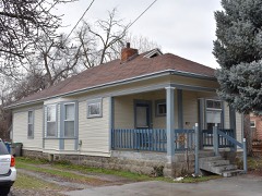 | Mrs. A. F. Rossi House | 0.8 miles | 1982 |
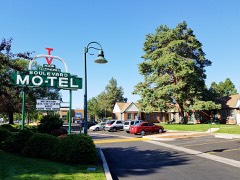 | Boulevard Mo-tel | 0.9 miles | 1998 |
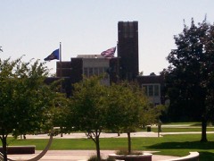 | Boise Junior College Administration Building | 0.9 miles | 1982 |
| National Archives record | The nomination case file for reference 100008162 in Record Group 79. |
| Ada County | All 167 listed properties in this county. |