 Block
From the record
One of 45 National Register listings published here for Kootenai County · listed in 2025 · category: District.
Sources: the National Register database, National Park Service
Listed on the National Register of Historic Places in 2025.
One of 45 National Register listings published here for Kootenai County · listed in 2025 · category: District.
Sources: the National Register database, National Park Service
Regional context, not property-specific evidence. The federal wildfire occurrence database lists 91 fires within 5 miles of Coeur d'Alene Garden District Historic District between 1992 and 2020, burning about 74 acres in total. 8 started naturally. 6 were recorded as arson. Distance is straight-line from the map coordinates, so a fire counted here may appear on a neighbouring settlement's page as well.
| Reported cause | Fires |
|---|---|
| Debris and open burning | 32 |
| Recreation and ceremony | 13 |
| Missing data/not specified/undetermined | 12 |
| Misuse of fire by a minor | 10 |
| Natural | 8 |
| Arson/incendiarism | 6 |
| Smoking | 6 |
| Equipment and vehicle use | 3 |
| Fireworks | 1 |
The most recent of them, most recent first, with the day each was reported and the service that recorded it.
| Date | Cause | Size | Reported by | Name on the report |
|---|---|---|---|---|
| 8 September 2014 | Recreation and ceremony | under an acre | Idaho Department of Lands | PRESLEY |
| 4 September 2010 | Smoking | under an acre | Mica Area Office | FERNAN HILL FIRE |
| 3 September 1994 | Misuse of fire by a minor | 1.0 acres | Idaho Department of Lands | PUMPKIN PATCH |
| 25 September 1999 | Misuse of fire by a minor | under an acre | Idaho Department of Lands | ATLAS 27 |
| 2 September 2003 | Smoking | under an acre | Idaho Department of Lands | SPORTSMAN |
| 2 September 1996 | Debris and open burning | under an acre | Idaho Department of Lands | COUGAR ESTATES |
| 18 September 1994 | Misuse of fire by a minor | under an acre | Idaho Department of Lands | GARBAGE FIRE |
| 16 September 2001 | Natural | under an acre | Idaho Department of Lands | HIENE |
Regional context, not property-specific evidence. The federal mineral resources record lists 13 workings within 5 miles of Coeur d'Alene Garden District Historic District: 5 producers, 4 prospects, 2 past producers, 1 occurrence. 5 still produce. What was taken out: Sand and Gravel, Construction, Clay, Kaolin, Aluminum. Distance is straight-line from the map coordinates, so a quarry counted here may appear on a neighbouring settlement's page as well.
| Where | Site | Commodity | Status | Recorded |
|---|---|---|---|---|
| Quarry | Stone, Crushed/Broken | Producer | ||
| Fernan Hill Clay Deposit | Kaolin | Prospect | ||
| Kid Island Clay Deposit | Clay | Occurrence | ||
| Kid Island Clay Deposit | Aluminum | Prospect | ||
| Stanley Hill Clay Deposit | Clay, Aluminum | Prospect | Clay | |
| Stockton Clay Deposit | Kaolin | Prospect | 1920 | |
| Couer D' Alene Pit and Plant | Sand and Gravel, Construction | Producer | ||
| Couer D'Alene Pit | Sand and Gravel, Construction | Unknown | ||
| Cpi Plant | Sand and Gravel, Construction | Past Producer | ||
| Gravel Pit | Sand and Gravel, Construction | Producer |
Regional context, not property-specific evidence. The National Weather Service names Coeur d'Alene, the town this property stands in, in 28 storm reports between 1997 and 2024: 8 thunderstorm wind, 7 flood, 4 lightning, 3 flash flood. No death or injury is recorded in these reports. Each account below is quoted exactly as the forecast office filed it, from the NOAA Storm Events Database, and each date opens the federal record of that event.
| When | Event | Place named | Harm | What the report says |
|---|---|---|---|---|
| June 2017 | Lightning | Coeur D Alene | $50,000 | Lightning set fire to a home on Lake Coeur D'Alene during the evening of June 28th. |
| June 2007 | Thunderstorm Wind | Coeur D Alene | $33,000 | no account filed |
| June 2007 | Lightning | Coeur D Alene | $30,000 | no account filed |
| June 2007 | Thunderstorm Wind | Coeur D Alene | $28,000 | no account filed |
| June 2022 | Flood | Coeur D Alene | $20,000 | Kootenai county sheriff reports 2 to 3 feet of water in the Coeur Dalene resort garage. |
| April 2012 | Flood | Coeur D Alene | $20,000 | Two homes in Fernan Village were flooded by Fernan Lake. Three other homes along the shores of the lake had their seawalls heightened with sandbags to prevent the lake from entering the homes. |
| March 2012 | Flood | Coeur D Alene | $20,000 | Two homes in Fernan Village were flooded by Fernan Lake. Three other homes along the shores of the lake had their seawalls heightened with sandbags to prevent the lake from entering their homes. |
| June 2007 | Thunderstorm Wind | Coeur D Alene | $20,000 | no account filed |
| April 2000 | Flash Flood | Coeur D Alene | $15,000 | Due to heavy rain and snowmelt, rapid rises on the Wolf Lodge Creek caused several flooded basements and minor road damage. |
| July 2006 | Lightning | Coeur D Alene | $15,000 | no account filed |
| January 2000 | Flood | Coeur D Alene | $15,000 | no account filed |
| August 1998 | Wildfire | Coeur D Alene | $10,000 | Truck sparked a fire in a wheat field, damaging 15 acres of wheat and 1 acre of timber. Truck was also destroyed. |
| May 1997 | Thunderstorm Wind | Coeur D Alene | $10,000 | tree in house from wind |
| July 1998 | Flash Flood | Coeur D Alene | $5,000 | heavy rains and local flooding in downtown Coeur d'Alene. |
| September 2024 | Thunderstorm Wind | Coeur D Alene | $2,000 | The storm caused 1019 customers to lose power in Kootenai County. A gust of 54 MPH was recorded 2 miles South of Twin Lakes. |
| August 2007 | Thunderstorm Wind | Coeur D Alene | $2,000 | no account filed |
| July 2012 | Lightning | Coeur D Alene | $1,000 | Lightning struck and damaged the level sensor on the Tubbs Hill reservoir. |
| May 2023 | Flash Flood | Coeur D Alene | $500 | Heavy rainfall of near half an inch in an hour resulted standing water on several streets across Coeur D Alene. It included but was not limited to Government Way near I-90 and Appleway at 15th. Water depth ranged from 6 to 12 inches in spots. Radar estimated near 1 inch of rain. CWOP station G1914 recorded 0.77 of an inch of rain. |
| August 2019 | Hail | Coeur D Alene | - | A member of the public reported hail covering the ground to a depth of 2 inches with a maximum hail size of 1.5 inches. |
| March 2012 | Flood | Coeur D Alene | - | Blue Creek Road washed out near Yellowstone Trail. |
| March 2012 | Flood | Coeur D Alene | - | Flooding was reported along several low spots along Highway 97 between Cataldo and Harrison. While the exact location was unknown, some residents were forced to sandbag to avoid flooded creeks from seeping into their homes. |
| March 2012 | Flood | Coeur D Alene | - | Excess runoff from heavy rain and snow melt resulted in sharp rises of Lake Coeur D Alene and minor flooding of its tributaries. Kid Island Bay Road which parallels the eastern shores of Kid Island Bay, a small outlet on the northwestern sections of Lake Coeur D Alene, had several inches of water over the roadway. |
| August 1999 | Heavy Rain | Coeur D Alene | - | 4-6" inches of rain overnight. One boat sunk from accumulated rain water. |
| August 1999 | Hail | Coeur D Alene | - | 3/4" hail |
| June 2010 | Heavy Rain | Coeur D Alene | - | no account filed |
| July 2007 | Thunderstorm Wind | Coeur D Alene | - | no account filed |
| March 2006 | Heavy Rain | Coeur D Alene | - | no account filed |
| May 2006 | Thunderstorm Wind | Coeur D Alene | - | no account filed |
No historic map-sheet match is published for this property yet. That does not mean no map exists. This record needs a coordinate-quality review before it can be joined to a sheet boundary. Browse the county's mapped places while that work is pending.
Other National Register properties close enough to walk or drive between, ordered by distance from this one. Both positions come from the same geocoding pass that matched these properties to their map sheets.
| Photograph | Property | Distance | Listed |
|---|---|---|---|
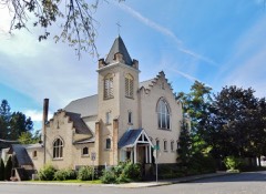 | First United Methodist Church | 0.1 miles | 1979 |
 | St. Thomas Catholic Church | 0.2 miles | 1977 |
 | Harvey M. Davey House | 0.3 miles | 1985 |
 | Coeur d'Alene Masonic Temple | 0.3 miles | 1978 |
 | Coeur d'Alene Federal Building | 0.3 miles | 1977 |
 | Coeur d'Alene City Hall | 0.4 miles | 1979 |
| National Archives record | The nomination case file for reference 100010923 in Record Group 79. |
| Kootenai County | All 45 listed properties in this county. |