Block
From the record
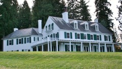
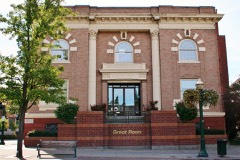
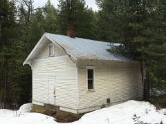
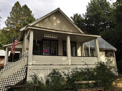
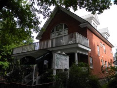
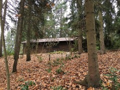
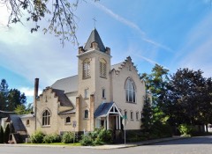
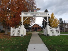
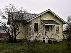
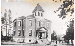
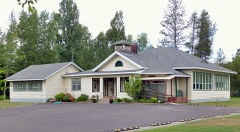
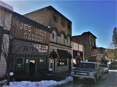
45 National Register listings published here, 1 of them a National Historic Landmark.
Sources: the National Register database, National Park Service
128 topographic sheets cover 61 settlements here, and 45 properties are on the National Register of Historic Places.
45 National Register listings published here, 1 of them a National Historic Landmark.
Sources: the National Register database, National Park Service
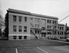
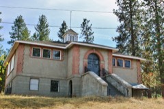
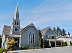
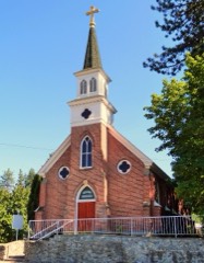
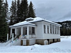
Every property in this county listed on the National Register of Historic Places, with the year it was listed and the federal nomination document.
Every wildfire the federal occurrence database records inside this county: 1,390 of them, burning about 4,792 acres. 476 started naturally and 49 were recorded as arson. Each settlement page carries the fires within five miles of it.
| Reported cause | Fires |
|---|---|
| Natural | 476 |
| Debris and open burning | 275 |
| Missing data/not specified/undetermined | 220 |
| Recreation and ceremony | 191 |
| Equipment and vehicle use | 68 |
| Arson/incendiarism | 49 |
| Misuse of fire by a minor | 47 |
| Smoking | 43 |
| Fireworks | 16 |
| Railroad operations and maintenance | 4 |
| Other causes | 1 |
The five largest, by the area the report gives. One of them was set deliberately.
| Date | Cause | Size | Reported by | Name on the report |
|---|---|---|---|---|
| 7 September 2020 | Recreation and ceremony | 1,405 acres | Idaho Panhandle National Forest | BERNARD |
| 21 August 2015 | Natural | 618 acres | Idaho Panhandle National Forest | MONUMENT |
| 13 September 1994 | Debris and open burning | 140 acres | Northern Idaho Agency | ALLOT 554 |
| 13 August 2015 | Natural | 135 acres | Idaho Panhandle National Forest | NOT CREATIVE |
| 29 August 2015 | Missing data/not specified/undetermined | 135 acres | Idaho Department of Lands | LONE MOUNTAIN |
| 7 October 2014 | Debris and open burning | 121 acres | Idaho Department of Lands | WELLER |
| 5 August 1992 | Equipment and vehicle use | 75 acres | Idaho Department of Lands | CONKLIN |
| 26 August 2016 | Arson/incendiarism | 69 acres | Idaho Department of Lands | BECK |
Every settlement page carries the fires within five miles of it - see the settlement index below.
The NOAA Storm Events Database holds 135 reports for this county, causing no deaths, 5 injuries and about $3,881,500 in recorded property damage. Each settlement page carries the reports that name it.
| Kind of event | Reports |
|---|---|
| Thunderstorm Wind | 42 |
| Flood | 31 |
| Hail | 23 |
| Heavy Rain | 8 |
| Lightning | 8 |
| Funnel Cloud | 8 |
| Flash Flood | 5 |
| Debris Flow | 5 |
| Wildfire | 3 |
| Tornado | 2 |
The most serious of them, by death, then injury, then recorded damage. The accounts are quoted exactly as the forecast office filed them.
| When | Event | Place named | Harm | What the report says |
|---|---|---|---|---|
| May 2002 | Thunderstorm Wind | Rathdrum | 2 hurt, $15,000 | Thunderstorm winds blew a tree onto two cars traveling in opposite directions along Idaho Highway 41 in Rathdrum. Two of the occupants of one vehicle suffered injuries requiring hospitalization. |
| August 2004 | Thunderstorm Wind | (Coe)Coeur D'Alene A | 2 hurt, $5,000 | no account filed |
| July 2014 | Hail | Conkling Park | 1 hurt, $200,000 | One inch hail was observed at Conkling Park on Lake Coeur D Alene. As the storm tracked into northern sections of Kootenai County, strong outflow winds became the main threat resulting in a corridor of tree damage from Coeur D Alene to Althol. The strongest winds surfaced near Althol and knocked down multiple trees in the RV park across the street from Silverwood Theme Park. One person suffered a minor injury in the RV Park. Trees damaged campers, flipped tents, and knocked over smaller campers. |
| March 2017 | Debris Flow | Spirit Lake | $900,000 | Snow melt and periodic heavy rain during the month of March caused numerous debris flows and areal flooding issues through out the county. A debris flow near Harrison forced the evacuation of a residential neighborhood with the land continuing to move through the beginning of April. Over 20 roads through out the county were washed out or cut by debris flows and numerous homes experienced basement and first floor flooding. Kootenai County was included in a Presidential Disaster Declaration as a result of the damage inflicted by this episode. |
| October 1994 | Thunderstorm Wind | not stated | $500,000 | Strong winds from thunderstorms knock down 50-foot high trees, damaging power poles and law enforcement vehicles. |
| March 2017 | Flood | State Line Vlg | $300,000 | The Lake Coeur D'Alene Lake Height Gage at Coeur D'Alene recorded a rise above the lake Flood Stage of 2133.0 feet at 3:30 PM PST on March 18th. The lake crested at 2134.9 feet at 8:00 PM on March 21st. The lake then slowly fell through the next week, passing back below the Flood Stage at 1:00 PM on March 21st. |
| August 2011 | Thunderstorm Wind | Worley | $300,000 | A microburst was thought to be responsible for snapping twenty consecutive power poles between the Setters substation and Highway 95 along Setters Road. It is inconclusive whether the initial wind gust snapped only a few poles or was the direct cause for damaging all the poles. It is speculated that a few poles broke in response to the microburst resulting in a domino effect to the remaining poles due to the absence of additional damage in the area. |
| March 2017 | Flood | Cataldo | $200,000 | The Coeur D'Alene River Gage at Cataldo reported a rise above the Flood Stage of 43.0 feet at 7:30 AM PST on March 15th. The river crested at 46.1 feet at 3:15 PM March 15th and then dropped below flood stage. The river then rose to Flood Stage again on March 18th, cresting at 44.7 feet at 3:00 PM on March 19th. The river dropped below Flood Stage at 4:30 PM March 20th, ending the flooding episode. |
| August 2013 | Lightning | Belmont | $200,000 | A bolt of lightning started a home on fire on Good Hope Road in Althol, ID. The homeowner got out safely but the fire, fueled by natural gas in the home, destroyed everything inside. |
| March 2013 | Thunderstorm Wind | Houser | $175,000 | National Weather Service survey team reported straight line wind damage. A total of 20 to 30 trees were blown over and another 30 to 40 trees were damaged in a swath of 150 yards wide and half a mile long. One tree fell on a barn, another on a house, and a third fell on a trailer. Some of the larger trees that fell over were up to three feet in diameter. Trees were laying in a southwest to northeast direction. Winds were estimated at between 70 to 80 miles per hour. The home owner was in the basement at the time of the damage and was not injured. A rough estimate was used for the total damage during the event. |
| February 2014 | Flood | Spirit Lake | $160,000 | Heavy runoff led to several drive washouts for residents on hilly terrain across Kootenai County. A swollen Latour creek washed away a small levee and parcel of land that supported a shed at a private residence on South Latour Creek Road. |
| March 2014 | Flood | Hayden | $100,000 | Large road washout ten feet across and eight feet deep on Rimrock Road due to a failed culvert. Two cars drove into a ditch resulting in three injuries. The washout also resulted in a loss of water to 150 residences in the area. Damage costs were estimated. |
| June 2023 | Hail | Dudley | $50,000 | Two reports of one inch hail from a thunderstorm in the area. The storm also caused ponding on roadways and widespread minor damage. The damage included tree limbs and downed power lines. It also damaged docks and boats along Lake Coeur D'Alene. An estimated 1700 customers lost power. Max wind gusts recorded was 39 MPH in Coeur D'Alene. |
| June 2017 | Lightning | Coeur D Alene | $50,000 | Lightning set fire to a home on Lake Coeur D'Alene during the evening of June 28th. |
| August 2014 | Thunderstorm Wind | State Line Vlg | $50,000 | Coeur D Alene Press reported that thunderstorms brought high winds and downed trees across portions of Post Falls, Hayden, Spirit Lake, and northern Coeur D'Alene. The Stateline Speedway and several other businesses on Pleasant View Road lost power and were forced to cancel the Idaho 200 race. The storm and strong winds also sparked a quick grass fire causing Love's Travel Center to evacuate. The storm was also blamed for a house fire on Cimmaron Street in Post Falls and another one at Fir and 13th Street caused by downed power lines. |
| May 1997 | Tornado (F2) | Athol | $50,000 | nws survey team concluded f2 tornado touched down and caused damage to old growth trees |
| September 1994 | Tornado (F0) | not stated | $50,000 | A funnel cloud touched down south of Stateline village. A number of other funnels had been spotted in eastern Washington. |
| April 1993 | Thunderstorm Wind | not stated | $50,000 | In the northern part of Coeur d'Alene, winds from a thunderstorm pushed a 60-foot ponderosa pine tree over onto a parked car. The car was "totaled," but no one was injured. |
| June 2007 | Thunderstorm Wind | Coeur D Alene | $33,000 | no account filed |
| March 2014 | Flood | Cataldo | $30,000 | A long duration of heavy rain and snow melt resulted in high flows on the Coeur d'Alene River and surrounding small creeks and streams. Water inundated numerous roads and low lying areas along the river from Cataldo to Harrison: Flood waters inundated CCC Road near the Mennonite Church, Latour Creek Road near a campground immediately south of Interstate 90, and along portions of Dudley Road west of Latour Creek. High flows on Latour Creek resulted in soil erosion near the garage section of a residence on Latour Creek Road. Damage costs were estimated. |
| June 2007 | Lightning | Coeur D Alene | $30,000 | no account filed |
| June 2007 | Thunderstorm Wind | Coeur D Alene | $28,000 | no account filed |
| June 2007 | Thunderstorm Wind | Rathdrum | $27,000 | no account filed |
| January 2011 | Flood | Cataldo | $25,000 | Moderate flooding occurred along the Coeur D'Alene River in Cataldo resulting in road closers of CCC Road and Latour Road. The flooding in Cataldo was the western most extent of moderate flooding along the Coeur D'Alene River. More extensive damage was felt upstream in Shoshone County. Minor flooding continued further downstream from Cataldo to Harrison along the Coeur D'Alene River. High water levels and strong currents on the Coeur D'Alene River caused a float home and two boat houses to break free from the Harrison Dock Builders (HDB) Marine in Harrison and drift down river into Coeur D'Alene Lake. The Coeur D'Alene River at Cataldo went above its flood stage of 43 feet at 2330PST on the 16th; crested at 45.94 feet at 2345PST on the 17th; and then went back below flood stage at 415PST on the 19th. |
| March 2001 | Thunderstorm Wind | Hayden | $25,000 | Strong winds blew down several trees and many larger tree limbs in the Hayden area. Several dozen power customers were without power when trees either blew into power lines or power lines were simply blown down. |
| August 2022 | Hail | State Line | $20,000 | A strong thunderstorm crossed over the WA, ID border near Stateline and tracked North to Hauser. It dropped hail ranging from half an inch to 2.75 inch. Most hail reports ranged from 0.75 inch to 1.5 inch. An estimated 2.75 inch size was reported around Hauser. Wind also knocked down power lines near Carlin Bay airport. |
| June 2022 | Flood | Coeur D Alene | $20,000 | Kootenai county sheriff reports 2 to 3 feet of water in the Coeur Dalene resort garage. |
| April 2012 | Flood | Coeur D Alene | $20,000 | Two homes in Fernan Village were flooded by Fernan Lake. Three other homes along the shores of the lake had their seawalls heightened with sandbags to prevent the lake from entering the homes. |
| March 2012 | Flood | Coeur D Alene | $20,000 | Two homes in Fernan Village were flooded by Fernan Lake. Three other homes along the shores of the lake had their seawalls heightened with sandbags to prevent the lake from entering their homes. |
| September 1998 | Wildfire | Worley | $20,000 | A 30 acre grass fire spread into timber land, closing Sunny Slope Road. Breezy winds helped carry the fire. |
| July 1998 | Thunderstorm Wind | Cataldo | $20,000 | 60 mph wind gust at 4th of July Pass. Highway 3 closed from Cataldo to Medimont due to downed trees. |
| August 1998 | Wildfire | Rose Lake | $20,000 | Lightning sparked 20 small fires in the Couer d'Alene National Forest near Rose Lake. Each fire was less than an acre. |
| June 2007 | Thunderstorm Wind | Coeur D Alene | $20,000 | no account filed |
| April 2000 | Flash Flood | Coeur D Alene | $15,000 | Due to heavy rain and snowmelt, rapid rises on the Wolf Lodge Creek caused several flooded basements and minor road damage. |
| April 2000 | Thunderstorm Wind | Post Falls | $15,000 | Wind gusts to 62 mph on Lake Coeur d'Alene. |
| July 2006 | Lightning | Coeur D Alene | $15,000 | no account filed |
| January 2000 | Flood | Coeur D Alene | $15,000 | no account filed |
| February 2017 | Debris Flow | Bayview | $10,000 | East Cape Horn Road near Bayview was washed out cutting off residents for two days while crews repaired the road and removed mud and debris. |
| January 2014 | Flood | Athol | $10,000 | A few homes in Athol were surrounded by standing water due to rain, snow melt and frozen soils. Homes that were affected by flood waters were located along Sienna Loop, East Seasons Road and on North Clagstone Road. Damage costs were estimated. |
| July 1998 | Thunderstorm Wind | Spirit Lake | $10,000 | small fire started from trees blowing onto power lines. |
| August 1998 | Wildfire | Coeur D Alene | $10,000 | Truck sparked a fire in a wheat field, damaging 15 acres of wheat and 1 acre of timber. Truck was also destroyed. |
| May 1997 | Thunderstorm Wind | Coeur D Alene | $10,000 | tree in house from wind |
| December 2010 | Flood | Rose Lake | $10,000 | no account filed |
| May 2006 | Lightning | Hayden | $10,000 | no account filed |
| March 2018 | Debris Flow | Rose Lake | $5,000 | Idaho State Police reported that a rock slide closed both westbound lanes of Interstate 90 near 4th of July Pass. |
| July 1998 | Flash Flood | Coeur D Alene | $5,000 | heavy rains and local flooding in downtown Coeur d'Alene. |
| August 2009 | Flash Flood | Bayview | $5,000 | no account filed |
| July 2014 | Lightning | Hayden | $4,500 | Four cows and one calf were killed by a lightning strike in Hayden, ID. |
| July 2012 | Lightning | Huetter | $2,500 | Non-severe thunderstorms during the early morning of July 17th, produced frequent lightning strikes in and around the Post Falls area. One bolt struck a man in his car while driving to work. The man did not receive any injuries from the strike however his car's sensors were damaged and he lost all power control while driving, including the brakes. He was able to safely pull the vehicle to the side of the road then noticed the car could not be turned off even without the key in the ignition. Two tires were also blown out from the strike. |
| September 2024 | Thunderstorm Wind | Coeur D Alene | $2,000 | The storm caused 1019 customers to lose power in Kootenai County. A gust of 54 MPH was recorded 2 miles South of Twin Lakes. |
| June 2023 | Hail | Bayview | $2,000 | Observer shared photo on social media of one inch sized hail stone around 1520LST. The storm also knocked out power Northwest of Hope Idaho. |
| July 2012 | Thunderstorm Wind | Conkling Park | $2,000 | Trees and power lines were blown down at Ogara and South Benewah Road. |
| January 2009 | Flood | Rose Lake | $2,000 | no account filed |
| August 2007 | Thunderstorm Wind | Coeur D Alene | $2,000 | no account filed |
| July 2019 | Thunderstorm Wind | Lane | $1,000 | A member of the public reported multiple downed trees blocking Idaho State Route 3 west of Rose Lake. |
| August 2014 | Thunderstorm Wind | Conkling Park | $1,000 | A large tree was blown down in Coeur D Alene. Numerous limbs were down across the county. |
| July 2012 | Lightning | Coeur D Alene | $1,000 | Lightning struck and damaged the level sensor on the Tubbs Hill reservoir. |
| July 2012 | Thunderstorm Wind | Dudley | $1,000 | A large tree was blown down on highway 3 blocking the roadway near Interstate 90. |
| July 2012 | Thunderstorm Wind | Rose Lake | $1,000 | Tree blown down on power line. |
| May 2023 | Flash Flood | Coeur D Alene | $500 | Heavy rainfall of near half an inch in an hour resulted standing water on several streets across Coeur D Alene. It included but was not limited to Government Way near I-90 and Appleway at 15th. Water depth ranged from 6 to 12 inches in spots. Radar estimated near 1 inch of rain. CWOP station G1914 recorded 0.77 of an inch of rain. |
The Survey's mineral resources record lists 132 workings inside this county. 41 still produce and 91 are closed or unrecorded. Each settlement page carries the workings within five miles of it.
| Commodity | Workings |
|---|---|
| Sand and Gravel, Construction | 59 |
| Lead | 19 |
| Copper | 14 |
| Silver | 9 |
| Zinc | 7 |
| Zinc, Lead | 5 |
| Tungsten | 4 |
| Stone, Crushed/Broken | 4 |
| Stone | 4 |
| Kaolin | 3 |
| Clay | 3 |
| Aluminum | 3 |
| Lead, Silver | 2 |
| Zinc, Copper | 2 |
The least common of them first, because a county's hundredth gravel pit says nothing its first ten did not.
| Where | Site | Commodity | Status | Recorded |
|---|---|---|---|---|
| Bayview Limestone Pit | Limestone, General, Dolomite, Limestone, Crushed/Broken | Past Producer | ||
| Beauty Bay Prospect | Lead, Copper, Zinc, Tungsten, Uranium, Arsenic | Prospect | Chalcopyrite, Galena | |
| Blue Bird Prospect | Lead, Arsenic, Copper, Silver, Tungsten, Zinc | Prospect | Galena | |
| Bradbury Prospect | Copper, Lead, Zinc, Molybdenum | Prospect | Chalcopyrite, Galena, Malachite | |
| Burnt Cabin Prospect | Copper, Gold, Silver, Lead, Zinc | Prospect | Mesothermal Deposit | |
| Caribou Mine | Silver, Zinc, Copper, Lead | Past Producer | 1918 | |
| Cataldo Clay Deposit | Brick Clay | Prospect | Unknown | |
| Chilco Moly Deposit | Molybdenum | Prospect | ||
| Coeur D'Alene Meadows Peat Occurrence | Peat | Occurrence | Peat | |
| Coeur d'Alene Mountain Prospect | Lead, Zinc, Arsenic | Prospect | 1929 | |
| Commonwealth Mine | Copper, Silver, Gold, Zinc, Lead, Barium-Barite | Past Producer | 1892 | |
| Elk Mountain Group | Tungsten, Silver, Lead, Zinc, Copper | Prospect | Scheelite | |
| Fourth of July Canyon | Zinc, Silver, Lead | Occurrence | ||
| Gray Wolf Prospect | Lead, Copper, Zinc, Bismuth | Past Producer | 1917 | |
| Great Western Copper Prospect | Copper, Silver, Lead, Gold | Occurrence | Vein | |
| Hand Spike Group | Copper, Lead, Zinc, Silver | Prospect | 1903 | |
| Homebuilder Property | Silver, Gold | Occurrence | Vein | |
| Idaho Diamond Sulphide Group | Copper, Vermiculite, Gold, Silver | Prospect | Vein | |
| Lucky Tuesday Prospect | Tungsten, Silver, Tin, Nickel, Lead, Zinc, Copper | Occurrence | Vein | |
| Palisades Property | Lead, Copper, Zinc, Silver | Prospect | 1910 | |
| Silver Strand | Silver, Lead, Gold, Copper | Past Producer | ||
| Stroebel Prospect | Lead, Zinc, Silver, Copper | Prospect | 1918 | |
| Wilson Mutual Prospect | Silver, Sulfides, Lead, Zinc | Prospect | Underground | |
| Gray Eagle Prospect | Lead, Zinc, Copper | Prospect | Chalcopyrite, Galena, Sphalerite | |
| Johnny Mack Prospect | Lead, Zinc, Copper | Prospect | Chalcopyrite, Galena, Sphalerite | |
| Jumbo Claim Group | Lead, Zinc, Silver | Unknown | ||
| Lost Cabin Mine | Lead, Silver, Zinc | Occurrence | Vein | |
| Master Mine No. 1 | Gold | Past Producer | ||
| Rainbow No. 3 Prospect | Lead, Silver, Copper, Zinc | Prospect | 1907, 1930 | |
| Riverside | Lead, Copper, Zinc | Prospect | 1906 | |
| Sage Prospect | Gold | Unknown | ||
| Shamrock Prospect | Lead, Silver, Copper | Past Producer | Chalcopyrite, Galena, Tetrahedrite | |
| Blue Creek Clay Deposit | Aluminum | Occurrence | ||
| Clay Occurrence Saxby Area | Clay | Occurrence | ||
| Fernan Hill Clay Deposit | Kaolin | Prospect | ||
| Kid Island Clay Deposit | Aluminum | Prospect | ||
| Saxby Clay Occurrence | Kaolin | Occurrence | ||
| Stanley Hill Clay Deposit | Clay, Aluminum | Prospect | Clay | |
| Stockton Clay Deposit | Kaolin | Prospect | 1920 | |
| Troy Division Mine | Clay | Past Producer | ||
| Beauty Bay Elk Mountain | Tungsten | Occurrence | Scheelite | |
| Elk Mountain Quarry | Stone | Producer | ||
| Ford Pit | Stone | Producer | ||
| Gish Pit | Stone, Crushed/Broken | Producer | ||
| Lt-106 Pit | Stone | Past Producer | ||
| Murphy Brothers State Line Pit | Stone, Crushed/Broken | Past Producer | ||
| Ordway Tungsten | Tungsten | Occurrence | ||
| Powder Horn Pit | Stone | Producer | ||
| Quarry | Stone, Crushed/Broken | Producer | ||
| Wolf Lodge Mountain Pit | Stone, Crushed/Broken | Past Producer | ||
| Connie Prospect | Silver, Zinc, Lead | Prospect | Vein | |
| Hamburg - American Prospect | Copper, Zinc, Lead | Prospect | 1908 | |
| Last Stand | Silver, Zinc, Lead | Past Producer | ||
| Porphyry Group | Zinc, Lead | Occurrence | ||
| Silver King Prospect | Zinc, Lead | Past Producer | Vein | |
| King Solomon Prospect | Lead, Zinc | Prospect | Vein | |
| King Tut Prospect | Lead, Zinc | Prospect | Vein | |
| Radio Prospect | Lead, Zinc | Prospect | Vein | |
| Rainbow No. 2 Prospect | Lead, Zinc | Prospect | Galena, Sphalerite | |
| Silver Mist Claim | Lead, Zinc | Occurrence | ||
| Silver Tip Mine | Lead, Zinc | Past Producer | Galena, Sphalerite | |
| Cedar Mountain | Silver, Lead | Past Producer | ||
| Hayden Creek Mines | Silver | Occurrence | ||
| Two Brothers Prospect | Silver | Occurrence | Vein | |
| Crystal Spring Prospect | Copper | Prospect | Vein | |
| Horseshoe | Copper | Prospect | ||
| Idaho Queen | Copper | Prospect | ||
| Little North Fork Copper Mining Co | Copper | Prospect | ||
| Lucky Bud Claim | Lead, Copper | Unknown | ||
| Red Horse Prospect | Copper | Prospect | 1904 | |
| Varnum Prospect | Copper | Prospect | Vein | |
| Mission Group | Lead | Prospect | ||
| Tom Levin Creek Prospect | Lead | Prospect | Vein | |
| B and N Switchyard Pit | Sand and Gravel, Construction | Past Producer | ||
| Couer D' Alene Pit and Plant | Sand and Gravel, Construction | Producer | ||
| Couer D'Alene Pit | Sand and Gravel, Construction | Unknown | ||
| Cpi Plant | Sand and Gravel, Construction | Past Producer | ||
| Dalton Road Pit | Sand and Gravel, Construction | Producer | ||
| Fuller Pit | Sand and Gravel, Construction | Past Producer | ||
| Gravel Pit | Sand and Gravel, Construction | Producer | ||
| Gravel Pit | Sand and Gravel, Construction | Past Producer | ||
| Gravel Pit | Sand and Gravel, Construction | Producer | ||
| Gravel Pit | Sand and Gravel, Construction | Producer | ||
| Gravel Pit | Sand and Gravel, Construction | Unknown | ||
| Gravel Pit | Sand and Gravel, Construction | Producer | ||
| Gravel Pit | Sand and Gravel, Construction | Producer | ||
| Gravel Pit | Sand and Gravel, Construction | Producer | ||
| Gravel Pit | Sand and Gravel, Construction | Producer | ||
| Gravel Pit | Sand and Gravel, Construction | Producer | ||
| Gravel Pit | Sand and Gravel, Construction | Producer | ||
| Gravel Pit | Sand and Gravel, Construction | Producer | ||
| Gravel Pit | Sand and Gravel, Construction | Producer | ||
| Gravel Pit | Sand and Gravel, Construction | Unknown | ||
| Gravel Pit | Sand and Gravel, Construction | Unknown | ||
| Gravel Pit | Sand and Gravel, Construction | Producer | ||
| Gravel Pit | Sand and Gravel, Construction | Past Producer | ||
| Gravel Pit | Sand and Gravel, Construction | Producer | ||
| Gravel Pit | Sand and Gravel, Construction | Producer | ||
| Gravel Pit | Sand and Gravel, Construction | Unknown | ||
| Gravel Pit | Sand and Gravel, Construction | Past Producer | ||
| Gravel Pit | Sand and Gravel, Construction | Producer | ||
| Gravel Pit | Sand and Gravel, Construction | Producer | ||
| Gravel Pit | Sand and Gravel, Construction | Past Producer | ||
| Gravel Pit | Sand and Gravel, Construction | Unknown | ||
| Gravel Pit | Sand and Gravel, Construction | Unknown | ||
| Gravel Pit | Sand and Gravel, Construction | Unknown | ||
| Gravel Pit | Sand and Gravel, Construction | Producer | ||
| Gravel Pit | Sand and Gravel, Construction | Producer | ||
| Gravel Pit | Sand and Gravel, Construction | Producer | ||
| Gravel Pit | Sand and Gravel, Construction | Producer | ||
| Gravel Pit | Sand and Gravel, Construction | Past Producer | ||
| Gravel Pit | Sand and Gravel, Construction | Producer | ||
| Gravel Pit | Sand and Gravel, Construction | Producer | ||
| Gravel Pit | Sand and Gravel, Construction | Past Producer | ||
| Gravel Pit | Sand and Gravel, Construction | Unknown | ||
| Gravel Pit | Sand and Gravel, Construction | Producer | ||
| Gravel Pit | Sand and Gravel, Construction | Producer | ||
| Gravel Pit | Sand and Gravel, Construction | Producer | ||
| Gravel Pit | Sand and Gravel, Construction | Producer | ||
| Gravel Pit | Sand and Gravel, Construction | Producer | ||
| Gravel Pit | Sand and Gravel, Construction | Past Producer | ||
| Gravel Pit | Sand and Gravel, Construction | Producer | ||
| Gravel Pit | Sand and Gravel, Construction | Past Producer | ||
| Gravel Pit | Sand and Gravel, Construction | Producer | ||
| Gravel Pit | Sand and Gravel, Construction | Past Producer | ||
| Hayden Lake Pit | Sand and Gravel, Construction | Past Producer | ||
| Hayden Pit | Sand and Gravel, Construction | Producer | ||
| Hayden Shop | Sand and Gravel, Construction | Producer | ||
| Moen Pit & Plant | Sand and Gravel, Construction | Past Producer | ||
| Pit and Plant | Sand and Gravel, Construction | Producer | ||
| Sand Pit | Sand and Gravel, Construction | Producer | ||
| Sand Pit | Sand and Gravel, Construction | Producer |
Named settlements recorded in the Geographic Names Information System, each with the topographic sheets covering it. Villages, hamlets and abandoned places alike. Each is shown with the nearest named watercourse or landform and the survey quadrangle it falls on.
Coeur d'Alene census division · 83814 · Near Tp'u'nełpm Flat · Coeur D'Alene quadrangle
15 sheets, 1903 to 1996
Spirit Lake-Athol census division · 83803 · Near Old Doe Draw · Bayview quadrangle
18 sheets, 1903 to 1996
Coeur d'Alene census division · 83814 · On Bellgrove Creek · Rockford Bay quadrangle
14 sheets, 1903 to 1987
Coeur d'Alene census division · 83814 · Near Tp'u'nełpm Flat · Coeur D'Alene quadrangle
15 sheets, 1903 to 1996
Harrison census division · 83810 · On Fern Creek · Rose Lake quadrangle
14 sheets, 1909 to 1996
Spirit Lake-Athol census division · 83801 · Near Rimrock · Hayden Lake quadrangle
17 sheets, 1903 to 1996
Harrison census division · 83833 · On Cottonwood Creek · Harrison quadrangle
10 sheets, 1955 to 1996
Coeur d'Alene census division · 83835 · On Windy Creek · Hayden Lake quadrangle
17 sheets, 1903 to 1996
Coeur d'Alene census division · 83814 · Near Tubbs Hill · Coeur D'Alene quadrangle
15 sheets, 1903 to 1996
Post Falls-Rathdrum census division · 83854 · Rathdrum quadrangle
16 sheets, 1903 to 1996
Worley census division · 83876 · On Squeatah Creek · Harrison quadrangle
10 sheets, 1955 to 1996
Spirit Lake-Athol census division · 83801 · Near Eightmile Prairie · Athol quadrangle
16 sheets, 1903 to 1996
Coeur d'Alene census division · 83815 · Coeur D'Alene quadrangle
15 sheets, 1903 to 1996
Harrison census division · 83810 · On Fourth of July Creek · Rose Lake quadrangle
14 sheets, 1909 to 1996
Post Falls-Rathdrum census division · 83854 · Rathdrum quadrangle
16 sheets, 1903 to 1996
Spirit Lake-Athol census division · 83858 · On Miller Creek · Spirit Lake West quadrangle
16 sheets, 1903 to 1996
Harrison census division · 83833 · On Steamchet Creek · Mount Coeur D'Alene quadrangle
16 sheets, 1903 to 1996
Coeur d'Alene census division · 83835 · Hayden Lake quadrangle
17 sheets, 1903 to 1996
Post Falls-Rathdrum census division · 83858 · On Miller Creek · Spirit Lake West quadrangle
16 sheets, 1903 to 1996
Coeur d'Alene census division · 83814 · On Fernan Creek · Fernan Lake quadrangle
16 sheets, 1903 to 1996
Spirit Lake-Athol census division · 83858 · On Miller Creek · Spirit Lake West quadrangle
16 sheets, 1903 to 1996
Coeur d'Alene census division · 83814 · Near Smłłene' Flat · Coeur D'Alene quadrangle
15 sheets, 1903 to 1996
Post Falls-Rathdrum census division · 83854 · Post Falls quadrangle
15 sheets, 1903 to 1987
Coeur d'Alene census division · 83835 · On McLeans Creek · Hayden Lake quadrangle
17 sheets, 1903 to 1996
Harrison census division · 83833 · On Coeur d'Alene River · Harrison quadrangle
10 sheets, 1955 to 1996
Post Falls-Rathdrum census division · 83854 · On Shaw Creek · Newman Lake quadrangle
19 sheets, 1901 to 1987
Post Falls-Rathdrum census division · 83858 · Near Howell Gulch · Rathdrum quadrangle
16 sheets, 1903 to 1996
Coeur d'Alene census division · 83814 · Near Hnsharpt Flat · Coeur D'Alene quadrangle
15 sheets, 1903 to 1996
Worley census division · 83861 · Near Bell Canyon · Black Lake quadrangle
10 sheets, 1955 to 1996
Harrison census division · 83810 · On Killarney Creek · Lane quadrangle
15 sheets, 1903 to 1996
Coeur d'Alene census division · 83814 · On Scott Creek · Mica Bay quadrangle
15 sheets, 1903 to 1996
Coeur d'Alene census division · 83814 · On Mica Creek · Mica Bay quadrangle
15 sheets, 1903 to 1996
No longer a settlement
Harrison census division · 83842 · Near Medicine Mountain · Medimont quadrangle
10 sheets, 1955 to 1996
Coeur d'Alene census division · 83814 · On Mica Flats · Mica Bay quadrangle
15 sheets, 1903 to 1996
Spirit Lake-Athol census division · 83801 · Near Eightmile Prairie · Athol quadrangle
16 sheets, 1903 to 1996
Post Falls-Rathdrum census division · 83854 · On Skalan Creek · Liberty Lake quadrangle
19 sheets, 1901 to 1987
Post Falls-Rathdrum census division · 83854 · Near Ford Rock · Post Falls quadrangle
15 sheets, 1903 to 1987
Post Falls-Rathdrum census division · 83858 · On Rathdrum Creek · Rathdrum quadrangle
16 sheets, 1903 to 1996
Worley census division · 83814 · On Fighting Creek · Rockford Bay quadrangle
14 sheets, 1903 to 1987
Harrison census division · 83810 · On Bull Run Creek · Rose Lake quadrangle
14 sheets, 1909 to 1996
Spirit Lake-Athol census division · 83869 · Spirit Lake West quadrangle
16 sheets, 1903 to 1996
Spirit Lake-Athol census division · 83858 · On Miller Creek · Spirit Lake West quadrangle
16 sheets, 1903 to 1996
Harrison census division · 83842 · Near Medicine Mountain · Medimont quadrangle
10 sheets, 1955 to 1996
Spirit Lake-Athol census division · 83869 · Near Butterworth Draw · Spirit Lake East quadrangle
16 sheets, 1903 to 1996
Harrison census division · 83833 · On Thompson Creek · Black Lake quadrangle
10 sheets, 1955 to 1996
Post Falls-Rathdrum census division · 83854 · Liberty Lake quadrangle
19 sheets, 1901 to 1987
Spirit Lake-Athol census division · 83858 · Spirit Lake East quadrangle
16 sheets, 1903 to 1996
Harrison census division · 83814 · Near Rutherford Gulch · Wolf Lodge quadrangle
14 sheets, 1903 to 1996
Worley census division · 83876 · On Worley Mountain · Worley quadrangle
9 sheets, 1955 to 1981
The vanished settlements of Kootenai County: the places named above that are no longer on the map.