 Block
From the record
One of 31 National Register listings published here for Bonneville County · listed in 1973 · category: Building.
Sources: the case file at the National Archives · the National Register database, National Park Service
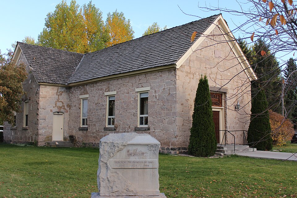
Listed on the National Register of Historic Places in 1973.
One of 31 National Register listings published here for Bonneville County · listed in 1973 · category: Building.
Sources: the case file at the National Archives · the National Register database, National Park Service
Regional context, not property-specific evidence. The federal wildfire occurrence database lists 13 fires within 5 miles of Iona Meetinghouse between 1992 and 2018, burning about 1,119 acres in total. 4 started naturally. None was recorded as arson. Distance is straight-line from the map coordinates, so a fire counted here may appear on a neighbouring settlement's page as well.
| Reported cause | Fires |
|---|---|
| Natural | 4 |
| Missing data/not specified/undetermined | 4 |
| Equipment and vehicle use | 3 |
| Debris and open burning | 1 |
| Power generation/transmission/distribution | 1 |
The most recent of them, most recent first, with the day each was reported and the service that recorded it.
| Date | Cause | Size | Reported by | Name on the report |
|---|---|---|---|---|
| 3 September 2018 | Missing data/not specified/undetermined | 2.5 acres | Idaho Falls District | BONNEVILLE COUNTY ASSIST 2 |
| 1 September 2005 | Equipment and vehicle use | 93 acres | Idaho Falls District | PANORAMA |
| 30 August 1994 | Equipment and vehicle use | 595 acres | Idaho Falls District | RIMROCK |
| 29 August 1997 | Natural | under an acre | Idaho Falls District | DENSMORE C |
| 27 August 1996 | Natural | 170 acres | Idaho Falls District | PANORAMA |
| 18 August 2010 | Power generation/transmission/distribution | 73 acres | Idaho Falls District | IONA |
| 11 August 1992 | Equipment and vehicle use | 98 acres | Idaho Falls District | PETERSON |
| 9 July 2013 | Missing data/not specified/undetermined | 1.0 acres | Idaho Falls District | PANORAMA |
Regional context, not property-specific evidence. The federal mineral resources record lists 11 workings within 5 miles of Iona Meetinghouse: 7 producers, 2 past producers, 1 unknown, 1 occurrence. 7 still produce. What was taken out: Sand and Gravel, Construction, Pumice, Clay. Distance is straight-line from the map coordinates, so a quarry counted here may appear on a neighbouring settlement's page as well.
| Where | Site | Commodity | Status | Recorded |
|---|---|---|---|---|
| Clay, Brick | Clay | Unknown | ||
| Pumice Deposit | Pumice | Occurrence | Pumice | |
| Pumice Deposit (Snake River Valley) | Pumice | Past Producer | Pumice | |
| Pumice, Inc. Mine | Pumice | Past Producer | Pumice | |
| Gravel Pit | Sand and Gravel, Construction | Producer | ||
| Gravel Pit | Sand and Gravel, Construction | Producer | ||
| Gravel Pit | Sand and Gravel, Construction | Producer | ||
| Gravel Pit, Bonneville Co | Sand and Gravel, Construction | Producer | ||
| Gravel Pit, Id Hwy Dpt | Sand and Gravel, Construction | Producer | ||
| Hatch Pit | Sand and Gravel, Construction | Producer |
Regional context, not property-specific evidence. The National Weather Service names Iona, the town this property stands in, in 9 storm reports between 2011 and 2024: 4 thunderstorm wind, 2 hail, 1 tornado, 1 flood. No death or injury is recorded in these reports. Each account below is quoted exactly as the forecast office filed it, from the NOAA Storm Events Database, and each date opens the federal record of that event.
| When | Event | Place named | Harm | What the report says |
|---|---|---|---|---|
| July 2022 | Lightning | Iona | $800,000 | A 2 story 5,000 square foot residence was struck by lightning causing a large fire. It occurred 2 miles northeast of Iona along E. Panorama Dr. A firefighter was injured in the fire. An estimated 800,000 dollars worth of damage occurred to the home. |
| April 2014 | Thunderstorm Wind | Iona | $3,000 | A trailer house on the Bonneville/Jefferson County line in between Rigby and Iona lost it's roof due to thunderstorm winds and 6 to 8 inch tree limbs were downed. |
| November 2017 | Tornado (EF0) | Iona | $200 | A cold air funnel touched ground between 225 and 235 PM MST on the bench between Idaho Falls and Ririe near highway 26. Several photographs were downloaded onto social media of the tornado. A destroyed metal picnic table was the only reported damage from the tornado. |
| August 2024 | Thunderstorm Wind | Iona | - | A private weather station in Iona measured a 67 mph wind gust from thunderstorm outflow along E Lincoln Rd near Wood River Rd. |
| July 2022 | Hail | Iona | - | One inch hail fell near Thunder Ridge High School. Photograph provided. |
| July 2021 | Flood | Iona | - | Significant street and yard flooding occurred in Iona. The intersection of E Lincoln Rd and Crook Rd and the intersection of E Tanner Dr and N Aubree Way were flooded with over 1 foot of water in the roads in some areas. |
| June 2015 | Hail | Iona | - | One inch hail recorded 6 miles south of Ririe. |
| August 2015 | Thunderstorm Wind | Iona | - | Photograph of small trees snapped and blown across road in Iona. |
| June 2011 | Thunderstorm Wind | Iona | - | Large oak tree downed in Iona. |
No historic map-sheet match is published for this property yet. That does not mean no map exists. This record needs a coordinate-quality review before it can be joined to a sheet boundary. Browse the county's mapped places while that work is pending.
Other National Register properties close enough to walk or drive between, ordered by distance from this one. Both positions come from the same geocoding pass that matched these properties to their map sheets.
| Photograph | Property | Distance | Listed |
|---|---|---|---|
| St. John Lutheran Church | 5.6 miles | 2024 | |
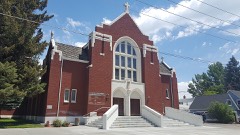 | Holy Rosary Church | 5.7 miles | 2002 |
| Eleventh Street Historic District | 5.8 miles | 1997 | |
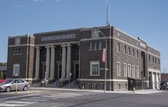 | Idaho Falls City Building | 6.0 miles | 1984 |
 | First Presbyterian Church | 6.0 miles | 1978 |
| Ridge Avenue Historic District | 6.0 miles | 1993 |
| National Archives record | The nomination case file for reference 73000681 in Record Group 79. |
| Bonneville County | All 31 listed properties in this county. |