Block
From the record
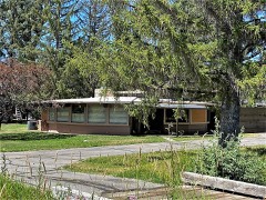
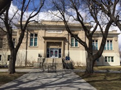
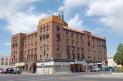
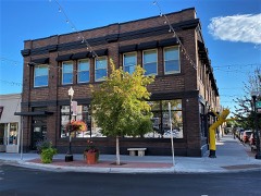
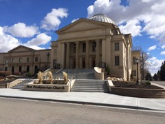
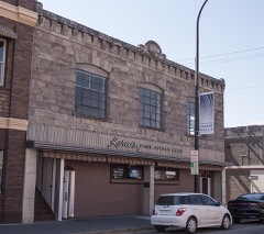
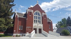
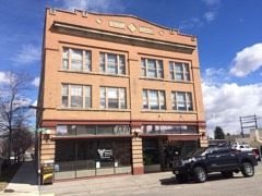
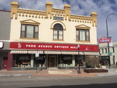
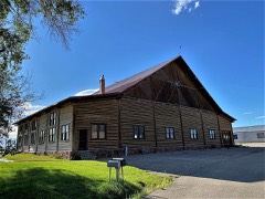
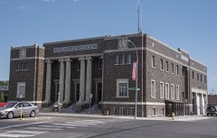
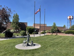
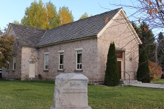
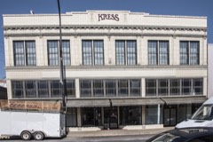
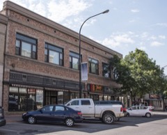
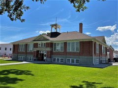
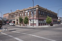
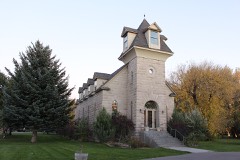
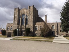
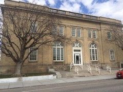
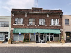
31 National Register listings published here.
Sources: the National Register database, National Park Service
70 topographic sheets cover 25 settlements here, and 31 properties are on the National Register of Historic Places.
31 National Register listings published here.
Sources: the National Register database, National Park Service
Every property in this county listed on the National Register of Historic Places, with the year it was listed and the federal nomination document.
Every wildfire the federal occurrence database records inside this county: 464 of them, burning about 122,547 acres. 250 started naturally and 19 were recorded as arson. Each settlement page carries the fires within five miles of it.
| Reported cause | Fires |
|---|---|
| Natural | 250 |
| Missing data/not specified/undetermined | 59 |
| Recreation and ceremony | 50 |
| Debris and open burning | 31 |
| Equipment and vehicle use | 29 |
| Arson/incendiarism | 19 |
| Power generation/transmission/distribution | 10 |
| Smoking | 6 |
| Firearms and explosives use | 5 |
| Fireworks | 3 |
| Misuse of fire by a minor | 1 |
| Other causes | 1 |
The five largest, by the area the report gives. None of them was recorded as arson.
| Date | Cause | Size | Reported by | Name on the report |
|---|---|---|---|---|
| 21 August 2016 | Missing data/not specified/undetermined | 52,512 acres | Idaho Falls District | HENRYS CREEK |
| 30 July 2017 | Natural | 27,181 acres | Idaho Falls District | WILDHORSE |
| 5 July 2007 | Fireworks | 6,225 acres | Idaho Falls District | BLACKHAWK |
| 23 July 2000 | Debris and open burning | 4,394 acres | Idaho Falls District | KETTLE BTE |
| 8 August 2007 | Natural | 3,621 acres | Caribou-Targhee National Forest | BEAR WFU |
| 25 July 2000 | Recreation and ceremony | 2,463 acres | Idaho Falls District | BLACKTAIL |
| 26 July 2005 | Natural | 2,098 acres | Caribou-Targhee National Forest | BIG DRY CANYON WFU |
| 2 September 1994 | Natural | 1,918 acres | Caribou-Targhee National Forest | LAKE |
Every settlement page carries the fires within five miles of it - see the settlement index below.
The NOAA Storm Events Database holds 223 reports for this county, causing 1 death, 8 injuries and about $34,682,500 in recorded property damage. Each settlement page carries the reports that name it.
| Kind of event | Reports |
|---|---|
| Thunderstorm Wind | 126 |
| Hail | 44 |
| Flood | 14 |
| Funnel Cloud | 10 |
| Heavy Rain | 8 |
| Lightning | 8 |
| Tornado | 6 |
| Flash Flood | 6 |
| Wildfire | 1 |
The most serious of them, by death, then injury, then recorded damage. The accounts are quoted exactly as the forecast office filed them.
| When | Event | Place named | Harm | What the report says |
|---|---|---|---|---|
| August 2011 | Thunderstorm Wind | Idaho Falls | 1 killed, $15,000 | Early on August 21st a thunderstorm caused trees to into a house on Pioneer Road in Idaho Falls killing an 82 year old man in his bedroom. Trees were also downed on East Lincoln Road. |
| August 2024 | Hail | Palisades | 4 hurt | Heavy hail fell on boat on Palisades Reservoir with larger than quarter sized hail falling on video. 4 occupants received bruises from the hail. |
| August 2024 | Hail | Palisades | 2 hurt | Hail recorded on a boat on Palisades Reservoir with 2 more injuries due to bruising from hail. |
| April 1978 | Tornado (F2) | not stated | 1 hurt, $2,500,000 | no account filed |
| July 2021 | Lightning | Idaho Falls | 1 hurt | A 60 year old man was struck by lightning at 1240 PM in the back parking lot of Love's Travel Stop in Idaho Falls at South 45th West. He was taken to Eastern Idaho Regional Medical Center for treatment. |
| April 2018 | Hail | Idaho Falls | $29,750,000 | At least 28 reports of 1 to 2 inch hail were reported in the Ammon and Idaho Falls area and extensive damage was reported to residential and business structures. Extensive automobile damage was reported as well. Emergency management and insurance company reports estimated the damage from the large hail at $29,750,000. Approximately 2,600 structures and 1,800 vehicles sustained damage from the hail storm. |
| May 2023 | Flash Flood | Idaho Falls | $800,000 | One to 3 inches of rain fell in two hours in the Idaho Falls area resulting in extreme street flooding in downtown Idaho Falls with underpasses with several feet of water and cars submerged in water. This occurred at the 17th Street underpass. Multiple homes with severe flooding and inches of water in their basements. Extreme damage to dozens of homes. Flooding in Idaho Falls City Hall and the Mountain America Events Center during a high school graduation ceremony. Several homes in the 30 to 80 thousand dollar damage amount from their home flooding. |
| July 2022 | Lightning | Iona | $800,000 | A 2 story 5,000 square foot residence was struck by lightning causing a large fire. It occurred 2 miles northeast of Iona along E. Panorama Dr. A firefighter was injured in the fire. An estimated 800,000 dollars worth of damage occurred to the home. |
| February 2017 | Flood | Ucon | $250,000 | Extensive snow melt with warmer temperatures caused extensive sheet flooding throughout the county mainly resulting in flooded fields, damaged roadways and extensive basement flooding. |
| February 2000 | Thunderstorm Wind | Countywide | $200,000 | A warehouse roof was torn off and crushed a car. Many large trees were downed, closing city streets in Idaho Falls and crushing at least one car. The vehicle's occupants narrowly escaped injury. Several large signs were destroyed. Farms were hit hard with damage to irrigation systems, outbuildings and farm implements. |
| February 2000 | Tornado (F1) | Cotton | $150,000 | no account filed |
| March 2017 | Flood | Ucon | $40,000 | Sheet flooding continued to cause road and some property damage mainly in early March due to snow melt. |
| February 2012 | Flood | Ammon | $40,000 | Extensive flooding of houses occurred in Ammon and just southeast of Ririe in Bonneville County. Homes along Tildy Lane and Tildy Circle had basements flooded with several feet of water in Ammon as a canal overflowed from snow melt. The neighborhoods near 55th East and Lincoln Road and the Cortland Ridge neighbrohood near Woodland Elementary school in Ammon also affected by the flooding. Birch Creek near Ririe flooded causing flooding at a home on US Route 26 and 160th East Road. |
| May 2023 | Flood | Swan Vly | $35,000 | One lane of Bear Creek Road in Swan Valley washed away due to extensive runoff and snow melt. Water flowing under the roadway caused the one lane collapse. It eliminated access to Calamity Campground. The collapse occurred on May 17th. |
| May 2017 | Flood | Ucon | $14,000 | Minor flooding continued in May with some damage to agricultural due to field flooding and recreation facilities. Levee repair was conducted to mitigate flooding problems. |
| June 2009 | Lightning | Idaho Falls | $13,000 | A lightning strike to a large tree in Taylorsville killed 13 dairy cows who were underneath it for shelter during a thunderstorn. |
| May 2023 | Thunderstorm Wind | Idaho Falls | $10,000 | Thunderstorm wind combined with hail destroyed trailer. |
| March 2006 | Thunderstorm Wind | Idaho Falls | $9,000 | no account filed |
| June 2017 | Flood | Ucon | $8,000 | Very minor flooding continue early in the month with damage to agricultural fields along with levee repair conducted. Snake River Road in the Heise area closed on the 15th due to flooding. |
| July 2019 | Lightning | Idaho Falls | $5,000 | On July 12th at about 9:15 pm lightning hit a chimney at the ARTitorium in downtown Idaho Falls. The Destinations Inn which shares a building with the ARTitorium was evacuated by all 24 guests until fire fighters could inspect the building. One vehicle was hit by a brick from the chimney. Damage amounts were estimated. |
| July 2018 | Thunderstorm Wind | Idaho Falls | $5,000 | Numerous large trees reported down in Idaho Falls. Homes and vehicles damaged. One wood and sheet metal shed destroyed. Several fences were blown down. At least 9,000 electric customers were without power. |
| June 2004 | Lightning | Idaho Falls | $5,000 | Lightning blew out windows in a house and split trees causing them to collapse. |
| September 1999 | Thunderstorm Wind | Idaho Falls | $4,000 | Thunderstorm induced winds broke power poles and lines, and downed numerous trees. A downed power line caused a fire that destroyed a billboard. |
| August 2025 | Thunderstorm Wind | Ammon | $3,000 | Two large carports were destroyed and blown into a wooden fence knocking it down. A trampoline landed on a utility trailer in the side of a residential yard. Several large tree limbs were knocked off a tree with isolated damage at a couple housed in the Ammon neighborhood. |
| April 2014 | Thunderstorm Wind | Iona | $3,000 | A trailer house on the Bonneville/Jefferson County line in between Rigby and Iona lost it's roof due to thunderstorm winds and 6 to 8 inch tree limbs were downed. |
| May 1989 | Tornado (F0) | not stated | $2,500 | no account filed |
| April 1981 | Tornado (F1) | not stated | $2,500 | no account filed |
| March 2025 | Flood | Coltman | $2,000 | ITD reported minor flooding encroaching the shoulder of Highway 20 west of Idaho Falls due to increased snowmelt in that area. |
| July 2017 | Flash Flood | Idaho Falls | $2,000 | Over an inch of rain fell in the Idaho Falls area in a two hour period causing flash flooding. In Idaho Falls water was over Buckboard Lane with several inches of water on city streets on the west side. The Yellowstone Ave underpass flooded along with some basements. Grandview Drive and Saturn Avenue flooded. A road near Russ Freeman Park was flooded. A vehicle was stuck in 2 feet of water on 17th Street. Flooding was several inches deep at the intersection of North Blvd and Shelley Street. The Idaho Falls airport set a daily precipitation record on July 26th of 1.06 inches. |
| June 2009 | Thunderstorm Wind | Idaho Falls | $2,000 | KIFI Channel 8 in Idaho Falls reported damage at an Idaho Falls home due to the wind uprooting a pine tree and damaging a newly built fence. |
| July 1996 | Thunderstorm Wind | Idaho Falls | $2,000 | no account filed |
| July 2022 | Thunderstorm Wind | Idaho Falls | $1,300 | Large tree limbs downed on power lne on South Boulevard near E 23rd St in Idaho Falls. Power outage for 1,400 customers reported by Idaho Power. |
| August 2024 | Thunderstorm Wind | Poplar | $1,000 | Large tree limbs were downed blocking 160 E near E Ririe Highway. |
| August 2024 | Thunderstorm Wind | Ammon | $1,000 | Media reported a large tree blown over onto a road in Ammon. |
| August 2024 | Thunderstorm Wind | Ammon | $1,000 | Tree downed across Sunnyside Road in Ammon blocking traffic. |
| August 2023 | Thunderstorm Wind | Ammon | $1,000 | Large tree downed on S Midway Ave between E Owen St and E Molen St south of Ammon. |
| August 2021 | Thunderstorm Wind | Osgood | $1,000 | Thunderstorm winds knocked out power to 176 customers west of Idaho Falls airport. |
| July 2018 | Thunderstorm Wind | Idaho Falls | $1,000 | Multiple trees and power lines reported in Idaho Falls. 2,000 customers were without electricity . |
| June 2017 | Hail | Idaho Falls | $1,000 | Hail 1.25 inches was recorded in Idaho Falls and 3,000 Idaho Falls Power customers lost power due to a transformer failure. The outage was areas south of 17th street. |
| April 2016 | Lightning | Idaho Falls | $1,000 | Lightning struck a power pole in the northern part of Idaho Falls and left 1,700 Rocky Mountain Power customers without power for just over one hour on April 10th. A power line was arcing on the ground and caused a brief fire. |
| May 2025 | Thunderstorm Wind | Ucon | $500 | A 2 to 3 foot diameter tree uprooted near Ucon. |
| July 2018 | Thunderstorm Wind | Ucon | $300 | Tree downed destroying a fence along East 97th North southwest of Ucon. |
| November 2017 | Tornado (EF0) | Iona | $200 | A cold air funnel touched ground between 225 and 235 PM MST on the bench between Idaho Falls and Ririe near highway 26. Several photographs were downloaded onto social media of the tornado. A destroyed metal picnic table was the only reported damage from the tornado. |
| July 2025 | Lightning | Ucon | $100 | Rocky Mountain Power reported a power outage due to lightning strike off of N 55th E near US 26 in Ucon. |
| April 2018 | Lightning | Idaho Falls | $100 | In an odd occurrence, Idaho Fish and Game gathered 50 dead geese which were struck by lighting over the city of Idaho Falls. They believed the geese were killed by lightning based on investigation of the geese's bodies. The dead geese fell from the sky. No monetary damage occurred, it was listed to be able to enter this event into the history of events. |
| May 2025 | Thunderstorm Wind | Palisades | - | A 59 mph wind gust recorded at ITDE5 Palisades Dam mesonet site. |
| May 2025 | Thunderstorm Wind | Irwin | - | Wind gusts caused power outages in the Irwin area. |
| May 2025 | Thunderstorm Wind | Palisades | - | Sixty to 70 mph wind gusts estimated over Pine Creek Pass. |
| May 2025 | Thunderstorm Wind | Palisades | - | Mount Baird recorded a 65 mph wind gust. |
| May 2025 | Thunderstorm Wind | Osgood | - | Mesonet station 8419 D6 Kettle Butte US Highway 20 recorded 58 mph wind gust. |
| May 2025 | Hail | Swan Vly | - | One inch hail measured in Swan Valley. |
| June 2025 | Thunderstorm Wind | Osgood | - | A 59 mph wind gust measured at Kettle Butte. |
| July 2025 | Thunderstorm Wind | Poplar | - | The Antelope Flats mesonet station recorded a 62 mph thunderstorm outflow wind gust. |
| July 2024 | Thunderstorm Wind | Osgood | - | The ITD Kettle Butte site on US 20 measured a 63 mph gust. |
| June 2024 | Thunderstorm Wind | Osgood | - | The Kettle Butte mesonet site measured a 62 mph wind gust. |
| August 2024 | Thunderstorm Wind | Poplar | - | The mesonet station Moss Avery recorded a 58 mph wind gust. |
| August 2024 | Thunderstorm Wind | Poplar | - | A private weather station just east of Birch Creek Rd measured a 59 mph wind gust. |
| August 2024 | Thunderstorm Wind | Poplar | - | RWIS ITD18 Ririe site recorded a 66 mph wind gust. |
| August 2024 | Hail | Palisades | - | One inch hail reported at Calamity Campground. |
| August 2024 | Hail | Palisades | - | Bear Lake Emergency Manager measured inch and quarter hail driving through region. |
The Survey's mineral resources record lists 217 workings inside this county. 45 still produce and 172 are closed or unrecorded. Each settlement page carries the workings within five miles of it.
| Commodity | Workings |
|---|---|
| Gold | 45 |
| Phosphorus-Phosphates | 40 |
| Sand and Gravel, Construction | 39 |
| Uranium | 28 |
| Pumice | 23 |
| Coal, Molybdenum, Germanium | 15 |
| Limestone, General | 13 |
| Copper | 6 |
| Coal, Molybdenum | 5 |
| Geothermal | 4 |
| Molybdenum, Coal | 2 |
| Vanadium, Uranium | 2 |
| Iron | 2 |
| Vanadium, Phosphorus-Phosphates | 2 |
The least common of them first, because a county's hundredth gravel pit says nothing its first ten did not.
| Where | Site | Commodity | Status | Recorded |
|---|---|---|---|---|
| Bilk Gulch Placer | Gold, Platinum | Past Producer | 1870 | |
| Brinson Coal Prospect | Uranium, Coal | Occurrence | 1900 | |
| Burns Pit | Stone | Producer | ||
| Caribou Mountain Feldspar Occurrence | Feldspar, Zirconium | Occurrence | ||
| Croley Mine | Lignite, Uranium | Past Producer | 1925 | |
| Fall Creek Coal Mine | Bituminous, Uranium | Past Producer | 1922 | |
| Fall Creek Travertine Mine | Limestone, Ultra Pure | Producer | Travertine | |
| Fall Creek, Porcupine Creek Limestone -Dolomite Deposit | Limestone, General, Dolomite, Magnesite | Occurrence | Dolomite, Limestone | |
| God Send To Health Mine | Coal, Uranium | Occurrence | 1922 | |
| Mccoy Creek Limestone - Dolomite Deposit | Dolomite, Limestone, General | Occurrence | Dolomite, Limestone | |
| Mount Pisgah, Caribou Mtn | Gold, Silver, Copper | Producer | Bornite, Chalcopyrite, Pyrite | |
| Nitrate | Nitrogen-Nitrates, Sodium | Occurrence | ||
| North Fork Rainy Creek | Phosphorus-Phosphates, Coal | Occurrence | ||
| North Fork Rainy Creek Prospect | Oil Shale, Phosphorus-Phosphates, Coal | Occurrence | Sedimentary | |
| North Fork of Eagle Creek Lode | Gold, Copper | Occurrence | Vein | |
| Palisades Creek Area Limestone - Dolomite Deposit | Limestone, General, Dolomite | Occurrence | Dolomite, Limestone | |
| Palisades Creek Coal and Phosphate Deposit | Phosphorus-Phosphates, Coal, Oil Shale | Occurrence | 1919 | |
| Perlite | Perlite | Occurrence | ||
| Pittsburg Mine | Gold, Copper, Silver | Past Producer | Bornite, Chalcopyrite | |
| Robinson Mine | Gold, Copper, Silver | Past Producer | 1877 | |
| Shale & Road Ballast Quarry | Stone, Crushed/Broken | Past Producer | ||
| Snake River Area (Bentonite Occurrence) | Bentonite | Occurrence | Bentonite | |
| South Rainy Creek Phosphate Deposit | Petroleum (Oil), Phosphorus-Phosphates | Occurrence | ||
| Trench G. Phosphate Occurrence | Phosphorus-Phosphates, Vanadium | Occurrence | ||
| Uranium Sampling Locality 39 | Uranium, Molybdenum, Coal, Germanium | Occurrence | 1952 | |
| Apache Iron Deposit | Iron | Occurrence | Vein | |
| Clay, Brick | Clay | Unknown | ||
| Clay, Brick | Clay | Unknown | ||
| Copper Queen Mine | Copper, Silver, Gold | Past Producer | Bornite, Chalcopyrite | |
| Fall Creek Travertine Quarry | Travertine | Past Producer | ||
| Iron Deposit | Iron | Occurrence | ||
| Mineral Springs | Travertine | Occurrence | ||
| Monte Cristo Mine | Copper, Silver, Gold | Past Producer | ||
| Pine Creek Phosphate Deposit | Phosphorus-Phosphates, Vanadium, Uranium | Occurrence | ||
| Swan Valley Phosphate | Phosphorus-Phosphates, Vanadium, Uranium | Prospect | ||
| Trench H Phosphate Occurrence | Vanadium, Phosphorus-Phosphates | Occurrence | ||
| Trench I Phosphate Occurrence | Vanadium, Phosphorus-Phosphates | Occurrence | ||
| Uranium Sampling Locality 31 | Uranium, Molybdenum, Coal | Occurrence | 1952 | |
| Uranium Sampling Locality 32 | Uranium, Molybdenum, Coal | Occurrence | 1952 | |
| Alpine Hot Spring | Geothermal | Occurrence | ||
| Unnamed Hot Spring | Geothermal | Producer | ||
| Unnamed Hot Spring | Geothermal | Producer | ||
| Unnamed Hot Spring | Geothermal | Producer | ||
| Uranium Sampling Locality 21 | Uranium, Coal, Molybdenum | Occurrence | 1952 | |
| Uranium Sampling Locality 22 | Uranium, Coal, Molybdenum | Occurrence | 1952 | |
| Uranium Sampling Locality 23 | Uranium, Coal, Molybdenum | Occurrence | 1952 | |
| Uranium Sampling Locality 24 | Uranium, Coal, Molybdenum | Occurrence | 1952 | |
| Uranium Sampling Locality 30 | Uranium, Coal, Molybdenum | Occurrence | 1952 | |
| Bell Boy | Gold, Copper | Occurrence | ||
| Evergreen Mine | Gold, Copper | Prospect | ||
| Oskaloosa | Gold, Copper | Occurrence | ||
| Dry Fork Limestone Deposit | Limestone, General | Occurrence | Limestone | |
| Fall Creek Limestone Deposit | Limestone, General | Occurrence | Limestone | |
| Limestone Deposit | Limestone, General | Occurrence | Limestone | |
| Limestone Deposit | Limestone, General | Occurrence | Limestone | |
| Palisades Reservoir Limestone Deposit | Limestone, General | Occurrence | Limestone | |
| Peterson Limestone | Limestone, General | Occurrence | ||
| Pine Creek Limestone Deposit | Limestone, General | Occurrence | Limestone | |
| Unnamed Limestone Deposit | Limestone, General | Occurrence | ||
| Unnamed Limestone Occurrence | Limestone, General | Occurrence | ||
| Unnamed Limestone Occurrence | Limestone, General | Occurrence | ||
| Unnamed Limestone Occurrence | Limestone, General | Occurrence | ||
| Upper Palisades Lake Limestone Deposit | Limestone, General | Occurrence | Limestone | |
| Uranium Sample Localities 17 and 18 | Uranium, Coal, Molybdenum, Germanium | Occurrence | 1952 | |
| Uranium Sample Locality 16 | Uranium, Coal, Molybdenum, Germanium | Occurrence | 1952 | |
| Uranium Sample Locality 2 | Uranium, Coal, Molybdenum, Germanium | Occurrence | 1952 | |
| Uranium Sample Locality 3 | Uranium, Coal, Molybdenum, Germanium | Occurrence | 1952 | |
| Uranium Sample Locality 6 | Uranium, Coal, Molybdenum, Germanium | Occurrence | 1952 | |
| Uranium Sample Locality 7 | Uranium, Coal, Molybdenum, Germanium | Occurrence | 1952 | |
| Uranium Sample Locality 8 | Uranium, Coal, Molybdenum, Germanium | Occurrence | 1952 | |
| Uranium Sampling Localities 19 and 20 | Uranium, Coal, Molybdenum, Germanium | Occurrence | 1952 | |
| Uranium Sampling Localities 25 and 26 | Uranium, Coal, Molybdenum, Germanium | Occurrence | 1952 | |
| Uranium Sampling Localities 27 and 28 | Uranium, Coal, Molybdenum, Germanium | Occurrence | 1952 | |
| Uranium Sampling Localities 33 and 34 | Uranium, Coal, Molybdenum, Germanium | Occurrence | 1952 | |
| Uranium Sampling Locality 29 | Uranium, Coal, Molybdenum, Germanium | Occurrence | 1952 | |
| Uranium Sampling Locality 35 | Uranium, Coal, Molybdenum, Germanium | Occurrence | 1952 | |
| Uranium Sampling Locality 36 | Uranium, Coal, Molybdenum, Germanium | Occurrence | 1952 | |
| Uranium Sampling Locality 38 | Uranium, Coal, Molybdenum, Germanium | Occurrence | 1952 | |
| Amcor Crushing Plant | Pumice | Producer | ||
| Ammon Area Pumice Deposit | Pumice | Past Producer | Pumice | |
| Cinder Hill | Pumice | Unknown | ||
| Cinder Pit | Pumice | Unknown | ||
| Cinder Pit | Pumice | Past Producer | ||
| Cinder Pit | Pumice | Past Producer | ||
| Cinder Pit | Pumice | Past Producer | ||
| Cinder Pit | Pumice | Past Producer | ||
| Cinder Pit | Pumice | Past Producer | ||
| Conant Valley | Pumice | Unknown | ||
| Fan Claim | Pumice | Past Producer | ||
| Gravel Pit | Pumice | Producer | ||
| Idaho Falls Pumice Co. Deposit | Pumice | Producer | Pumice | |
| Meadow Creek - Call Dugway Occurrance | Pumice | Occurrence | Pumice | |
| Pumice Deposit | Pumice | Occurrence | Pumice | |
| Pumice Deposit (Ammon Valley) | Pumice | Occurrence | Pumice | |
| Pumice Deposit (Indian Siding Pit) | Pumice | Occurrence | Pumice | |
| Pumice Deposit (Snake River Valley) | Pumice | Past Producer | Pumice | |
| Pumice Deposit (West of Ammon) | Pumice | Occurrence | Pumice | |
| Pumice, Inc. Mine | Pumice | Past Producer | Pumice | |
| Rock Hollow | Pumice | Producer | ||
| Taylor and Henry Creek Pumice Depst | Pumice | Unknown | ||
| Unnamed Location | Pumice | Occurrence | ||
| Fall Creek Phosphate Deposit | Phosphorus-Phosphates, Uranium | Past Producer | ||
| Grays Lake | Uranium | Occurrence | ||
| Unnamed Prospect | Uranium | Occurrence | ||
| Gravel Pit | Sand and Gravel, Construction | Producer | ||
| Gravel Pit | Sand and Gravel, Construction | Producer | ||
| Gravel Pit | Sand and Gravel, Construction | Past Producer | ||
| Gravel Pit | Sand and Gravel, Construction | Producer | ||
| Gravel Pit | Sand and Gravel, Construction | Producer | ||
| Gravel Pit | Sand and Gravel, Construction | Producer | ||
| Gravel Pit | Sand and Gravel, Construction | Producer | ||
| Gravel Pit | Sand and Gravel, Construction | Producer | ||
| Gravel Pit | Sand and Gravel, Construction | Producer | ||
| Gravel Pit | Sand and Gravel, Construction | Producer | ||
| Gravel Pit | Sand and Gravel, Construction | Producer | ||
| Gravel Pit | Sand and Gravel, Construction | Producer | ||
| Gravel Pit | Sand and Gravel, Construction | Producer | ||
| Gravel Pit | Sand and Gravel, Construction | Producer | ||
| Gravel Pit | Sand and Gravel, Construction | Past Producer | ||
| Gravel Pit | Sand and Gravel, Construction | Producer | ||
| Gravel Pit | Sand and Gravel, Construction | Producer | ||
| Gravel Pit | Sand and Gravel, Construction | Past Producer | ||
| Gravel Pit | Sand and Gravel, Construction | Past Producer | ||
| Gravel Pit, Bonneville Co | Sand and Gravel, Construction | Producer | ||
| Gravel Pit, Bonneville Co | Sand and Gravel, Construction | Producer | ||
| Gravel Pit, Bonneville Co | Sand and Gravel, Construction | Producer | ||
| Gravel Pit, Bonneville Co | Sand and Gravel, Construction | Producer | ||
| Gravel Pit, Bonneville Co | Sand and Gravel, Construction | Producer | ||
| Gravel Pit, Bonneville Co | Sand and Gravel, Construction | Producer | ||
| Gravel Pit, Bonneville Co | Sand and Gravel, Construction | Producer | ||
| Gravel Pit, Bonneville Co | Sand and Gravel, Construction | Producer | ||
| Gravel Pit, Id Hwy Dpt | Sand and Gravel, Construction | Producer | ||
| Gravel Pit, Id Hwy Dpt | Sand and Gravel, Construction | Producer | ||
| Gravel Pit, Id Hwy Dpt | Sand and Gravel, Construction | Producer | ||
| Gravel Pit, Id Hwy Dpt | Sand and Gravel, Construction | Producer | ||
| Gravel Pit, Id Hwy Dpt | Sand and Gravel, Construction | Producer | ||
| Gravel Pit, Id Hwy Dpt | Sand and Gravel, Construction | Producer | ||
| Hatch Pit | Sand and Gravel, Construction | Producer | ||
| Idaho Falls Pit and Plant | Sand and Gravel, Construction | Producer | ||
| Mcgrain Pit | Sand and Gravel, Construction | Producer | ||
| Tyler Pit | Sand and Gravel, Construction | Producer | ||
| Valley Ready Mix Plant | Sand and Gravel, Construction | Producer | ||
| Wheeler Pit No 4 | Sand and Gravel, Construction | Producer | ||
| Bear Creek Phosphate Deposit | Phosphorus-Phosphates | Prospect | 1951 | |
| E. A. Rex Mining Co. Phosphate Lease | Phosphorus-Phosphates | Occurrence | ||
| Garden Creek | Phosphorus-Phosphates | Unknown | ||
| Highway 31 Phosphate Outcrop | Phosphorus-Phosphates | Occurrence | ||
| Little Valley Phosphate Occurrence | Phosphorus-Phosphates | Occurrence | ||
| Long Gulch | Phosphorus-Phosphates | Prospect | ||
| Papoose Creek Phosphate Deposit | Phosphorus-Phosphates | Occurrence | ||
| Phosphate Deposit | Phosphorus-Phosphates | Occurrence | ||
| Phosphate Occurrence | Phosphorus-Phosphates | Unknown | ||
| Phosphate Occurrence | Phosphorus-Phosphates | Unknown | ||
| Pritchard Creek Phosphate | Phosphorus-Phosphates | Prospect | ||
| Rainy Creek Phosphate | Phosphorus-Phosphates | Occurrence | ||
| Red Ridge Phosphate Deposit | Phosphorus-Phosphates | Prospect | ||
| Snake River Area | Phosphorus-Phosphates | Occurrence | ||
| Unnamed Phosphate Deposit | Phosphorus-Phosphates | Occurrence | ||
| Unnamed Phosphate Deposit | Phosphorus-Phosphates | Occurrence | ||
| Unnamed Phosphate Prospect | Phosphorus-Phosphates | Prospect | ||
| Unnamed Prospect | Phosphorus-Phosphates | Prospect | ||
| Unnamed Prospect | Phosphorus-Phosphates | Prospect | ||
| Unnamed Prospect | Phosphorus-Phosphates | Prospect | ||
| Unnamed Prospect | Phosphorus-Phosphates | Prospect | ||
| Unnamed Prospect | Phosphorus-Phosphates | Prospect | ||
| Unnamed Prospect | Phosphorus-Phosphates | Prospect | ||
| Unnamed Prospect | Phosphorus-Phosphates | Prospect | ||
| Unnamed Prospect | Phosphorus-Phosphates | Prospect | ||
| Unnamed Prospect | Phosphorus-Phosphates | Prospect | ||
| Unnamed Prospect | Phosphorus-Phosphates | Prospect | ||
| Unnamed Prospect | Phosphorus-Phosphates | Prospect | ||
| Unnamed Prospect | Phosphorus-Phosphates | Prospect | ||
| Unnamed Prospect | Phosphorus-Phosphates | Prospect | ||
| Unnamed Prospect | Phosphorus-Phosphates | Prospect | ||
| Unnamed Prospect | Phosphorus-Phosphates | Prospect | ||
| Unnamed Prospect | Phosphorus-Phosphates | Prospect | ||
| Unnamed Prospect | Phosphorus-Phosphates | Prospect | ||
| Unnamed Prospect | Phosphorus-Phosphates | Prospect | ||
| Anderson Creek Placer | Gold | Past Producer | ||
| Austin Mine | Gold | Past Producer | 1877 | |
| Barnes Creek Placer | Gold | Past Producer | Placer | |
| Bilk Creek Placer | Gold | Past Producer | ||
| Caribou City-Stump Creek Area Mla | Gold | Prospect | ||
| City Creek Gold Placer | Gold | Past Producer | Placer | |
| Gold Placer | Gold | Past Producer | ||
| Gold Placers | Gold | Past Producer | ||
| Grey Eagle | Gold | Prospect | ||
| Griffin Prospect | Gold | Prospect | 1879 | |
| Iowa Bar Placer | Gold | Past Producer | 1887 | |
| Iowa Creek Placer | Gold | Past Producer | ||
| Lakeview | Gold | Occurrence | ||
| Lalla Rooth | Gold | Prospect | ||
| Lucky Strike Group Placers | Gold | Past Producer | Placer | |
| Mayflower | Gold | Occurrence | ||
| Mc Coy Creek Gold Placer I | Gold | Past Producer | Placer | |
| Mccoy - Iowa Creeks Placer | Gold | Past Producer | Placer | |
| Mccoy Creek Placer Ii | Gold | Past Producer | 1875 | |
| Mountain Chief Mine | Gold | Prospect | ||
| N.S. Davenport Mine | Gold | Prospect | ||
| Nabob Mine | Gold | Prospect | ||
| Noal B | Gold | Occurrence | ||
| Northern Light Mine | Gold | Prospect | ||
| Oneida | Gold | Prospect | ||
| Paymaster Mine | Gold | Prospect | ||
| Peterson Mine | Gold | Prospect | ||
| Real Mc Coy No 1 | Gold | Occurrence | Placer | |
| Real Mc Coy No. 1 | Gold | Prospect | ||
| Robinson Mill | Gold | Unknown | ||
| Rough & Ready | Gold | Occurrence | ||
| Roy Coles Placer | Gold | Past Producer | Placer | |
| Rusler | Gold | Occurrence | ||
| Silver Star Mine | Gold | Prospect | ||
| Tincup Creek Placer | Gold | Past Producer | Placer | |
| Tincup Placer | Gold | Past Producer | ||
| Virginia Mine | Gold | Prospect | ||
| Wasatch Mill | Gold | Unknown | ||
| Xlnt | Gold | Occurrence |
Named settlements recorded in the Geographic Names Information System, each with the topographic sheets covering it. Villages, hamlets and abandoned places alike. Each is shown with the nearest named watercourse or landform and the survey quadrangle it falls on.
Idaho Falls census division · 83406 · Near Snake River Plain · Ammon quadrangle
14 sheets, 1924 to 1986
Idaho Falls census division · 83401 · On Willow Creek · Ucon quadrangle
12 sheets, 1948 to 1988
Swan Valley census division · 83427 · On Canyon Creek · Bone quadrangle
12 sheets, 1924 to 1986
Swan Valley census division · 83285 · On Taylor Creek · Caribou Mountain quadrangle
16 sheets, 1932 to 1986
No longer a settlement
Swan Valley census division · 83427 · Near Big Horse Butte · Lone Pine Ridge quadrangle
13 sheets, 1924 to 1986
Swan Valley census division · 83285 · On Eagle Creek · Bear Island quadrangle
14 sheets, 1932 to 1986
Swan Valley census division · 83442 · On Spring Creek · Lone Pine Ridge quadrangle
13 sheets, 1924 to 1986
Idaho Falls census division · 83404 · On Crow Creek · Idaho Falls South quadrangle
13 sheets, 1948 to 1978
Swan Valley census division · 83449 · Near Flatiron · Swan Valley quadrangle
16 sheets, 1932 to 1986
Swan Valley census division · 83285 · On City Creek · Big Elk Mountain quadrangle
16 sheets, 1932 to 1986
No longer a settlement
Idaho Falls West census division · 83402 · Idaho Falls North quadrangle
14 sheets, 1948 to 1980
Swan Valley census division · 83428 · On Russell Creek · Palisades Dam quadrangle
16 sheets, 1932 to 1986
Idaho Falls West census division · 83402 · Idaho Falls North quadrangle
14 sheets, 1948 to 1980
Swan Valley census division · 83449 · On Oakden Creek · Swan Valley quadrangle
16 sheets, 1932 to 1986
Idaho Falls census division · 83404 · Idaho Falls South quadrangle
13 sheets, 1948 to 1978
The vanished settlements of Bonneville County: the places named above that are no longer on the map.