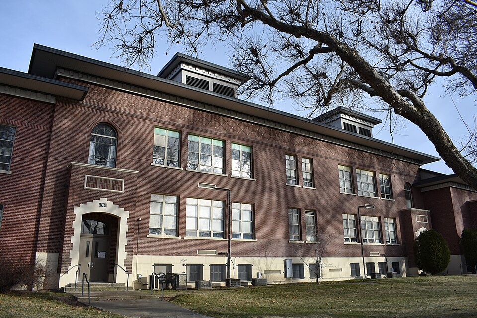
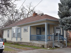
Listed on the National Register of Historic Places in 1982.
From the record
“Garfield School in Boise, Idaho, is a 2-story, flat roof brick building designed by Tourtellotte & Hummel and constructed in 1929. The 1929 facade is symmetrical and shows a Tudor Revival influence, and shallow arch entries at north and south ends of the building are prominent features of the Broadway Avenue exposure.”
Wikipedia article Garfield School (Boise, Idaho), CC BY-SA 4.0.
One of 167 National Register listings published here for Ada County · listed in 1982 · category: Building.
National Register reference number.82000204- the number the National Park Service assigned this property when it was listed, and the key its nomination file is catalogued under at the National Archives.
Fires near this property
36 since 1992
Regional context, not property-specific
evidence. The
federal wildfire occurrence database
lists 36 fires within 5 miles of Garfield School
between 1992 and 2019, burning about 20,022 acres in total. 4 started naturally. 4 were recorded as arson.
Distance is straight-line from the map coordinates, so a fire counted
here may appear on a neighbouring settlement's page as well.
Reported cause
Fires
Missing data/not specified/undetermined
16
Natural
4
Arson/incendiarism
4
Recreation and ceremony
3
Power generation/transmission/distribution
2
Equipment and vehicle use
2
Fireworks
2
Misuse of fire by a minor
1
Debris and open burning
1
Smoking
1
The most recent of
them, most recent first, with the day each was reported and the service
that recorded it.
Regional context, not property-specific
evidence. The federal mineral resources record lists
55 workings within 5 miles of Garfield School: 36 past producers, 10 producers, 5 unknowns, 3 occurrences.
10 still produce. What was taken out: Sand and Gravel, Construction, Gold, Silver, Stone, Dimension. Distance is straight-line from the
map coordinates, so a quarry counted here may appear on a neighbouring
settlement's page as well.
Regional context, not property-specific
evidence. The National Weather Service names
Boise, the town this property stands in, in 48 storm reports between 1993 and 2024: 23 thunderstorm wind, 10 hail, 5 flash flood, 4 flood.
No death or injury is recorded in these reports. Each account below is quoted exactly as the forecast office
filed it, from the NOAA Storm Events Database, and each date
opens the federal record of that event.
Thunderstorms produced heavy rain across portions of the Lower Treasure Valley, including the city of Boise. Social media, weather spotter, and emergency manager reports indicated localized flooding.
During the evening of September 11, a flash flood occurred in the foothills of the Boise Mountains. The foothills had received significant rainfall all day long. Between 500 pm and 600 pm MST a heavy shower dumped 4 tenths of an inch of rain in 9 minutes on the foothills triggering flash flooding into the north end of Boise. The wall of mud and debris was estimated at 15 feet high as it breached six flood control dams and washed over a golf course. While most of the damage consisted of mud and debris on local roadways, the golf course sustained damage and 12 houses were slightly damaged at the foundations. No injuries were reported. As of publishing , damages to roads in the city and clean up costs were estimated at at least 60,000 dollars.
Heavy rain from slow moving thunderstorms caused flash flooding in the Boise metro area. Over an inch of rain fell in less than an hour across portions of Boise. Flash flooding was reported in the downtown area and in the north and northwest parts of the city.
A strong outflow boundary from a thunderstorm damaged several power lines around the Boise metropolitan area and Garden Valley. Around 2,000-3,000 people were estimated to be without power in both of those regions due to wind damage.
The public reported a large spruce tree was knocked down along with old juniper trees. Idaho Power reported that this caused 2000 customers to be without power in the Boise North End.
Thunderstorms that moved across Ada County caused damage around the Boise area, including tree tops torn off, a large tree snapped at its base, and residential fences blown down.
Gusty winds and rain ripped through the Treasure Valley, causing power outages and knocking down huge trees. KBCI TV reported numerous trees and power lines down across the Boise metro area.
A line of thunderstorms produced wind gusts to 44 knots (51 mph) and hail up to 3/4 inch diameter from 10 miles west of Boise into the city of Boise. Numerous trees and power lines were brought down by the storm.
During the afternoon of May 3rd a thunderstorm over Boise sent a bolt of lightning onto the Crane Creek Country Club golf course. Three golfers were knocked down when a the lightening struck the ground near by. None of the golfers felt an electric shock but the explosion knocked them to the ground. Medical authorities summoned to the scene determined that there were no injuries to the golfers.
A severe weather spotter reported hail, measuring 1.00 inch in diameter, falling from a thunderstorm 7 miles north of Boise. The storm also produced heavy rains and frequent lightning that lasted for almost an hour.
No historic map-sheet match is published
for this property yet. That does not mean no map exists. This record needs
a coordinate-quality review before it can be joined to a sheet boundary.
Browse the county's mapped places while that work is
pending.
Listed places nearby
6 within 8 miles
Other National Register properties close
enough to walk or drive between, ordered by distance from this one. Both
positions come from the same geocoding pass that matched these properties
to their map sheets.
Listing record. National Park Service National Register of Historic Places, listed-properties dataset, current to 2026-05-22.
Map join. Address geocoded through the United States Census geocoder, then tested against the published boundary of every sheet in the USGS Historical Topographic Map Collection.
How this page is made. Listing fields come from federal records; map-sheet coverage is a labelled coordinate-to-boundary calculation, not a source-field claim.
Wildfire. Short, Karen C. 2022. Spatial wildfire occurrence data for the United States, 1992-2020 [FPA_FOD_20221014]. 6th Edition. Fort Collins, CO: Forest Service Research Data Archive. https://doi.org/10.2737/RDS-2013-0009.6 Collected with United States Government funding and usable without additional permissions or fees.
Mines and quarries. USGS Mineral Resources Data System (MRDS) https://mrdata.usgs.gov/mrds/ A work of the United States government, no copyright under 17 U.S.C. 105.
Storms. NOAA National Centers for Environmental Information, Storm Events Database https://www.ncei.noaa.gov/stormevents/ A work of the United States government, no copyright under 17 U.S.C. 105. Narratives are quoted verbatim from the National Weather Service report and are not edited or summarised.
 Block