 Block
From the record
3 National Register listings published here · the county-history sources tell 2 stories.
Sources: the county history on the Internet Archive · the National Register database, National Park Service
47 topographic sheets cover 13 settlements here, and 3 properties are on the National Register of Historic Places.
3 National Register listings published here · the county-history sources tell 2 stories.
Sources: the county history on the Internet Archive · the National Register database, National Park Service
Among them: Alarm; Death Of Phillips. These passages come from the identified county-history source books. Each inset names its own source and opens the exact section it comes from.
The alarm spread, homes were abandoned, the plow was left in the furrow, all kinds of property was forsaken, the people fleeing from the murderous rifle and tomahawk. All the inhabitants on the west side of the Illinois crossed over to the east side where they fixed the frontier and made a stand.
A party of men going from Hennepin to Dover, 16 miles distant, to secure tlieir cattle were followed and watched all night by Indians,and in the morning one man named Pliillips was shot as lie cauie out of the cabin in which they had passed the night. The Indians then fled, a boy named Dimmick rode to Hennepin and gave the alarm.
Every property in this county listed on the National Register of Historic Places, with the year it was listed and the federal nomination document.
| Photograph | Property | Type | Listed | Reference |
|---|---|---|---|---|
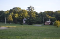 | Cortland Condit House | building | 1983 | 83000335 |
 | Edward Pulsifer House | building | 1979 | 79000864 |
 | Putnam County Courthouse | building | 1975 | 75000672 |
Every wildfire the federal occurrence database records inside this county: 11 of them, burning about 99 acres. None started naturally and none was recorded as arson. Each settlement page carries the fires within five miles of it.
| Reported cause | Fires |
|---|---|
| Missing data/not specified/undetermined | 7 |
| Debris and open burning | 3 |
| Smoking | 1 |
The five largest, by the area the report gives. None of them was recorded as arson.
| Date | Cause | Size | Reported by | Name on the report |
|---|---|---|---|---|
| 28 March 2010 | Missing data/not specified/undetermined | 60 acres | Illinois Division of Forestry Resources | 1046 |
| 30 March 2010 | Debris and open burning | 30 acres | Illinois Division of Forestry Resources | 1051 |
| 1 May 2013 | Smoking | 5.0 acres | Illinois Division of Forestry Resources | STAND3 |
| 17 November 2008 | Missing data/not specified/undetermined | 2.0 acres | Illinois Division of Forestry Resources | 008-130 |
| 26 March 2008 | Missing data/not specified/undetermined | 1.0 acres | Illinois Division of Forestry Resources | 008-032 |
| 20 June 2013 | Missing data/not specified/undetermined | under an acre | Illinois Division of Forestry Resources | STAND5 |
| 30 March 2014 | Debris and open burning | under an acre | Illinois Division of Forestry Resources | STAND6 |
| 30 March 2014 | Debris and open burning | under an acre | Illinois Division of Forestry Resources | 014-025 |
Every settlement page carries the fires within five miles of it - see the settlement index below.
The NOAA Storm Events Database holds 187 reports for this county, causing no deaths, 6 injuries and about $14,081,520 in recorded property damage. Each settlement page carries the reports that name it.
| Kind of event | Reports |
|---|---|
| Thunderstorm Wind | 93 |
| Hail | 64 |
| Tornado | 12 |
| Flash Flood | 11 |
| Flood | 3 |
| Heavy Rain | 2 |
| Funnel Cloud | 2 |
The most serious of them, by death, then injury, then recorded damage. The accounts are quoted exactly as the forecast office filed them.
| When | Event | Place named | Harm | What the report says |
|---|---|---|---|---|
| April 2004 | Tornado (F2) | Florid | 5 hurt, $8,000,000 | Rated very high end F2 |
| April 1967 | Tornado (F2) | not stated | 1 hurt, $2,500 | no account filed |
| April 2003 | Thunderstorm Wind | Putnam | $3,000,000 | Bow echo |
| June 2010 | Tornado (EF2) | Putnam | $1,000,000 | Between approximately 810 pm and 835 pm on June 5, an EF2 tornado moved across areas from about 2.75 miles east northeast of Henry, IL, through Magnolia, IL, into western La Salle County about 3 miles east of Magnolia, IL. Wind speeds were estimated to be 135 mph. The tornado touched down at the shore of Sawmill Lake with a width of about 0.5 miles. Numerous trees were snapped off and shredded, laying in scattered directions. Extensive tree damage and some structural damage was observed toward Taylor Rd. Along County Road 150 N and Highway 18 west of Magnolia, several farm outbuildings including a large barn and steel shed were destroyed. A 400 to 450 foot tall cell phone tower was completely destroyed. |In Magnolia, IL, the tornado caused extensive tree damage across the northern two thirds of town with minor damage to numerous residences. On the north side of town, the tornado ripped the roofs completely off of four structures. The tornado weakened to an EF0 rating as it approached and crossed into La Salle County, where the NWS Chicago Storm Survey Team indicated it lifted about 1.23 miles east of the county line just south of Highway 18. |
| April 2003 | Thunderstorm Wind | Standard | $1,000,000 | no account filed |
| April 2003 | Thunderstorm Wind | Putnam | $500,000 | Tree down & truck rolled over |
| November 1965 | Tornado (F2) | not stated | $250,000 | no account filed |
| July 2008 | Flash Flood | Hennepin | $50,000 | Torrential rains eroded several roads south and west of McNabb, IL and in the vicinity of Florid, IL during the morning of July 12. |
| June 1994 | Thunderstorm Wind | Hennipin | $50,000 | A construction trailer was overturned and another was moved off its foundation. |
| May 2000 | Thunderstorm Wind | Mt Palatine | $30,000 | no account filed |
| April 1981 | Tornado (F0) | not stated | $25,000 | no account filed |
| September 1974 | Tornado (F2) | not stated | $25,000 | no account filed |
| March 2006 | Hail | Countywide | $20,000 | An intense thunderstorm moved across the southern part of Putnam County producing hail of 1.00 to 1.50 inches. Hail was reported between Magnolia and Mc Nabb in the 1615-1625 CST time period by several spotters. Additional spotters reported large hail on Illinois 18 west of Magnolia. |
| October 2004 | Thunderstorm Wind | Standard | $20,000 | The same storm that produced a downburst 10 minutes earlier produced another around the town of Standard, Illinois. Numerous trees and powerlines were downed with a brand new 20x16 shed destroyed. The debris from the shed was scattered up to 400 yards away. The sheriff stated that the strongest winds only lasted 20 to 30 seconds. |
| April 2006 | Hail | Countywide | $15,000 | Lake Thunderbird to Magnolia; radar would indicate a near continuous hail swath. Based on the reports received from spotters, the hail likely varied from nickel to golfball size. |
| May 2004 | Flash Flood | Countywide | $10,000 | Numerous creeks out of their banks with many roads closed in the western part of the county |
| June 1998 | Thunderstorm Wind | Countywide | $10,000 | Widespread damage was reported across the county after thunderstorm winds downed trees and power lines. The cities of Hennepin, Granville, and Standard suffered power outages. And numerous trees were blown down in Mc Nabb, Mark, and Magnolia. |
| April 2006 | Hail | Magnolia | $10,000 | no account filed |
| April 2006 | Hail | Putnam | $10,000 | no account filed |
| June 2005 | Hail | Mc Nabb | $7,000 | no account filed |
| May 2011 | Thunderstorm Wind | Granville | $5,000 | Wind gusts estimated to be 75 mph blew down some trees and power lines in Granville, IL at 1140 am CDT May 29. |
| June 2010 | Thunderstorm Wind | Granville | $5,000 | Wind gusts estimated to be 65 mph blew down some power lines in the Granville, IL area at 337 pm June 18. Heavy rain and lightning was also reported. |
| August 2007 | Thunderstorm Wind | Magnolia | $5,000 | Winds estimated to be 70 mph blew down some power lines near Magnolia, IL. |
| March 2006 | Hail | Magnolia | $5,000 | multiple reports |
| July 2006 | Thunderstorm Wind | Hennepin | $5,000 | Tree down on car. Time estimated based on radar. |
| October 2004 | Thunderstorm Wind | Florid | $5,000 | Location is near the junction of Illinois 18 and 26, along King's Curve, or 1.2 miles ESE of Henry, Illinois near the Putnam/Marshall County line. Numerous trees were downed in a downburst, some rotted but other fully solid. Several cars ran off into the roadside ditches in an attempt to avoid the trees across the road. |
| September 2005 | Hail | Granville | $5,000 | no account filed |
| August 2000 | Thunderstorm Wind | Putnam | $5,000 | no account filed |
| May 2006 | Thunderstorm Wind | Granville | $2,000 | Trees down across IL 89 |
| July 2006 | Thunderstorm Wind | Granville | $2,000 | 6 inch diameter tree down |
| June 2005 | Thunderstorm Wind | Hennepin | $2,000 | A few trees down in Hennepin. South of town several 12 to 16 inch diameter trees (mainly rotted) were also downed. |
| July 2006 | Thunderstorm Wind | Standard | $500 | 3 to 4 inch diameter limbs down |
| July 2006 | Thunderstorm Wind | Mc Nabb | $500 | 4 inch diameter limbs down on Meridian Rd along the Putnam/La Salle line. |
| May 1998 | Thunderstorm Wind | Magnolia | $20 | Strong thunderstorm winds downed trees and power lines. |
| April 2026 | Thunderstorm Wind | Hennepin | - | Public measured wind equipement. |
| April 2026 | Thunderstorm Wind | Granville | - | Putnam County emergency management reported a power line blown down. Time estimated from radar data. |
| April 2026 | Thunderstorm Wind | Hennepin | - | Garage door blown in on a home, with multiple 3 inch diameter tree branched down. Time estimated from radar data. |
| April 2026 | Thunderstorm Wind | Hennepin | - | Multiple small trees up to 8 inches in diameter snapped at base or uprooted. Time estimated from radar data. |
| April 2026 | Thunderstorm Wind | Hennepin | - | Measured winds of 58 mph. |
| March 2025 | Thunderstorm Wind | Hennepin | - | Numerous trees blown down, blocking roads south of Hennepin. |
| March 2025 | Thunderstorm Wind | Hennepin | - | Several power poles were snapped off between Hennepin and Mark. 1400 power customers are without power. |
| July 2025 | Thunderstorm Wind | Florid | - | The Emergency Manager reported a 2 inch diameter tree limbs down. |
| February 2024 | Tornado (EF1) | Magnolia | - | A tornado touched down just east of Hwy 26 south of Henry, in northern Marshall County, at 440 pm CST. It crossed into Putnam county about 300 yards southeast of IL Highway 18, around 4:44 pm CST, and later overturned a semi on Hwy 18. Several large trees were uprooted or snapped along the path. In addition, some damage to a few outbuildings was observed. The tornado then dissipated in an open field that was seen by a chaser. Estimated peak winds reached 110 mph. |
| May 2024 | Thunderstorm Wind | Florid | - | Reported 12 inch diameter tree limb reported down across Highway 26. The time was estimated from radar data. |
| May 2024 | Thunderstorm Wind | Florid | - | A large 8 to 10 inch tree limb was reported down on a remote rural road. The time was estimated from radar data. |
| May 2024 | Thunderstorm Wind | Hennepin | - | An 8 inch diameter tree limb down. The time was estimated from radar data. |
| July 2024 | Thunderstorm Wind | Florid | - | The Fire Department reported a thunderstorm wind gusts of 64 MPH as the gust front hit. |
| July 2024 | Thunderstorm Wind | Putnam | - | A trained spotter reported that a tree was down and blocking Illinois 18 just east of the Illinois River bridge. The time of the event was estimated using radar. |
| July 2024 | Thunderstorm Wind | Mark | - | The Emergency Manager reported that a large tree blown down on a car. |
| July 2024 | Thunderstorm Wind | Mc Nabb | - | The Emergency Manager reported large tree down on a portion of a house damaging the roof and gutters. |
| July 2024 | Thunderstorm Wind | Mc Nabb | - | The Emergency Manager reported damage to a grain bin and trees. |
| July 2024 | Thunderstorm Wind | Mc Nabb | - | Law Enforcement reported large branches of 1 foot plus in diameter downed. |
| July 2024 | Thunderstorm Wind | Moronts | - | Law Enforcement reported a couple of trees down in the Wolf Hollow area. The time of the event was estimated using radar. |
| August 2024 | Thunderstorm Wind | Mc Nabb | - | A 3 inch diameter tree branch blown down in a yard. |
| July 2023 | Thunderstorm Wind | Hennepin | - | Eight inch diameter tree snapped near the sheriff's office, with branches downed around town. |
| May 2023 | Thunderstorm Wind | Florid | - | Estimated winds around 65 mph, with trees down throughout the county. Time was estimated by radar. |
| May 2022 | Hail | Granville | - | Hail up to quarter sized, relayed through social media. |
| August 2022 | Thunderstorm Wind | Hennepin | - | The COOP Observer reported a large tree knocked down in their yard. The time of the event was estimated using radar. |
| August 2022 | Hail | Mc Nabb | - | A trained spotter reports estimated penny to quarter size hail. |
| July 2022 | Thunderstorm Wind | Mc Nabb | - | A trained spotter reported a garage door damaged along with a few trees down on property. There is also erratic corn damage in fields near residence. |
The Survey's mineral resources record lists 12 workings inside this county. 4 still produce and 8 are closed or unrecorded. Each settlement page carries the workings within five miles of it.
| Commodity | Workings |
|---|---|
| Sand and Gravel, Construction | 12 |
The least common of them first, because a county's hundredth gravel pit says nothing its first ten did not.
| Where | Site | Commodity | Status | Recorded |
|---|---|---|---|---|
| Bonucci Gravel Pit | Sand and Gravel, Construction | Producer | ||
| Chiado Gravel Co. | Sand and Gravel, Construction | Producer | ||
| Crowder Pit | Sand and Gravel, Construction | Past Producer | ||
| Edward Hunt Pit | Sand and Gravel, Construction | Past Producer | ||
| Gedraitis Pit | Sand and Gravel, Construction | Past Producer | ||
| Hennepin Pit | Sand and Gravel, Construction | Producer | ||
| Hope Township Pit | Sand and Gravel, Construction | Past Producer | ||
| Jones Pit | Sand and Gravel, Construction | Producer | ||
| Magnolia Pit | Sand and Gravel, Construction | Past Producer | ||
| Morine Pit | Sand and Gravel, Construction | Past Producer | ||
| Newbaum Pit | Sand and Gravel, Construction | Past Producer | ||
| Ossola Pit | Sand and Gravel, Construction | Past Producer |
History of Putnam County from Its Earliest Settlement to the Year 1876 devotes a chapter to each township: its boundaries and streams, who settled it and when, the mills, the schools and the churches. All 2 are reproduced here in full. Each row shows the township's own shape and where it lies in the county, drawn from the Census Bureau's boundary. Which settlements belong to which township is computed from that same boundary, not taken from the book.
| Shape and position in the county | Township | Settlements in it | Length | Sections |
|---|---|---|---|---|
| Magnolia Township | Caledonia, Magnolia, McNabb | 203 words | 1 | |
| Senachwine Township | Indian Spring, Putnam, Undercliff, Walnut Grove | 3,827 words | 19 |
Named settlements recorded in the Geographic Names Information System, each with the topographic sheets covering it. Villages, hamlets and abandoned places alike. Each is shown with the nearest named watercourse or landform and the survey quadrangle it falls on.
Magnolia township · 61336 · Henry quadrangle
17 sheets, 1893 to 1985
No longer a settlement
Senachwine township · 61560 · On Senachwine Creek · Florid quadrangle
17 sheets, 1893 to 1985
Senachwine township · 61560 · On Senachwine Creek · Putnam quadrangle
17 sheets, 1893 to 1985
Senachwine township · 61560 · On Senachwine Creek · Florid quadrangle
17 sheets, 1893 to 1985
The vanished settlements of Putnam County: the places named above that are no longer on the map.