 Block
Putnam, Illinois
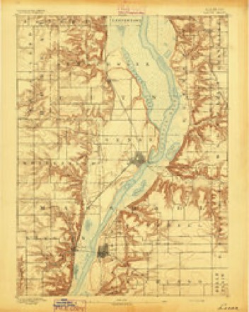
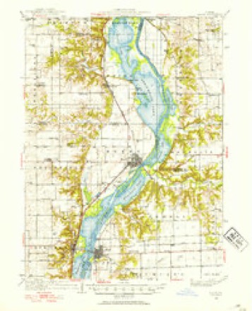
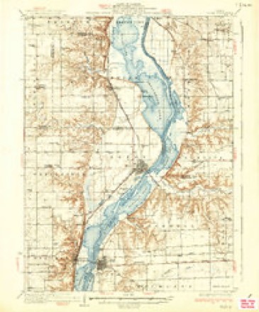
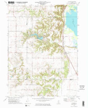
17 topographic sheets cover this place, the earliest surveyed in 1893 and the latest in 1985. It stands in Senachwine Township. It lies in ZIP code area 61560. It stands on Senachwine Creek. The Survey maps it on the Putnam quadrangle.
On record in Putnam
Buildings and businesses the archive holds for this place. Each opens its own page, with the source record it came from.
On the National Register within a mile 1 record
The National Register names another town for these. They stand within one mile of this settlement's coordinate.
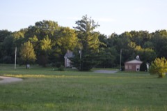 Cortland Condit Houselisted 1983 · 0.2 miles away
Topographic sheets covering this place
7 surveys from 17 printed sheetsMatched by testing this settlement's coordinate against the published boundary of every sheet in the United States Geological Survey's historical collection. Each opens the scanned sheet at the Survey.
- 1893 USGS Lacon quadrangle1:62500, 4 printings
- 1933 USGS Lacon quadrangle1:62500, 3 printings
- 1937 USGS Lacon quadrangle1:62500, 2 printings
- 1958 USGS Aurora quadrangle1:250000, 3 printings
- 1961 USGS Aurora quadrangle1:250000
- 1972 USGS Putnam quadrangle1:24000, 2 printings
- 1985 USGS Kewanee quadrangle1:100000, 2 printings


What happened here
An account from the chapter on Senachwine township. The inset identifies its exact source book and publication year.
Alarm
The alarm spread, homes were abandoned, the plow was left in the furrow, all kinds of property was forsaken, the people fleeing from the murderous rifle and tomahawk. All the inhabitants on the west side of the Illinois crossed over to the east side where they fixed the frontier and made a stand.
In the county-history sources
3,827 words on this townshipHistory of Putnam County from Its Earliest Settlement to the Year 1876, published 1877 names this settlement in its chapter on Senachwine Township. These are the passages that mention it, exactly as the scans read.
Senachwine received its name from an Indian chief whose home and hunting grounds were in tluit township, on a stream also bearing his name. He was buried on a hilly point that juts out into the valley commanding a view of the scene of hisearthly career. The town originated from a station on the Peoria and Bureau Valley Rail Road, upon the opening of that road the place was laid out, stores, shops and dwellings were erected, schools and churches followed, and it bids fair to become an important point, it being the oidy Rail Road station at this date in tlie iiiuits of Putnam county. John and Curtis Williams and James R. Taliferro were the first settlers. Population in 1875, 801
Passage source: History of Putnam County from Its Earliest Settlement to the Year 1876, published 1877.
Runners were sent in all directions calling for volunteers for the defence. Hennepin was the place of rendezvous for the Putnam county rangers, where fifteen hundred men were organized and from which point they took field.
Passage source: History of Putnam County from Its Earliest Settlement to the Year 1876, published 1877.
A party of men going from Hennepin to Dover, 16 miles distant, to secure tlieir cattle were followed and watched all night by Indians,and in the morning one man named Pliillips was shot as lie cauie out of the cabin in which they had passed the night. The Indians then fled, a boy named Dimmick rode to Hennepin and gave the alarm. It was the day of the disbanding of the rangers, many of whom were there. About thirty of them, as many as could be gotten over the river in time, responded and hastened to Dover where they found the body of Phillips lying as lie fell and liis companions still in ihe cabin. The Indians were followed but not overtaken. The company returned to Hennepin, bearing the remains of the unfortunate man, and Thomas Hartzell, J. S. Simpson, H. K. Zenorand Williamson Durley, selected a burying place, and assisted in burying the only man who fell by Indian hands within the limits of Putnam county, and the first to fill a grave in the burying ground of Hennepin.
Passage source: History of Putnam County from Its Earliest Settlement to the Year 1876, published 1877.
Machine-read from a century-old scan, so expect the errors a machine makes: misspelled names, dropped words, stray characters.
Read the whole chapter on Senachwine Township - it names this place 8 more 8 times.
Mines and quarries near this place
6 within 5 milesRegional context, not property-specific evidence. The federal mineral resources record lists 6 workings within 5 miles of Putnam: 4 past producers, 2 producers. 2 still produce. What was taken out: Sand and Gravel, Construction, Stone, Crushed/Broken. Distance is straight-line from the map coordinates, so a quarry counted here may appear on a neighbouring settlement's page as well.
| Where | Site | Commodity | Status | Recorded |
|---|---|---|---|---|
| Sheely Quarry Renner's Quarry Co. | Stone, Crushed/Broken | Past Producer | ||
| Crowder Pit | Sand and Gravel, Construction | Past Producer | ||
| Edwin Hank Pit | Sand and Gravel, Construction | Past Producer | ||
| Hennepin Pit | Sand and Gravel, Construction | Producer | ||
| Newbaum Pit | Sand and Gravel, Construction | Past Producer | ||
| Stadel Pit & Plant | Sand and Gravel, Construction | Producer |
Storms near this place
14 since 2000Regional context, not property-specific evidence. The National Weather Service names Putnam in 14 storm reports between 2000 and 2024: 7 hail, 5 thunderstorm wind, 2 tornado. No death or injury is recorded in these reports. Each account below is quoted exactly as the forecast office filed it, from the NOAA Storm Events Database, and each date opens the federal record of that event.
| When | Event | Place named | Harm | What the report says |
|---|---|---|---|---|
| April 2003 | Thunderstorm Wind | Putnam | $3,000,000 | Bow echo |
| June 2010 | Tornado (EF2) | Putnam | $1,000,000 | Between approximately 810 pm and 835 pm on June 5, an EF2 tornado moved across areas from about 2.75 miles east northeast of Henry, IL, through Magnolia, IL, into western La Salle County about 3 miles east of Magnolia, IL. Wind speeds were estimated to be 135 mph. The tornado touched down at the shore of Sawmill Lake with a width of about 0.5 miles. Numerous trees were snapped off and shredded, laying in scattered directions. Extensive tree damage and some structural damage was observed toward Taylor Rd. Along County Road 150 N and Highway 18 west of Magnolia, several farm outbuildings including a large barn and steel shed were destroyed. A 400 to 450 foot tall cell phone tower was completely destroyed. |In Magnolia, IL, the tornado caused extensive tree damage across the northern two thirds of town with minor damage to numerous residences. On the north side of town, the tornado ripped the roofs completely off of four structures. The tornado weakened to an EF0 rating as it approached and crossed into La Salle County, where the NWS Chicago Storm Survey Team indicated it lifted about 1.23 miles east of the county line just south of Highway 18. |
| April 2003 | Thunderstorm Wind | Putnam | $500,000 | Tree down & truck rolled over |
| April 2006 | Hail | Putnam | $10,000 | no account filed |
| August 2000 | Thunderstorm Wind | Putnam | $5,000 | no account filed |
| July 2024 | Thunderstorm Wind | Putnam | - | A trained spotter reported that a tree was down and blocking Illinois 18 just east of the Illinois River bridge. The time of the event was estimated using radar. |
| July 2020 | Thunderstorm Wind | Putnam | - | Reports of numerous trees and limbs down, as well as power lines across the county. |
| July 2016 | Tornado (EF0) | Putnam | - | The local fire chief reported a brief touchdown with no significant damage. The time was estimated by radar. |
| May 2012 | Hail | Putnam | - | A trained spotter reported quarter sized hail near the Putnam and Marshall County lines. |
| June 2008 | Hail | Putnam | - | Dime to penny-sized hail fell about three miles west of Putnam, IL at 6:20 pm June 20. |
| April 2006 | Hail | Putnam | - | Location is 3SSW of Lake Thunderbird on the Putnam/Bureau line; pea to nickel size hail |
| April 2006 | Hail | Putnam | - | dime to nickel size hail with heavy rain |
| March 2006 | Hail | Putnam | - | 2 minute duration just north of the Putnam/Marshall county line. |
| May 2014 | Hail | Putnam | - | no account filed |
Nearest settlements
The eight closest, with where each one stands in the county. Distances are straight-line, computed from the Geographic Names Information System coordinates.
| Map | Place | Distance | Sheets |
|---|---|---|---|
| Undercliff | 1.6 miles | 17 | |
| Indian Spring | 1.9 miles | 17 | |
| Walnut Grove | 2.0 miles | 17 | |
| Hennepin | 5.6 miles | 13 | |
| Florid | 6.8 miles | 17 | |
| Moronts | 8.8 miles | 13 | |
| Caledonia (historical) | 9.0 miles | 17 | |
| Mark | 9.5 miles | 13 |
Provenance
This settlement is recorded in the Geographic Names Information System as feature 416295. The sheet list is computed by point-in-boundary test against the United States Geological Survey's historical topographic inventory. Both are works of the United States government and carry no copyright under 17 U.S.C. 105.
Mines and quarries. USGS Mineral Resources Data System (MRDS) https://mrdata.usgs.gov/mrds/ A work of the United States government, no copyright under 17 U.S.C. 105.
Storms. NOAA National Centers for Environmental Information, Storm Events Database https://www.ncei.noaa.gov/stormevents/ A work of the United States government, no copyright under 17 U.S.C. 105. Narratives are quoted verbatim from the National Weather Service report and are not edited or summarised.