 Block
From the record
4 National Register listings published here.
Sources: the National Register database, National Park Service
42 topographic sheets cover 21 settlements here, and 4 properties are on the National Register of Historic Places.
4 National Register listings published here.
Sources: the National Register database, National Park Service
Every property in this county listed on the National Register of Historic Places, with the year it was listed and the federal nomination document.
| Photograph | Property | Type | Listed | Reference |
|---|---|---|---|---|
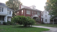 | Elliott Street Historic District | district | 1980 | 80001405 |
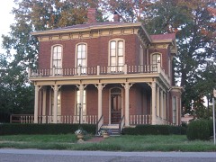 | Ambrose Hopkinson House | building | 2001 | 01000083 |
 | Larchmound | building | 1980 | 80001406 |
 | Olney Carnegie Library | building | 2002 | 02000037 |
Every wildfire the federal occurrence database records inside this county: 7 of them, burning about 11 acres. None started naturally and 1 was recorded as arson. Each settlement page carries the fires within five miles of it.
| Reported cause | Fires |
|---|---|
| Debris and open burning | 4 |
| Missing data/not specified/undetermined | 2 |
| Arson/incendiarism | 1 |
The five largest, by the area the report gives. One of them was set deliberately.
| Date | Cause | Size | Reported by | Name on the report |
|---|---|---|---|---|
| 23 September 2010 | Debris and open burning | 5.0 acres | Illinois Division of Forestry Resources | RUDOLPHI |
| 13 November 2010 | Arson/incendiarism | 2.0 acres | Illinois Division of Forestry Resources | HERMAN |
| 9 November 2010 | Missing data/not specified/undetermined | 2.0 acres | Illinois Division of Forestry Resources | OLNEY2 |
| 11 October 2010 | Debris and open burning | 1.5 acres | Illinois Division of Forestry Resources | ARCHER |
| 6 April 2010 | Debris and open burning | under an acre | Illinois Division of Forestry Resources | SLOAN |
| 6 April 2010 | Debris and open burning | under an acre | Illinois Division of Forestry Resources | BAUMAN |
| 15 October 2010 | Missing data/not specified/undetermined | under an acre | Illinois Division of Forestry Resources | OLNEY |
Every settlement page carries the fires within five miles of it - see the settlement index below.
The NOAA Storm Events Database holds 212 reports for this county, causing no deaths, 6 injuries and about $6,745,150 in recorded property damage. Each settlement page carries the reports that name it.
| Kind of event | Reports |
|---|---|
| Thunderstorm Wind | 110 |
| Hail | 46 |
| Flash Flood | 32 |
| Tornado | 17 |
| Flood | 5 |
| Lightning | 1 |
| Funnel Cloud | 1 |
The most serious of them, by death, then injury, then recorded damage. The accounts are quoted exactly as the forecast office filed them.
| When | Event | Place named | Harm | What the report says |
|---|---|---|---|---|
| November 1965 | Tornado (F2) | not stated | 5 hurt, $25,000 | no account filed |
| May 2004 | Thunderstorm Wind | Countywide | 1 hurt | Numerous trees, tree limbs, power poles and power lines were blown down countywide. Several homes sustained minor to moderate roof damage after trees fell on them. One tree fell on an occupied vehicle trapping the driver for a time. She sustained minor injuries. The roof of a barn was blown off 3 miles west southwest of Olney. |
| August 1991 | Tornado (F1) | not stated | $2,500,000 | no account filed |
| February 1956 | Tornado (F2) | not stated | $2,500,000 | no account filed |
| June 1990 | Tornado (F4) | not stated | $250,000 | no account filed |
| March 1984 | Tornado (F0) | not stated | $250,000 | no account filed |
| May 1995 | Thunderstorm Wind | Countywide | $100,000 | Numerous trees were blown down across the county. |
| April 2017 | Thunderstorm Wind | Noble | $70,000 | Straight line winds blew numerous trees and power lines down from Noble eastward through Calhoun and Claremont between 4:10 PM CDT and 4:45 PM CDT. |
| November 2017 | Tornado (EF1) | Pureton | $70,000 | A tornado touched down in an open field about 3.4 miles north of Noble at 5:24 pm CST. The tornado tracked to the east-northeast...damaging the roof of a house, destroying a garage, damaging a truck in the garage, and downing several trees before doing damage to the roof of a barn on Pleasant Ridge Lane at around 5:26 pm. The tornado continued to the east-northeast for another 7 minutes primarily damaging trees. The tornado dissipated at 5:33 pm CST, 3.2 miles north-northwest of Olney about one-half mile northwest of the Richland Country Club. |
| May 2008 | Lightning | Olney | $62,000 | A lightning strike to a 60 foot tall brick chimney in downtown Olney resulted in damage to 16 autos and the roof of the building. Bricks were thrown as far as one block away. Three people were indirectly injured by falling bricks and debris. Ages and genders of the three people were not available. The three injuries were minor, and the people were treated and released at a local hospital. |
| July 2017 | Thunderstorm Wind | Olney | $60,000 | Several trees and power lines were blown down across Olney. |
| April 2020 | Thunderstorm Wind | Olney | $50,000 | A barn was blown over northwest of Olney. |
| May 2011 | Thunderstorm Wind | Olney | $50,000 | Numerous tree limbs and powerlines were blown down across Olney. |
| July 2011 | Thunderstorm Wind | Olney | $50,000 | Numerous tree branches and power lines were blown down in Olney. |
| June 2010 | Thunderstorm Wind | Olney | $50,000 | Roofing material was blown off a garage onto Route 130. In addition, numerous trees, tree limbs and power lines were blown down around. One tree was blown onto a home and another tree was blown onto a garage. |
| April 1994 | Thunderstorm Wind | Noble | $50,000 | A mobile home was overturned. The Noble High School roof was partially peeled off. Trees and branches were blown down on the north side of town. |
| January 2005 | Flash Flood | Central Portion | $46,000 | Many roads along the Fox River had water flowing across them. In addition, numerous streets in Olney were flooded. |
| December 2015 | Thunderstorm Wind | Parkersburg | $35,000 | Seven trees were uprooted and windows were blown out of a house. Grain bins and a storage shed were also damaged. |
| March 2009 | Thunderstorm Wind | Parkersburg | $35,000 | A roof was torn off a trailer in Parkersburg, and a pole barn was destroyed 3 miles east of Claremont. |
| June 2008 | Thunderstorm Wind | Olney | $35,000 | Numerous trees and power lines were blown down. |
| July 2016 | Thunderstorm Wind | Olney | $30,000 | Numerous trees were blown down in Olney. |
| May 2016 | Thunderstorm Wind | Calhoun | $25,000 | Several trees and power poles were blown down in Calhoun. |
| July 2016 | Thunderstorm Wind | Olney | $25,000 | The metal roof was peeled off the grandstand at the Richland County Fairgrounds. |
| June 2009 | Thunderstorm Wind | Olney | $25,000 | Local law enforcement reported several trees blown down across Richland County. |
| May 1957 | Tornado (F2) | not stated | $25,000 | no account filed |
| August 1956 | Tornado (F1) | not stated | $25,000 | no account filed |
| June 2010 | Thunderstorm Wind | Olney | $23,000 | A large oak tree was snapped off at its base and landed on a house on East Street. Roofing from an old garage along Route 130 was blown onto the roadway. |
| July 2010 | Thunderstorm Wind | Olney | $22,000 | A large tree was blown down in a park in Olney. Numerous large trees and power lines were downed just west of town. |
| July 2016 | Thunderstorm Wind | Olney | $20,000 | Several large tree branches were blown down in Olney City Park. |
| June 2015 | Tornado (EF0) | Olney | $20,000 | A tornado touched down 2.3 miles north-northwest of Olney at 4:50 PM CDT. The tornado uprooted a few trees and knocked numerous 6 to 10-inch diameter tree branches down as it tracked northwestward through a mobile home park and a golf course off Route 130. It dissipated 2.8 miles north-northwest of Olney at 4:53 PM CDT. |
| April 2011 | Thunderstorm Wind | Noble | $20,000 | The steeple of a church was was torn off in West Salem. Numerous large tree limbs were blown down in Olney. |
| February 2008 | Thunderstorm Wind | Noble | $20,000 | Numerous trees and power lines were blown down. |
| January 2008 | Thunderstorm Wind | Olney | $20,000 | Numerous trees and power lines were blown down in the county. |
| October 2007 | Thunderstorm Wind | Olney | $20,000 | Numerous tree limbs and power lines were blown down. |
| November 2017 | Thunderstorm Wind | Dundas | $15,000 | Three power poles were leaned over southeast of Dundas. |
| May 2016 | Thunderstorm Wind | Gallagher | $12,000 | Trees were blown down in Wynoose. |
| June 2011 | Thunderstorm Wind | Calhoun | $12,000 | Several trees were blown down onto Sunnybrook Road southwest of Olney. |
| May 2018 | Thunderstorm Wind | Olney | $10,000 | A pine tree was blown onto a house and another tree was blown across a driveway in Olney. |
| November 2017 | Thunderstorm Wind | Pureton | $10,000 | Metal siding was peeled off a home and a rotten tree was uprooted. This damage occurred south of a tornado track. |
| June 2015 | Tornado (EF0) | Olney | $10,000 | A tornado briefly touched down 1.4 miles northwest of Olney at 4:45 PM CDT. It caused minor damage to a retail store before dissipating at 4:46 PM CDT. |
| July 2014 | Thunderstorm Wind | Amity | $10,000 | Numerous tree branches were blown down northeast of Claremont. |
| June 2011 | Thunderstorm Wind | Calhoun | $10,000 | Trees were blown down onto Meridian Road southeast of Olney. |
| May 1999 | Thunderstorm Wind | Olney | $10,000 | A severe thunderstorm moved across Richland county. As it moved into Olney winds blew down the roof over a hotel swimming pool and meeting room area. The debris from the roof damaged several vehicles in the hotel parking lot. As the storm moved to the northeast it blew down numerous trees and power lines. One mile south of Stringtown, a barn and a silo were destroyed. No injuries were reported and damage to the hotel was estimated around $10,000. |
| September 2012 | Thunderstorm Wind | Olney | $8,000 | Power lines were blown down in Olney. |
| May 2018 | Thunderstorm Wind | Wakefield | $6,000 | A power pole was blown down. |
| July 2014 | Thunderstorm Wind | Olney | $5,000 | A tree was blown down onto power lines causing a power outage across parts of Olney. |
| July 1994 | Thunderstorm Wind | Olney | $5,000 | Several trees were blown down in Olney and the surrounding area. |
| May 2010 | Thunderstorm Wind | Claremont | $4,000 | A few trees were blown down in Claremont. |
| January 2013 | Thunderstorm Wind | Olney | $2,000 | Four power poles were blown down north of Olney. In addition, several small tree branches were knocked down around town. |
| May 2013 | Thunderstorm Wind | Claremont | $2,000 | A tree was blown down 3 miles south of Claremont. |
| June 2010 | Thunderstorm Wind | Olney | $2,000 | A tree was blown down 1 mile south of Olney. |
| June 2010 | Thunderstorm Wind | Olney | $2,000 | A tree was blown down across Silver Street in Olney. |
| June 2008 | Thunderstorm Wind | Olney | $2,000 | A large tree was blown down across Highway 130. |
| April 1994 | Hail | Olney | $50 | no account filed |
| July 1994 | Hail | Olney | $50 | no account filed |
| October 1993 | Hail | not stated | $50 | no account filed |
| March 2026 | Tornado (EF0) | Olney | - | The tornado began just west of Olney and was sighted at the intersection of west Main Street and west Elms Street. The tornado proceeded through town, causing areas of tree and fencing damage. The tornado dissipated on the east side of town. It was rated EF-0, with a path length of just over two miles and a duration of two minutes. |
| March 2026 | Thunderstorm Wind | Dundas | - | Measured by a personal weather station. |
| February 2026 | Funnel Cloud | Stringtown | - | Storm chaser video showed a well-defined funnel cloud extending at least half way to the ground approximately four miles west of Chauncey. However, no evidence of a tornado was found in this area. This thunderstorm went on to produce a tornado in Crawford County four minutes after this funnel cloud was sighted. |
| July 2024 | Thunderstorm Wind | Olney | - | Several large tree limbs were blown down. |
The Survey's mineral resources record lists 1 working inside this county. It is closed or unrecorded. Each settlement page carries the workings within five miles of it.
| Commodity | Workings |
|---|---|
| Clay | 1 |
The least common of them first, because a county's hundredth gravel pit says nothing its first ten did not.
| Where | Site | Commodity | Status | Recorded |
|---|---|---|---|---|
| N.Parkersburg Shale Exposure | Clay | Past Producer |
Named settlements recorded in the Geographic Names Information System, each with the topographic sheets covering it. Villages, hamlets and abandoned places alike. Each is shown with the nearest named watercourse or landform and the survey quadrangle it falls on.
Decker township · 62450 · On Susan Branch · Noble quadrangle
10 sheets, 1949 to 1986
No longer a settlement
Noble township · 62868 · Clay City quadrangle
11 sheets, 1948 to 1986
No longer a settlement
Denver township · 62868 · Wakefield quadrangle
10 sheets, 1941 to 1986
No longer a settlement
The vanished settlements of Richland County: the places named above that are no longer on the map.