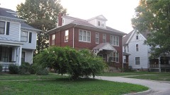
| May 2008 | Lightning | Olney | $62,000 | A lightning strike to a 60 foot tall brick chimney in downtown Olney resulted in damage to 16 autos and the roof of the building. Bricks were thrown as far as one block away. Three people were indirectly injured by falling bricks and debris. Ages and genders of the three people were not available. The three injuries were minor, and the people were treated and released at a local hospital. |
| July 2017 | Thunderstorm Wind | Olney | $60,000 | Several trees and power lines were blown down across Olney. |
| April 2020 | Thunderstorm Wind | Olney | $50,000 | A barn was blown over northwest of Olney. |
| May 2011 | Thunderstorm Wind | Olney | $50,000 | Numerous tree limbs and powerlines were blown down across Olney. |
| July 2011 | Thunderstorm Wind | Olney | $50,000 | Numerous tree branches and power lines were blown down in Olney. |
| June 2010 | Thunderstorm Wind | Olney | $50,000 | Roofing material was blown off a garage onto Route 130. In addition, numerous trees, tree limbs and power lines were blown down around. One tree was blown onto a home and another tree was blown onto a garage. |
| June 2008 | Thunderstorm Wind | Olney | $35,000 | Numerous trees and power lines were blown down. |
| July 2016 | Thunderstorm Wind | Olney | $30,000 | Numerous trees were blown down in Olney. |
| July 2016 | Thunderstorm Wind | Olney | $25,000 | The metal roof was peeled off the grandstand at the Richland County Fairgrounds. |
| June 2009 | Thunderstorm Wind | Olney | $25,000 | Local law enforcement reported several trees blown down across Richland County. |
| June 2010 | Thunderstorm Wind | Olney | $23,000 | A large oak tree was snapped off at its base and landed on a house on East Street. Roofing from an old garage along Route 130 was blown onto the roadway. |
| July 2010 | Thunderstorm Wind | Olney | $22,000 | A large tree was blown down in a park in Olney. Numerous large trees and power lines were downed just west of town. |
| July 2016 | Thunderstorm Wind | Olney | $20,000 | Several large tree branches were blown down in Olney City Park. |
| June 2015 | Tornado (EF0) | Olney | $20,000 | A tornado touched down 2.3 miles north-northwest of Olney at 4:50 PM CDT. The tornado uprooted a few trees and knocked numerous 6 to 10-inch diameter tree branches down as it tracked northwestward through a mobile home park and a golf course off Route 130. It dissipated 2.8 miles north-northwest of Olney at 4:53 PM CDT. |
| January 2008 | Thunderstorm Wind | Olney | $20,000 | Numerous trees and power lines were blown down in the county. |
| October 2007 | Thunderstorm Wind | Olney | $20,000 | Numerous tree limbs and power lines were blown down. |
| May 2018 | Thunderstorm Wind | Olney | $10,000 | A pine tree was blown onto a house and another tree was blown across a driveway in Olney. |
| June 2015 | Tornado (EF0) | Olney | $10,000 | A tornado briefly touched down 1.4 miles northwest of Olney at 4:45 PM CDT. It caused minor damage to a retail store before dissipating at 4:46 PM CDT. |
| May 1999 | Thunderstorm Wind | Olney | $10,000 | A severe thunderstorm moved across Richland county. As it moved into Olney winds blew down the roof over a hotel swimming pool and meeting room area. The debris from the roof damaged several vehicles in the hotel parking lot. As the storm moved to the northeast it blew down numerous trees and power lines. One mile south of Stringtown, a barn and a silo were destroyed. No injuries were reported and damage to the hotel was estimated around $10,000. |
| September 2012 | Thunderstorm Wind | Olney | $8,000 | Power lines were blown down in Olney. |
| July 2014 | Thunderstorm Wind | Olney | $5,000 | A tree was blown down onto power lines causing a power outage across parts of Olney. |
| July 1994 | Thunderstorm Wind | Olney | $5,000 | Several trees were blown down in Olney and the surrounding area. |
| January 2013 | Thunderstorm Wind | Olney | $2,000 | Four power poles were blown down north of Olney. In addition, several small tree branches were knocked down around town. |
| June 2010 | Thunderstorm Wind | Olney | $2,000 | A tree was blown down 1 mile south of Olney. |
| June 2010 | Thunderstorm Wind | Olney | $2,000 | A tree was blown down across Silver Street in Olney. |
| June 2008 | Thunderstorm Wind | Olney | $2,000 | A large tree was blown down across Highway 130. |
| April 1994 | Hail | Olney | $50 | no account filed |
| July 1994 | Hail | Olney | $50 | no account filed |
| March 2026 | Tornado (EF0) | Olney | - | The tornado began just west of Olney and was sighted at the intersection of west Main Street and west Elms Street. The tornado proceeded through town, causing areas of tree and fencing damage. The tornado dissipated on the east side of town. It was rated EF-0, with a path length of just over two miles and a duration of two minutes. |
| July 2024 | Thunderstorm Wind | Olney | - | Several large tree limbs were blown down. |
| July 2024 | Thunderstorm Wind | Olney | - | A tree was blown down near the intersection of East IL-250 and West North Avenue on the west side of Olney. |
| August 2024 | Thunderstorm Wind | Olney | - | Numerous tree branches were blown down across Olney. |
| August 2022 | Thunderstorm Wind | Olney | - | A large tree was blown down on North East Street a few yards from Carle Richland Memorial Hospital. |
| October 2021 | Thunderstorm Wind | Olney | - | Numerous trees and large tree branches were blown down across Olney, including some that fell onto houses and cars. One falling tree clipped part of the roof and brick facade of an apartment complex on Main Street. |
| July 2017 | Thunderstorm Wind | Olney | - | A tree was snapped in Olney. |
| April 2016 | Tornado (EF0) | Olney | - | A tornado briefly touched down in an open field about 1.7 miles north of Olney at 7:47 PM CDT. No damage occurred. |
| June 2011 | Thunderstorm Wind | Olney | - | Several trees were blown down onto Holly Road just southeast of Olney. |
| May 2008 | Tornado (EF0) | Olney | - | A landspout tornado briefly touched down in a field. No damage was reported. |
| May 2008 | Flash Flood | Olney | - | Heavy rains caused many roads to flood to the south and east of Olney. |
| August 2006 | Thunderstorm Wind | Olney | - | Power lines were blown down. |
| April 2005 | Thunderstorm Wind | Olney | - | Trees and power lines down. |
| April 2005 | Thunderstorm Wind | Olney | - | Trees and power lines down. |
| May 2005 | Thunderstorm Wind | Olney | - | Few trees blown down. |
| July 2004 | Thunderstorm Wind | Olney | - | Several trees were blown down in Olney. |
| September 2003 | Thunderstorm Wind | Olney | - | Numerous tree limbs and several trees were blown down around town. No injuries were reported. |
| August 2003 | Thunderstorm Wind | Olney | - | Thunderstorm winds blew down several power lines and trees. One tree fell down on a house causing minor damage. |
| May 2002 | Thunderstorm Wind | Olney | - | Several large trees were blown down around town. Some homes sustained minor damage from the fallen trees. |
| May 2002 | Flash Flood | Olney | - | Numerous streets in town were flooded for around half an hour due to heavy rains. One street had a section collapse that was over a 48 inch drainage pipe. Also, several basements were flooded and one Olney Central College building suffered water damage from the flooding. |
| June 2001 | Flash Flood | Olney | - | The Fox River went out of its banks during the event, roughly 1 mile north of Olney, resulting in water across portions of Illinois Route 130. |
| October 2001 | Thunderstorm Wind | Olney | - | Several tree limbs and power lines were blown down. Also, a couple of grain bins were blown over in Calhoun. |
| August 2000 | Flash Flood | Olney | - | Severe thunderstorms across the county dropped heavy rainfall onto already saturated ground. Radar estimates indicated 3 to 4 inches of rain fell during the evening hours. As a result, numerous roads in the Olney area were reported underwater and impassable through the evening. No injuries were reported and no damage estimates were available. |
| August 2000 | Thunderstorm Wind | Olney | - | Several power lines and a large tree were blown down in Olney. |
| February 1999 | Thunderstorm Wind | Olney | - | Several large trees were blown down in Olney. One mile north of Parkersburg, a trailer home sustained minor damage and a shed was destroyed. |
| July 1998 | Thunderstorm Wind | Olney | - | Thunderstorm winds blew down several power lines 1 mile west of Olney. |
| November 1998 | Thunderstorm Wind | Olney | - | Thunderstorm winds blew off part of the roof of the old railroad depot in Olney. Numerous trees and power lines were blown down throughout the county. Also, the city park building in Olney sustained minor roof damage when a 40 foot tall tree fell onto it. No damage estimate was available. |
| July 1997 | Thunderstorm Wind | Olney | - | Thunderstorms blew down several trees, tree limbs, and power lines in Olney. No injuries were reported and no damage estimate was available. |
| April 1997 | Thunderstorm Wind | Olney | - | Thunderstorm winds blew down several trees in Olney. Two trees fell onto cars, causing damage but no injuries. Also, numerous tree limbs and power lines were blown down. No damage estimate was available. |
| July 2024 | Hail | Olney | - | no account filed |
| July 2024 | Hail | Olney | - | no account filed |
| March 2023 | Hail | Olney | - | no account filed |
 Block