 Block
From the record
1 National Register listing published here.
Sources: the National Register database, National Park Service
56 topographic sheets cover 20 settlements here, and 1 property is on the National Register of Historic Places.
1 National Register listing published here.
Sources: the National Register database, National Park Service
Every property in this county listed on the National Register of Historic Places, with the year it was listed and the federal nomination document.
| Photograph | Property | Type | Listed | Reference |
|---|---|---|---|---|
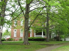 | Beall-Orr House | building | 1994 | 94000028 |
Every wildfire the federal occurrence database records inside this county: 1 of them, burning under an acre. None started naturally and none was recorded as arson. Each settlement page carries the fires within five miles of it.
| Reported cause | Fires |
|---|---|
| Missing data/not specified/undetermined | 1 |
The five largest, by the area the report gives. None of them was recorded as arson.
| Date | Cause | Size | Reported by | Name on the report |
|---|---|---|---|---|
| 1 December 2013 | Missing data/not specified/undetermined | under an acre | Illinois Division of Forestry Resources | 1319511 |
Every settlement page carries the fires within five miles of it - see the settlement index below.
The NOAA Storm Events Database holds 282 reports for this county, causing 1 death, 55 injuries and about $35,794,500 in recorded property damage. Each settlement page carries the reports that name it.
| Kind of event | Reports |
|---|---|
| Flood | 90 |
| Thunderstorm Wind | 78 |
| Hail | 56 |
| Tornado | 19 |
| Flash Flood | 18 |
| Heavy Rain | 14 |
| Funnel Cloud | 5 |
| Lightning | 2 |
The most serious of them, by death, then injury, then recorded damage. The accounts are quoted exactly as the forecast office filed them.
| When | Event | Place named | Harm | What the report says |
|---|---|---|---|---|
| March 2015 | Flood | Mt Carmel | 1 killed, $5,000 | Minor flooding occurred on the Wabash River. At the Mount Carmel river gage, the river crested at 24.78 feet on the 19th. Flood stage is 19 feet. Backwater flooding of tributary creeks occurred, including Coffee Creek near Keensburg. One person drowned when his ultra-terrain vehicle became submerged in creek floodwaters near Keensburg. The 22-year-old man was found several days later, after floodwaters had receded a couple of feet. Cattle and farm equipment were relocated. Most local roads along or near the river were impassible. Extensive lowland flooding occurred. Installation of flood gate A at Mount Carmel was necessary. Access to local camp sites was blocked. The Wabash River was more than 2 miles wide at I-64. |
| January 1989 | Tornado (F4) | not stated | 50 hurt, $25,000,000 | no account filed |
| November 2013 | Tornado (EF2) | Gards Pt | 1 hurt, $250,000 | Four homes were damaged, and two mobile homes were destroyed. One mobile home was thrown across the road and the frame was wrapped around a tree. One woman inside was injured. Another nearby mobile home was turned on its side. One home had part of the roof lifted off. The garage of the residence was destroyed, but most of the articles inside were left untouched. Debris from this residence was thrown several hundred yards. Several outbuildings were destroyed. Peak winds in this tornado were estimated near 125 mph. The peak intensity occurred almost due north of Mount Carmel. This tornado was spawned by the same supercell that produced EF-2 tornadoes in Wayne and Edwards Counties. |
| October 2001 | Thunderstorm Wind | Countywide | 1 hurt, $50,000 | A line of thunderstorms produced strong winds across the county. Mount Carmel's public utility lost about 15 poles, six of which were steel. A semi-tractor trailer rig was blown over on Illinois Route 1 at Keensburg. A trailer home was blown about 30 feet. Although the trailer was heavily damaged or destroyed, nobody was injured. At the Mount Carmel Municipal Airport, the highest recorded wind gust was 70 MPH, which occurred at 4:02 P.M. CDT. In Mount Carmel, a youth was injured when a tree fell and landed on a vehicle. Southwest of Mount Carmel, a grain bin and storage sheds were heavily damaged. West of Mount Carmel, a barn was unroofed. A three-car garage was destroyed. |
| July 2004 | Thunderstorm Wind | Countywide | 1 hurt, $25,000 | Large trees were blown down in Wabash County, specifically in the communities of Mount Carmel, Keensburg, and Bellmont. In Keensburg, several large trees were uprooted, and numerous large limbs over 6 inches in diameter were down. There was some minor structural damage. One car was damaged by a very large falling tree limb. Numerous trees and limbs were blown down in Mount Carmel, where power was not fully restored until the following day. One man was injured when a tree fell on his boat while he was boating in the Wabash River. The tree trapped him on his pontoon boat, which began floating down the river. The boat was towed ashore after floating for half a mile, and the man was taken to a local hospital with minor injuries. In Bellmont, a tree took down live power lines that landed on an occupied pickup truck, but there were no injuries. |
| April 2002 | Thunderstorm Wind | Countywide | 1 hurt, $25,000 | Trees and power lines were down throughout the county. A woman received minor injuries from being struck by flying debris. A tree landed on a mobile home, causing moderate damage but no injuries. |
| July 1987 | Thunderstorm Wind | not stated | 1 hurt | no account filed |
| April 2011 | Tornado (EF2) | Keensburg | $2,500,000 | Three steel towers carrying high-voltage power lines were bent or partially collapsed. A single wide mobile home was demolished. The frame was blown about 50 yards but was not bent. There was curvature in the debris field. A grain bin was blown one mile into a tree line, and three other grain bins were destroyed. Machine sheds were unroofed, with some walls collapsing. Barns were destroyed, and hundreds of trees were uprooted or snapped. Power poles were snapped. There was minor to moderate damage to house roofs. The tornado reached EF-2 intensity in sparsely populated areas. Where it crossed through the north and west part of Mount Carmel near the end of its path, the tornado weakened to EF-1 intensity. The damage in Mount Carmel consisted of numerous uprooted and snapped trees, moderate roof damage to at least 4 or 5 houses, and destroyed sheds. In the vicinity of where the tornado crossed Route 15, damage was minimal, consisting of just a few downed trees. Peak winds were near 125 mph. The average path width was about 100 yards. |
| June 1990 | Tornado (F4) | not stated | $2,500,000 | no account filed |
| January 1989 | Tornado (F2) | not stated | $2,500,000 | no account filed |
| May 2022 | Tornado (EF2) | Keensburg | $500,000 | The tornado touched down near Keensburg and moved northeast, passing across the southeast portion of Mount Carmel and across the Wabash River into Indiana. A few homes lost large portions of roofing, mainly shingles. Outbuildings and small sheds were destroyed. Numerous power lines were down. Many trees were snapped or uprooted. Many trees landed on homes and structures, causing some structural damage. Dozens of power poles were snapped off. A large machine shed lost small sections of metal roof and wall panels. Several pivot irrigation systems were flipped. Peak winds were estimated near 115 mph in Wabash County. The tornado crossed the Wabash River into Gibson County, Indiana. |
| May 1996 | Hail | Mt Carmel | $500,000 | no account filed |
| April 1963 | Tornado (F2) | not stated | $250,000 | no account filed |
| July 2023 | Thunderstorm Wind | Mt Carmel | $100,000 | Numerous trees were uprooted and snapped. A roof was partially blown off of a church. Power poles were broken. Vehicle traffic was impeded by the wind. A trained spotter estimated peak winds were 80 to 90 mph. |
| July 2017 | Thunderstorm Wind | Bellmont | $80,000 | This damaging wind event continued east from Edwards County into Wabash County. Scattered straight-line wind damage was observed across much of central Wabash County from Mount Carmel west. Within the overall area of scattered damage, more concentrated damage was located in Bellmont. Hundreds of tree limbs and about a half-dozen trees were blown down. Downed trees and limbs damaged a couple of homes, barns, and garages. Several power poles were blown over. The only damage in Mt. Carmel itself consisted of a few large limbs down on the western edge of the city. Peak winds were estimated near 80 mph. |
| June 1998 | Thunderstorm Wind | Gards Pt | $80,000 | Straight-line damaging winds across the county resulted in numerous downed trees and several destroyed barns. In Mt. Carmel, considerable damage was caused by large tree limbs striking vehicles and residences. A number of streets were blocked by downed trees. |
| April 2006 | Thunderstorm Wind | Mt Carmel | $70,000 | Wind gusts were estimated to 70 MPH at Allendale, where numerous trees were blown down. In Mount Carmel, winds estimated to 65 MPH downed tree limbs, mostly on the north side of town. Some of the limbs landed in power lines, and an intersection was blocked. Fallen tree limbs damaged a house, a vehicle, and a fence. Several power poles and numerous power lines were down from Mount Carmel to Allendale. |
| May 2016 | Thunderstorm Wind | Mt Carmel Muni Arpt | $60,000 | A wind gust to 66 mph was measured at the Mount Carmel Municipal Airport. In Mount Carmel, the roof was blown off of the middle school gym. About 500 gallons of rainwater was removed from the gym. Numerous trees and power lines were down throughout the city. Portions of the city were without power. |
| May 2011 | Flood | Mt Carmel | $50,000 | Record flooding occurred on the Wabash River. At the Mount Carmel river gage, the river crested at 34.02 feet on May 3. The old record that was set in the January, 2005 flood was broken by less than an inch. A restaurant was surrounded by water. Some residences were inaccessible due to flooded roadways. Several roads were flooded, even inside the city of Mount Carmel. Backwater from the Wabash River contributed to flooding of Greathouse Creek, which spilled onto a couple of streets and properties in Mount Carmel. Sandbagging was done to reinforce a section of levee. |
| April 2011 | Thunderstorm Wind | Allendale | $50,000 | On the east side of Route 1, there were swaths of wind damage caused by apparent microbursts. An unattached garage was demolished. A grain bin was destroyed. A house roof sustained considerable shingle loss. Numerous trees were snapped or uprooted. |
| April 2011 | Tornado (EF1) | Allendale | $50,000 | A mobile home was rolled. Numerous large and mature trees were snapped and uprooted. Power poles were down. Siding was blown off a house. The well-defined path extended through dense cedar and pine groves, where nearly every tree was snapped or uprooted. A back porch was blown off. Peak winds were estimated around 110 mph. |
| October 2011 | Lightning | Allendale | $50,000 | Lightning was the suspected cause of a water main break. The lightning hit a fire hydrant on the east side of Allendale, after which water main breaks were found in three places nearby. A boil-water order was issued for locations east of Highway 1. Lightning also struck the fire station in Allendale, damaging wires and radios. |
| June 2008 | Flood | Patton | $50,000 | Major flooding of the Wabash River occurred. At Mount Carmel, the river crested at 33.24 feet on the 14th. Flood stage there is 19 feet. This crest was almost one foot below the record flood crest that occurred in January of 2005. Sandbagging operations were conducted at the public utility company's substation. Debris floating in the river snapped a utility pole, causing a power outage over two hours long that affected the whole city of Mount Carmel. All unprotected flood plain areas were flooded, including the northern outskirts of Mount Carmel and eastern Wabash County. Three streets were impacted by backwater flooding of Greathouse Creek. Numerous local roads were impassable. A few evacuations were necessary. Agricultural losses were near 100 percent in areas that were not protected by levees. |
| November 2005 | Thunderstorm Wind | Keensburg | $50,000 | In the Keensburg area, several barns were damaged or destroyed. A house sustained moderate damage. The wall of an attached garage was damaged, and outbuildings sustained major damage. Several utility poles and trees were knocked over. In Mount Carmel, tree limbs were blown down throughout the city, and a tree was down on Oak Street. |
| February 1999 | Thunderstorm Wind | Lancaster | $50,000 | Thunderstorm wind gusts were estimated by spotters to be around 70 MPH. A barn was blown down near Allendale, and trees were uprooted elsewhere in the county. |
| May 1995 | Tornado (F1) | Mt Carmel | $50,000 | A brief tornado touchdown produced minor damage to three homes just north of Mt. Carmel along Highway 1. Elsewhere across the county several trees and power lines were blown down by straight- * Wayne County Fairfield,24,1345CST,,,0,0,1K,0,Hail (0.75) |
| August 1993 | Tornado (F1) | Mt.Carmel | $50,000 | A small tornado touched down in a bean field and then turned north and struck a mobile home. The mobile home sustained major damage as half of the roof was torn off. The tornado moved back into a bean field depositing the roof 0.25 mile from the mobile home. The tornado moved between two more homes without damaging them but did cause major damage to a barn behind one of the homes. One other home in the area sustained minor damage. The tornado was described as "small and pencil shaped". The maximum damage width was 100 yards when the tornado was crossing the bean field. |
| April 1996 | Flash Flood | Mt Carmel | $50,000 | no account filed |
| February 2019 | Flood | Allendale | $30,000 | Moderate flooding occurred on the Wabash River. At the Mt. Carmel river gage, the river crested at 28.38 feet on the 15th. Flood stage is 19 feet. There was considerable inundation of low-lying woodlands and fields. Around Mount Carmel, most roads outside the floodwall along the river were impassable. Cattle and farm equipment were moved to higher ground. Some mobile homes had to be moved, and the city of Mount Carmel had to install flood gates. |
| June 2019 | Flood | Cowling | $30,000 | The Wabash River crested at Mount Carmel at 27.26 feet on the 26th. This resulted in moderate flooding. Flood stage is 19 feet. There was considerable inundation of low-lying woodlands and fields. Around Mount Carmel, most roads outside the floodwall along the river were impassable. Cattle and farm equipment were moved to higher ground. Some mobile homes had to be moved, and the city of Mount Carmel had to install flood gates. This flood impact was very similar to the flood in February. |
| May 2011 | Flood | Allendale | $30,000 | no account filed |
| March 2024 | Thunderstorm Wind | Odgen | $25,000 | A roof was blown off of the south side of a church at 400E and Wabash 17, while further east near 700E the tops were removed off of cedar trees. |
| June 2022 | Thunderstorm Wind | Mt Carmel | $25,000 | Several power lines and trees were down. At least one tree landed on a house. Numerous tree limbs were down. A downed power line blocked Illinois Route 1 and 15. |
| March 2018 | Flood | Patton | $25,000 | Moderate flooding continued on the Wabash River from late February. At the Mount Carmel river gage, the river crested at 29.68 feet on the 3rd of March. Flood stage is 19 feet. This flood crest was about one foot lower then the flood of May, 2017. Extensive flooding of low-lying agricultural land occurred. Some residents along one Mt. Carmel street and another street in the Keensburg area were forced to relocate. Numerous local roads were flooded, some by several feet of water. These included County Road 1280 E and three township roads south of Illinois 1 near Keensburg. |
| May 2017 | Flood | Mt Carmel | $25,000 | Moderate flooding occurred on the Wabash River. At the Mt. Carmel river gage, the river crested at 30.62 feet on the 10th. Flood stage is 19 feet. Extensive flooding occurred on the northern outskirts of Mount Carmel. Numerous local river roads were flooded. In the City of Mt. Carmel, all local roads were flooded east of the levee except for one. Old Illinois 1 north of Mt. Carmel began to flood. Some residents along a street in the Mt. Carmel area and in the Keensburg area were forced to relocate. Over 100 acres of Beall Woods State Park were flooded. |
| April 2018 | Flood | Mt Carmel | $25,000 | no account filed |
| May 1971 | Tornado (F1) | not stated | $25,000 | no account filed |
| July 1958 | Tornado (F2) | not stated | $25,000 | no account filed |
| April 2014 | Flood | Keensburg | $20,000 | Moderate flooding occurred along the Wabash River. At the Mount Carmel river gage, the river crested at 27.14 feet on the 11th. Flood stage is 19 feet, and moderate flooding begins at 25 feet. Extensive agricultural flooding occurred in areas that are not protected by levees. Three Illinois township roads south of Illinois 1 between Keensburg and Grayville were flooded for a total of 10 miles, blocking access to oil fields. The flooding necessitated relocations of cattle and some farm equipment to higher ground. Numerous local river roads were flooded. Some mobile homes were moved to higher ground. Installation of flood gate A was required at Mount Carmel. Access to local camp sites was blocked by the gate, but there was minimal impact to commercial activities because of the gate closure. |
| January 2013 | Thunderstorm Wind | Mt Carmel | $20,000 | Numerous power lines were blown down in the city, along with many trees. Some metal debris was wrapped around a telephone pole. |
| April 2013 | Flood | Patton | $20,000 | Moderate flooding occurred along the Wabash River around Mt. Carmel. The crest of 30.24 feet on April 28 was the 13th highest crest in records dating back to the late 1800's. Extensive flooding occurred on the northern outskirts of Mount Carmel. Numerous local river roads were flooded. In the City of Mt. Carmel, all local roads were flooded east of the levee except for one. Old Illinois 1 north of Mt. Carmel began to flood. Some residents along a street in the Mt. Carmel area and in the Keensburg area were forced to relocate. Over 100 acres of Beall Woods State Park were flooded. The flooding continued into early May. |
| July 2011 | Thunderstorm Wind | Mt Carmel | $20,000 | Trees and power lines were brought down in at least three places. The majority of the east side of Mount Carmel was without power. |
| October 2010 | Thunderstorm Wind | Mt Carmel | $20,000 | Trees were down in the city limits of Mount Carmel. A radio station measured a wind gust to 60 mph. The radio station reported a tree about one foot in diameter was blown down near the studio. A tree limb landed on a house, causing major damage to the roof. |
| December 2008 | Thunderstorm Wind | Mt Carmel | $20,000 | A new workplace structure under construction was blown down. None of the walls or roof were complete. Trees were damaged at another location in town. |
| May 1998 | Tornado (F0) | Allendale | $20,000 | A cold air funnel briefly touched ground in northeast Wabash County. Along the quarter-mile long damage path, a trailer was moved, and several small trees were broken. |
| July 1996 | Thunderstorm Wind | Mt Carmel | $20,000 | no account filed |
| July 2024 | Thunderstorm Wind | Mt Carmel | $15,000 | A tree fell through a garage heavily damaging a car on the northeast side of Mount Carmel. |
| May 2011 | Thunderstorm Wind | Mt Carmel | $15,000 | Numerous tree limbs and a couple of trees were blown down. One uprooted tree fell onto the back end of a school bus. Tree limbs fell on power lines, causing scattered power outages. |
| February 2011 | Thunderstorm Wind | Bellmont | $15,000 | In Mt. Carmel, wind gusts estimated from 60 to 65 mph destroyed a transformer and downed a large tree. The tree landed on a house, causing some roof damage. A vehicle and a television antenna sustained damage from the tree. In Bellmont, a trained spotter estimated a gust to 60 mph. |
| June 2010 | Thunderstorm Wind | Mt Carmel | $15,000 | A trained spotter estimated a wind gust to 60 mph on the west side of town. A power line was down across a street. Tree limbs were blown down across the city, and some of them landed on power lines. Some of the limbs were three to four inches in diameter. Power was out for 12 to 24 hours in some cases. A tree limb fell on a gas line, causing a leak. |
| August 2007 | Thunderstorm Wind | Mt Carmel | $15,000 | Trees were blown down on houses on the west end of Mt. Carmel. |
| April 2000 | Thunderstorm Wind | Mt Carmel | $15,000 | A very small thunderstorm microburst damaged one building in Mt. Carmel. The roof of a brick/block building used as a flower shop lost its roof. |
| July 2012 | Thunderstorm Wind | Mt Carmel | $14,000 | Several trees were down in the city limits. A very large tree blocked an intersection of two side streets. Another tree was down on a road off Illinois Route 1. |
| September 2018 | Flash Flood | Mt Carmel | $10,000 | Numerous streets in Mt. Carmel were seriously flooded, including at least one closure. Floodwater appeared to be entering a few residences. A 48-hour rainfall total of 6.90 inches was reported in Mt. Carmel by the broadcast media. |
| January 2016 | Flood | Allendale | $10,000 | Moderate flooding of the Wabash River continued into January. At the Mt. Carmel river gage, the river crested at 29.1 feet on the 6th. Flood stage there is 19 feet. This flood was similar to the flood of March, 2008, when the river crested at 29.72 feet. Some residents along South Division Street in the Mt. Carmel area and in the Keensburg area were evacuated. Several local roads were flooded, some by several feet of water. These included South Division Street, CR 1280 E, and three township roads south of Illinois 1 near Keensburg. Extensive flooding occurred on the northern outskirts of Mount Carmel. Numerous local river roads were flooded. High water backed up into Bon Pas Creek. Installation of flood gates at Mount Carmel was necessary. Access to local camp sites was blocked, but there was minimal impact to commercial activities because of gate closure. Fifth Street that parallels the river was closed. Twin Restaurant along the river also closed. All oil field production ceased with the exception of pumping units on substructures. Access to these was by boat only. |
| December 2013 | Flood | Mt Carmel | $10,000 | Water began to flow over County Road 1280 on the north side of Mt. Carmel. A city street that parallels the river was closed. A local restaurant along the river also was closed. Several local river roads flooded. All oil field production ceased with the exception of pumping units on substructures. Access to these was by boat only. Many river cabins became inaccessible. |
| May 2012 | Thunderstorm Wind | Friendsville | $10,000 | A couple of power poles were down. |
| April 2011 | Flood | Mt Carmel | $10,000 | Sandbagging was started to reinforce levees along the Wabash River. |
| July 2011 | Lightning | Mt Carmel | $10,000 | A storage shed on the west side of town was destroyed by an apparent lightning strike. |
| July 2010 | Thunderstorm Wind | Maud | $10,000 | A number of trees were blown down across the county. |
The Survey's mineral resources record lists 6 workings inside this county. 2 still produce and 4 are closed or unrecorded. Each settlement page carries the workings within five miles of it.
| Commodity | Workings |
|---|---|
| Sand and Gravel, Construction | 6 |
The least common of them first, because a county's hundredth gravel pit says nothing its first ten did not.
| Where | Site | Commodity | Status | Recorded |
|---|---|---|---|---|
| Albion Dredge and Mill | Sand and Gravel, Construction | Past Producer | ||
| Allendale Gravel Co. Pit #1 | Sand and Gravel, Construction | Producer | ||
| Allendale Gravel Co. Pit #2 | Sand and Gravel, Construction | Past Producer | ||
| Jack Hocking Sand Co. | Sand and Gravel, Construction | Producer | ||
| Keensburg Sand Pit | Sand and Gravel, Construction | Past Producer | ||
| Mount Carmel Plant & Pit | Sand and Gravel, Construction | Past Producer |
Named settlements recorded in the Geographic Names Information System, each with the topographic sheets covering it. Villages, hamlets and abandoned places alike. Each is shown with the nearest named watercourse or landform and the survey quadrangle it falls on.
Coffee precinct · 62863 · Grayville quadrangle
19 sheets, 1903 to 1986
No longer a settlement
Mount Carmel precinct · 62863 · On Greathouse Creek · Mount Carmel quadrangle
20 sheets, 1903 to 1986
Bellmont precinct · 62818 · Bone Gap quadrangle
18 sheets, 1903 to 1986
No longer a settlement
Wabash precinct · 62863 · On Crawfish Creek · Mount Carmel quadrangle
20 sheets, 1903 to 1986
Mount Carmel precinct · 62863 · By Hanging Rock · East Mount Carmel quadrangle
24 sheets, 1901 to 1986
No longer a settlement
Mount Carmel precinct · 62863 · East Mount Carmel quadrangle
24 sheets, 1901 to 1986
No longer a settlement
The vanished settlements of Wabash County: the places named above that are no longer on the map.