| November 2013 | Tornado (EF3) | Metamora | 4 hurt, $25,000,000 | This tornado crossed the border from Tazewell County at 11:12 AM CST, then tracked northeastward across rural Woodford County before entering into far southern LaSalle County in National Weather Service Chicago's County Warning Area (CWA) at 11:33 AM CST. It weakened a bit to EF3 intensity but remained between 1/4 and 1/2 mile wide as it crossed into Woodford County. During much of its time in Woodford County, the tornado traveled across open fields, impacting dozens of farmsteads. Nearly 70 farm buildings and 7 homes were destroyed. Major damage occurred to 17 homes, while 23 others received minor damage. About 100 vehicles were damaged, including several semi trucks at a truck stop north of Minonk. Three people were injured in overturned semi trucks. One cell tower was toppled and hundreds of power poles and trees were snapped. Total damage from the tornado was estimated at $25 million. |
| May 2003 | Tornado (F2) | Eureka | 4 hurt | As the tornado crossed from Tazewell County into Woodford County it increased in intensity. It destroyed several homes, outbuildings and businesses along US 24 before clipping the northwestern side of Eureka damaging several homes there. As it traveled to the northeast, additional homes sustained damage as well as trees, power lines, power poles, sheds and outbuildings. It moved through the extreme northern portions of Roanoke before lifting and dissipating one mile north of Roanoke. Several homes in this area sustained damage. Overall, 4 people sustained minor injuries. |
| July 2004 | Tornado (F4) | Metamora | 3 hurt | The tornado touched down around 234 pm CDT approximately 1.75 miles north-northeast of Metamora in western Woodford County. The tornado traveled southeast for about 2.5 miles, before beginning a temporary eastward jog between county roads 1300E and 1400E. The tornado curved southeast again, striking the Parsons Company, Inc.'s manufacturing plant around 241 pm CDT. The plant was severely damaged by the tornado. Approximately 140 people were in the plant at the time, but all personnel made it to storm shelters in time (approximately 3 to 5 minutes before the tornado arrived). Steel beams and metal siding from the plant were found approximately three quarters of a mile east in a farm field. From the plant, the tornado continued east, just south of Illinois Route 116/117, affecting 4 farmsteads approximately 1/2 to 1 mile east of the plant. Two of the farmsteads closest to the plant (about 1/2 to 3/4 mile east) had the 2-story houses completely blown away, with only debris remaining in the basements and nearby property. The other two farmsteads had significant damage to the 2-story houses with outbuildings demolished. The center of the tornado tracked about 100 yards south of the houses located on the south side of the road.From the plant to the farmsteads, the average width of the tornado was 400 yards and was close to 1/4 mile wide at times. The greatest tornado intensity was during this approximately 1 mile stretch and has been rated F4 by the National Weather Service.At this point, the tornado began to move more east-southeast and caused significant damage to a barn near the intersection of County Roads 1300N and 1600E, about 2.5 miles southwest of Roanoke. The tornado continued to move east-southeast and damaged a house about 1.25 miles south-southwest of Roanoke, near the intersection of County Roads 1300N and 1700E. The tornado crossed 1300N shortly afterward and curved sharply to the southeast. The tornado lifted around 254 pm about 2 miles southeast of Roanoke, at County Road 1900E. |
| May 2000 | Tornado (F0) | Metamora | 1 hurt, $5,000 | A tornado briefly touched down half a mile west of Metamora just south of Illinois Route 116. A teenager was driving through the area. His car was flipped several times into a field. Fortunately he only suffered some cuts and bruises, but his 1997 Cavalier was totaled. No other damage or injuries were reported. |
| July 2010 | Lightning | Washburn | 1 hurt | A road construction flagger, on Illinois Route 89 between Washburn and Cazenovia, was struck by lightning while on the job during an early evening thunderstorm. The victim was struck in the left shoulder with the bolt exiting his left foot, where part of his boot was blown off. He was treated for burns. |
| November 1988 | Thunderstorm Wind | not stated | 1 hurt | no account filed |
| April 2013 | Flood | Spring Bay | $13,800,000 | Around 276 homes, two businesses, a fire station and numerous roads along the Illinois river in Spring Bay and Bay View Gardens were inundated, and suffered damage due to record river levels. The river stage at Peoria climbed to a record level of 29.35 feet on April 23rd at 19:30 local time, which was nearly 12 feet above flood stage. High impact flooding continued into the month of May 2013. |
| April 2013 | Flash Flood | Metamora | $13,000,000 | Rainfall rates of 2.00 inches per hour for three to four hours produced up to 8.00 inches of rain and major flash flooding. Hundreds of homes and businesses in Roanoke, Eureka and Metamora were flooded and several water rescues had to be made. Roads near the town of Minonk were flooded with more than one foot of flowing water. Every road from the central to northeast part of the county was impassable. No injuries were reported. |
| July 2020 | Flood | Roanoke | $10,000,000 | Heavy rainfall of 5 to 7 inches brought widespread flash flooding to much of Woodford County, including the city of Roanoke, during the afternoon of July 15th. Once the rain ended, the water continued to rise and cause significant issues in Roanoke through the morning of July 16th. 71 homes and 15 businesses were flooded, including 10 homes and 5 businesses with major flooding. Several basement walls and foundations collapsed within the structures impacted by major flooding. 10 people were rescued by boat due to the high water. In addition, Route 116 was closed in and just east of Roanoke. |
| April 2013 | Flash Flood | Peoria Hgts | $5,000,000 | Rainfall rates of 2.00 inches for two to three hours produced nearly 7.00 inches of rain in rural sections of western Woodford County. Hundreds of homes were damaged in northwest and western parts of the county. All roads were impassable and water rescues were made. No injuries were reported. |
| June 2013 | Flash Flood | Spring Bay | $3,000,000 | Thunderstorms moving over the same areas multiple times resulted in 2.50 to 6.00 inches of rain in the western half of Woodford County during the early morning hours of June 24th. The locations that experienced the greatest impacts from the flooding included Spring Bay and Germantown Hills where streets and houses were flooded. Several state highways were impassable, including Highway 26, 89 and 116. Most of the flash flooding subsided by late morning. |
| February 2017 | Tornado (EF3) | Low Pt | $1,500,000 | A tornado touched down in an open field about 3.7 miles west of Washburn in extreme northern Woodford County at 5:26 PM CST. The tornado broke windows and did roof damage to a house and destroyed several outbuildings about a mile from its origin. The tornado rapidly widened to more than 1/4 mile across and increased in intensity to EF-3 as it destroyed a house about 2.5 miles west of Washburn. One mile to the east, the tornado tore the roof off a house before moving into Washburn. The tornado damaged 8 houses in town...doing significant damage to roofs, garages, automobiles, and trees before crossing into extreme southern Marshall County at 5:31 PM CST. |
| June 2008 | Lightning | Germantown | $300,000 | Lightning struck a house in Germantown Hills and started a fire. The house and its contents were destroyed in the fire. There were no injuries. |
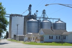
| April 2000 | Thunderstorm Wind | Countywide | $300,000 | Damage was reported countywide with numerous power poles, power lines, and trees blown down. Numerous sheds were destroyed. The most intense damage occurred from 4 miles east of Metamora through Roanoke and into the Benson area. Fifty-six power poles were snapped off near the intersection of IL Routes 116 and 117. In Roanoke, the roof of a business was blown off and it damaged 20 cars in the adjacent parking lot. In Benson, the legs of a grain elevator were damaged, several outbuildings destroyed, and a large tree fell onto a home causing moderate damage. Damage to the grain elevator was estimated around $300,000. |
| May 2000 | Hail | Eureka | $300,000 | Over 100 cars sustained hail damage in the Eureka and Roanoke areas. Damage is estimated around $300,000. |
| September 1986 | Tornado (F2) | not stated | $250,000 | no account filed |
| March 1976 | Tornado (F2) | not stated | $250,000 | no account filed |
| May 1970 | Tornado (F1) | not stated | $250,000 | no account filed |
| September 2010 | Thunderstorm Wind | Roanoke | $170,000 | Eight large 64,000 volt powerlines were blown down on the south edge of Roanoke, causing approximately $170,000 in damages. As a result, the entire town lost power from 3:30 PM to around 7 AM the next day. |
| April 2001 | Hail | Minonk | $100,000 | Hail ranging from pea to golf ball size fell for at least 20 minutes in parts of Minonk and piled several inches deep. Widespread damage was noted to vehicles in the area, with some minor roof damage to homes. At least 50 vehicles were reported to have between $2000 and $4000 in damage each. Damage estimates are based on minimum damage figures available and is likely higher. |
| September 2008 | Flash Flood | Spring Bay | $90,000 | Several homes were flooded in Spring Bay, prompting boat evacuations. |
| July 2020 | Thunderstorm Wind | Secor | $80,000 | Numerous trees were blown down, including one that landed on a camper vehicle at Hickory Hills Campground. |
| May 1997 | Thunderstorm Wind | Benson | $80,000 | Thunderstorm winds blew down a few trees and tree limbs in Benson. Also, the "doglegs" of a grain bin were blown off, several large sheds had their doors blown in, and some siding damage was reported in the area. No injuries were reported and damage was estimated around $80,000. |
| July 2020 | Thunderstorm Wind | Roanoke | $70,000 | Ten power poles were blown down near 1700E and 1200 N just southwest of Roanoke. |
| June 2010 | Tornado (EF2) | Metamora | $70,000 | A tornado crossed into Woodford County from Tazewell County approximately 3.2 miles south-southwest of Metamora. Several trees were snapped, five power poles were damaged, the metal roof of a barn was lifted off and windows were broken on a house. The tornado lifted 2.6 miles south-southeast of Metamora. |
| May 2013 | Thunderstorm Wind | El Paso | $65,000 | Numerous trees and power lines were blown down. |
| September 2008 | Flash Flood | Roanoke | $55,000 | Panther Creek rose out of its banks and flooded Main Street and Mill Street in Roanoke...with 1.5 feet of water coming into the American Legion. Numerous other homes and businesses around Roanoke had water in their basements. |
| April 2024 | Lightning | Metamora | $50,000 | Lightning struck and damaged a building near Metamora Fields Golf Club in Metamora in Woodford County. A power outage also occurred due to the lightning strike. |
| August 2020 | Thunderstorm Wind | Germantown | $50,000 | Part of the Germantown Hills Middle School roof was blown off. |
| August 2020 | Thunderstorm Wind | Washburn | $50,000 | Multiple trees and power lines were blown down. One tree fell onto a house, and the residents had to be helped out of the house. |
| August 2020 | Thunderstorm Wind | Eureka | $50,000 | Power lines were blown down in Eureka. |
| August 2015 | Thunderstorm Wind | Goodfield | $45,000 | A few trees were blown down along I-74 near mile marker 112 and damage was done to the roof of a barn/dinner theater near Goodfield. |
| May 2009 | Lightning | Kappa | $45,000 | Lightning struck a tree near a house in Kappa, setting the power lines and part of the house on fire. The kitchen, a staircase and the room above the kitchen were damaged. A man, who was asleep when the fire started, escaped unharmed. |
| May 2020 | Thunderstorm Wind | Eureka | $40,000 | Power poles were snapped on the southwest side of Eureka. |
| July 2020 | Thunderstorm Wind | El Paso | $40,000 | Strong thunderstorm winds flattened a large area of corn. |
| August 2020 | Thunderstorm Wind | Metamora | $40,000 | Several trees and fences were blown down. |
| June 2008 | Thunderstorm Wind | Secor | $40,000 | Numerous trees and tree limbs were blown down. In addition, a house near El Paso had part of its roof blown off. |
| August 2020 | Thunderstorm Wind | Spring Bay | $30,000 | A roof was blown off a large shed. |
| June 2017 | Thunderstorm Wind | Wilbern | $30,000 | Numerous trees were blown down along Highway 26 from the Woodford-Marshall County line southward for about 3 miles. |
| June 2017 | Thunderstorm Wind | Metamora | $30,000 | Numerous trees were blown down. |
| June 2008 | Thunderstorm Wind | Goodfield | $30,000 | Numerous tree limbs and power lines were blown down. |
| July 2008 | Thunderstorm Wind | Roanoke | $30,000 | Numerous trees were blown down in Roanoke. A wind gust of 81 mph was reported at the county EOC on the south side of Roanoke. |
| May 2017 | Thunderstorm Wind | Secor | $27,000 | Several trees were blown down, including one that fell onto power lines. |
| June 2017 | Thunderstorm Wind | Spring Bay | $25,000 | Numerous trees were blown down. |
| June 2015 | Thunderstorm Wind | Metamora | $25,000 | Numerous tree limbs were blown down in Metamora. |
| November 2015 | Thunderstorm Wind | El Paso | $25,000 | Several power lines were blown down in El Paso. |
| November 2015 | Thunderstorm Wind | Minonk | $25,000 | Several power lines were blown down in Minonk. |
| March 2009 | Thunderstorm Wind | Metamora | $25,000 | Several houses in Metamora experienced shingle and trim damage. |
| July 2008 | Thunderstorm Wind | Minonk | $25,000 | Numerous trees and tree limbs down across the town of Minonk. |
| June 1990 | Tornado (F1) | not stated | $25,000 | no account filed |
| April 1981 | Tornado (F1) | not stated | $25,000 | no account filed |
| June 1974 | Tornado (F2) | not stated | $25,000 | no account filed |
| May 1954 | Tornado (F1) | not stated | $25,000 | no account filed |
| May 2014 | Thunderstorm Wind | Washburn | $22,000 | A machine shed was damaged and a power pole was blown over. |
| May 2020 | Tornado (EF0) | Panola | $20,000 | A tornado touched down 1.1 miles southwest of Panola at 1:54 PM CDT. The tornado tracked northeastward through the small community of Panola damaging the roof of an outbuilding, cracking a window in a house, and knocking down several tree branches before dissipating 2.3 miles northeast of Panola at 1:59 PM CDT. |
| June 2017 | Thunderstorm Wind | Low Pt | $20,000 | Numerous trees were blown down. |
| June 2015 | Thunderstorm Wind | Eureka | $20,000 | Several trees were damaged in Eureka. |
| May 2014 | Thunderstorm Wind | Benson | $20,000 | A machine shed was damaged. |
| June 2009 | Thunderstorm Wind | Eureka | $20,000 | Power lines were blown down onto Rt. 24. |
| August 2009 | Thunderstorm Wind | Eureka | $20,000 | Several trees and power lines were blown down in Eureka. |
 Block