 Block
Abingdon, Illinois
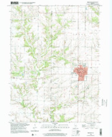
18 topographic sheets cover this place, the earliest surveyed in 1925 and the latest in 1998. It stands in Cedar Township. It lies in ZIP code area 61410. The Survey maps it on the Abingdon quadrangle. 2,951 people lived here at the 2020 count. It stands 751 feet above sea level.
Population over time
2 figuresAbingdon fell from 3,319 to 2,951 between 2010 and 2020. These are the recorded population figures Wikidata holds for this place, reached through the Geographic Names Information System number this page is keyed on rather than by name, so they belong to this place and not to another of the same name. Most are census counts, but not all are: an early figure may be a founding or settlement estimate, and an estimate published within five years of a census is left out. The change column is computed, and is left blank where more than 20 years separate a figure from the one before it, because a gap that long is not a change between two counts.
| Year | People | Change |
|---|---|---|
| 2010 | 3,319 | |
| 2020 | 2,951 | -368 (-11%) |
Topographic sheets covering this place
10 surveys from 18 printed sheetsMatched by testing this settlement's coordinate against the published boundary of every sheet in the United States Geological Survey's historical collection. Each opens the scanned sheet at the Survey.
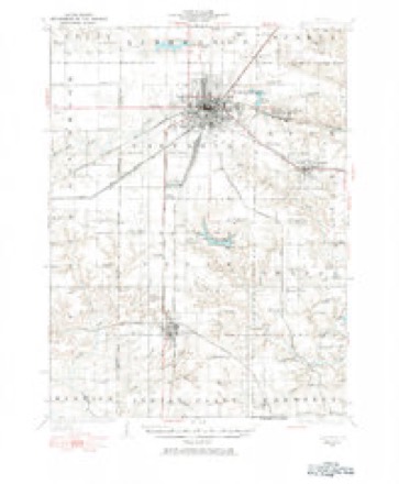
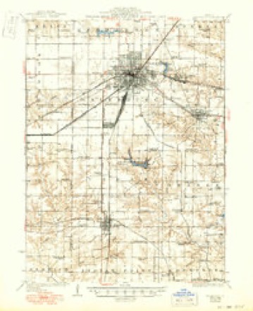
- 1925 USGS Galesburg quadrangle1:62500, 2 printings
- 1927 USGS Galesburg quadrangle1:62500, 3 printings
- 1958 USGS Burlington quadrangle1:250000, 4 printings
- 1961 USGS Burlington quadrangle1:250000
- 1963 USGS Burlington quadrangle1:250000
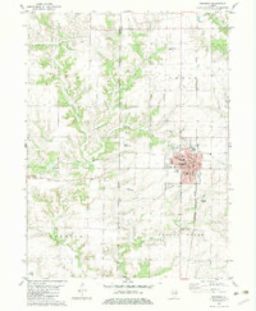
- 1982 USGS Abingdon quadrangle1:24000
- 1985 USGS Galesburg quadrangle1:100000, 2 printings
- 1989 USGS Galesburg quadrangle1:100000
- 1990 USGS Burlington quadrangle1:250000, 2 printings
- 1998 USGS Abingdon quadrangle1:24000





In the county-history sources
13,949 words on this townshipHistory of Knox County, Illinois : Together with Sketches of the Cities, Villages and Townships; Record of Its Volunteers in the Late War; Educational, Religious, Civil and Political History; Portraits of Prominent Persons and Biographical Sketches of the Subscribers; History of Illinois; Abstracts of the State Laws, Etc., Etc., Etc. ; Illustrated, published 1878 names this settlement in its chapter on Cedar Township. These are the passages that mention it, exactly as the scans read.
This township is 10 north, range 1 east, and was one of the earliest settled townships in the county. It is said that Rev. Hiram Palmer settled on section 7 in 1828. Abraham D. Swartz came to the township in 1829. Jonathan Latimer came in 1832 and settled on section 28. He erected a little log cabin, and not being able to construct a door to it for some time, they filled a bed-tick with straw, and hung it up in the doorway to keep out the cold. Wolves frequently came prowling around and threatening an invasion of the house. When her husband was away from home Mrs. Latimer would keep up a fire all night to prevent the wolves from entering the house. These pests of a new country would often come to the doorway and press against the bed, crowding it in ; but when they saw the fire would retreat, Mrs. Latimer says they have done this many nights, but the bright fire kept them at bay. Mrs. Latimer has often taken the products of her loom on horseback to Knoxville, and exchanged them for family supplies. Mrs. Catharine Heed, widow of John Reed, settled on section 17 in 1836. They located on the very ground the Indians camped on before the Black Hawk war, and used water from the same spring. Mrs. Reed was born in Scotland, in 1790, and came to America in 1796. She at present resides with her son-in-law, J. W. Kays, of this township. One of the early settlers of this township is Reuben Castle, who came in 1834 and settled on section 12. The country was in its native state, except here and there a cabin, and a field improved, until 1844; and while prairie fires ran over the country all the grass and brush were annually burned off. As soon as these fires were stopped the timber began to grow; and now much of it has attained lofty proportions, and will make from four to six rails to the cut. Mr. Castle says that panthers, wolves, and other animals would prowl around, destroying stock and annoying the settlers. William Bevans, in 1834, was carrying some soft soap to his home from where he was working, and was attacked by three black wolves. In defending himself with his axe he spilled his soap; and while the wolves were devouring it he fled and reached home in safety.
The first child born in this township was Helen E. Swartz, daughter of A. D. Swartz, born in November, 1829. The first marriage was that of U. D. Coy and Susie Latimer, in December, 1833. The first death was Miss Olive Strange, who died in 1834. The first sermon was preached at the residence of A. D. Swartz, by Rev. Hiram Palmer.
This is one of the finest bodies of land in Knox county. It contains more miles of railroad than any other township in the county. The corporate limits of the city of Galesburg cover nine sections. Gaddial Scott broke the first land in the township. He, with Edward Morse, were the first settlers. Mr. Scott settled on section 19 in 1834. Mr. Morse settled on section 3. As the historj of the city of Galesburg mostly includes the history of the township, we will not repeat it, but refer the reader to that portion of this work.
Machine-read from a century-old scan, so expect the errors a machine makes: misspelled names, dropped words, stray characters.
Read the whole chapter on Cedar Township - it names this place 36 more 36 times.
Mines and quarries near this place
3 within 5 milesRegional context, not property-specific evidence. The federal mineral resources record lists 3 workings within 5 miles of Abingdon: 2 past producers, 1 plant. 1 still produces. What was taken out: Stone, Crushed/Broken. Distance is straight-line from the map coordinates, so a quarry counted here may appear on a neighbouring settlement's page as well.
| Where | Site | Commodity | Status | Recorded |
|---|---|---|---|---|
| Abingdon Quarry | Stone, Crushed/Broken | Past Producer | ||
| Bingdon Rock Quarry | Stone, Crushed/Broken | Past Producer | ||
| Valley Plant #7 & Pit | Stone, Crushed/Broken | Plant |
Storms near this place
39 since 1997Regional context, not property-specific evidence. The National Weather Service names Abingdon in 39 storm reports between 1997 and 2023: 26 thunderstorm wind, 11 hail, 2 flash flood. No death or injury is recorded in these reports. Each account below is quoted exactly as the forecast office filed it, from the NOAA Storm Events Database, and each date opens the federal record of that event.
| When | Event | Place named | Harm | What the report says |
|---|---|---|---|---|
| September 2016 | Thunderstorm Wind | Abingdon | $100,000 | A downburst with estimated winds of 80-90mph created considerable damage at several farms near the town of Abingdon. A silage wagon was flipped over, the roof of a livestock barn was ripped off, and a machine shed was destroyed at Malone Farms. Numerous trees were blown down around the area, and neighboring farm buildings were damaged as well. |
| June 2021 | Thunderstorm Wind | Abingdon | $75,000 | Numerous trees and powerlines were damaged in Abingdon, causing a power outage in town. |
| June 2009 | Thunderstorm Wind | Abingdon | $75,000 | Numerous large tree limbs were blown down and shingles were stripped off roofs in Abingdon. |
| June 2021 | Thunderstorm Wind | Abingdon | $60,000 | Several trees were snapped and power lines were blown down along Route 41. |
| May 2020 | Thunderstorm Wind | Abingdon | $50,000 | Several power poles were blown down in Abingdon. |
| June 2015 | Thunderstorm Wind | Abingdon | $30,000 | Numerous tree branches were blown down. |
| May 2014 | Thunderstorm Wind | Abingdon | $25,000 | Part of a chicken coop was blown down. |
| July 2011 | Thunderstorm Wind | Abingdon | $25,000 | Numerous large tree limbs were blown down just north of Abingdon. |
| September 2011 | Thunderstorm Wind | Abingdon | $20,000 | Large tree branches were blown down near Abingdon. |
| October 2017 | Thunderstorm Wind | Abingdon | $15,000 | Several large tree branches were blown down about a mile north of Abingdon. |
| June 2009 | Thunderstorm Wind | Abingdon | $12,000 | Numerous large tree limbs were blown down. |
| May 2011 | Thunderstorm Wind | Abingdon | $10,000 | Several large tree limbs were blown down. |
| August 2008 | Thunderstorm Wind | Abingdon | $10,000 | Trees were blown down onto powerlines. |
| March 2017 | Thunderstorm Wind | Abingdon | $2,000 | Sheet metal was blown off a building. |
| August 2009 | Thunderstorm Wind | Abingdon | $2,000 | The top of a large tree was snapped off just north of Abingdon. |
| June 2013 | Thunderstorm Wind | Abingdon | $1,000 | A large tree limb was blown down in Abingdon. |
| May 2023 | Thunderstorm Wind | Abingdon | - | Several 6-inch diameter tree branches were blown down. |
| June 2022 | Flash Flood | Abingdon | - | Streets were flooded in Abingdon. |
| June 2019 | Thunderstorm Wind | Abingdon | - | Several 3-inch diameter tree branches were blown down. |
| June 2012 | Thunderstorm Wind | Abingdon | - | Numerous trees and power lines were blown down. |
| September 2011 | Hail | Abingdon | - | Significant weather observer reported golf ball sized hail north of Abingdon. |
| June 2010 | Flash Flood | Abingdon | - | Around 2.00 of rain fell between 0630 and 0830 CST on top of already saturated ground. This produced rapid flash flooding in southern Knox County from Abingdon to Yates City. Many rural roads were impassable due to the flooding. |
| July 2008 | Thunderstorm Wind | Abingdon | - | A large tree limb fell near the old Pottery in Abingdon. |
| September 2005 | Thunderstorm Wind | Abingdon | - | Large tree blown down. |
| May 2004 | Thunderstorm Wind | Abingdon | - | Several power lines and large tree limbs were blown down. |
| June 2000 | Thunderstorm Wind | Abingdon | - | Several power lines were blown down in Abingdon. |
| May 2000 | Thunderstorm Wind | Abingdon | - | A couple of large trees were blown down onto US 150 near Knoxville. Another tree fell onto county highway 26. |
| March 1998 | Thunderstorm Wind | Abingdon | - | A line of severe thunderstorms moved across Knox county. A semi was overturned two miles south of Abingdon. Numerous trees, tree limbs, and power poles were blown down. Two miles east of Altona, a garage was destroyed. No injuries were reported and no damage estimate was available. |
| September 2019 | Hail | Abingdon | - | no account filed |
| September 2019 | Hail | Abingdon | - | no account filed |
| October 2016 | Hail | Abingdon | - | no account filed |
| June 2015 | Hail | Abingdon | - | no account filed |
| September 2012 | Hail | Abingdon | - | no account filed |
| May 2011 | Hail | Abingdon | - | no account filed |
| June 2011 | Hail | Abingdon | - | no account filed |
| June 2009 | Hail | Abingdon | - | no account filed |
| June 2006 | Hail | Abingdon | - | no account filed |
| June 2003 | Thunderstorm Wind | Abingdon | - | no account filed |
| May 1997 | Hail | Abingdon | - | no account filed |
Nearest settlements
The eight closest, with where each one stands in the county. Distances are straight-line, computed from the Geographic Names Information System coordinates.
| Map | Place | Distance | Sheets |
|---|---|---|---|
| Saluda | 4.7 miles | 18 | |
| DeLong | 5.2 miles | 18 | |
| Hermon | 5.4 miles | 18 | |
| Saint Augustine | 6.0 miles | 17 | |
| Burnside (historical) | 7.2 miles | 18 | |
| Knoxville | 9.5 miles | 17 | |
| Bridgeport (historical) | 9.7 miles | 17 | |
| Galesburg | 10.0 miles | 17 |
Elsewhere
Matched on this settlement's Geographic Names Information System number rather than its name, so it cannot be a different place of the same name in another state.
| Wikipedia article on Abingdon | An encyclopaedic summary. Its text is share-alike, so it is linked here rather than copied. |
| Wikidata item Q579672 | The structured record the population and elevation above come from. Public domain (CC0). |
Provenance
This settlement is recorded in the Geographic Names Information System as feature 403320. The sheet list is computed by point-in-boundary test against the United States Geological Survey's historical topographic inventory. Both are works of the United States government and carry no copyright under 17 U.S.C. 105.
Mines and quarries. USGS Mineral Resources Data System (MRDS) https://mrdata.usgs.gov/mrds/ A work of the United States government, no copyright under 17 U.S.C. 105.
Storms. NOAA National Centers for Environmental Information, Storm Events Database https://www.ncei.noaa.gov/stormevents/ A work of the United States government, no copyright under 17 U.S.C. 105. Narratives are quoted verbatim from the National Weather Service report and are not edited or summarised.