 Block
Antioch, Illinois
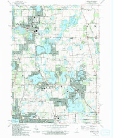
20 topographic sheets cover this place, the earliest surveyed in 1920 and the latest in 1993. It stands in Antioch Township. It lies in ZIP code area 60002. It stands on Sequoit Creek. The Survey maps it on the Antioch quadrangle. 14,622 people lived here at the 2020 count. It stands 784 feet above sea level.
Population over time
2 figuresAntioch grew from 14,430 to 14,622 between 2010 and 2020. These are the recorded population figures Wikidata holds for this place, reached through the Geographic Names Information System number this page is keyed on rather than by name, so they belong to this place and not to another of the same name. Most are census counts, but not all are: an early figure may be a founding or settlement estimate, and an estimate published within five years of a census is left out. The change column is computed, and is left blank where more than 20 years separate a figure from the one before it, because a gap that long is not a change between two counts.
| Year | People | Change |
|---|---|---|
| 2010 | 14,430 | |
| 2020 | 14,622 | +192 (+1%) |
Topographic sheets covering this place
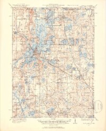
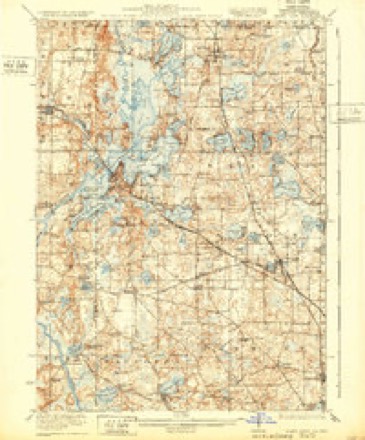
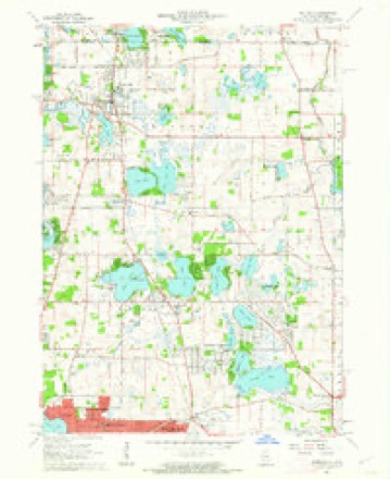
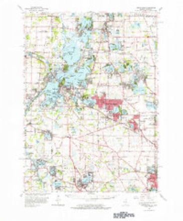
10 surveys from 20 printed sheetsMatched by testing this settlement's coordinate against the published boundary of every sheet in the United States Geological Survey's historical collection. Each opens the scanned sheet at the Survey.
- 1920 USGS Grays Lake quadrangle1:62500, 3 printings
- 1923 USGS Grays Lake quadrangle1:62500, 4 printings
- 1954 USGS Rockford quadrangle1:250000
- 1955 USGS Rockford quadrangle1:250000
- 1958 USGS Rockford quadrangle1:250000, 4 printings
- 1960 USGS Antioch quadrangle1:24000, 3 printings
- 1960 USGS Grayslake quadrangle1:62500
- 1963 USGS Rockford quadrangle1:250000
- 1981 USGS Elgin quadrangle1:100000
- 1993 USGS Antioch quadrangle1:24000





In the county-history sources
2,433 words on this townshipThe Past and Present of Lake County, Illinois, published 1877 names this settlement in its chapter on Antioch Township. These are the passages that mention it, exactly as the scans read.
The first permanent claims of Government lands made in this town were made in the month of December, 1886, by D. B. Gage, Thomas Q. Gage and Thomas Warner. The first house built within the limits of the town was built in April, 1837, by D. B. and Thomas Q. Gage, on the north side of the creek, in the present village of Antioch. The second was built by Thomas Warner, near Loon Lake, in the month of June of the same year. These persons had located themselves temporarily at Walker's bridge, on the Des Plaines River, in Cook County. In December, 1836, they followed up the river on an In4ian trail, to Mill Creek, from whence they proceeded westward to Loon Lake, where they made a claim and put up a log cabin, from whence, after a few days, they proceeded on their return, by way of the Maquonago trail, which was a trail diverging from the great Milwaukee trail at a point near the mouth of Indian Creek, where formerly had been an Indian village, and running from thence northwesterly to an Indian village in Wisconsin, called Maquonago.
Passage source: The Past and Present of Lake County, Illinois, published 1877.
The first town meeting held in this town under township organization was held on the first Tuesday in April, 1850, at the tavern of D. B. Gage, in the village of Antioch. Dr. L. D. Gage was chosen Moderator, and Eli S. Derby, Clerk. The following is a list of the town officers elected at this meeting: Har¬ rison P. Nelson, Supervisor ; Eli Gage, Town Clerk ; Thomas Webb, Assessor ; John H. Elliott, Collector ; Chas. Webb and Robert K. Colls, Justices of the Peace ; Ira Webb, A. B. Paddock and E. C. Stephens, Commissioners of High¬ ways; Robert Pollock, Overseer of Poor; John H. Elliott and Albert Webb, Constables. The number of votes cast at this town meeting was 145.
Passage source: The Past and Present of Lake County, Illinois, published 1877.
The village of Antioch, in this township, acquired considerable local noto¬ riety at the beginning, from the numerous attempts made to adopt a name. In the northern part of the township is a small stream flowing from the lakes on the east, westward into Fox River. Darius and Thomas Gage, as before men¬ tioned, built their houses near this creek, at the crossing of the Maquonago trail, and named it Sequoit Creek. They were attracted here on account of the mill site the stream apparently afforded at this point. A saw-mill was soon after built here by Hiram Butrick (1839). This, with other inducements, drew into the vicinity mechanics of various kinds, the first being Eleazer F. Ingalls, blacksmith. The first store of goods was opened by F. F. Munson. The place finally taking rank as a village, an attempt was made to agree upon a name. It was situated in what was then called Bristol Precinct. It was therefore pro¬ posed to call the village by that name, but without effect. Among the first settlers - prominent among whom was Wm. F. Shepard - a large proportion belonged to the sect of Religionists called Christians, or Disciples, otherwise known as Campbellites, who were generally very zealous in church matters. Whereupon the wags of the neighborhood who were not of this church, rather in a spirit of ridicule, suggested various Scripture names for the place. Among them Jericho and Joppa. Finally, during a general assembly of the church at that place, it was agreed to take the suggestion of their mischievous neighbors and adopt a Scripture name, and that it should be Antioch - the place where the Disciples were first called Christians. A general acquiescence followed, and the place became known by that name.
Passage source: The Past and Present of Lake County, Illinois, published 1877.
Machine-read from a century-old scan, so expect the errors a machine makes: misspelled names, dropped words, stray characters.
Read the whole chapter on Antioch Township - it names this place 8 more 8 times.
Fires near this place
4 since 2018Regional context, not property-specific evidence. The federal wildfire occurrence database lists 4 fires within 5 miles of Antioch in 2018, burning about 6 acres in total. None started naturally. None was recorded as arson. Distance is straight-line from the map coordinates, so a fire counted here may appear on a neighbouring settlement's page as well.
| Reported cause | Fires |
|---|---|
| Missing data/not specified/undetermined | 2 |
| Smoking | 1 |
| Debris and open burning | 1 |
The most recent of them, most recent first, with the day each was reported and the service that recorded it.
| Date | Cause | Size | Reported by | Name on the report |
|---|---|---|---|---|
| 8 July 2018 | Smoking | under an acre | Wisconsin Department of Natural Resources | 218402 |
| 2 May 2018 | Missing data/not specified/undetermined | 1.0 acres | Wisconsin Department of Natural Resources | 218249 |
| 8 April 2018 | Debris and open burning | 2.0 acres | Wisconsin Department of Natural Resources | 218175 |
| 18 March 2018 | Missing data/not specified/undetermined | 3.0 acres | Wisconsin Department of Natural Resources | 218145 |
Settlements close enough to share some of these fires:
Mines and quarries near this place
3 within 5 milesRegional context, not property-specific evidence. The federal mineral resources record lists 3 workings within 5 miles of Antioch: 2 past producers, 1 producer. 1 still produces. What was taken out: Sand and Gravel, Construction. Distance is straight-line from the map coordinates, so a quarry counted here may appear on a neighbouring settlement's page as well.
| Where | Site | Commodity | Status | Recorded |
|---|---|---|---|---|
| Barthel Pit | Sand and Gravel, Construction | Past Producer | ||
| Fox Pit | Sand and Gravel, Construction | Past Producer | ||
| Thelen Pit | Sand and Gravel, Construction | Producer |
Storms near this place
27 since 1997Regional context, not property-specific evidence. The National Weather Service names Antioch in 27 storm reports between 1997 and 2026: 22 thunderstorm wind, 5 hail. No death or injury is recorded in these reports. Each account below is quoted exactly as the forecast office filed it, from the NOAA Storm Events Database, and each date opens the federal record of that event.
| When | Event | Place named | Harm | What the report says |
|---|---|---|---|---|
| June 2010 | Thunderstorm Wind | Antioch | $100,000 | Industrial buildings and a bowling alley sustained extensive roof damage. Several trees and utility poles were blown down. Some of the trees blocked roads and some trees fell onto houses. |
| April 2026 | Thunderstorm Wind | Antioch | - | Multiple reports were received of trees downed on the north side of Antioch. |
| May 2025 | Thunderstorm Wind | Antioch | - | Photos showed a large tree that was blown down onto a house causing damage to siding, gutters and part of the roof. |
| May 2025 | Thunderstorm Wind | Antioch | - | A 2.5 foot diameter tree was blown down onto a house. |
| June 2024 | Thunderstorm Wind | Antioch | - | A 9 inch diameter tree branch was reported down just southeast of Antioch. |
| August 2023 | Thunderstorm Wind | Antioch | - | Two trees and a fence were blown down at a residence. |
| March 2022 | Thunderstorm Wind | Antioch | - | A wind gust to 60 mph was measured. |
| June 2022 | Thunderstorm Wind | Antioch | - | Trees, tree limbs and power lines were blown down in Antioch. Some roads were blocked by the fallen trees. |
| July 2021 | Thunderstorm Wind | Antioch | - | Power lines were blown down and a vehicle was damaged along Forest Drive. |
| April 2021 | Thunderstorm Wind | Antioch | - | A wind gust to 63 mph was reported. |
| April 2021 | Thunderstorm Wind | Antioch | - | A tree was blown down blocking North Avenue, west of Trevor Road. |
| August 2021 | Thunderstorm Wind | Antioch | - | Siding was ripped off of a house and a fence was blown down. |
| November 2020 | Thunderstorm Wind | Antioch | - | Trees were uprooted and fences were blown down in Antioch. |
| September 2019 | Thunderstorm Wind | Antioch | - | Wind gusts were estimated to 60 mph. |
| May 2018 | Hail | Antioch | - | Numerous reports of tree limbs down as well as damage to siding and cars from the hail. |
| June 2017 | Thunderstorm Wind | Antioch | - | Numerous trees and large tree limbs were blown down, possibly from a concentrated microburst. |
| September 2016 | Thunderstorm Wind | Antioch | - | Power lines blown down. Report received via twitter. |
| October 2016 | Thunderstorm Wind | Antioch | - | Power lines and large tree downed. Time estimated based on radar. |
| October 2010 | Thunderstorm Wind | Antioch | - | Wires and large tree limbs were blown down across roads. |
| June 2007 | Thunderstorm Wind | Antioch | - | Tree limbs were blown down. |
| May 2004 | Thunderstorm Wind | Antioch | - | Trees and power lines were down. |
| July 2003 | Hail | Antioch | - | Reported on 59th Street between Antioch and Fox Lake. |
| June 2019 | Hail | Antioch | - | no account filed |
| April 2014 | Hail | Antioch | - | no account filed |
| May 2003 | Hail | Antioch | - | no account filed |
| June 2001 | Thunderstorm Wind | Antioch | - | no account filed |
| July 1997 | Thunderstorm Wind | Antioch | - | no account filed |
Nearest settlements
The eight closest, with where each one stands in the county. Distances are straight-line, computed from the Geographic Names Information System coordinates.
| Map | Place | Distance | Sheets |
|---|---|---|---|
| Lake Catherine | 2.0 miles | 20 | |
| Loon Lake | 2.1 miles | 20 | |
| Channel Lake | 2.2 miles | 20 | |
| Grass Lake | 3.0 miles | 20 | |
| Hickory Corners | 4.2 miles | 20 | |
| Lake Villa | 4.3 miles | 20 | |
| Klondike | 4.6 miles | 20 | |
| Fox Lake Hills | 5.1 miles | 20 |
Elsewhere
Matched on this settlement's Geographic Names Information System number rather than its name, so it cannot be a different place of the same name in another state.
| Wikipedia article on Antioch | An encyclopaedic summary. Its text is share-alike, so it is linked here rather than copied. |
| Wikidata item Q520010 | The structured record the population and elevation above come from. Public domain (CC0). |
Provenance
This settlement is recorded in the Geographic Names Information System as feature 403541. The sheet list is computed by point-in-boundary test against the United States Geological Survey's historical topographic inventory. Both are works of the United States government and carry no copyright under 17 U.S.C. 105.
Wildfire. Short, Karen C. 2022. Spatial wildfire occurrence data for the United States, 1992-2020 [FPA_FOD_20221014]. 6th Edition. Fort Collins, CO: Forest Service Research Data Archive. https://doi.org/10.2737/RDS-2013-0009.6 Collected with United States Government funding and usable without additional permissions or fees.
Mines and quarries. USGS Mineral Resources Data System (MRDS) https://mrdata.usgs.gov/mrds/ A work of the United States government, no copyright under 17 U.S.C. 105.
Storms. NOAA National Centers for Environmental Information, Storm Events Database https://www.ncei.noaa.gov/stormevents/ A work of the United States government, no copyright under 17 U.S.C. 105. Narratives are quoted verbatim from the National Weather Service report and are not edited or summarised.