Block
From the record
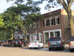
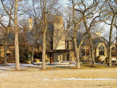
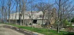
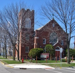
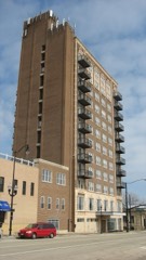
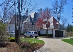
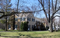
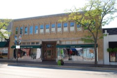
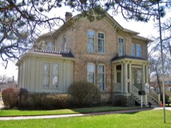
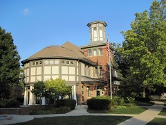
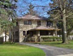
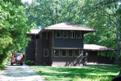
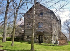
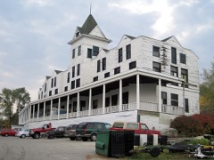
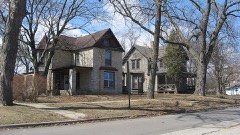
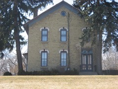
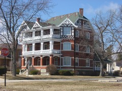
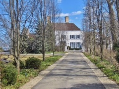
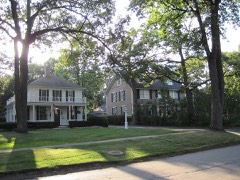
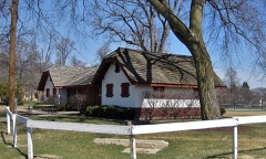
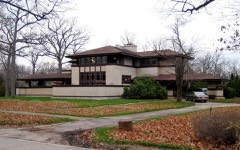
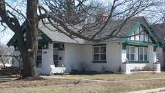
98 National Register listings published here, 2 of them National Historic Landmarks.
Sources: the county history on the Internet Archive · the National Register database, National Park Service
118 topographic sheets cover 210 settlements here, and 98 properties are on the National Register of Historic Places.
98 National Register listings published here, 2 of them National Historic Landmarks.
Sources: the county history on the Internet Archive · the National Register database, National Park Service
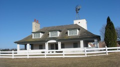
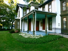
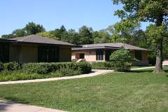
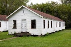
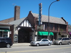
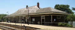
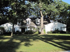
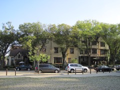
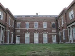
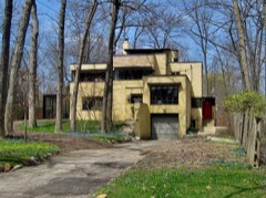
Every property in this county listed on the National Register of Historic Places, with the year it was listed and the federal nomination document.
Every wildfire the federal occurrence database records inside this county: 72 of them, burning about 1,509 acres. 1 started naturally and 2 were recorded as arson. Each settlement page carries the fires within five miles of it.
| Reported cause | Fires |
|---|---|
| Missing data/not specified/undetermined | 35 |
| Debris and open burning | 20 |
| Fireworks | 5 |
| Equipment and vehicle use | 3 |
| Power generation/transmission/distribution | 2 |
| Arson/incendiarism | 2 |
| Misuse of fire by a minor | 2 |
| Smoking | 1 |
| Recreation and ceremony | 1 |
| Natural | 1 |
The five largest, by the area the report gives. None of them was recorded as arson.
| Date | Cause | Size | Reported by | Name on the report |
|---|---|---|---|---|
| 5 April 2015 | Misuse of fire by a minor | 750 acres | Illinois Division of Forestry Resources | 15-314 |
| 28 April 2003 | Missing data/not specified/undetermined | 450 acres | Illinois Division of Forestry Resources | ZION |
| 8 July 2012 | Missing data/not specified/undetermined | 50 acres | Illinois Division of Forestry Resources | NORTH UNIT |
| 13 April 2016 | Debris and open burning | 40 acres | Illinois Division of Forestry Resources | VOLO BOG |
| 24 May 2018 | Missing data/not specified/undetermined | 35 acres | Illinois Division of Forestry Resources | 18-0001610 |
| 12 April 2011 | Missing data/not specified/undetermined | 25 acres | Illinois Division of Forestry Resources | IDNR |
| 15 December 2020 | Debris and open burning | 23 acres | Illinois Division of Forestry Resources | 2020-2498 |
| 4 April 2013 | Missing data/not specified/undetermined | 21 acres | Illinois Division of Forestry Resources | MOLIDOR RX FIRE |
Every settlement page carries the fires within five miles of it - see the settlement index below.
The NOAA Storm Events Database holds 641 reports for this county, causing 3 deaths, 155 injuries and about $42,333,000 in recorded property damage. Each settlement page carries the reports that name it.
| Kind of event | Reports |
|---|---|
| Thunderstorm Wind | 299 |
| Hail | 185 |
| Flash Flood | 47 |
| Flood | 41 |
| Lightning | 24 |
| Tornado | 22 |
| Heavy Rain | 21 |
| Waterspout | 1 |
| Wildfire | 1 |
The most serious of them, by death, then injury, then recorded damage. The accounts are quoted exactly as the forecast office filed them.
| When | Event | Place named | Harm | What the report says |
|---|---|---|---|---|
| April 1967 | Tornado (F4) | not stated | 1 killed, 97 hurt, $2,500,000 | no account filed |
| August 2007 | Thunderstorm Wind | Zion | 1 killed, 1 hurt | A tree was blown down onto a tent with two people sleeping inside at Illinois Beach State Park. One person was killed and the other was injured. |
| June 2002 | Lightning | Buffalo Grove | 1 killed, 1 hurt | no account filed |
| September 1972 | Tornado (F4) | not stated | 20 hurt, $2,500,000 | no account filed |
| July 1992 | Thunderstorm Wind | not stated | 10 hurt | no account filed |
| May 1999 | Thunderstorm Wind | Wauconda | 7 hurt | no account filed |
| September 2018 | Lightning | Round Lake Hgts | 3 hurt | Three students standing at a bus stop waiting for their school bus were struck by lightning. All three were transported to a medical center with non-life threatening injuries. |
| July 1998 | Thunderstorm Wind | Fox Lake | 3 hurt | no account filed |
| April 1996 | Tornado (F2) | Zion | 2 hurt, $6,600,000 | no account filed |
| April 1996 | Thunderstorm Wind | Fox Lake | 2 hurt, $5,000,000 | no account filed |
| April 1976 | Tornado (F2) | not stated | 2 hurt, $25,000 | no account filed |
| August 2018 | Lightning | Highland Park | 2 hurt | Two women were returning to their car after a concert and sought shelter under a tree as a storm moved through the area. Lightning struck the tree and both women sustained cuts, bruises and burns. |
| October 2010 | Thunderstorm Wind | Lindenhurst | 1 hurt, $10,000 | A 41 year old woman was eastbound on Grand Avenue near Deep Lake Road when a tree limb blew down, crashed through her windshield, and impaled her abdomen. She was hospitalized. |
| February 2024 | Tornado (EF1) | Mundelein | 1 hurt | This tornado had a very short path with damage confined primarily to a single two-story apartment building. Most of the roof was removed from the building, and a portion of the brick facade also collapsed when the roof was removed. Two large softwood trees in the parking lot east of the building were uprooted. Debris was deposited to the east across the street, where a few tree branches were also snapped. In the apartment building south of the main one that was damaged, a resident described seeing a second story glass patio door on the east side being pulled out and shattered by the winds. One 13 year old resident sustained bad bruising after part of his ceiling collapsed and struck him in the arm. |
| August 2020 | Thunderstorm Wind | Round Lake Hgts | 1 hurt | Trees, tree limbs and power lines were blown down in Lake Villa. One tree fell onto a house in unincorporated Lake Villa causing the homeowner to sustain a minor injury. Another tree fell onto a SUV causing significant damage to the roof and windshield. Trees and power lines were blown down blocking portions of Route 83. |
| September 2019 | Tornado (EF1) | (Ugn) Waukegan Airport | 1 hurt | A tornado touched downed just west of Twyford Road and moved east southeast through parts of Waukegan. Damage from the tornado was minor to commercial buildings and residences, including windows blown out, minor roof damage, fence destruction and damage to a gas station canopy. A vehicle was flipped over just east of the intersection of York House Road and Lewis Avenue where one minor injury occurred. Numerous trees were blown down or suffered heavy branch damage. The tornado was at its widest and strongest in the latter half of its path. Estimated peak winds for this tornado were 90 mph. A one mile stretch between the last damage point and the Lake Michigan shore was unable to be surveyed due a nature area in the Illinois Beach Nature Preserve. A waterspout was reported just off shore and so by interpolation, the path for this tornado was continued to the Lake Michigan shore. |
| July 2011 | Lightning | Grayslake | 1 hurt | Lightning struck a lightning rod attached to a building. Apparently, an employee was shocked as he opened a door to that building. He was disoriented, but suffered no serious injuries. |
| July 2017 | Flash Flood | Barrington Hills | $12,700,000 | Torrential rain fell across much of Lake County during the morning of July 12th causing widespread flash flooding. Numerous roads were impassable. In Mundelein, numerous houses were flooded and people were rescued by raft. Cars were stranded in flood waters in Libertyville. Garage and basement flooding was reported in Fox Lake. Two day storm total rainfall amounts included 7.22 inches two miles west of Gurnee; 7.13 inches in Round Lake Park; 7.11 inches two miles west southwest of Lake Villa; 6.75 inches in Mundelein; 6.69 inches one mile west of Lake Bluff; 6.46 inches two miles north northeast of Lake Forest; 5.53 inches two miles east of Waukegan; 5.49 inches two miles west northwest of Mundelein; 5.15 inches two miles southeast of Fox Lake; 4.70 inches in Riverwoods and 4.55 inches two miles southeast of Lakemoor. Major flooding with record crests occurred on the Des Plaines River. |
| April 2013 | Flash Flood | Channel Lake | $4,700,000 | A levee was breached in Lincolnshire requiring 49 homes to be evacuated. Route 41 was closed between Route 137 and Route 176. Near Beach Park, water was reported over many roads, ponds were out of banks, and many homes had water up to doorsteps. County emergency managers estimated that 4,500 properties were affected by the flooding. |
| October 1958 | Tornado (F2) | not stated | $2,500,000 | no account filed |
| August 2015 | Tornado (EF1) | Round Lake | $1,000,000 | The tornado touched down near Cedar Lake Road in Round Lake where tree damage occurred. The tornado moved east and damaged hundreds of trees along the 7.5 mile long path, including dozens that were snapped at the base or uprooted. The most significant tree damage was noted in the subdivisions of Grayslake and Wildwood. A roof was blown off of a restaurant along Illinois Route 134 with a sign from the restaurant ending up over two miles away in Grayslake. Several homes and businesses suffered roof damage from either falling trees or loss of shingles. A large part of the roof of the Grayslake Central High School was blown across the street. A nearby skatepark was heavily damaged. The last points of damage were noted along Illinois Route 120 just west of I-94 in unincorporated Wildwood. |
| June 2011 | Thunderstorm Wind | Zion | $500,000 | Over 1,000 trees were either uprooted or split in half at the Illinois Beach State Park. Various structures as well as mobile campers sustained damage from the falling trees. |
| May 2010 | Flash Flood | Channel Lake | $500,000 | Flash flooding occurred in many areas in Lake County during the morning hours of May 13th. Numerous roads were closed and flooded including, Route 60, east of St. Mary Road; Route 41 between Westleigh and Kennedy Roads; Peterson Road at Route 60; Cuba Road, west of Ela Road; Route 45 south of Hawley Street; Route 173 at Delany Road; Russell Road east of Lewis Avenue; Southbound Route 41 at Milwaukee Road; Route 60, eastbound between Saint Marys and Riverwood Roads; Grand Avenue east of Oplaine Road and two vehicles were stranded in flood waters at the Deerpath and Route 41 underpass in Lake Forest. A house was surrounded by flood waters in Lake Forest and the occupants had to be carried out. Flood waters began flowing into a senior apartment building near Route 45 and Division Street and 12 residents were evacuated. Significant flooding occurred at the Deerpath Golf Course in Lake Forest. The Des Plaines River rose out of its banks near Gurnee. Numerous creeks, streams and retention ponds swelled out of their banks. Flood waters were reported in numerous ditches, fields and backyards. Basement flooding was also reported in many areas.||Storm total rainfall amounts included 3.60 inches 1 mile north of Hawthorn Woods; 3.30 inches in Mundelein; 3.26 inches 2 miles north northeast of Lake Forest; 3.21 inches 1 mile north northeast of Long Grove; 3.20 inches 1 mile west of Lake Bluff; 2.79 inches 1 mile north of Lincolnshire and 2.59 inches 2 miles southeast of Lakemoor. |
| May 1998 | Lightning | Waukegan | $500,000 | Lightning struck the roof of a million dollar home, causing serious damage to the roof and attic. Total estimated damage - $500,000.00. |
| June 2008 | Flood | Channel Lake | $500,000 | no account filed |
| April 1965 | Tornado (F2) | not stated | $250,000 | no account filed |
| April 1965 | Tornado (F1) | not stated | $250,000 | no account filed |
| June 2009 | Lightning | Ivanhoe | $200,000 | Lightning struck a house on Bagatelle Lane which started a fire. While the fire was small, the house suffered extensive smoke and heat damage. Firefighters also had to remove much of the ceiling throughout the home to remove insulation to prevent the fire from spreading. |
| May 2006 | Lightning | Wadsworth | $200,000 | Three seperate buildings were struck by lightning on Mill Creek Raod and on Orchard Bluff Lane between the Tri-State Tollway and Route 41. One building, a cabinet shop, was destroyed by a fire started by lightning. Damage to the other two buildings, both houses, was not major. |
| August 2006 | Lightning | Buffalo Grove | $200,000 | Two houses were struck by lightning in Buffalo Grove. The roof of one house was completed destroyed by fire. The second house was heavily damaged by fire. |
| October 2001 | Flash Flood | Lake Forest | $180,000 | no account filed |
| June 2011 | Lightning | Wauconda | $150,000 | A house was struck by lightning which started a fire. The home suffered severe damage and was left unhabitable. |
| July 2008 | Lightning | Diamond Lake | $130,000 | Lightning struck a house and started a fire in the attic. The fire was contained, but damage to the home was extensive. |
| August 2010 | Lightning | North Barrington | $100,000 | A house on Lakeside Lane was struck by lightning which started a fire in the attic. The home was devastated by the fire. |
| June 2010 | Thunderstorm Wind | Antioch | $100,000 | Industrial buildings and a bowling alley sustained extensive roof damage. Several trees and utility poles were blown down. Some of the trees blocked roads and some trees fell onto houses. |
| August 2007 | Flood | Russell | $100,000 | Heavy rainfall over the upper part of the Des Plaines watershed in Wisconsin combined with well above normal precipitation over portions of Lake County Illinois brought the parts of Des Plaines River into flood by August 20th. Additional rains on August 23rd resulted in crests during the following 3 days from points at Russell and Gurnee. Water inundated some homes along the river near Russell between the river and Kilbourne Road. Downstream at Gurnee, volunteers sandbagged around the Gurnee Grade School to prevent floodwaters from damaging the structure. Flood waters inundated large areas of forest preserve along the river. Elsewhere in Gurnee flooding closed portions of Old Grand Avenue as well as Emerald Avenue and Kilbourne Road. Sandbags were placed in front of several businesses along Old Grand Avenue. In North Libertyville Estates, a floodwall designed to hold flood waters from the Des Plaines River at bay, appeared to work as the area remained dry. In Libertyville, the Libertyville Golf Course at Riverside Park was flooded. The river crested at 10.55 feet at Russell on the 24th and at 9.82 feet on the evening of the 25th. High flows from near record flooding on the Fox River in Wisconsin were also moving downstream. These high flows, combined with excessive runoff over northern Illinois resulted in widespread flooding along the Fox River in the Chain of Lakes area. Homes in Antioch were surrounded by flood waters and many roads were closed. Most piers were under water and sandbagging efforts were ongoing. |
| September 2000 | Lightning | Kildeer | $100,000 | no account filed |
| May 2006 | Lightning | Vernon Hills | $75,000 | Lightning struck a four unit condominium in the Plymouth Farms subdivision in Vernon Hills, causing a fire in the attic with moderate smoke damage in two units. |
| September 2018 | Flash Flood | Wildwood | $50,000 | A partially collapsed concrete wall was discovered on a railroad underpass on Route 45, which was closed between Peterson Road and Route 137. |
| August 2008 | Lightning | Mundelein | $50,000 | A house on East Hawthorne Boulevard was struck by lightning, which caused a fire in the attic. The house suffered roof and ceiling damage. |
| June 2007 | Thunderstorm Wind | Round Lake | $50,000 | A roof was torn off a lumberyard. |
| March 2007 | Flash Flood | Knollwood | $50,000 | Three cars were submerged in flood waters up to eight feet deep on U.S. 41 between and Route 176 and 137. Mundelein reported 1.81 inches of rainfall. |
| June 2011 | Thunderstorm Wind | Bonnie Brooks | $40,000 | In Beach Park, a tree fell onto a car and structural damage was reported to a house after a tree fell on it. |
| August 2006 | Lightning | Grayslake | $40,000 | Lightning struck a house which started a fire. |
| July 2011 | Thunderstorm Wind | Lincolnshire | $30,000 | A few roofs were blown off of buildings in the Lincolnshire-Riverwoods district. |
| October 2017 | Flash Flood | Forest Lake | $25,000 | At least 10 people were rescued from submerged vehicles on Route 41 near Deerpath Road and on Washington Circle. No injuries were reported. A few homes in the area were also reported flooded. Storm total rainfall of 4.54 inches was measured two miles north northeast of Lake Forest and 4.28 inches was measured one mile north of Lincolnshire. |
| September 2013 | Lightning | Forest Lake | $25,000 | Lightning struck a house in the 300 block of Ravine Park Drive punching a hole in the roof and damaging a third story bedroom. No one was injured. |
| December 2008 | Flash Flood | Bannockburn | $25,000 | Numerous basements were flooded in Highland Park. Several roads were also flooded including Trailway Street, Green Bay Road and Park Avenue. |
| April 2008 | Lightning | Wauconda | $25,000 | Lightning struck a house on Fenview Drive and blew out a four by four foot hole in the roof. The lightning also started a fire on the cedar shake roof. The fire was contained to the roof, but the house suffered water damage inside. |
| September 2000 | Lightning | Libertyville | $25,000 | Several lightning strikes reported throughout the city, with only one fire reported. |
| April 2002 | Thunderstorm Wind | Lake Villa | $25,000 | no account filed |
| June 1990 | Tornado (F1) | not stated | $25,000 | no account filed |
| August 1979 | Tornado (F1) | not stated | $25,000 | no account filed |
| November 1975 | Tornado (F1) | not stated | $25,000 | no account filed |
| September 2018 | Flash Flood | Chittenden | $20,000 | Route 41 was closed due to flooding between Route 137 and Route 176. Two cars were stuck in the flood waters. |
| June 2014 | Thunderstorm Wind | Fairfield | $20,000 | A tree was blown down and split the roof of a house near Pheasant Run just north of Fairfield Road. |
| June 2010 | Thunderstorm Wind | Vernon Hills | $20,000 | A multi-family residential building suffered roof damage. |
| April 2008 | Lightning | Wauconda | $15,000 | Lightning struck a house on Circle Road and caused some smoke and charring in the house, as well as blowing a hole in part of the roof. |
| June 2007 | Thunderstorm Wind | Grayslake | $15,000 | A large tree was blown down onto a house. |
| June 2014 | Thunderstorm Wind | Volo | $10,000 | A gazebo was lifted from a backyard and dropped into the front yard onto a gas regulator on Gilmer Road just south of Route 120. |
The Survey's mineral resources record lists 20 workings inside this county. 6 still produce and 14 are closed or unrecorded. Each settlement page carries the workings within five miles of it.
| Commodity | Workings |
|---|---|
| Sand and Gravel, Construction | 13 |
| Stone | 3 |
| Tantalum | 1 |
| Niobium (Columbium), Tungsten | 1 |
| Iodine | 1 |
| Stone, Crushed/Broken | 1 |
| Perlite | 1 |
The least common of them first, because a county's hundredth gravel pit says nothing its first ten did not.
| Where | Site | Commodity | Status | Recorded |
|---|---|---|---|---|
| Abbotts North Chicago Iodine Plant | Iodine | Plant | ||
| Fansteel #1 Tantalum Plant | Tantalum, Niobium (Columbium), Tungsten | Producer | ||
| Filter Materials Perlite Plant | Perlite | Producer | ||
| Unamed Limestone Quarry | Stone, Crushed/Broken | Past Producer | ||
| Deerfield Pit | Stone | Past Producer | ||
| Mundelein Pit | Stone | Past Producer | ||
| Zion City Pit | Stone | Past Producer | ||
| Aptakisic Sand Corp. | Sand and Gravel, Construction | Producer | ||
| Barthel Pit | Sand and Gravel, Construction | Past Producer | ||
| Cow Hey Pit | Sand and Gravel, Construction | Past Producer | ||
| Economy Pit | Sand and Gravel, Construction | Past Producer | ||
| Fox Pit | Sand and Gravel, Construction | Past Producer | ||
| Gurnee Pit | Sand and Gravel, Construction | Past Producer | ||
| Gurnee Pit | Sand and Gravel, Construction | Past Producer | ||
| Lake County Pit No. 1 | Sand and Gravel, Construction | Producer | ||
| Lake County Pit No. 2 | Sand and Gravel, Construction | Past Producer | ||
| Peterson Pit | Sand and Gravel, Construction | Past Producer | ||
| Thelen Pit | Sand and Gravel, Construction | Producer | ||
| Volo Pit | Sand and Gravel, Construction | Past Producer | ||
| Wadsworth Pit | Sand and Gravel, Construction | Past Producer |
The Past and Present of Lake County, Illinois devotes a chapter to each township: its boundaries and streams, who settled it and when, the mills, the schools and the churches. All 14 are reproduced here in full. Each row shows the township's own shape and where it lies in the county, drawn from the Census Bureau's boundary. Which settlements belong to which township is computed from that same boundary, not taken from the book.
Named settlements recorded in the Geographic Names Information System, each with the topographic sheets covering it. Villages, hamlets and abandoned places alike. Each is shown with the nearest named watercourse or landform and the survey quadrangle it falls on.
Newport township · 60083 · On Hastings Creek · Wadsworth quadrangle
17 sheets, 1906 to 1993
Antioch township · 60002 · On Trevor Creek · Fox Lake quadrangle
20 sheets, 1920 to 1993
Shields township · 60064 · On Pettibone Creek · Waukegan quadrangle
18 sheets, 1906 to 1998
Grant township · 60020 · Near Riverside Island · Fox Lake quadrangle
20 sheets, 1920 to 1993
Lake Villa township · 60046 · On Manitou Creek · Fox Lake quadrangle
20 sheets, 1920 to 1993
Antioch township · 60002 · Near Grass Island · Fox Lake quadrangle
20 sheets, 1920 to 1993
Shields township · 60088 · On Pettibone Creek · Waukegan quadrangle
18 sheets, 1906 to 1998
Antioch township · 60002 · On Hastings Creek · Antioch quadrangle
20 sheets, 1920 to 1993
Grant township · 60041 · On Manitou Creek · Fox Lake quadrangle
20 sheets, 1920 to 1993
Wauconda township · 60042 · On Mutton Creek · Wauconda quadrangle
23 sheets, 1920 to 1998
Grant township · 60020 · Near Queens Island · Fox Lake quadrangle
20 sheets, 1920 to 1993
Antioch township · 60002 · Near Crabapple Island · Fox Lake quadrangle
20 sheets, 1920 to 1993
Cuba township · 60010 · On North Flint Creek · Barrington quadrangle
19 sheets, 1923 to 1993
Antioch township · 60002 · On Trevor Creek · Fox Lake quadrangle
20 sheets, 1920 to 1993
Lake Villa township · 60046 · Near Cedar Island · Antioch quadrangle
20 sheets, 1920 to 1993
Vernon township · 60069 · On Indian Creek · Wheeling quadrangle
23 sheets, 1900 to 1998
Antioch township · 60081 · Near Crabapple Island · Fox Lake quadrangle
20 sheets, 1920 to 1993
Wauconda township · 60042 · On Mutton Creek · Wauconda quadrangle
23 sheets, 1920 to 1998
Cuba township · 60010 · On North Flint Creek · Barrington quadrangle
19 sheets, 1923 to 1993
Shields township · 60064 · On Sunderland Creek · Waukegan quadrangle
18 sheets, 1906 to 1998
Avon township · 60073 · On Eagle Creek · Antioch quadrangle
20 sheets, 1920 to 1993
Waukegan township · 60085 · On Waukegan River · Waukegan quadrangle
18 sheets, 1906 to 1998
Benton township · 60096 · Near Kellogg Ravine · Zion quadrangle
16 sheets, 1906 to 1993