 Block
Athensville, Illinois
11 topographic sheets cover this place, the earliest surveyed in 1932 and the latest in 1985. It stands in Athensville Township. It lies in ZIP code area 62082. It lies near Happy Hollow. The Survey maps it on the Athensville quadrangle.
Topographic sheets covering this place
5 surveys from 11 printed sheetsMatched by testing this settlement's coordinate against the published boundary of every sheet in the United States Geological Survey's historical collection. Each opens the scanned sheet at the Survey.
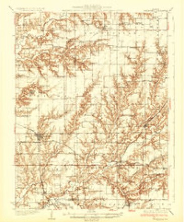
- 1932 USGS Greenfield quadrangle1:62500, 3 printings
- 1948 USGS Quincy quadrangle1:250000, 2 printings
- 1956 USGS Quincy quadrangle1:250000, 3 printings
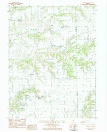
- 1983 USGS Athensville quadrangle1:24000
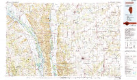
- 1985 USGS Jerseyville quadrangle1:100000, 2 printings


In the county-history sources
1,022 words on this townshipHistory of Greene County, Illinois : Its Past and Present, Containing a History of the County ; Its Cities, Towns, Etc. ; a Biographical Directory of Its Citizens ; War Record.., published 1879 names this settlement in its chapter on Athensville Township. These are the passages that mention it, exactly as the scans read.
Sometime previous to 1830, a man named s Scroggs from Morgan County came into this county and settled very near where Athensville was afterward located. Others made improvements east of Athensville about 1831 or 1832, among wliom was Mr. Rigsby. He took possession of a place which had previously been occupied by Sandy Wiggins. It was about a mile east of the present town. John Ruyle settled two miles east of this place about 1831, and near him was a man named Jackson. Orphy Shepherd made his home a mile northeast, and Mr. Morton settled about the same distance west of Athensville. Not far from his cabin were the improvements of Mr. Musgrove and Alexander Robinson. Just north was Benoni Banning, who had made an earlier settlement near Hickory Grove.
Passage source: History of Greene County, Illinois : Its Past and Present, Containing a History of the County ; Its Cities, Towns, Etc. ; a Biographical Directory of Its Citizens ; War Record.., published 1879.
The first building in Athensville was probably erected in 1832 or 1833, by Greene Weaver. Mr. Weaver had been sent from CarroUton by John Evans with a stock of goods, which he first undertook to sell at Mt. Airy. This stock he brought to Athensville with him, at the date above mentioned. After a time Mr. John Armstrong, from near Carrollton became the proprietor, in part at least, and continued the business for several years. Hon. Alexander King was for several years a partner of Mr. Armstrong and continued with him until the death of the latter some fifteen years since. Mr. Armstrong was an Englishman by birth, but emigrated to this county during the early history of Greene County. He was well acquainted with the early settlers and few men have been more generally esteemed by those around them than John Armstrong.
Passage source: History of Greene County, Illinois : Its Past and Present, Containing a History of the County ; Its Cities, Towns, Etc. ; a Biographical Directory of Its Citizens ; War Record.., published 1879.
The people of that part of Greene County are more inclined to agricultural pursuits than to town building, and for that reason Athensville has not grown to the dimensions of some other towns in the county. Nevertheless it is a place of same business. There are three stores in the town. John English sells dry goods, etc., and Chas. Mason and W. D. Hardcastle keep a general stock. There are besides three blacksmiths and one shoemaker. Tilmon S. Patterson is the postmaster and has acted in that capacity for some years. Rev. John Johnson is the Baptist minister.
Passage source: History of Greene County, Illinois : Its Past and Present, Containing a History of the County ; Its Cities, Towns, Etc. ; a Biographical Directory of Its Citizens ; War Record.., published 1879.
Machine-read from a century-old scan, so expect the errors a machine makes: misspelled names, dropped words, stray characters.
Fires near this place
1 since 2011Regional context, not property-specific evidence. The federal wildfire occurrence database lists 1 fire within 5 miles of Athensville in 2011, burning about 50 acres in total. None started naturally. None was recorded as arson. Distance is straight-line from the map coordinates, so a fire counted here may appear on a neighbouring settlement's page as well.
| Reported cause | Fires |
|---|---|
| Missing data/not specified/undetermined | 1 |
The most recent of them, most recent first, with the day each was reported and the service that recorded it.
| Date | Cause | Size | Reported by | Name on the report |
|---|---|---|---|---|
| 9 October 2011 | Missing data/not specified/undetermined | 50 acres | Illinois Division of Forestry Resources | I72 67 |
Storms near this place
3 since 2009Regional context, not property-specific evidence. The National Weather Service names Athensville in 3 storm reports between 2009 and 2022: 2 hail, 1 tornado. No death or injury is recorded in these reports. Each account below is quoted exactly as the forecast office filed it, from the NOAA Storm Events Database, and each date opens the federal record of that event.
| When | Event | Place named | Harm | What the report says |
|---|---|---|---|---|
| March 2009 | Tornado (EF1) | Athensville | - | The tornado touched down on County Road 51, about three quarters of a mile west southwest of the intersection of Roodhouse Road and 2000E. A large machine shed was totally destroyed at this location. The tornado travelled northeast damaging a number of large trees between CR 51 and 2000E. The tornado crossed 2000E and damaged a large number of trees east of 2000E. The damage width at this location was two tenths of a mile. Further to the northeast, the tornado damaged a church at the intersection of Roodhouse Road and County Road 2075E. The entire church was displaced about 10 feet. A machine shed south of the church was destroyed with debris extending to the north towards the church. Many trees were damaged in this area. The tornado crossed Roodhouse Road and travelled just south of a farmstead on CR 2100E. There was minor shingle damage to the home, one machine shed was damaged. A second farm sustained damage on CR 2600N, about a quarter of a mile west of Illinois Route 267. At this location, one barn and three machine sheds sustained severe damage while parts of the roof and sides of the farm house were uplifted and displaced to the east. The damage path width was a tenth of a mile at this location. Debris from these structures were tossed over 120 yards to the east. The tornado crossed Illinois Route 267 and travelled over an open field then crossed CR 298 where tree damage occurred. The tornado severely damaged a large section of mature pine trees just south of CR 304 and CR 2700N in an open field before it lifted and dissipated. |
| April 2022 | Hail | Athensville | - | no account filed |
| July 2017 | Hail | Athensville | - | no account filed |
Nearest settlements
The eight closest, with where each one stands in the county. Distances are straight-line, computed from the Geographic Names Information System coordinates.
| Map | Place | Distance | Sheets |
|---|---|---|---|
| Greenfield | 7.8 miles | 11 | |
| Wrights | 7.8 miles | 12 | |
| Fayette | 9.5 miles | 11 | |
| Kahm | 9.6 miles | 12 | |
| Roodhouse | 9.9 miles | 12 | |
| Daum | 11.1 miles | 12 | |
| White Hall | 11.4 miles | 12 | |
| Barrow | 11.8 miles | 12 |
Elsewhere
Matched on this settlement's Geographic Names Information System number rather than its name, so it cannot be a different place of the same name in another state.
| Wikidata item Q122594390 | The structured record the population and elevation above come from. Public domain (CC0). |
Provenance
This settlement is recorded in the Geographic Names Information System as feature 422419. The sheet list is computed by point-in-boundary test against the United States Geological Survey's historical topographic inventory. Both are works of the United States government and carry no copyright under 17 U.S.C. 105.
Wildfire. Short, Karen C. 2022. Spatial wildfire occurrence data for the United States, 1992-2020 [FPA_FOD_20221014]. 6th Edition. Fort Collins, CO: Forest Service Research Data Archive. https://doi.org/10.2737/RDS-2013-0009.6 Collected with United States Government funding and usable without additional permissions or fees.
Storms. NOAA National Centers for Environmental Information, Storm Events Database https://www.ncei.noaa.gov/stormevents/ A work of the United States government, no copyright under 17 U.S.C. 105. Narratives are quoted verbatim from the National Weather Service report and are not edited or summarised.