 Block
Aurora, Illinois
15 topographic sheets cover this place, the earliest surveyed in 1932 and the latest in 1998. It stands in Aurora Township. It lies in ZIP code area 60506. It lies near Stolp Island. The Survey maps it on the Aurora North quadrangle. 180,542 people lived here at the 2020 count. It stands 722 feet above sea level.
On record in Aurora
Buildings and businesses the archive holds for this place. Each opens its own page, with the source record it came from.
On the National Register 12 of 29 shown
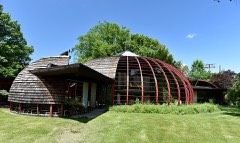 Sam and Ruth Van Sickle Ford HouseNational Historic Landmark
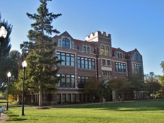 Aurora College Complexlisted 1984
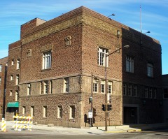 Aurora Elks Lodge No. 705listed 1980
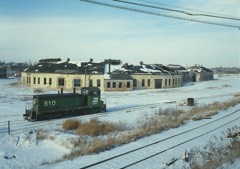 Chicago, Burlington, & Quincy Roundhouse and Locomotive Shoplisted 1978
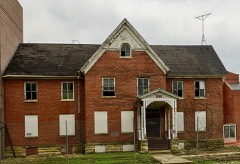 Copley Hospitallisted 2019
 Col. Ira C. Copley Mansionlisted 1978
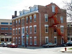 Fox River Houselisted 1976
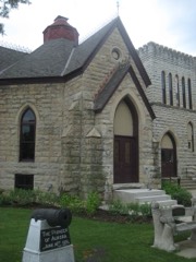 GAR Memorial Buildinglisted 1984
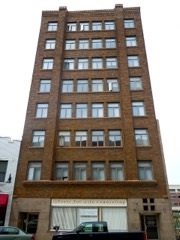 Graham Buildinglisted 1982
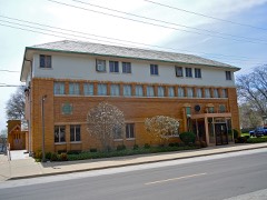 Healy Chapellisted 1985
 Hobbs Buildinglisted 2021
 Hotel Arthurlisted 2005
Population over time
2 figuresAurora fell from 197,899 to 180,542 between 2010 and 2020. These are the recorded population figures Wikidata holds for this place, reached through the Geographic Names Information System number this page is keyed on rather than by name, so they belong to this place and not to another of the same name. Most are census counts, but not all are: an early figure may be a founding or settlement estimate, and an estimate published within five years of a census is left out. The change column is computed, and is left blank where more than 20 years separate a figure from the one before it, because a gap that long is not a change between two counts.
| Year | People | Change |
|---|---|---|
| 2010 | 197,899 | |
| 2020 | 180,542 | -17,357 (-9%) |
Topographic sheets covering this place
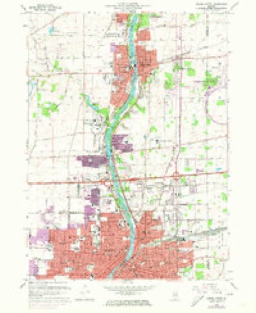
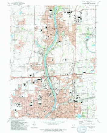
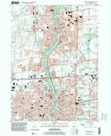
9 surveys from 15 printed sheetsMatched by testing this settlement's coordinate against the published boundary of every sheet in the United States Geological Survey's historical collection. Each opens the scanned sheet at the Survey.
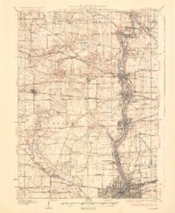
- 1932 USGS Geneva quadrangle1:62500, 3 printings
- 1948 USGS Geneva quadrangle1:62500
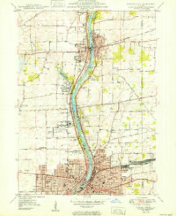
- 1950 USGS Aurora North quadrangle1:24000
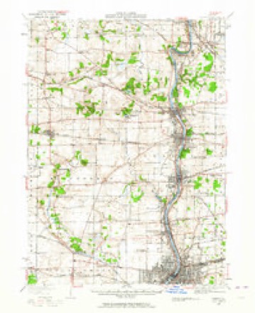
- 1958 USGS Aurora quadrangle1:250000, 3 printings
- 1961 USGS Aurora quadrangle1:250000
- 1964 USGS Aurora North quadrangle1:24000, 3 printings
- 1985 USGS Aurora quadrangle1:100000
- 1993 USGS Aurora North quadrangle1:24000
- 1998 USGS Aurora North quadrangle1:24000



Fires near this place
1 since 2020Regional context, not property-specific evidence. The federal wildfire occurrence database lists 1 fire within 5 miles of Aurora in 2020, burning about 1 acre in total. None started naturally. 1 was recorded as arson. Distance is straight-line from the map coordinates, so a fire counted here may appear on a neighbouring settlement's page as well.
| Reported cause | Fires |
|---|---|
| Arson/incendiarism | 1 |
The most recent of them, most recent first, with the day each was reported and the service that recorded it.
| Date | Cause | Size | Reported by | Name on the report |
|---|---|---|---|---|
| 8 April 2020 | Arson/incendiarism | 1.0 acres | Illinois Division of Forestry Resources | 20-0000121 |
Settlements close enough to share some of these fires:
Mines and quarries near this place
5 within 5 milesRegional context, not property-specific evidence. The federal mineral resources record lists 5 workings within 5 miles of Aurora: 3 past producers, 2 producers. 2 still produce. What was taken out: Sand and Gravel, Construction, Stone, Crushed/Broken. Distance is straight-line from the map coordinates, so a quarry counted here may appear on a neighbouring settlement's page as well.
| Where | Site | Commodity | Status | Recorded |
|---|---|---|---|---|
| Aurora Quarry | Stone, Crushed/Broken | Producer | ||
| Unamed Limestone Quarry | Stone, Crushed/Broken | Past Producer | ||
| Feltes Pit No. 6 | Sand and Gravel, Construction | Producer | ||
| Fox Valley Gravel Pit | Sand and Gravel, Construction | Past Producer | ||
| Hafrenrichter Gravel Pit | Sand and Gravel, Construction | Past Producer |
Storms near this place
60 of 84 shownRegional context, not property-specific evidence. The National Weather Service names Aurora in 84 storm reports between 1994 and 2026: 48 thunderstorm wind, 31 hail, 3 flood, 2 flash flood. No death or injury is recorded in these reports. Each account below is quoted exactly as the forecast office filed it, from the NOAA Storm Events Database, and each date opens the federal record of that event.
| When | Event | Place named | Harm | What the report says |
|---|---|---|---|---|
| March 2007 | Thunderstorm Wind | Aurora | $200,000 | A maintenance building and two condo buildings were damaged by high winds. Ten large trees were also uprooted. |
| August 2012 | Thunderstorm Wind | Aurora | $50,000 | Wind gusts were estimated to 70 mph in Aurora. A 14 inch diameter maple tree was blown down onto a garage. Part of a roof was ripped off of an apartment complex with water causing damage to 96 units. |
| July 1994 | Thunderstorm Wind | Aurora | $50,000 | Two businesses were damaged by winds. The roof was torn off a body shop. A tractor semi-trailer was overturned. The damage occurred on the east side of Aurora near Interstate 88. |
| August 2007 | Thunderstorm Wind | Aurora | $20,000 | A large tree was blown down and crushed a car at the corner of Jackson Street and Parker Avenue. |
| October 2006 | Thunderstorm Wind | Aurora | $5,000 | Ten inch diameter tree blown down at Church Street and Interstate 88, blocking westbound Interstate 88. On vehicle was damaged. |
| March 2017 | Thunderstorm Wind | Aurora | $1,000 | A tree was blown down onto a car. A nearby mesonet site measured a wind gust to 59 mph. |
| March 2025 | Thunderstorm Wind | North Aurora | - | Fascia was partially torn off of a house in northwest Aurora. |
| July 2025 | Thunderstorm Wind | Aurora | - | Multiple trees, tree limbs and power lines were blown down across Aurora with over 100 reports of damage. |
| July 2025 | Thunderstorm Wind | North Aurora | - | A large tree limb was blown down blocking a roadway. |
| July 2025 | Thunderstorm Wind | Aurora | - | Trees and power lines were blown down. |
| July 2025 | Thunderstorm Wind | Aurora | - | Trees and power lines were blown down. |
| August 2025 | Thunderstorm Wind | North Aurora | - | A tree was down and blocking Exposition Ave in North Aurora. |
| August 2025 | Thunderstorm Wind | Aurora | - | A healthy tree had split and was blocking a residential road in Aurora. |
| June 2024 | Thunderstorm Wind | Aurora | - | A large tree branch was downed south of Aurora. |
| June 2024 | Thunderstorm Wind | North Aurora | - | An NWS employee reported a sizeable tree branch down, easily over one inch in diameter. |
| July 2024 | Thunderstorm Wind | Aurora | - | Numerous medium size tree limbs were blown down between Illinois Avenue and Indian Trail. |
| April 2023 | Hail | Aurora | - | Golf ball size hail was reported at Aurora University. |
| April 2023 | Hail | Aurora | - | Tennis ball size hail was reported at West Aurora High School. |
| April 2023 | Hail | Aurora | - | Ping pong ball size hail was reported at East Aurora High School. |
| March 2023 | Thunderstorm Wind | North Aurora | - | A section of metal roofing panels was torn off of the Huntoon Stables on the east side of Highland Park in North Aurora. |
| March 2023 | Thunderstorm Wind | North Aurora | - | A tree was blown down across N Randall Rd north of W Indian Trail. |
| July 2023 | Thunderstorm Wind | Aurora | - | Emergency management reported numerous trees and power lines down across Aurora. |
| July 2023 | Thunderstorm Wind | Aurora | - | A tree was reported down near Aurora University. Time was estimated using radar. |
| August 2022 | Thunderstorm Wind | North Aurora | - | A webcam caught a large tree that was blown over along the Fox River. |
| November 2022 | Thunderstorm Wind | Aurora | - | There were multiple reports of tree and power line damage in the Aurora area. Some of the more significant reports included a 40 inch diameter Locust tree uprooted on Kennsington; a 36 inch diameter tree uprooted on West Downer; two 30 inch diameter trees snapped at the trunk, one on Havenshire Road and the other on Legacy; a 26 inch diameter tree uprooted on East Galena and a 20 inch diameter tree uprooted at Broadway and Washington. |
| June 2021 | Hail | Aurora | - | Nickel to quarter size hail was reported. |
| August 2021 | Thunderstorm Wind | Aurora | - | Multiple trees and power lines were blown down. |
| August 2021 | Thunderstorm Wind | Aurora | - | A 12 inch diameter tree limb was blown down. |
| August 2021 | Thunderstorm Wind | Aurora | - | A large tree limb was blown down in Wilder Park. A nearby utility pole was tilted. |
| August 2021 | Thunderstorm Wind | North Aurora | - | A large tree was snapped. |
| September 2018 | Thunderstorm Wind | Aurora | - | Large trees and power lines were blown down onto a house and car near Garfield Avenue and Franklin Avenue. |
| May 2017 | Thunderstorm Wind | North Aurora | - | A large tree was blown down in a backyard in North Aurora. |
| July 2017 | Hail | Aurora | - | Hail between nickel and ping pong ball size was reported at multiple locations. |
| June 2017 | Hail | Aurora | - | Nickel size hail was reported near Aurora. |
| May 2014 | Hail | North Aurora | - | Numerous reports of hail penny to golf ball size came in from near Aurora. |
| May 2014 | Hail | North Aurora | - | Numerous reports of hail between 1.00 inches and 1.75 inches came in from Aurora. |
| November 2012 | Hail | Aurora | - | Hail fell at Wolfs Crossing and Eola Road. |
| August 2010 | Flood | North Aurora | - | Up to four inches of standing water was reported on roads south of Interstate 88 in Aurora. |
| June 2010 | Thunderstorm Wind | Aurora | - | Aurora city crews received 245 calls regarding trees or tree limbs that were blown down in Aurora. |
| September 2009 | Thunderstorm Wind | Aurora | - | Six inch diameter tree limbs were blown down. |
| June 2009 | Thunderstorm Wind | North Aurora | - | An eight inch diameter tree was broken at its base. |
| July 2008 | Thunderstorm Wind | Aurora | - | A tree was blown down onto a house on Front Street. |
| August 2008 | Thunderstorm Wind | Aurora | - | A wind gust to 70 mph was measured at Aurora High School. |
| March 2007 | Flood | Aurora | - | Numerous roads were closed due to high water, in addition to flooded fields, ditches and streams. Aurora only measured 0.90 inches of rainfall but estimated another inch of water from melting snow. |
| March 2007 | Thunderstorm Wind | Aurora | - | Tree limbs blown down. |
| July 2007 | Flash Flood | Aurora | - | Four to six inches of flowing water at Middle Avenue and Second Street. Aurora measured 2.07 inches of rain. |
| April 2006 | Hail | Aurora | - | Hail as big as golfballs were reported around the city of Aurora. |
| August 2006 | Thunderstorm Wind | Aurora | - | A five inch diameter tree limb was blown down near Normantown and Montgomery Roads. |
| October 2006 | Hail | Aurora | - | Nickel size hail reported at Route 59 and Liberty Road. |
| March 2004 | Hail | Aurora | - | Reported 3 miles west of intersection of Interstate 88 and State Highway 47 |
| May 2004 | Thunderstorm Wind | Aurora | - | Trees were blown down in the road at the intersection of Elmwood and Sullivan Roads. |
| May 2004 | Thunderstorm Wind | Aurora | - | A tree was blown down at Elmwood and Sullivan Roads. |
| May 2004 | Thunderstorm Wind | Aurora | - | Trees were uprooted at the intersection of Dugan Avenue and Route 30. |
| May 2004 | Thunderstorm Wind | Aurora | - | Trees were blown down at Route 47 and Walker Road. |
| June 2004 | Flash Flood | Aurora | - | One lane was closed due to flooding at the intersection of Sullivan Road and Route 31. A total of 2.15 inches of rain was reported. |
| July 2003 | Hail | Aurora | - | Quarter to golf ball size hail was reported in Aurora. Golf ball size hail was reported at Route 25 and Route 31. |
| August 2003 | Hail | Aurora | - | Reported along Fifth Avenue. |
| May 1999 | Thunderstorm Wind | Aurora | - | A microburst damaged tree limbs and power lines in a small section of Aurora. A large tree limb fell on the roof of a house. |
| March 2026 | Hail | Aurora | - | no account filed |
| March 2026 | Hail | Aurora | - | no account filed |
Nearest settlements
The eight closest, with where each one stands in the county. Distances are straight-line, computed from the Geographic Names Information System coordinates.
| Map | Place | Distance | Sheets |
|---|---|---|---|
| South Park | 1.9 miles | 14 | |
| Scraper-Moecherville | 2.3 miles | 14 | |
| Montgomery | 2.5 miles | 14 | |
| Exposition View | 2.5 miles | 15 | |
| Marywood | 2.8 miles | 15 | |
| North Aurora | 3.2 miles | 15 | |
| Randall Hills | 3.7 miles | 15 | |
| Mooseheart | 4.4 miles | 15 |
Elsewhere
Matched on this settlement's Geographic Names Information System number rather than its name, so it cannot be a different place of the same name in another state.
| Wikipedia article on Aurora | An encyclopaedic summary. Its text is share-alike, so it is linked here rather than copied. |
| Wikidata item Q22595 | The structured record the population and elevation above come from. Public domain (CC0). |
Provenance
This settlement is recorded in the Geographic Names Information System as feature 403732. The sheet list is computed by point-in-boundary test against the United States Geological Survey's historical topographic inventory. Both are works of the United States government and carry no copyright under 17 U.S.C. 105.
Wildfire. Short, Karen C. 2022. Spatial wildfire occurrence data for the United States, 1992-2020 [FPA_FOD_20221014]. 6th Edition. Fort Collins, CO: Forest Service Research Data Archive. https://doi.org/10.2737/RDS-2013-0009.6 Collected with United States Government funding and usable without additional permissions or fees.
Mines and quarries. USGS Mineral Resources Data System (MRDS) https://mrdata.usgs.gov/mrds/ A work of the United States government, no copyright under 17 U.S.C. 105.
Storms. NOAA National Centers for Environmental Information, Storm Events Database https://www.ncei.noaa.gov/stormevents/ A work of the United States government, no copyright under 17 U.S.C. 105. Narratives are quoted verbatim from the National Weather Service report and are not edited or summarised.