 Block
Avon, Illinois
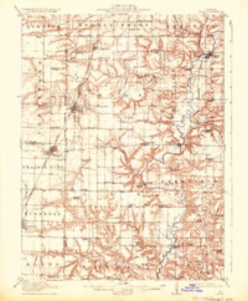
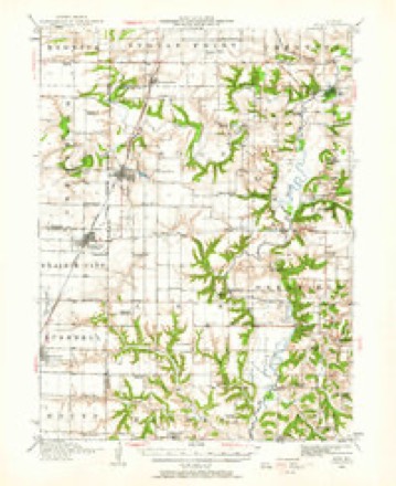
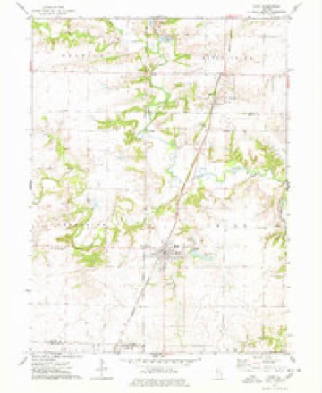
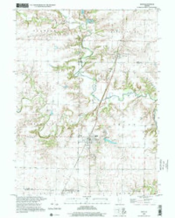
17 topographic sheets cover this place, the earliest surveyed in 1915 and the latest in 1998. It stands in Union Township. It lies in ZIP code area 61415. The Survey maps it on the Avon quadrangle.
Topographic sheets covering this place
10 surveys from 17 printed sheetsMatched by testing this settlement's coordinate against the published boundary of every sheet in the United States Geological Survey's historical collection. Each opens the scanned sheet at the Survey.
- 1915 USGS Avon quadrangle1:62500, 3 printings
- 1944 USGS Avon quadrangle1:62500
- 1958 USGS Burlington quadrangle1:250000, 4 printings
- 1961 USGS Burlington quadrangle1:250000
- 1963 USGS Burlington quadrangle1:250000
- 1974 USGS Avon quadrangle1:24000
- 1985 USGS Galesburg quadrangle1:100000, 2 printings
- 1989 USGS Galesburg quadrangle1:100000
- 1990 USGS Burlington quadrangle1:250000, 2 printings
- 1998 USGS Avon quadrangle1:24000





In the county-history sources
7,018 words on this townshipHistory of Fulton County, Illinois;, published 1879 names this settlement in its chapter on Union Township. These are the passages that mention it, exactly as the scans read.
Union township was first settled by Robert Grant, Isaac Hnlick and a Mr. Betson, who located in 1829 on section 12, near where the ancient town of Troy stood. Job Babbitt settled on the same section in 1831. The first Justice was James Ogden. Rev. Mr. Betson preached the first sermon. Melinda Babbitt was baptized at Troy in 1832, which was the first baptism in the township, and also the first in Cedar creek. The first married was John Rogers to Miss Taylor. Mary Ogden was the first child born in the township. The first death was a son of Rev. Mr. Betson. Among the early pioneers who settled in this township prior to 1838 were Rev. Richard Haney, Stephen Tompkins, Job Babbitt, John Gallet, and others. Jonathan Babbitt is the oldest pioneer now living in the township. The first school in Union township was taught by John Parkerson in 1836, in old St. Augustine. The first mill was built by >vathaniel B. Childs in 1833. For further history, see history of Avon, biographies, sketch of the Churches, etc.
Passage source: History of Fulton County, Illinois;, published 1879.
This lovely little village is situated in the western part of Union township, on the C, B. cV: Q. Railroad, and was founded March 5, 1854, by R. Woods, O. H. Woods and D. N. Wright, and now has a population of about one thousand inhabitants. The town of Avon was chartered March 8, 18G7, by a sj)ecial act of the Legislature, and tiie first corporate election was held the same year, at which the following officers were elected: D. H. Small, President; J. L. Coe,
Passage source: History of Fulton County, Illinois;, published 1879.
L. H. Hewett, A. J, Churchill, and M. R. Gutridge, Trustees; Simon Stevens, Police Magistrate; J. W, Frarapton, Clerk. The first name of the town was Woodvillc, but in 1843 an application was made for a postoffice, and as there was an office of that name in Adams county, the town and office were changed to, Woodstock. On April 4, 1852, the Postmaster General, James Campbell, changed the name to Avon, as the county seat of McHenry county had also the name of Woodstock. The first postmaster was Stephen Tompkins, who held the office 7 years. It is said that he at first kept the postoffice in his hat, so that he would not have to leave his work when any person called for mail, as he was a shoemaker, and was very busy.
Passage source: History of Fulton County, Illinois;, published 1879.
Machine-read from a century-old scan, so expect the errors a machine makes: misspelled names, dropped words, stray characters.
Read the whole chapter on Union Township - it names this place 26 more 26 times.
Fires near this place
1 since 2013Regional context, not property-specific evidence. The federal wildfire occurrence database lists 1 fire within 5 miles of Avon in 2013, burning about 37 acres in total. None started naturally. None was recorded as arson. Distance is straight-line from the map coordinates, so a fire counted here may appear on a neighbouring settlement's page as well.
| Reported cause | Fires |
|---|---|
| Debris and open burning | 1 |
The most recent of them, most recent first, with the day each was reported and the service that recorded it.
| Date | Cause | Size | Reported by | Name on the report |
|---|---|---|---|---|
| 5 April 2013 | Debris and open burning | 37 acres | Illinois Division of Forestry Resources | 201327 |
Storms near this place
21 since 1998Regional context, not property-specific evidence. The National Weather Service names Avon in 21 storm reports between 1998 and 2024: 6 thunderstorm wind, 6 flash flood, 3 tornado, 3 hail. The reports record 2 deaths. Each account below is quoted exactly as the forecast office filed it, from the NOAA Storm Events Database, and each date opens the federal record of that event.
| When | Event | Place named | Harm | What the report says |
|---|---|---|---|---|
| May 2009 | Flood | Avon | 1 killed | Periods of heavy rain between May 13 and May 16 resulted in near record river levels on much of the Spoon River. The gage at London Mills, IL recorded its third highest crest on record at 25.28 feet at 1445 CST on May 16th, which was more than 10 feet above flood stage. This was the highest crest since the major floods of July 1993. The gage at Seville, IL also recorded its third highest stage on record at 30.84 feet at 1430 CST on May 17th, which was nearly 9 feet above flood stage. This was the highest crest in 35 years. Sandbagging efforts at London Mills and Seville prevented property damage. A levee was breached about 2.6 miles west-northwest of the town of Blyton, IL. The breach was about 500 feet across at the levee, with the cone of damage consisting of tree debris and field erosion about 1/2 mile out and 1/2 mile across at the widest point. Two smaller levees also breached about two miles downstream. These breaches and the associated flooding closed a large partion of Illinois Route 9 and caused significant inundation of agricultural land. There was one fatality due to the flooding. A 45 year old man drove around a barricade into the floodwaters of the Spoon River about 1 mile southwest of London Mills and drowned around 1930CST on May 16th. His body was found on May 18th about 85 yards from where he entered the river. |
| May 2009 | Flood | Avon | 1 killed | Periods of heavy rain on saturated soil resulted in extensive flooding in northern Fulton county, particularly in the vicinity of the upper Spoon River basin. Nearly every road was under water and impassible. A 46 year old woman died when she drove her car around a barricade and was swept into the Spoon River just north of the Fulton/Knox County line. She drowned in Fulton County around Midnight and was found in the Spoon River near London Mills. |
| June 2021 | Thunderstorm Wind | Avon | $50,000 | Several trees were snapped and a barn was heavily damaged. |
| March 2016 | Tornado (EF1) | Avon | $15,000 | A tornado crossed into northwest Fulton County from southeast Warren County (NWS Quad Cities) 1.4 miles north-northwest of Avon at 6:56 PM CDT. The tornado tracked northeastward for 2 miles before lifting 2.5 miles north-northeast of Avon at 7:00 PM CDT. The tornado damaged several trees along its path before dissipating in an open field. |
| June 1998 | Tornado (F1) | Avon | $15,000 | A tornado touched down initially 4 miles east northeast of Avon, travelling to the east southeast. Initial damage occurred at a farmstead with damage to a barn ($15,000). A farm house was damaged, ripping off part of the roof, part of the siding, and moving it off the foundation. Damage to a nearby beanfield was estimated around $50,000. The tornado lifted briefly then touched down 8 miles east of Avon, damaging a machine shed and a horse barn. Numerous trees were also damaged along the tornado's path. No injuries were reported. |
| March 2024 | Tornado (EF1) | Avon | - | This tornado initially touched down in the National Weather Service Quad Cities County Warning Area (CWA) in eastern Warren County, then crossed into far northwestern Fulton County about 2 miles northwest of Avon at 4:36 AM CDT. It broke a few large tree branches in Fulton County before quickly dissipating at 4:37 AM CDT. |
| April 2023 | Thunderstorm Wind | Avon | - | Power lines were blown down. |
| June 2023 | Thunderstorm Wind | Avon | - | Several trees were blown over, power lines were downed, and an AC unit was blown into a home. |
| June 2023 | Thunderstorm Wind | Avon | - | Numerous trees and power lines were blown down. |
| May 2022 | Flash Flood | Avon | - | Gallett Creek spilled out of its banks and flooded a few low-lying rural roads across far northwestern Fulton County just north of the town of Avon. |
| June 2015 | Flash Flood | Avon | - | Thunderstorms with rainfall rates of 1.50 to 2.00 per hour for nearly two hours produced a total of 2.50 to 5.00 of rain in northern and central Fulton County. Flash flooding rapidly developed, which made many roads impassable. U.S. Highways 24 and 136 were impassable, as were State Highways 78 and 95. Most secondary roads in rural areas were also inundated. |
| May 2013 | Flash Flood | Avon | - | Thunderstorms with torrential rainfall produced 3.00 to 5.00 inches of rain in a large part of Fulton County during the early morning hours of May 27th. Several roads were closed and many rural roads were reported as having several inches of water flowing over them. |
| May 2010 | Flash Flood | Avon | - | Rainfall rates of 2.00 to 2.50 inches in less than two hours produced flash flooding in the northwest part of Fulton County. Numerous rural roads and small streams were inundated by the flooding. |
| June 2010 | Flash Flood | Avon | - | Rainfall amounts around 2.00 during the evening fell on saturated ground from previous flooding. This resulted in widespread flash flooding across much of northern Fulton County. Numerous roads had several inches of water flowing over them, viaducts were flooded, drainage ditches were overflowing, and fields were inundated with water. Parts of State Highway 9, 78, 97 and 100 were impassable due to the flooding. |
| March 2009 | Flood | Avon | - | Water was flowing across one lane of County Highway 20 during the morning of March 10th. Tarter Ferry Road off of Old County Highway 2 had three feet of water covering the road due to the Spoon River overflowing its banks. |
| May 2009 | Flash Flood | Avon | - | Heavy rain produced up to 2 feet of water on parts of county road 20 near Avon. Water also covered a rural road near London Mills. |
| February 2000 | Thunderstorm Wind | Avon | - | Thunderstorm winds blew down several large tree limbs and power lines in Avon. |
| April 1999 | Thunderstorm Wind | Avon | - | As a line of severe thunderstorms moved through northern Fulton county, widespread damage was reported. A horse trailer was blown over 2 miles south of Avon and a semi was blown over on Route 116 near London Mills. Three miles northeast of Fairview to 6 miles north of Canton, several barns, machine sheds, and silos were destroyed. Also, numerous power poles and power lines were blown down. No injuries were reported. |
| April 2020 | Hail | Avon | - | no account filed |
| May 2004 | Hail | Avon | - | no account filed |
| May 2000 | Hail | Avon | - | no account filed |
Nearest settlements
The eight closest, with where each one stands in the county. Distances are straight-line, computed from the Geographic Names Information System coordinates.
| Map | Place | Distance | Sheets |
|---|---|---|---|
| Virgil (historical) | 3.4 miles | 16 | |
| Pleasant Ridge (historical) | 4.6 miles | 16 | |
| Manley | 5.6 miles | 16 | |
| Troy (historical) | 5.6 miles | 16 | |
| Babylon | 6.8 miles | 17 | |
| Ellisville | 7.3 miles | 16 | |
| Checkrow | 8.2 miles | 16 | |
| London Mills | 9.5 miles | 16 |
Provenance
This settlement is recorded in the Geographic Names Information System as feature 403766. The sheet list is computed by point-in-boundary test against the United States Geological Survey's historical topographic inventory. Both are works of the United States government and carry no copyright under 17 U.S.C. 105.
Wildfire. Short, Karen C. 2022. Spatial wildfire occurrence data for the United States, 1992-2020 [FPA_FOD_20221014]. 6th Edition. Fort Collins, CO: Forest Service Research Data Archive. https://doi.org/10.2737/RDS-2013-0009.6 Collected with United States Government funding and usable without additional permissions or fees.
Storms. NOAA National Centers for Environmental Information, Storm Events Database https://www.ncei.noaa.gov/stormevents/ A work of the United States government, no copyright under 17 U.S.C. 105. Narratives are quoted verbatim from the National Weather Service report and are not edited or summarised.