 Block
Ellisville, Illinois
16 topographic sheets cover this place, the earliest surveyed in 1915 and the latest in 1990. It stands in Ellisville Township. It lies in ZIP code area 61431. It stands on Coal Creek. The Survey maps it on the London Mills quadrangle. 87 people lived here at the 2020 count. It stands 550 feet above sea level.
On record in Ellisville
Buildings and businesses the archive holds for this place. Each opens its own page, with the source record it came from.
On the National Register 2 records
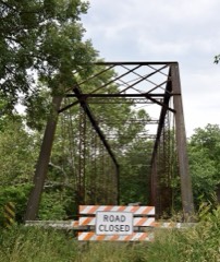 Babylon Bend Bridgelisted 1980
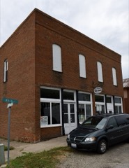 Odd Fellows Opera Blocklisted 1996
Population over time
2 figuresEllisville fell from 96 to 87 between 2010 and 2020. These are the recorded population figures Wikidata holds for this place, reached through the Geographic Names Information System number this page is keyed on rather than by name, so they belong to this place and not to another of the same name. Most are census counts, but not all are: an early figure may be a founding or settlement estimate, and an estimate published within five years of a census is left out. The change column is computed, and is left blank where more than 20 years separate a figure from the one before it, because a gap that long is not a change between two counts.
| Year | People | Change |
|---|---|---|
| 2010 | 96 | |
| 2020 | 87 | -9 (-9%) |
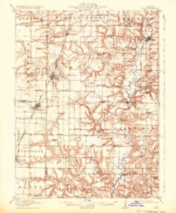
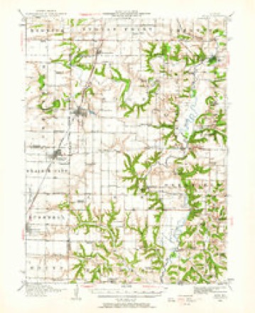
Topographic sheets covering this place
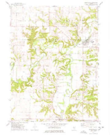
9 surveys from 16 printed sheetsMatched by testing this settlement's coordinate against the published boundary of every sheet in the United States Geological Survey's historical collection. Each opens the scanned sheet at the Survey.
- 1915 USGS Avon quadrangle1:62500, 3 printings
- 1944 USGS Avon quadrangle1:62500
- 1958 USGS Burlington quadrangle1:250000, 4 printings
- 1961 USGS Burlington quadrangle1:250000
- 1963 USGS Burlington quadrangle1:250000
- 1974 USGS London Mills quadrangle1:24000
- 1985 USGS Galesburg quadrangle1:100000, 2 printings
- 1989 USGS Galesburg quadrangle1:100000
- 1990 USGS Burlington quadrangle1:250000, 2 printings




In the county-history sources
3,719 words on this townshipHistory of Fulton County, Illinois;, published 1879 names this settlement in its chapter on Ellisville Township. These are the passages that mention it, exactly as the scans read.
The life of Levi D. Ellis, the founder of the village of Ellisville, is so completely interwoven with the history of this township that we deem a short personal sketch of him important in this connection. He was born in South Carolina in the year 1789, and a half-orphan, his father having died before his birth. At the age of thirteen he went to Tennessee, leaving his friends behind, who however joined him two years thereafter. From there he moved to Illinois, stopping near Belleville ; from there to where Springfield now stands, which was at that time a wilderness. Mr. Ellis here cut the first tree for the first cabin ever erected in the capital city. He came to Fulton county in 1838, and located in Joshua township, his being the second family in the township. Here he built a mill. In 1828 he moved to this township and erected the first house in the township on the site of the present town of Ellisville. In 1829 he erected the first mill on Spoon river.
Passage source: History of Fulton County, Illinois;, published 1879.
The village of Ellisville was founded in 1830. It was at one time a great center for business. The people for forty miles around came here to have their grain ground and do their trading. But this prosperity was banished on the construction of the C, B. & Q. Railroad.
Passage source: History of Fulton County, Illinois;, published 1879.
The Ellisville mill, which was known far and wide, was re-built in 1869 by Sheckler Bros. & Co., who have also added a saw-mill to it. The capacity of the mill at present is 75 l)arrel.s in 24 hours. The first school-house in the township was built in 1S40, and Chas. O. Nickerson was the first teacher. There are are now three school buildings in the township.
Passage source: History of Fulton County, Illinois;, published 1879.
Machine-read from a century-old scan, so expect the errors a machine makes: misspelled names, dropped words, stray characters.
Read the whole chapter on Ellisville Township - it names this place 16 more 16 times.
Mines and quarries near this place
3 within 5 milesRegional context, not property-specific evidence. The federal mineral resources record lists 3 workings within 5 miles of Ellisville: 3 past producers. None of them still produces. What was taken out: Sand and Gravel, Construction. Distance is straight-line from the map coordinates, so a quarry counted here may appear on a neighbouring settlement's page as well.
| Where | Site | Commodity | Status | Recorded |
|---|---|---|---|---|
| Glaser Pit | Sand and Gravel, Construction | Past Producer | ||
| Spoon River Pit | Sand and Gravel, Construction | Past Producer | ||
| Spoon River Pit | Sand and Gravel, Construction | Past Producer |
Storms near this place
6 since 1997Regional context, not property-specific evidence. The National Weather Service names Ellisville in 6 storm reports between 1997 and 2023: 4 thunderstorm wind, 2 hail. No death or injury is recorded in these reports. Each account below is quoted exactly as the forecast office filed it, from the NOAA Storm Events Database, and each date opens the federal record of that event.
| When | Event | Place named | Harm | What the report says |
|---|---|---|---|---|
| May 1998 | Thunderstorm Wind | Ellisville | $500 | Thunderstorm winds blew down several large trees and power lines between Ellisville and Farmington. No injuries were reported. |
| August 2019 | Thunderstorm Wind | Ellisville | - | A young cedar tree was blown down. |
| November 1998 | Thunderstorm Wind | Ellisville | - | Several large trees were blown down. Also, several utility poles were blown down in Ellisville, Lewistown, and Canton. |
| August 1997 | Thunderstorm Wind | Ellisville | - | Thunderstorm winds blew down several large trees, tree limbs, and power lines as they moved through the Ellisville, Canton, and Lewistown areas. One large tree blocked Route 9 four miles west of Canton. No injuries were reported and no damage estimate was available. |
| May 2023 | Hail | Ellisville | - | no account filed |
| July 2008 | Hail | Ellisville | - | no account filed |
Nearest settlements
The eight closest, with where each one stands in the county. Distances are straight-line, computed from the Geographic Names Information System coordinates.
| Map | Place | Distance | Sheets |
|---|---|---|---|
| Babylon | 3.4 miles | 17 | |
| Blyton | 4.6 miles | 17 | |
| Troy (historical) | 4.7 miles | 16 | |
| Virgil (historical) | 4.9 miles | 16 | |
| Pleasant Ridge (historical) | 5.3 miles | 16 | |
| Midway (historical) | 5.9 miles | 17 | |
| London Mills | 6.1 miles | 16 | |
| Checkrow | 6.3 miles | 16 |
Elsewhere
Matched on this settlement's Geographic Names Information System number rather than its name, so it cannot be a different place of the same name in another state.
| Wikipedia article on Ellisville | An encyclopaedic summary. Its text is share-alike, so it is linked here rather than copied. |
| Wikidata item Q930212 | The structured record the population and elevation above come from. Public domain (CC0). |
Provenance
This settlement is recorded in the Geographic Names Information System as feature 407909. The sheet list is computed by point-in-boundary test against the United States Geological Survey's historical topographic inventory. Both are works of the United States government and carry no copyright under 17 U.S.C. 105.
Mines and quarries. USGS Mineral Resources Data System (MRDS) https://mrdata.usgs.gov/mrds/ A work of the United States government, no copyright under 17 U.S.C. 105.
Storms. NOAA National Centers for Environmental Information, Storm Events Database https://www.ncei.noaa.gov/stormevents/ A work of the United States government, no copyright under 17 U.S.C. 105. Narratives are quoted verbatim from the National Weather Service report and are not edited or summarised.