 Block
Banner, Illinois
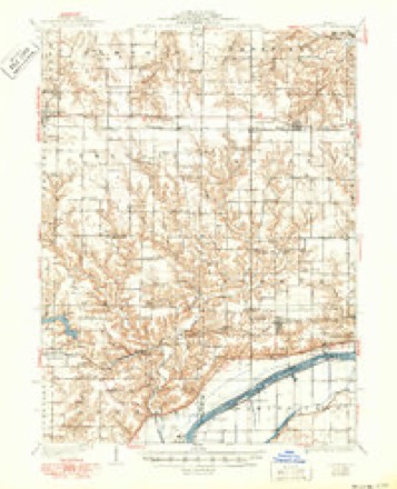
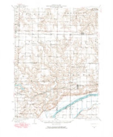
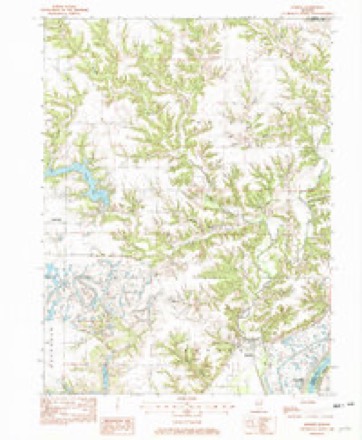
14 topographic sheets cover this place, the earliest surveyed in 1930 and the latest in 1990. It stands in Banner Township. It lies in ZIP code area 61520. It lies near Baker Hollow. The Survey maps it on the Banner quadrangle. 169 people lived here at the 2020 count. It stands 470 feet above sea level.
Population over time
2 figuresBanner fell from 189 to 169 between 2010 and 2020. These are the recorded population figures Wikidata holds for this place, reached through the Geographic Names Information System number this page is keyed on rather than by name, so they belong to this place and not to another of the same name. Most are census counts, but not all are: an early figure may be a founding or settlement estimate, and an estimate published within five years of a census is left out. The change column is computed, and is left blank where more than 20 years separate a figure from the one before it, because a gap that long is not a change between two counts.
| Year | People | Change |
|---|---|---|
| 2010 | 189 | |
| 2020 | 169 | -20 (-11%) |
Topographic sheets covering this place
9 surveys from 14 printed sheetsMatched by testing this settlement's coordinate against the published boundary of every sheet in the United States Geological Survey's historical collection. Each opens the scanned sheet at the Survey.
- 1930 USGS Glasford quadrangle1:62500, 3 printings
- 1948 USGS Glasford quadrangle1:62500
- 1958 USGS Peoria quadrangle1:250000, 4 printings
- 1961 USGS Peoria quadrangle1:250000
- 1963 USGS Peoria quadrangle1:250000
- 1982 USGS Banner quadrangle1:24000
- 1985 USGS Peoria quadrangle1:100000
- 1989 USGS Peoria quadrangle1:100000
- 1990 USGS Peoria quadrangle1:250000






In the county-history sources
3,450 words on this townshipHistory of Fulton County, Illinois;, published 1879 names this settlement in its chapter on Banner Township. These are the passages that mention it, exactly as the scans read.
Joxcph S. Addis, farmer, see. 5, Banner tj). ; V. O., Canton. His father, Aaron I). Addis, was a native of Xew Jersey and died Jan. 23, 1873, in Fulton Co.; his mother, Jane E., also a native of New Jersey, is still living and resides at the old homestead ; they emigrated with a moving wagon to Illinois in 1(S37, first located at Fairview, then in Buckheart tp., and finally in Banner tp. Joseph S. was born in Banner tp. Oct. 11, 1848, educated in the common schools, and Eeb. '27, 1873, married Emma C. Weller, Avho was born in New Jersey June 13, 1852. Their chikb-enare Aaron D., Luella IVIay and Lottie. Mr. Addis has served as Town Collector and School Trustee: has 100 acres of good land. He is a Democrat, and he and his wife are both members of the Methodist Protestant Church.
Passage source: History of Fulton County, Illinois;, published 1879.
William L. Beefs, farmer, sec. 19, Banner township, was born in Highland county, Ohio, Feb. 27, 1851. His parent-^ are Elihu and Sarah (Daugherty) Beets, the former a native of A'irginia and the latter of Ohio. William had the advantages of only the common schools of this county at which to gain an education. He has been moderately successful in his chosen calling.
Passage source: History of Fulton County, Illinois;, published 1879.
Henry Siiiith was born in Canada, of Dutch ancestry, and came to Fulton Co. in 184U. In Canada his wages as a farm hand was always very small, but by industry and economy he is now able to own the east half of sec. 17, Banner tp. June 18, 1846 he married Elizabeth Hutchison. They have had no children of their own but have brought uj> two, - Josephine and Willard Maloon. The girl is in Iowa, married; the boy still at home. German Baptists. Republican.
Passage source: History of Fulton County, Illinois;, published 1879.
Machine-read from a century-old scan, so expect the errors a machine makes: misspelled names, dropped words, stray characters.
Read the whole chapter on Banner Township - it names this place 5 more 5 times.
Fires near this place
1 since 2018Regional context, not property-specific evidence. The federal wildfire occurrence database lists 1 fire within 5 miles of Banner in 2018, burning under an acre in total. None started naturally. None was recorded as arson. Distance is straight-line from the map coordinates, so a fire counted here may appear on a neighbouring settlement's page as well.
| Reported cause | Fires |
|---|---|
| Debris and open burning | 1 |
The most recent of them, most recent first, with the day each was reported and the service that recorded it.
| Date | Cause | Size | Reported by | Name on the report |
|---|---|---|---|---|
| 17 May 2018 | Debris and open burning | under an acre | Illinois Division of Forestry Resources | 2018235 |
Settlements close enough to share some of these fires:
Storms near this place
9 since 2005Regional context, not property-specific evidence. The National Weather Service names Banner in 9 storm reports between 2005 and 2023: 6 hail, 2 flood, 1 flash flood. No death or injury is recorded in these reports. Each account below is quoted exactly as the forecast office filed it, from the NOAA Storm Events Database, and each date opens the federal record of that event.
| When | Event | Place named | Harm | What the report says |
|---|---|---|---|---|
| April 2013 | Flood | Banner | $3,600,000 | No homes were damaged by record levels of flooding on the Illinois River. However, thousands of acres of agricultural land and nature reserves were inundated by the flood waters. Several roads along the river were also damaged. The river stage at Havana climbed to a record level of 27.78 feet on April 25th at 19:15 local time, which was nearly 14 feet above flood stage. High impact flooding continued into the month of May 2013. |
| March 2023 | Hail | Banner | - | The hail caused significant damage to vehicles, with several cars requiring towing from the roadway. |
| May 2013 | Flood | Banner | - | High impact flooding on the Illinois River continued from April.||No homes were damaged by record levels of flooding on the Illinois River. However, thousands of acres of agricultural land and nature reserves were inundated by the flood waters. Several roads along the river were also damaged. High impact flooding subsided when the river level at Havana fell below a stage of 17 feet on May 19th.||Damage estimates for the roads and agricultural land were not available for this event. |
| June 2011 | Flash Flood | Banner | - | Thunderstorms moved along the Illinois River, producing a band of heavy rainfall in northeast Fulton County during the early morning hours. More than 1.00 of rain occurred in less than 20 minutes after 0100 LST. Many streets in the town of Banner were flooded, and numerous rural roads were impassable along the Illinois River. |
| March 2023 | Hail | Banner | - | no account filed |
| April 2023 | Hail | Banner | - | no account filed |
| April 2014 | Hail | Banner | - | no account filed |
| April 2013 | Hail | Banner | - | no account filed |
| September 2005 | Hail | Banner | - | no account filed |
Nearest settlements
The eight closest, with where each one stands in the county. Distances are straight-line, computed from the Geographic Names Information System coordinates.
| Map | Place | Distance | Sheets |
|---|---|---|---|
| Monterey | 2.2 miles | 14 | |
| Breeds | 2.7 miles | 14 | |
| Rawalts | 4.5 miles | 14 | |
| Village Square | 6.7 miles | 17 | |
| Dunfermline | 6.8 miles | 19 | |
| East Lawndale | 6.8 miles | 17 | |
| Prospect Heights Addition | 6.9 miles | 17 | |
| Canton | 7.3 miles | 17 |
Elsewhere
Matched on this settlement's Geographic Names Information System number rather than its name, so it cannot be a different place of the same name in another state.
| Wikipedia article on Banner | An encyclopaedic summary. Its text is share-alike, so it is linked here rather than copied. |
| Wikidata item Q2671640 | The structured record the population and elevation above come from. Public domain (CC0). |
Provenance
This settlement is recorded in the Geographic Names Information System as feature 403874. The sheet list is computed by point-in-boundary test against the United States Geological Survey's historical topographic inventory. Both are works of the United States government and carry no copyright under 17 U.S.C. 105.
Wildfire. Short, Karen C. 2022. Spatial wildfire occurrence data for the United States, 1992-2020 [FPA_FOD_20221014]. 6th Edition. Fort Collins, CO: Forest Service Research Data Archive. https://doi.org/10.2737/RDS-2013-0009.6 Collected with United States Government funding and usable without additional permissions or fees.
Storms. NOAA National Centers for Environmental Information, Storm Events Database https://www.ncei.noaa.gov/stormevents/ A work of the United States government, no copyright under 17 U.S.C. 105. Narratives are quoted verbatim from the National Weather Service report and are not edited or summarised.