 Block
Beardstown, Illinois
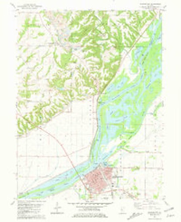
16 topographic sheets cover this place, the earliest surveyed in 1926 and the latest in 1990. It stands in Beardstown Township. It lies in ZIP code area 62618. It stands on Sangamon River. The Survey maps it on the Beardstown quadrangle. 5,951 people lived here at the 2020 count. It stands 443 feet above sea level.
Research this city
On record in Beardstown
Buildings and businesses the archive holds for this place. Each opens its own page, with the source record it came from.
On the National Register 1 record
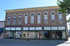 Beardstown Grand Opera Houselisted 2000
Population over time
2 figuresBeardstown fell from 6,123 to 5,951 between 2010 and 2020. These are the recorded population figures Wikidata holds for this place, reached through the Geographic Names Information System number this page is keyed on rather than by name, so they belong to this place and not to another of the same name. Most are census counts, but not all are: an early figure may be a founding or settlement estimate, and an estimate published within five years of a census is left out. The change column is computed, and is left blank where more than 20 years separate a figure from the one before it, because a gap that long is not a change between two counts.
| Year | People | Change |
|---|---|---|
| 2010 | 6,123 | |
| 2020 | 5,951 | -172 (-3%) |
Topographic sheets covering this place
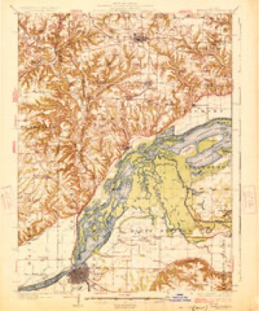
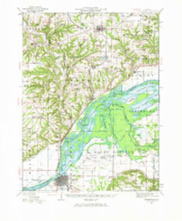
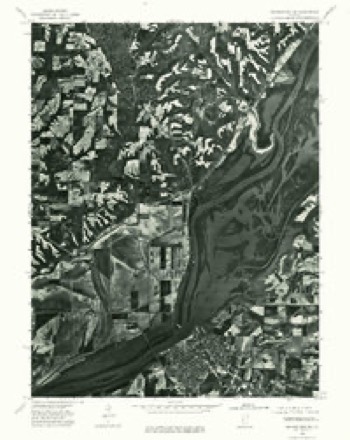
10 surveys from 16 printed sheetsMatched by testing this settlement's coordinate against the published boundary of every sheet in the United States Geological Survey's historical collection. Each opens the scanned sheet at the Survey.
- 1926 USGS Beardstown quadrangle1:62500, 2 printings
- 1944 USGS Beardstown quadrangle1:62500, 2 printings
- 1958 USGS Burlington quadrangle1:250000, 4 printings
- 1961 USGS Burlington quadrangle1:250000
- 1963 USGS Burlington quadrangle1:250000
- 1975 USGS Beardstown SW quadrangle1:24000
- 1981 USGS Beardstown quadrangle1:24000
- 1985 USGS Macomb quadrangle1:100000
- 1989 USGS Macomb quadrangle1:100000
- 1990 USGS Burlington quadrangle1:250000, 2 printings




In the county-history sources
3,500 words on this townshipHistory of Cass County Illinois, published 1915 names this settlement in its chapter on Beardstown Township. These are the passages that mention it, exactly as the scans read.
On October 10, 1827, Mr. Beard alone entered the east half of the southwest quarter of section 15, township 18. north, range 12, west. The original town of Beardstown was platted and laid out in September, 1829. The certificate bears date of September 9, 1829, and was recorded the same day, and states that the plat is on the north fractional half of section 1, township 18, north, range 12. west. in Morgan County, Dll. The original town contained 175 lots lying adjacent to the river, extending southward. The explanation states that Main street's course is north 52 degrees east, and vice versa. Mareh and Beard made an addition to the town, March 6, 18383, containing 268 lots. one of the blocks being on the easterly side. and the remainder south and west. On May 9, 1836, Thomas Beard and Nolte A. Ware made another addition, Ware certifies by his attorney in fact, Francis A. Arenz. John Ayers made a small addition on July 19, 1886, and in July, 1837, Beard and Arenz made an addition. Havekluft & Ehrhardt, Clendennin and Denison, Ravenswood and several others made small additions.
Passage source: History of Cass County Illinois, published 1915.
The first town organization was in 1834, when a board of trustees was elected, consisting of Haywood Reed, president; John B. Fulks, then the manager of the first newspaper in the county, clerk; Edward Tull, assessor; Martin S. Trent, collector; Isaac Spence, treasurer ; and William Nelms, supervisor. In September of that year the first ordinances for the government of the town were enacted. This organization existed until under an act of the legislature passed February 10, 1849, there was a reorganization as a town; on February 4, 1850, the proposition was adopted, and the following persons elected as officers: mayor, John A. Arenz; aldermen: First Ward, Thomas Eyre, father of William Eyre, who has had charge of the courthouse at Virginia as janitor for several years, and Jesse Riggins; Second Ward, James Hope and Joseph Stehlin; Third Ward, George Guenther and Jacob Ritcher. Sylvester Emmons was appointed clerk, Dr. T. A. Hoffman treasurer, and Eli S. Houghton was appointed marshal. Some doubts having arisen concerning the legality of organization. the legislature of 1857, by an act approved February 16 of that year, legalized the incorporation, and all official acts of its officers. and, by section 4 of the act, fixed the corporate limits of the town as follows: "That hereafter the corporate limits of the city of Beardstown shall embrace a territory of one and one-half miles square, extending threefourths of a mile from the center of the public square, east, west. north and south, unless where said line interferes with the Illinois River, and there the boundary of said city shall run to the middle of the channel of said river; provided, that where the new territory included by this act shall not be laid off into lots or out-lots, said territory so annexed shall not be subject to taxation for city purposes without the consent of the owners of the land not laid off into lots or out-lots."
Passage source: History of Cass County Illinois, published 1915.
Encouraged by the good will of the legislature towards them, a number of these same citizens, with others, were emboldened to ask and received from the legislature at the same session on February 16 a charter for the Beardstown Gas Light and Coke Company. The incorporators were: C. H. C. Havekluft, Charles Sprague, Horace Billings, Thomas Eyre, Henry E. Dummer, Francis Rearick and J. Henry Shaw.
Passage source: History of Cass County Illinois, published 1915.
Machine-read from a century-old scan, so expect the errors a machine makes: misspelled names, dropped words, stray characters.
Read the whole chapter on Beardstown Township - it names this place 11 more 11 times.
Mines and quarries near this place
3 within 5 milesRegional context, not property-specific evidence. The federal mineral resources record lists 3 workings within 5 miles of Beardstown: 2 producers, 1 past producer. 2 still produce. What was taken out: Sand and Gravel, Construction, Stone, Crushed/Broken. Distance is straight-line from the map coordinates, so a quarry counted here may appear on a neighbouring settlement's page as well.
| Where | Site | Commodity | Status | Recorded |
|---|---|---|---|---|
| Hammitt Quarry | Stone, Crushed/Broken | Producer | ||
| Coal Creek Pit | Sand and Gravel, Construction | Producer | ||
| Illinois Valley Asphalt Co. Pit | Sand and Gravel, Construction | Past Producer |
Storms near this place
60 of 66 shownRegional context, not property-specific evidence. The National Weather Service names Beardstown in 66 storm reports between 1993 and 2026: 35 thunderstorm wind, 19 hail, 7 flash flood, 3 flood. No death or injury is recorded in these reports. Each account below is quoted exactly as the forecast office filed it, from the NOAA Storm Events Database, and each date opens the federal record of that event.
| When | Event | Place named | Harm | What the report says |
|---|---|---|---|---|
| June 2010 | Thunderstorm Wind | Beardstown | $3,500,000 | Numerous large trees were uprooted, and many large tree branches and power lines were downed. Thirty nine structures sustained damage and most needed repairs to be returned to a habitable state. These structures included single and multiple family homes, mobile homes, and businesses. Three structures were a total loss. |
| August 1999 | Thunderstorm Wind | Beardstown | $210,000 | As a line of severe thunderstorms moved into Cass County, several miles stretch of US Route 67 was closed due to 40 power poles being blown down. Also, ten homes sustained minor damage from the storms. A barn and a garage were destroyed, and numerous trees, tree limbs, and other power lines were blown down. In Arenzville, one of the fallen trees damaged a pickup truck. Also, considerable crop damage was reported countywide, especially between Beardstown and Arenzville. Damage to the crops was estimated around $6.8 million. |
| December 2018 | Tornado (EF1) | Beardstown | $200,000 | A tornado touched down 1.1 miles southeast of Beardstown at 3:25 PM CST. The tornado damaged some power poles near the railroad tracks east of the nursing home south of Beardstown, then tracked northeastward, causing tree damage as it crossed IL Route 125. The tornado damaged the Water Treatment Plant, including 3 of the 4 wells that serve the city, and knocked down numerous trees as it passed just east of Roy Roberts Park. It also knocked the windows out of several vehicles in the parking lot of the Park. The tornado continued moving to the northeast across Chandlerville Rd, causing an elongated area of tree damage along Duck Slough Rd before dissipating in a field east of Phelps Ditch Rd about 3.9 miles northeast of Beardstown at 3:33 PM CST. |
| July 2010 | Flash Flood | Beardstown | $100,000 | Slow moving thunderstorms produced copious amounts of rainfall in western Cass County late in the evening of July 28th. Rainfall amounts of 4.00 to 5.00 were measured in 90 minutes which produced nearly two feet of water on many roads. Numerous cars were stranded on the streets in Beardstown. |
| March 2008 | Thunderstorm Wind | Beardstown | $67,000 | Thunderstorm winds damaged the roof of the Beardstown Fire Department. |
| September 2008 | Flash Flood | Beardstown | $60,000 | Water from Indian Creek was flooding homes in a subdivision 2 miles south of Beardstown. |
| June 2018 | Thunderstorm Wind | Beardstown | $35,000 | Numerous tree limbs and power lines were blown down. |
| September 2014 | Thunderstorm Wind | Beardstown | $35,000 | Several trees and power lines were blown down. |
| June 2010 | Thunderstorm Wind | Beardstown | $15,000 | One tree and numerous tree limbs were blown down in and around Beardstown. |
| September 2014 | Thunderstorm Wind | Beardstown | $12,000 | Numerous large tree limbs were blown down. |
| February 2011 | Hail | Beardstown | $10,000 | Golfball-sized hail damaged a vehicle. |
| June 2018 | Thunderstorm Wind | Beardstown | $6,000 | A power pole was blown down in Beardstown. |
| May 2013 | Thunderstorm Wind | Beardstown | $6,000 | A power pole was blown down in Beardstown. |
| May 2016 | Thunderstorm Wind | Beardstown | $2,000 | A tree was blown across US-67 just south of Beardstown. |
| June 2024 | Thunderstorm Wind | Beardstown | - | A few tree branches were blown down. |
| May 2023 | Thunderstorm Wind | Beardstown | - | Power lines were blown onto railroad tracks. |
| April 2017 | Flash Flood | Beardstown | - | Rain amounts of 3.40 to 4.00 inches in about a two hour period during the evening hours, on already saturated ground, resulted in flash flooding across mush of Cass County. Numerous streets in Virginia and Ashland were impassable, as were numerous rural roads in the county. Ashland Road south of Illinois Route 125 was closed near the Sangamon County line because it was washed out. |
| April 2017 | Flood | Beardstown | - | Rain amounts of 3.40 to 4.00 inches in about a two hour period during the evening hours, on already saturated ground, resulted in flash flooding across mush of Cass County. Numerous streets in Virginia and Ashland were impassable, as were numerous rural roads in the county. Ashland Road south of Illinois Route 125 was closed near the Sangamon County line because it was washed out. Additional rain of 0.50 to 1.00 inch during the early morning hours kept many roads flooded. Flood waters subsided by mid-morning on the 30th. |
| May 2013 | Flood | Beardstown | - | High impact flooding on the Illinois River continued from April. Several structures southwest of Beardstown in rural parts of Cass County were damaged by record levels of flooding on the Illinois River. The flood wall in Beardstown, however, spared the city for significant damage. Agricultural land and several roads adjacent to the river were also damaged. High impact flooding subsided when the river level at Beardstown fell below a stage of 18 feet on May 22nd. Damage estimates for the buildings, agricultural land and roads were not available for this event. |
| April 2013 | Flood | Beardstown | - | Several structures southwest of Beardstown in rural parts of Cass County were damaged by record levels of flooding on the Illinois River. The flood wall in Beardstown, however, spared the city from significant damage. Agricultural land and several roads adjacent to the river were also damaged. The river stage at Beardstown climbed to a record level of 29.81 feet on April 27th at 01:25 local time, which was nearly 16 feet above flood stage. High impact flooding continued into the month of May 2013. |
| May 2011 | Thunderstorm Wind | Beardstown | - | Several trees and power lines were blown down in Beardstown. |
| June 2011 | Flash Flood | Beardstown | - | Severe thunderstorms during the late evening hours produced 1.00 to 2.00 of rain on extremely saturated ground. This resulted in rapid flash flooding of creeks, streams and roads in extreme southern Cass County. Illinois Route 100/U.S. Highway 67 had several areas of standing water, and most rural roads were impassable. |
| June 2011 | Flash Flood | Beardstown | - | Thunderstorms during the late evening hours only produced 1.00 to 2.00 of rain. However, the ground was extremely saturated and flash flooding had occurred at times during the previous week. Thus, rapid flash flooding of creeks and roads occurred across almost all of Cass County. Streets in Beardstown and Virginia were flooded and Illinois Routes 78 and 125 had standing water in spots. Nearly all rural roads were impassable due to the flooding. |
| July 2010 | Flash Flood | Beardstown | - | Heavy rainfall rates of 2.00 per hour produced flash flooding in much of Cass County during the late evening hours of July 24th. Total rainfall amounts of nearly 3.00 were common across the county, with many rural roads closed due to the flooding. |
| November 2005 | Thunderstorm Wind | Beardstown | - | Tree blown down. |
| May 2004 | Thunderstorm Wind | Beardstown | - | Several trees and tree limbs were blown down. Also, a storage building east of town had some of the metal siding peeled off. |
| October 2004 | Thunderstorm Wind | Beardstown | - | Few trees and power lines down. |
| July 2003 | Thunderstorm Wind | Beardstown | - | A large tree was blown down across US 67 on the southwest side of Beardstown. |
| September 2003 | Thunderstorm Wind | Beardstown | - | Several trees were blown down onto US 67 south of Beardstown. |
| April 2002 | Thunderstorm Wind | Beardstown | - | Scattered wind damage was reported in portions of Cass County along and south of a Beardstown to Philadelphia line. The damage was due to the rear flank downdraft of the severe thunderstorm. Damage consisted of numerous trees toppled or broken off, power poles snapped off, an irrigation rig thrown over and damage to a barn. |
| July 2002 | Thunderstorm Wind | Beardstown | - | Several large tree limbs were blown down around town. |
| July 2001 | Thunderstorm Wind | Beardstown | - | Several trees and power lines were blown down. |
| August 2001 | Flash Flood | Beardstown | - | Flooding mainly affected the town of Beardstown, based on reports. Numerous roads flooded with standing water in Beardstown reported at 1130 PM CDT. At 1245 AM CDT, minor flooding was reported on Illinois Route 125 from the Cass County sheriff's office. No significant problems reported with any of the flooding |
| August 2000 | Thunderstorm Wind | Beardstown | - | Several large tree limbs were blown down. |
| June 2000 | Thunderstorm Wind | Beardstown | - | A large tree was blown down just south of town. |
| September 2000 | Thunderstorm Wind | Beardstown | - | A tree was blown down, as well as some tree limbs and power lines. |
| June 2000 | Thunderstorm Wind | Beardstown | - | Several trees and tree limbs were blown down. |
| June 1999 | Thunderstorm Wind | Beardstown | - | Several trees were blown down one mile east of Beardstown. Also, a home in the area lost some siding. |
| February 1999 | Thunderstorm Wind | Beardstown | - | Several trees were blown down in Beardstown. |
| August 1999 | Thunderstorm Wind | Beardstown | - | Several trees blown down. |
| April 1998 | Tornado (F0) | Beardstown | - | A tornado touched down near Clear Lake. It caused minor damage to 5 cabins and tore part of the roof off of another one. Also, numerous trees were blown down. No injuries were reported and no damage estimate was available. |
| June 1998 | Thunderstorm Wind | Beardstown | - | Thunderstorm winds blew down a tree onto a house and another one fell onto a car in Beardstown. No injuries were reported and no damage estimate was available. |
| June 1998 | Thunderstorm Wind | Beardstown | - | Large tree limbs were blown down, some of which were lying on Route 125 between Beardstown and Virginia. |
| March 1998 | Thunderstorm Wind | Beardstown | - | Several large trees were blown down and some siding was taken off of one home in Beardstown. No injuries were reported and no damage estimate was available. |
| July 1994 | Thunderstorm Wind | Beardstown | - | Thunderstorm winds blew down a large tree 2 S of Beardstown. |
| July 1994 | Thunderstorm Wind | Beardstown | - | Thunderstorm winds blew down three large trees in a cemetery in Beardstown. A storm spotter in Newmansville estimated thunderstorm winds around 60 mph. No damage was reported. Thunderstorm winds blew down several power lines in Chandlerville. |
| August 1993 | Thunderstorm Wind | Beardstown | - | Thunderstorm winds blew down several trees. Some trees fell onto Highway 125, blocking it briefly. |
| March 2026 | Hail | Beardstown | - | no account filed |
| July 2023 | Hail | Beardstown | - | no account filed |
| July 2019 | Hail | Beardstown | - | no account filed |
| May 2019 | Hail | Beardstown | - | no account filed |
| June 2019 | Hail | Beardstown | - | no account filed |
| June 2018 | Hail | Beardstown | - | no account filed |
| February 2017 | Hail | Beardstown | - | no account filed |
| March 2017 | Hail | Beardstown | - | no account filed |
| June 2017 | Hail | Beardstown | - | no account filed |
| April 2014 | Hail | Beardstown | - | no account filed |
| June 2014 | Hail | Beardstown | - | no account filed |
| July 2006 | Hail | Beardstown | - | no account filed |
| August 2006 | Hail | Beardstown | - | no account filed |
Nearest settlements
The eight closest, with where each one stands in the county. Distances are straight-line, computed from the Geographic Names Information System coordinates.
| Map | Place | Distance | Sheets |
|---|---|---|---|
| Oak Grove | 0.5 miles | 16 | |
| Bluff Springs | 4.6 miles | 11 | |
| Hagener | 6.5 miles | 12 | |
| Clear Lake | 6.5 miles | 15 | |
| Cass (historical) | 8.9 miles | 11 | |
| Jules | 9.3 miles | 11 | |
| Arenzville | 10.1 miles | 11 | |
| Virginia | 12.1 miles | 12 |
Elsewhere
Matched on this settlement's Geographic Names Information System number rather than its name, so it cannot be a different place of the same name in another state.
| Wikipedia article on Beardstown | An encyclopaedic summary. Its text is share-alike, so it is linked here rather than copied. |
| Wikidata item Q581096 | The structured record the population and elevation above come from. Public domain (CC0). |
Provenance
This settlement is recorded in the Geographic Names Information System as feature 404036. The sheet list is computed by point-in-boundary test against the United States Geological Survey's historical topographic inventory. Both are works of the United States government and carry no copyright under 17 U.S.C. 105.
Mines and quarries. USGS Mineral Resources Data System (MRDS) https://mrdata.usgs.gov/mrds/ A work of the United States government, no copyright under 17 U.S.C. 105.
Storms. NOAA National Centers for Environmental Information, Storm Events Database https://www.ncei.noaa.gov/stormevents/ A work of the United States government, no copyright under 17 U.S.C. 105. Narratives are quoted verbatim from the National Weather Service report and are not edited or summarised.