 Block
Benton, Illinois
18 topographic sheets cover this place, the earliest surveyed in 1909 and the latest in 1987. It stands in Benton Township. It lies in ZIP code area 62812. The Survey maps it on the West Frankfort quadrangle. 6,709 people lived here at the 2020 count. It stands 446 feet above sea level.
On record in Benton
Buildings and businesses the archive holds for this place. Each opens its own page, with the source record it came from.
On the National Register 1 record
 Franklin County Jaillisted 1999
Population over time
3 figuresBenton fell from 6,880 to 6,709 between 2000 and 2020. These are the recorded population figures Wikidata holds for this place, reached through the Geographic Names Information System number this page is keyed on rather than by name, so they belong to this place and not to another of the same name. Most are census counts, but not all are: an early figure may be a founding or settlement estimate, and an estimate published within five years of a census is left out. The change column is computed, and is left blank where more than 20 years separate a figure from the one before it, because a gap that long is not a change between two counts.
| Year | People | Change |
|---|---|---|
| 2000 | 6,880 | |
| 2010 | 7,087 | +207 (+3%) |
| 2020 | 6,709 | -378 (-5%) |
Topographic sheets covering this place
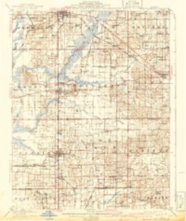
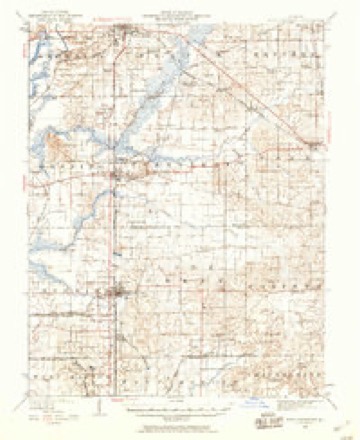
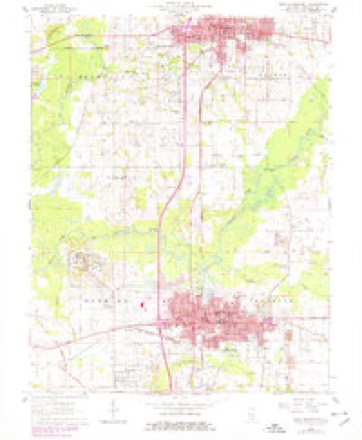
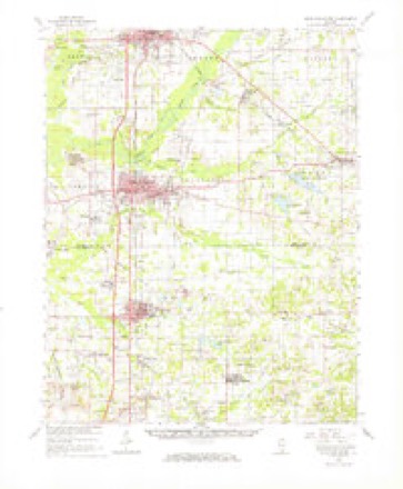
12 surveys from 18 printed sheetsMatched by testing this settlement's coordinate against the published boundary of every sheet in the United States Geological Survey's historical collection. Each opens the scanned sheet at the Survey.
- 1909 USGS West Frankfort quadrangle1:62500, 2 printings
- 1941 USGS West Frankfort quadrangle1:62500
- 1949 USGS Paducah quadrangle1:250000, 2 printings
- 1950 USGS Paducah quadrangle1:250000
- 1954 USGS Paducah quadrangle1:250000, 2 printings
- 1961 USGS Paducah quadrangle1:250000, 2 printings
- 1963 USGS West Frankfort quadrangle1:24000, 2 printings
- 1963 USGS West Frankfort quadrangle1:62500
- 1964 USGS Paducah quadrangle1:250000, 2 printings
- 1984 USGS West Frankfort quadrangle1:100000
- 1987 USGS Paducah quadrangle1:250000
- 1987 USGS West Frankfort quadrangle1:100000






In the county-history sources
5,733 words on this townshipThe Prospects of Franklin County, Illinois, 1912, published 1912 names this settlement in its chapter on Benton Township. These are the passages that mention it, exactly as the scans read.
St. Louis, probably in 1845. Four days were required to get a communication to St. Louis, marked "Post Haste." James Swofford, Levi Browning and others erected the first flouring mill in Benton about the year 1856; an explosion occurred at the mill in 1862, killing Mr. Swofford and a Mr. Graham. This mill was later torn down. W. W. McFall built another mill in the year 1873. It was
Passage source: The Prospects of Franklin County, Illinois, 1912, published 1912.
Benton is in a measure one of the railroad centers of Southern Illinois, having three trunk lines, namely, the Illinois Central, the Chicago and Eastern Illinois, and the Missouri Pacific, while the Egyptian Southern Railway, the Zeigler and Gulf Coast Railway and the Toledo,
Passage source: The Prospects of Franklin County, Illinois, 1912, published 1912.
St. Louis and New Orleans are already worked out on paper. Other lines of railway are building in this direction, and there will be at least three more important roads added to our transportation facilities before 1915. This County is one of the largest freighting points of the state as shown by the fact that in 1911, nearly two and one half million dollars worth of freight was billed out of Benton alone. It is only a question of time until a system of interurban railways will connect and give to the different points in this County rapid, cheap and efficient means of intercommunication.
Passage source: The Prospects of Franklin County, Illinois, 1912, published 1912.
Machine-read from a century-old scan, so expect the errors a machine makes: misspelled names, dropped words, stray characters.
Read the whole chapter on Benton Township - it names this place 23 more 23 times.
Fires near this place
2 since 2001Regional context, not property-specific evidence. The federal wildfire occurrence database lists 2 fires within 5 miles of Benton between 2001 and 2009, burning about 1 acre in total. None started naturally. None was recorded as arson. Distance is straight-line from the map coordinates, so a fire counted here may appear on a neighbouring settlement's page as well.
| Reported cause | Fires |
|---|---|
| Debris and open burning | 1 |
| Missing data/not specified/undetermined | 1 |
The most recent of them, most recent first, with the day each was reported and the service that recorded it.
| Date | Cause | Size | Reported by | Name on the report |
|---|---|---|---|---|
| 19 April 2001 | Debris and open burning | under an acre | Illinois State Fire Marshal's Office | not named |
| 15 March 2009 | Missing data/not specified/undetermined | under an acre | Illinois Division of Forestry Resources | DAVIDSON |
Settlements close enough to share some of these fires:
Mines and quarries near this place
1 within 5 milesRegional context, not property-specific evidence. The federal mineral resources record lists 1 working within 5 miles of Benton: 1 past producer. None of them still produces. What was taken out: Sand and Gravel, Construction. Distance is straight-line from the map coordinates, so a quarry counted here may appear on a neighbouring settlement's page as well.
| Where | Site | Commodity | Status | Recorded |
|---|---|---|---|---|
| Buchner Sand Pit | Sand and Gravel, Construction | Past Producer |
Storms near this place
51 since 1995Regional context, not property-specific evidence. The National Weather Service names Benton in 51 storm reports between 1995 and 2025: 23 thunderstorm wind, 9 hail, 8 flash flood, 4 flood. The reports record 1 injury. Each account below is quoted exactly as the forecast office filed it, from the NOAA Storm Events Database, and each date opens the federal record of that event.
| When | Event | Place named | Harm | What the report says |
|---|---|---|---|---|
| October 2001 | Thunderstorm Wind | Benton | 1 hurt, $75,000 | Straight-line thunderstorm winds uprooted or snapped numerous trees. A porch was blown away. Four sheds in Benton were heavily damaged or destroyed. A pole barn was destroyed about 4 miles east of Benton. A young man was injured when a tree limb fell on the back of his neck. He was treated and released by a local hospital. The Leisure Lane area was hardest hit, where a house was heavily damaged and barns were destroyed. |
| June 2011 | Thunderstorm Wind | Benton | $180,000 | A microburst with 95 mph winds caused extensive damage along a path about 1.25 miles wide and 18 miles long. The damage path started in the general vicinity of Rend Lake Dam and continued northeast across the Jefferson County border. Hundreds of trees were uprooted or snapped. A few utility poles were broken by falling trees. About a dozen homes were damaged, primarily from falling trees. Several barns and garages were destroyed or heavily damaged. One of the greatest concentrations of damage was at Lake Benton. |
| April 2011 | Thunderstorm Wind | Benton | $100,000 | In Benton, about one-quarter of the roof of an apartment complex was lifted off. There was extensive rainwater damage to an apartment. At least a dozen trees and power lines were blown down throughout Benton. Three trees fell on power lines or across roadways. Power was restored to most customers within 12 hours. In West Frankfort, numerous trees and limbs were down. A few streets were blocked. |
| January 1999 | Thunderstorm Wind | Benton | $50,000 | In the Benton area, a trailer was moved off its foundation, and a small shed was turned over. Near West Frankfort, a pole barn was heavily damaged. |
| April 2017 | Flood | Benton | $40,000 | There was extensive flooding of a neighborhood in the northeast part of Benton from heavy rain during the overnight and early morning hours. Homes on two streets were flooded. In West Frankfort, residents of an apartment complex were evacuated. A co-operative observer near Plumfield measured 4.10 inches of rain in the previous 24 hours. |
| August 2000 | Thunderstorm Wind | Benton | $20,000 | About 10 trees were uprooted or blown down in the Lake Moses subdivision. Power lines were also down. |
| March 2020 | Thunderstorm Wind | Benton | $15,000 | A pole barn was destroyed in the city. |
| January 2008 | Thunderstorm Wind | Benton | $15,000 | A portion of roof was blown off of a garage, damaging a vehicle traveling along a roadway in downtown Benton. |
| June 1995 | Thunderstorm Wind | Benton | $15,000 | Damage to trees and power lines was most widespread between Benton and Thompsonville. |
| July 2025 | Flash Flood | Benton | $10,000 | Multiple roads were flooded in Benton with stormwater drainage systems overloaded. Some structures were impacted. Radar estimated hourly rainfall amounts for Benton peaked at just over 1. |
| July 2016 | Thunderstorm Wind | Benton | $10,000 | Numerous trees and power lines were blown down across Franklin County, including Benton and West Frankfort. At least a couple of trees were uprooted. About 4,000 utility customers were without power. Several trees were down throughout the community of Benton. Large branches were also snapped. A large tree was down across a secondary road near Plumfield. |
| August 2015 | Lightning | Benton | $10,000 | There were several reports of power outages caused by lightning. |
| April 2011 | Tornado (EF1) | Benton | $10,000 | Extremely large oak trees were snapped 30 feet off the ground and thrown several yards and left intertwined. Other large trees were uprooted, and a fence was damaged. Peak winds in this brief tornado were estimated near 105 mph. |
| June 2008 | Thunderstorm Wind | Benton | $10,000 | An off-duty NWS meteorologist reported several large trees were down, blocking Route 37. |
| July 2001 | Thunderstorm Wind | Benton | $10,000 | Thunderstorms producing damaging winds moved slowly south across Franklin County. Numerous trees and large limbs were blown down in West Frankfort. |
| June 1999 | Thunderstorm Wind | Benton | $10,000 | State police reported trees down in Benton. Glass was blown out of a video store in West Frankfort. |
| May 2011 | Thunderstorm Wind | Benton | $9,000 | A few trees were blown down. Two of the trees took down power lines. |
| November 2017 | Flash Flood | Benton | $5,000 | Illinois Route 14 was flooded at an intersection on the west side of Benton. Cars were stalling in the intersection. A car slid off Route 14 between Benton and Macedonia. |
| April 2015 | Thunderstorm Wind | Benton | $5,000 | Several large trees were down along Highway 14. |
| July 2021 | Thunderstorm Wind | Benton | $3,000 | One tree and several tree limbs were down at a farm north of Benton. The roof tin was bent back on a barn. A 65 mph wind gust was recorded on the home weather station. |
| June 2013 | Heavy Rain | Benton | $3,000 | Vehicles stalled on a few water-covered roadways throughout the city. |
| May 2004 | Thunderstorm Wind | Benton | $3,000 | Several large trees were uprooted near Rend Lake, south of Route 154 near a golf course. Trees and power lines were down near Yellow Banks Road. |
| July 1997 | Thunderstorm Wind | Benton | $3,000 | Trees were down. |
| July 2021 | Thunderstorm Wind | Benton | $2,000 | A tree was downed just east of Benton. The tree fell onto a trailer. |
| June 2015 | Thunderstorm Wind | Benton | $2,000 | A large tree was blown down. with isolated power outages reported. |
| February 2024 | Hail | Benton | - | Sub-severe hail was reported via mPING at Benton from the same storm that produced quarter size hail to the west in Christopher and Buckner. |
| January 2023 | Flood | Benton | - | Water was over roads in low areas. |
| July 2021 | Flash Flood | Benton | - | Water was over the road on both the on and off ramps on Illinois Highway 14 near Interstate 57, extending into the town of Benton. |
| May 2019 | Flood | Benton | - | Some street flooding was reported on Route 37 in Benton. |
| December 2018 | Flash Flood | Benton | - | Water was running over the intersection of County Roads 5 and 18 southeast of Benton. A motorist encountered problems keeping the vehicle on the road while driving through the water. |
| February 2017 | Hail | Benton | - | This large hail was associated with the supercell that produced a strong tornado in Jackson and western Franklin Counties. Hailstones were slightly larger than baseballs on the north side of Benton. Quarter-size hail fell on the west side of Benton. |
| June 2015 | Heavy Rain | Benton | - | Minor street flooding was reported. |
| April 2014 | Heavy Rain | Benton | - | Numerous roads became covered with water during a thunderstorm in Benton. |
| April 2008 | Hail | Benton | - | Quarter-size hail was reported near the 68 mile marker on Interstate 57. |
| June 2008 | Funnel Cloud | Benton | - | A brief occurrence of a funnel cloud was reported. The funnel was seen at a rest stop along Interstate 57. |
| May 2007 | Flash Flood | Benton | - | Eight inches of water was over a three-block stretch of roadway. The flooded road was west of the intersection with Highway 14. Eight inches of water was reported blocking Highway 14 in Benton. |
| April 2007 | Heavy Rain | Benton | - | A street was flooded in Benton. A one-inch rain total was reported near the Jefferson County line. |
| March 2006 | Flash Flood | Benton | - | The viaduct between Benton and Christopher was flooded. |
| July 2004 | Thunderstorm Wind | Benton | - | Five trees, including four large old oak trees, were blown down at a golf course. |
| October 2004 | Flash Flood | Benton | - | Street flooding occurred in Benton, which was particularly bad on East Main Street. Floodwaters entered the sheriff's department building and jail. About a mile south of Sesser on Route 148, a car was submerged in floodwaters. |
| June 1998 | Thunderstorm Wind | Benton | - | Three trees were down. |
| March 1998 | Thunderstorm Wind | Benton | - | Strong thunderstorm winds snapped trees along Interstate 57 between Benton and West Frankfort. |
| June 2023 | Hail | Benton | - | no account filed |
| May 2016 | Hail | Benton | - | no account filed |
| July 2012 | Hail | Benton | - | no account filed |
| March 2012 | Hail | Benton | - | no account filed |
| April 2006 | Hail | Benton | - | no account filed |
| May 2004 | Flash Flood | Benton | - | no account filed |
| June 1998 | Hail | Benton | - | no account filed |
| August 1996 | Flood | Benton | - | no account filed |
| May 1995 | Thunderstorm Wind | Benton | - | no account filed |
Nearest settlements
The eight closest, with where each one stands in the county. Distances are straight-line, computed from the Geographic Names Information System coordinates.
| Map | Place | Distance | Sheets |
|---|---|---|---|
| West City | 0.8 miles | 18 | |
| Steel City | 2.2 miles | 18 | |
| Groat | 3.3 miles | 18 | |
| Rend City | 4.0 miles | 11 | |
| Benton Park | 4.4 miles | 11 | |
| Hickory Corners | 4.4 miles | 18 | |
| Logan | 5.1 miles | 18 | |
| Smothersville | 5.1 miles | 18 |
Elsewhere
Matched on this settlement's Geographic Names Information System number rather than its name, so it cannot be a different place of the same name in another state.
| Wikipedia article on Benton | An encyclopaedic summary. Its text is share-alike, so it is linked here rather than copied. |
| Wikidata item Q575432 | The structured record the population and elevation above come from. Public domain (CC0). |
Provenance
This settlement is recorded in the Geographic Names Information System as feature 404187. The sheet list is computed by point-in-boundary test against the United States Geological Survey's historical topographic inventory. Both are works of the United States government and carry no copyright under 17 U.S.C. 105.
Wildfire. Short, Karen C. 2022. Spatial wildfire occurrence data for the United States, 1992-2020 [FPA_FOD_20221014]. 6th Edition. Fort Collins, CO: Forest Service Research Data Archive. https://doi.org/10.2737/RDS-2013-0009.6 Collected with United States Government funding and usable without additional permissions or fees.
Mines and quarries. USGS Mineral Resources Data System (MRDS) https://mrdata.usgs.gov/mrds/ A work of the United States government, no copyright under 17 U.S.C. 105.
Storms. NOAA National Centers for Environmental Information, Storm Events Database https://www.ncei.noaa.gov/stormevents/ A work of the United States government, no copyright under 17 U.S.C. 105. Narratives are quoted verbatim from the National Weather Service report and are not edited or summarised.