 Block
Berlin, Illinois
13 topographic sheets cover this place, the earliest surveyed in 1909 and the latest in 1985. It stands in Island Grove Township. It lies in ZIP code area 62670. The Survey maps it on the Pleasant Plains quadrangle. 141 people lived here at the 2020 count. It stands 636 feet above sea level.
Population over time
2 figuresBerlin fell from 180 to 141 between 2010 and 2020. These are the recorded population figures Wikidata holds for this place, reached through the Geographic Names Information System number this page is keyed on rather than by name, so they belong to this place and not to another of the same name. Most are census counts, but not all are: an early figure may be a founding or settlement estimate, and an estimate published within five years of a census is left out. The change column is computed, and is left blank where more than 20 years separate a figure from the one before it, because a gap that long is not a change between two counts.
| Year | People | Change |
|---|---|---|
| 2010 | 180 | |
| 2020 | 141 | -39 (-22%) |
Topographic sheets covering this place
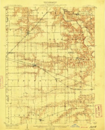
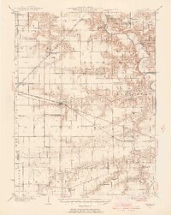
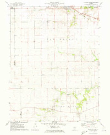
6 surveys from 13 printed sheetsMatched by testing this settlement's coordinate against the published boundary of every sheet in the United States Geological Survey's historical collection. Each opens the scanned sheet at the Survey.
- 1909 USGS Tallula quadrangle1:62500, 3 printings
- 1940 USGS Tallula quadrangle1:62500, 2 printings
- 1958 USGS Decatur quadrangle1:250000, 3 printings
- 1961 USGS Decatur quadrangle1:250000, 2 printings
- 1971 USGS Pleasant Plains quadrangle1:24000
- 1985 USGS Springfield quadrangle1:100000, 2 printings



In the county-history sources
1,730 words on this townshipHistory of Sangamon County, Illinois; Together with Sketches of Its Cities, Villages and Townships ... Portraits of Prominent Persons, and Biographies of Representative Citizens. History of Illinois, published 1881 names this settlement in its chapter on Island Grove Township. These are the passages that mention it, exactly as the scans read.
Island Grove is one of the western tier of townships, and is bounded on the east by Curran township, on the west by Morgan county, on the north by Cartwright, and on the south by New Berlin. It has twenty-seven square miles of land in the township. It is mostly prairie and quite level. Island grove, which gives the name to the township, is an irregular shaped grove, about eight miles long, and averaging one mile in width, extending along one branch of Spring creek in the northwestern part of the township. There is also some timber along Skillet fork of Spring creek, in the eastern part, otherwise it is all prairie.
Passage source: History of Sangamon County, Illinois; Together with Sketches of Its Cities, Villages and Townships ... Portraits of Prominent Persons, and Biographies of Representative Citizens. History of Illinois, published 1881.
John Roberts, from Tennessee, first settled here in 1818, at the foot of the grove, in the northeastern part. He was followed, about a year afterwards, by his son, Jerry Roberts, and by David Troxell, Fred. Troxell, Thomas Evans, Andrew Scott, William Hart and Josiah Hedges. At this time there were two Indian villages in the township - one on Skillet fork, and the other at the head of the grove, near the west line. There were about three hundred Indians in each village. They were of the Pottowatamie and Delaware tribes, but were peaceable, and soon moved west. Among other early settlers may be mentioned the names of McCoy, Douglass, Rhea, Foutch, Smith, Brown, Hursley, Gibson, Yates, Ellis, Campbell, Harmon, Weger, Wyekoff, and others, whose descendants and relatives now form a large proportion of the present inhabitants. The first whites here were mostly of a wandering character, and soon moved away. Those mentioned came a few years later and made permanent homes here.
Passage source: History of Sangamon County, Illinois; Together with Sketches of Its Cities, Villages and Townships ... Portraits of Prominent Persons, and Biographies of Representative Citizens. History of Illinois, published 1881.
Simon Hensley was born February 26, 1785, in Washington county, Virginia. He was married February 2, 1820, near Dayton, Montgomery county, Ohio, to Mary Arnold, who was born August 24, 1792, in Ohio. They moved to Sangamon county, Illinois, arriving in the fall of 1823, in what is now Island Grove township, north of Spring creek.
Passage source: History of Sangamon County, Illinois; Together with Sketches of Its Cities, Villages and Townships ... Portraits of Prominent Persons, and Biographies of Representative Citizens. History of Illinois, published 1881.
Machine-read from a century-old scan, so expect the errors a machine makes: misspelled names, dropped words, stray characters.
Read the whole chapter on Island Grove Township - it names this place 15 more 15 times.
Storms near this place
35 since 1996Regional context, not property-specific evidence. The National Weather Service names Berlin in 35 storm reports between 1996 and 2025: 13 hail, 12 thunderstorm wind, 4 flash flood, 3 tornado. The reports record 1 death and 19 injuries. Each account below is quoted exactly as the forecast office filed it, from the NOAA Storm Events Database, and each date opens the federal record of that event.
| When | Event | Place named | Harm | What the report says |
|---|---|---|---|---|
| June 2011 | Flood | Berlin | 1 killed | The impacts of the flash flooding from the late evening of June 17th into the early morning of June 18th continued for another 20 hours in western Sangamon County. In addition, another 1.00 to 2.00 of rain fell over the flooded area from June 18th into the 19th. ||During the afternoon of June 18th at 1:55 PM LST, a 75 year old man drove around a barricade into a flooded roadway on East Loami Road near the Lick Creek South Fork. He climbed to the top of the vehicle, but it was swept away by the rapid current. His truck was found in a nearby pond, but his body was not recovered until the morning of June 20th.||Many streets in Loami and New Berlin, and the rural roads and state highways in western parts of the county were flooded for almost 48 hours. The water finally receded on most roadways by early evening on June 19th. ||See the Flash Flood entry for June 17th-18th for estimated damages due to this historic flooding. |
| March 2006 | Tornado (F2) | New Berlin | 19 hurt | Continuation of Morgan county tornado. The total path length of the tornado was about 65.5 miles, including a 45.0 mile path across the WFO Central Illinois service area.Damage from the storm over Scott, Morgan and rural Sangamon counties consisted of the snapping of power poles and major tree damage, either ripped up or uprooted. Numerous farm buildings (both Morton type buildings and barns) were damaged or destroyed, as were numerous grain bins. One mobile home was destroyed.This long track tornado moved into the city of Springfield before dissipating. The tornado crossed Interstate 72 near mile marker 92, around 8:20 PM. It entered the city of Springfield near Cockrell Lane and Constitution Drive, tracking to the east-northeast around 50 mph. The tornado was about 300 yards wide, and produced F2 damage to several businesses from Constitution Drive, through Parkway Pointe, to Veterans Parkway and Lindbergh Blvd.The tornado widened to about 0.4 mile wide as it continued to track east-northeast south of Wabash Avenue, between Veterans Parkway and Chatham Road. The tornado widened further, to just over 1/2 mile wide from Westchester Blvd to the village of Jerome. The damage was rated as F2 along Wabash Avenue, between Chatham Road and MacArthur Blvd.The tornado then weakened slightly, producing F1 damage, as it turned to the northeast, nearly parallel with the Norfolk Southern Railroad tracks. The damage path remained nearly 1/2 mile wide. The width of the tornado decreased to about 1/4 mile wide as it strengthened again, and turned to the north-northeast near Iles Park and in the vicinity of Oak and Myrtle Streets, between 6th and 9th Streets. The damage was rated as F2 in these locations, with roofs blown off of homes and businesses, and garages severely damaged. This tornado dissipated just north of 9th Street and South Grand Avenue.1 injury was reported in Morgan county, with 19 injuries reported in Sangamon county. No fatalities were reported. |
| June 2011 | Flash Flood | Berlin | $3,000,000 | Flash flooding of historic proportions occurred in western Sangamon County from late in the evening of June 17th through much of June 18th. Rainfall amounts of 5.00 to 9.00 were reported, with the highest totals along the boder with Morgan County. The nearly stationary thunderstorms produced a majority of the rain between 2200 LST and 0300 LST. ||Every rural road and state highway in western Sangamon County was water covered and closed. Streets and about 300 homes in the towns of New Berlin and Loami, as well as numerous farms in west central parts of the county, were severely flooded. Around 22,000 acres of farmland also sustained significant flooding.||Property and business damages were estimated to be about $3 Million, while crop losses could be close to $10 Million. The flash flooding continued as an areal flood for the same areas for at least another 20 hours. |
| April 1996 | Tornado (F0) | New Berlin | $250,000 | no account filed |
| May 2000 | Thunderstorm Wind | New Berlin | $92,000 | Thunderstorm winds destroyed a house under construction one mile south of Loami. Also, numerous trees and tree limbs were blown down. One tree fell onto a car, destroying it in New Berlin. No injuries were reported. |
| May 2017 | Thunderstorm Wind | Berlin | $70,000 | Power poles were blown down. |
| April 2017 | Thunderstorm Wind | New Berlin | $12,000 | A tree was uprooted and an outbuilding was damaged. |
| July 2008 | Thunderstorm Wind | Berlin | $2,000 | A tree limb fell on a power line, knocking out power to Berlin. |
| March 2025 | Thunderstorm Wind | New Berlin | - | Wind gusts of 60 to 70 mph were estimated from New Berlin to Loami. |
| May 2022 | Thunderstorm Wind | New Berlin | - | Several tree limbs were blown down. |
| March 2022 | Thunderstorm Wind | New Berlin | - | The fascia was damaged on a house. |
| July 2021 | Flash Flood | Berlin | - | Water was flowing across the eastbound lanes of I-72 southeast of Berlin. |
| May 2020 | Flood | New Berlin | - | Numerous roads were flooded...including State Highway 4 between Jackson Street and Divernon Road in Auburn and Francis Drive between Carrie Lane and Bens Drive in Chatham. In addition, Panther Creek spilled out of its banks and flooded Covered Bridge Road between Ostermeier Road and South Main Street just south of Chatham. |
| May 2019 | Thunderstorm Wind | New Berlin | - | A large tree was snapped. |
| June 2018 | Thunderstorm Wind | New Berlin | - | A large tree branch was blown down in New Berlin. |
| June 2013 | Flash Flood | New Berlin | - | Slow moving thunderstorms, which produced 1.50 to 3.00 inches of rain on already saturated ground in a two hour period during the late evening of May 31st across much of Sangamon County, resulted in flash flooding which continued into June 1st. Many roads in Springfield were impassable. Numerous vehicles became trapped in the rapidly rising water in the city of Springfield, where several water rescues were made. Many rural roads were closed, especially to the south and east of the Springfield metro area. |
| June 2013 | Flood | New Berlin | - | Slow moving thunderstorms, which produced 1.50 to 3.00 inches of rain on already saturated ground in a two hour period during the late evening of May 31st across much of Sangamon County, resulted in flash flooding which continued into June 1st. Many roads in Springfield were impassable. Numerous vehicles became trapped in the rapidly rising water in the city of Springfield, where several water rescues were made. Many rural roads were closed, especially to the south and east of the Springfield metro area. The heavy rain caused most roads to remain in flood through the early morning hours of June 1st, before subsiding early in the afternoon. |
| May 2013 | Flash Flood | New Berlin | - | Slow moving thunderstorms produced 1.50 to 3.00 inches of rain on already saturated ground in a two hour period during the late evening across much of Sangamon County. This rapidly produced flash flooding which made many roads impassable. Numerous vehicles became trapped in the rapidly rising water in the city of Springfield, where several water rescues were made. Many rural roads were closed, especially to the south and east of the Springfield metro area. The flash flooding continued through the night, and into June 1st. |
| March 2006 | Thunderstorm Wind | New Berlin | - | Building and power line damage. |
| April 2006 | Tornado (F1) | Berlin | - | The tornado completely destroyed a grain bin and a pole barn, with numerous 12 to 18 inch diameter trees splintered off at various heights. Near the end of the tornado track, a pole barn had its main door blown in, and half of the roof completely destroyed. |
| August 2006 | Thunderstorm Wind | New Berlin | - | Small tree limbs were blown across Interstate 72 along the Morgan/Sangamon county line. |
| August 1997 | Thunderstorm Wind | New Berlin | - | A line of severe thunderstorms moved across Sangamon County blowing down numerous trees in the New Berlin, Springfield, and Riverton areas. Also, numerous power lines were blown down. No injuries were reported and no damage estimate was available. |
| May 2025 | Hail | Berlin | - | no account filed |
| May 2023 | Hail | New Berlin | - | no account filed |
| May 2023 | Hail | New Berlin | - | no account filed |
| January 2018 | Hail | New Berlin | - | no account filed |
| March 2016 | Hail | New Berlin | - | no account filed |
| April 2011 | Hail | New Berlin | - | no account filed |
| April 2011 | Hail | New Berlin | - | no account filed |
| April 2008 | Hail | New Berlin | - | no account filed |
| May 2008 | Hail | Berlin | - | no account filed |
| May 2008 | Hail | New Berlin | - | no account filed |
| March 2006 | Hail | New Berlin | - | no account filed |
| March 2006 | Hail | New Berlin | - | no account filed |
| April 1998 | Hail | New Berlin | - | no account filed |
Nearest settlements
The eight closest, with where each one stands in the county. Distances are straight-line, computed from the Geographic Names Information System coordinates.
| Map | Place | Distance | Sheets |
|---|---|---|---|
| New Berlin | 2.4 miles | 12 | |
| Bates | 3.7 miles | 12 | |
| Island Grove | 3.9 miles | 12 | |
| Pasfield | 4.1 miles | 14 | |
| Browns Crossing | 4.9 miles | 12 | |
| Prouty | 5.5 miles | 12 | |
| Knapp | 5.5 miles | 12 | |
| Sudduth (historical) | 5.9 miles | 12 |
Elsewhere
Matched on this settlement's Geographic Names Information System number rather than its name, so it cannot be a different place of the same name in another state.
| Wikipedia article on Berlin | An encyclopaedic summary. Its text is share-alike, so it is linked here rather than copied. |
| Wikidata item Q2504681 | The structured record the population and elevation above come from. Public domain (CC0). |
Provenance
This settlement is recorded in the Geographic Names Information System as feature 404215. The sheet list is computed by point-in-boundary test against the United States Geological Survey's historical topographic inventory. Both are works of the United States government and carry no copyright under 17 U.S.C. 105.
Storms. NOAA National Centers for Environmental Information, Storm Events Database https://www.ncei.noaa.gov/stormevents/ A work of the United States government, no copyright under 17 U.S.C. 105. Narratives are quoted verbatim from the National Weather Service report and are not edited or summarised.