 Block
Brownstown, Illinois
11 topographic sheets cover this place, the earliest surveyed in 1945 and the latest in 1986. It stands in Otego Township. It lies in ZIP code area 62418. The Survey maps it on the Brownstown quadrangle. 690 people lived here at the 2020 count. It stands 594 feet above sea level.
On record in Brownstown
Buildings and businesses the archive holds for this place. Each opens its own page, with the source record it came from.
On the National Register 1 record
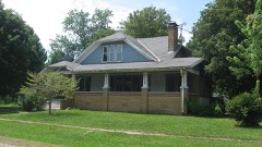 Floyd and Glenora Dycus Houselisted 2001
Population over time
2 figuresBrownstown fell from 759 to 690 between 2010 and 2020. These are the recorded population figures Wikidata holds for this place, reached through the Geographic Names Information System number this page is keyed on rather than by name, so they belong to this place and not to another of the same name. Most are census counts, but not all are: an early figure may be a founding or settlement estimate, and an estimate published within five years of a census is left out. The change column is computed, and is left blank where more than 20 years separate a figure from the one before it, because a gap that long is not a change between two counts.
| Year | People | Change |
|---|---|---|
| 2010 | 759 | |
| 2020 | 690 | -69 (-9%) |
Topographic sheets covering this place
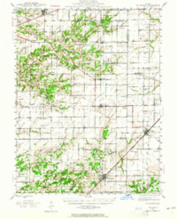
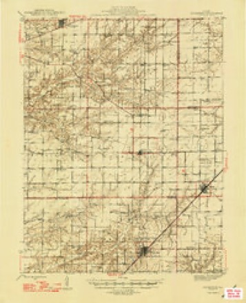
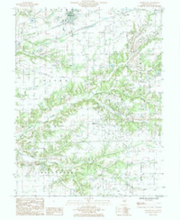
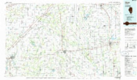
6 surveys from 11 printed sheetsMatched by testing this settlement's coordinate against the published boundary of every sheet in the United States Geological Survey's historical collection. Each opens the scanned sheet at the Survey.
- 1945 USGS Kinmundy quadrangle1:62500, 2 printings
- 1947 USGS Kinmundy quadrangle1:62500, 2 printings
- 1958 USGS Belleville quadrangle1:250000, 3 printings
- 1962 USGS Belleville quadrangle1:250000
- 1985 USGS Brownstown quadrangle1:24000
- 1986 USGS Olney quadrangle1:100000, 2 printings


In the county-history sources
5,541 words on this townshipHistory of Fayette County, Illinois, published 1878 names this settlement in its chapter on Otego Township. These are the passages that mention it, exactly as the scans read.
The soil in the timber land is a red-colored clay, but in the prairie is a light grey-colored loam. About one-third of the township is prairie, part of which lays in the north-east around Brownstown, and the " four mile " which lays in the center of the township.
Passage source: History of Fayette County, Illinois, published 1878.
Isaac Washburn was the first resident physician; he lived in Section 23, and practiced first in 1837. Then came Simeon Bishop, who lived in Section 17, and practiced in 1838; then John F. Morey, who resided in Section 22, and who was the most prominent physician who had lived in the township. L. A. Morey, son of John F. Morey, is now practicing in Otego, and is living in Section 14. Dr. Noll and Dr. Sethman lived and practiced a short time in the township. Dr. Darnell and Dr. Stringer are the present resident physicians of Brownstown.
Passage source: History of Fayette County, Illinois, published 1878.
The Christian Church was organized in the township about 1843, at the Central School-house, Four-Mile Prairie, by William Chaflin and Mr. Schooley. \ Among the first members were Moses D. Morey, M. W. Hickerson, J V. Morey, Jacob Tinker. Abner Griffith, Mrs. Griffith, Mrs. Campbell, Mrs. j Tinker and Mrs. Smith. This denomination have a church in Brownstown, erected in 1871. The Rev. Mr. Bridges was the last officiating minister, ! there being no regular preacher attending there at present. j
Passage source: History of Fayette County, Illinois, published 1878.
Machine-read from a century-old scan, so expect the errors a machine makes: misspelled names, dropped words, stray characters.
Read the whole chapter on Otego Township - it names this place 2 more 2 times.
Storms near this place
14 since 1994Regional context, not property-specific evidence. The National Weather Service names Brownstown in 14 storm reports between 1994 and 2020: 9 thunderstorm wind, 3 hail, 2 tornado. No death or injury is recorded in these reports. Each account below is quoted exactly as the forecast office filed it, from the NOAA Storm Events Database, and each date opens the federal record of that event.
| When | Event | Place named | Harm | What the report says |
|---|---|---|---|---|
| April 1994 | Thunderstorm Wind | Brownstown | $5,000 | Trees and power lines were blown down north of Brownstown while a barn and garage were heavily damaged in St. Peter. |
| August 2020 | Thunderstorm Wind | Brownstown | - | Thunderstorm gust front blew down several trees and power lines between Brownstown and St. Elmo. |
| August 2014 | Thunderstorm Wind | Brownstown | - | Thunderstorm winds blew a large tree limb down and blew an empty grain bin across a yard and onto a road. |
| February 2014 | Tornado (EF1) | Brownstown | - | The tornado developed 2.8 miles northwest of Brownstown or 0.3 miles north of the intersection of County Roads 1900N and 1375E. One large old tree was down while several large branches along a row of trees were snapped two thirds up the trunk. The damage path was approximately 40 yards wide and damage intensity was rated EF0. Two witnesses observed the tornado near the intersection of County Roads 2000N and 1450E. The tornado was rain wrapped and skipped over this area. One large machine shed was damaged about 150 yards southwest of this intersection while the southern part of another barn southeast of the intersection was severely damaged. Debris from both structures were tossed about one third mile to the northeast. At the intersection of 2100N and 1600E three tall wooden transmission line poles were snapped two thirds up the pole at this intersection. Approximately 50 yards to the southeast of this intersection a medium size machine shed was severely damaged with the east and south sides of the shed shredded and tossed one third mile to the northeast. The tornado continued northeast and destroyed a large machine shed housing farm equipment. The tornado totally shredded the metal panels and tossed them over one third mile to the north. A medium size machine shed approximately one half mile to the northeast of the large machine shed lost a few metal roof panels. The tornado lifted and dissipated about 5.5 miles north northeast of Brownstown. The maximum intensity was EF1 with a maximum wind speed of 105 mph. The total path length was 4.8 miles with a maximum width 50 yards. |
| June 2009 | Thunderstorm Wind | Brownstown | - | Thunderstorm winds caused minor damage in the Brownstown area. Three miles west of Brownstown a few windows were blown out of a trailer. Just south of Brownstown several large tree limbs were blown down. |
| June 2008 | Thunderstorm Wind | Brownstown | - | Thunderstorm winds blew the roof off of a small shed in Brownstown and destroyed a small shed and 60 foot radio tower just north of St. Elmo. |
| March 2005 | Hail | Brownstown | - | Storm spotters reported 1 inch hail. |
| July 1997 | Thunderstorm Wind | Brownstown | - | The Illinois State Police reported trees down in the Brownstown area. |
| June 2009 | Hail | Brownstown | - | no account filed |
| January 2005 | Thunderstorm Wind | Brownstown | - | no account filed |
| June 2002 | Thunderstorm Wind | Brownstown | - | no account filed |
| June 1999 | Tornado (F2) | Brownstown | - | no account filed |
| July 1998 | Thunderstorm Wind | Brownstown | - | no account filed |
| March 1997 | Hail | Brownstown | - | no account filed |
Nearest settlements
The eight closest, with where each one stands in the county. Distances are straight-line, computed from the Geographic Names Information System coordinates.
| Map | Place | Distance | Sheets |
|---|---|---|---|
| Avena | 1.6 miles | 13 | |
| Sefton | 5.2 miles | 13 | |
| Confidence | 5.2 miles | 11 | |
| Pruett | 5.2 miles | 13 | |
| Howards Point (historical) | 5.3 miles | 13 | |
| Bluff City | 5.4 miles | 9 | |
| Saint Elmo | 6.0 miles | 13 | |
| Saint James | 6.1 miles | 11 |
Elsewhere
Matched on this settlement's Geographic Names Information System number rather than its name, so it cannot be a different place of the same name in another state.
| Wikipedia article on Brownstown | An encyclopaedic summary. Its text is share-alike, so it is linked here rather than copied. |
| Wikidata item Q2671636 | The structured record the population and elevation above come from. Public domain (CC0). |
Provenance
This settlement is recorded in the Geographic Names Information System as feature 404988. The sheet list is computed by point-in-boundary test against the United States Geological Survey's historical topographic inventory. Both are works of the United States government and carry no copyright under 17 U.S.C. 105.
Storms. NOAA National Centers for Environmental Information, Storm Events Database https://www.ncei.noaa.gov/stormevents/ A work of the United States government, no copyright under 17 U.S.C. 105. Narratives are quoted verbatim from the National Weather Service report and are not edited or summarised.