 Block
Camargo, Illinois
11 topographic sheets cover this place, the earliest surveyed in 1956 and the latest in 1998. It stands in Camargo Township. It lies in ZIP code area 61919. The Survey maps it on the Villa Grove quadrangle. 452 people lived here at the 2020 count. It stands 653 feet above sea level.
Population over time
2 figuresCamargo grew from 445 to 452 between 2010 and 2020. These are the recorded population figures Wikidata holds for this place, reached through the Geographic Names Information System number this page is keyed on rather than by name, so they belong to this place and not to another of the same name. Most are census counts, but not all are: an early figure may be a founding or settlement estimate, and an estimate published within five years of a census is left out. The change column is computed, and is left blank where more than 20 years separate a figure from the one before it, because a gap that long is not a change between two counts.
| Year | People | Change |
|---|---|---|
| 2010 | 445 | |
| 2020 | 452 | +7 (+2%) |
Topographic sheets covering this place
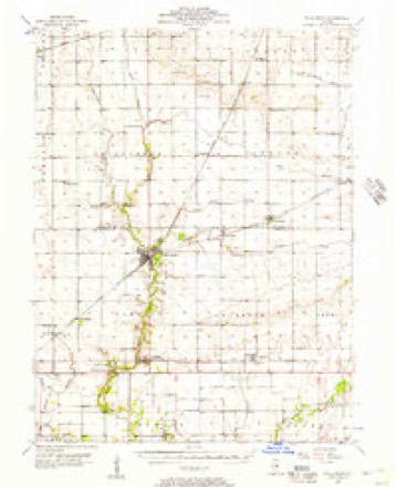
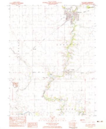
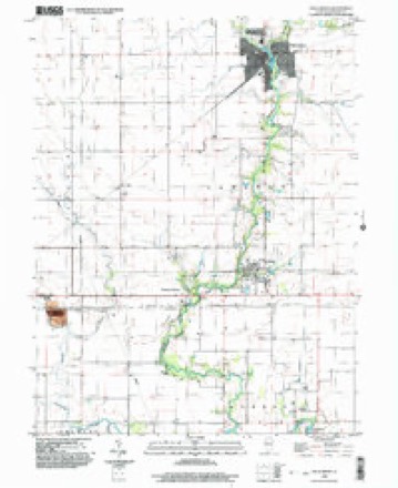
6 surveys from 11 printed sheetsMatched by testing this settlement's coordinate against the published boundary of every sheet in the United States Geological Survey's historical collection. Each opens the scanned sheet at the Survey.
- 1956 USGS Villa Grove quadrangle1:62500, 2 printings
- 1958 USGS Decatur quadrangle1:250000, 3 printings
- 1961 USGS Decatur quadrangle1:250000, 2 printings
- 1982 USGS Villa Grove quadrangle1:24000
- 1985 USGS Decatur quadrangle1:100000, 2 printings
- 1998 USGS Villa Grove quadrangle1:24000



In the county-history sources
1,502 words on this townshipHistory of Douglas County, Illinois, published 1876 names this settlement in its chapter on Camargo Township. These are the passages that mention it, exactly as the scans read.
Camargo Township enjoys the honor of being the oldest settled portion of Douglas county, the first comers of whom we have any account having arrived in 1S29. The township derives its name from the city of Camargo in Mexico, and was suggested by Col. McCown. The first house built in Douglas county is yet standing on section 33, 16, 9, on the lies' land, west of the railroad bridge at Camargo and north of the track. It was raised in 1829 by John A. Richman, the father of John Richman of our day, and well and familiarly known as "Uncle Jack." John A. Richman lived to be over So, and even at that age would hardly deign to ride a horse, but would gird himself with knife and tomahawk and with gun on shoulder, would "step over" to the Okaw timber, twelve or fifteen miles and back, as coolly as a man of the present day would walk a mile. Mr. Richman came from West Virginia, in the year mentioned - some say, however, 1S27 - and John Richman, then a lad, made a hand at the raising. This house was for a long time the headquarters for elections and military musters.
Passage source: History of Douglas County, Illinois, published 1876.
Mr. John Hammet and his sons, Win. S. and Jas. R., arrived in November, 1S30. The family lived in a tent the first winter and were visited by large numbers of Indians who would call and sit aruund the fire. Their general conduct was such as to leave the impression that they were honest, and although the family of the Hammet's was at their mercy, nothing was stolen, and they had no fears for their per- sonal safety. However one or two battles with Indians from the upper Embarras are spoken of as having occurred, 1S15-1S1S; one \\ ith Government Surveyors, near the creek in Coles county. John Ham met and Harrison Gill, of Kentucky, were the first land owners in the area of the county, after the Government, having entered land on the same day. Mr. H. took several hundred acres north of Camargo village, and Mr. Gill entering 240 acres in section 35, east of Camargo. The Patents for these first entered lands were signed by Andrew Jackson, in March, 1S30. Mr. Gill is still living in Bath county, Kentucky. Samuel Ashmore entered part of section 36, 1 ^, 10, in 1S30, also. Mr. Gill came from Kentucky on horse-back and in company with his Uncle Robert visited the Indians at Hugo. His Uncle told the "boss" Indian that Gill, being about to enter land, wanted a wife. Upon hearing the news the "ladies" at once gathered around the candidate for matrimonial honors as if they meant business. All of them wanted a white man, "if he could hunt." Mr. Gill only got out of the difficulty by informing them that, much to his regret, he was a "poor hunter," and so would make but a sorry husband. The two winters immediately succeeding the arrival of these early settlers, were the hardest known in the history of the State, that of 1 S3 1 -2 being known as the winter of the great snow. The milling of the neighborhood was done principally at Eugene, Ind., a distance of forty miles.
Passage source: History of Douglas County, Illinois, published 1876.
Jas. R. Hammet was active in the intesests of the new county of Douglas and also in those of the east and west railroad, of which he was one of the incorporators and a director for fourteen years. G. \Y. Henson, Charles Brewer, John Brown, Martin Rice, John D. Murdock, Alexander Bragg and the Watson's were also of the first arrivals. C. Brewer came in 1S55. Jonn Brown, who arrived in 1S3S, was elected Associate Justice of the county of Douglas in 1S65. Mr. Rice has been a resident of the State since 1S49, and of what is now Douglas county since 1S53. He actively assisted in the movement of the new county, and was a member of the first political convention held in it. In the second vear after township organizntion - 1S69 - he was elected Supervisor of Camargo Township, re-elected in 1S73 and every year since, being a member of the present Board. John D. Murdock was elected Associate Justice of Douglas county, as a member of the first County Board in 1S59, and re-elected in 1861. Coleman Bright, a native of Virginia, came from Indiana to Camargo in August, 1S50. He has been a merchant about ever since, and is now senior member of the firm of Bright & Jones, in Tuscola. Alexander Bragg came to the State in 18^5, and served in the Mexican War, 1S46. W. D. Watson, of this township, was in the State Senate at the time of forming the county. Geo. W. Henson arrived in 1S44. H. L. Thornsbrue, of this township, is probably the oldest living person born within the area of the county - 1S30.
Passage source: History of Douglas County, Illinois, published 1876.
Machine-read from a century-old scan, so expect the errors a machine makes: misspelled names, dropped words, stray characters.
Read the whole chapter on Camargo Township - it names this place 5 more 5 times.
Fires near this place
1 since 2020Regional context, not property-specific evidence. The federal wildfire occurrence database lists 1 fire within 5 miles of Camargo in 2020, burning under an acre in total. None started naturally. None was recorded as arson. Distance is straight-line from the map coordinates, so a fire counted here may appear on a neighbouring settlement's page as well.
| Reported cause | Fires |
|---|---|
| Power generation/transmission/distribution | 1 |
The most recent of them, most recent first, with the day each was reported and the service that recorded it.
| Date | Cause | Size | Reported by | Name on the report |
|---|---|---|---|---|
| 20 July 2020 | Power generation/transmission/distribution | under an acre | Illinois Division of Forestry Resources | 20-0000108 |
Settlements close enough to share some of these fires:
Mines and quarries near this place
1 within 5 milesRegional context, not property-specific evidence. The federal mineral resources record lists 1 working within 5 miles of Camargo: 1 producer. All of them still produce. What was taken out: Stone, Crushed/Broken. Distance is straight-line from the map coordinates, so a quarry counted here may appear on a neighbouring settlement's page as well.
| Where | Site | Commodity | Status | Recorded |
|---|---|---|---|---|
| Tuscola Quarry | Stone, Crushed/Broken | Producer |
Storms near this place
13 since 2001Regional context, not property-specific evidence. The National Weather Service names Camargo in 13 storm reports between 2001 and 2023: 8 thunderstorm wind, 5 hail. No death or injury is recorded in these reports. Each account below is quoted exactly as the forecast office filed it, from the NOAA Storm Events Database, and each date opens the federal record of that event.
| When | Event | Place named | Harm | What the report says |
|---|---|---|---|---|
| June 2015 | Thunderstorm Wind | Camargo | $50,000 | Numerous tree branches and power lines were blown down in Camargo. |
| April 2013 | Thunderstorm Wind | Camargo | $35,000 | A front porch was detached from a house, roof damage occurred to two homes, a large shed had its doors blown in, and several trees were knocked down. |
| May 2009 | Thunderstorm Wind | Camargo | $10,000 | Powerlines were blown down. |
| June 2023 | Thunderstorm Wind | Camargo | - | A large tree branch was snapped. |
| March 2022 | Thunderstorm Wind | Camargo | - | An 80 by 40-foot machine shed was destroyed. |
| December 2015 | Thunderstorm Wind | Camargo | - | A tree was blown down across Route 130 about 2 miles south of Villa Grove. |
| May 2011 | Thunderstorm Wind | Camargo | - | A few 8 to 12-inch diameter tree branches were blown onto a wood fence in Camargo. |
| June 2001 | Thunderstorm Wind | Camargo | - | Numerous tree limbs were blown down. |
| June 2023 | Hail | Camargo | - | no account filed |
| May 2018 | Hail | Camargo | - | no account filed |
| May 2014 | Hail | Camargo | - | no account filed |
| May 2011 | Hail | Camargo | - | no account filed |
| June 2006 | Hail | Camargo | - | no account filed |
Nearest settlements
The eight closest, with where each one stands in the county. Distances are straight-line, computed from the Geographic Names Information System coordinates.
| Map | Place | Distance | Sheets |
|---|---|---|---|
| Patterson Springs | 1.6 miles | 11 | |
| Hugo | 3.3 miles | 11 | |
| West Ridge | 3.3 miles | 11 | |
| Villa Grove | 4.3 miles | 11 | |
| Murdock | 4.5 miles | 11 | |
| North Prairie Acres | 5.8 miles | 14 | |
| Meadowview | 5.9 miles | 14 | |
| Yoder Addition | 6.0 miles | 14 |
Elsewhere
Matched on this settlement's Geographic Names Information System number rather than its name, so it cannot be a different place of the same name in another state.
| Wikipedia article on Camargo | An encyclopaedic summary. Its text is share-alike, so it is linked here rather than copied. |
| Wikidata item Q2343434 | The structured record the population and elevation above come from. Public domain (CC0). |
Provenance
This settlement is recorded in the Geographic Names Information System as feature 405416. The sheet list is computed by point-in-boundary test against the United States Geological Survey's historical topographic inventory. Both are works of the United States government and carry no copyright under 17 U.S.C. 105.
Wildfire. Short, Karen C. 2022. Spatial wildfire occurrence data for the United States, 1992-2020 [FPA_FOD_20221014]. 6th Edition. Fort Collins, CO: Forest Service Research Data Archive. https://doi.org/10.2737/RDS-2013-0009.6 Collected with United States Government funding and usable without additional permissions or fees.
Mines and quarries. USGS Mineral Resources Data System (MRDS) https://mrdata.usgs.gov/mrds/ A work of the United States government, no copyright under 17 U.S.C. 105.
Storms. NOAA National Centers for Environmental Information, Storm Events Database https://www.ncei.noaa.gov/stormevents/ A work of the United States government, no copyright under 17 U.S.C. 105. Narratives are quoted verbatim from the National Weather Service report and are not edited or summarised.