 Block
Carmi, Illinois
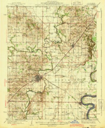
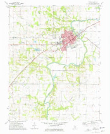
9 topographic sheets cover this place, the earliest surveyed in 1940 and the latest in 1982. It stands in Carmi Township. It lies in ZIP code area 62821. It stands on Big Hill Branch. The Survey maps it on the Carmi quadrangle.
Research this city
On record in Carmi
Buildings and businesses the archive holds for this place. Each opens its own page, with the source record it came from.
On the National Register 5 records
 Carmi Chapter Houselisted 1980
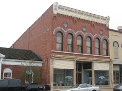 L. Haas Storelisted 1994
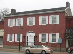 Ratcliff Innlisted 1973
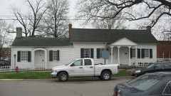 Robinson-Stewart Houselisted 1973
 James Robert Williams Houselisted 1987
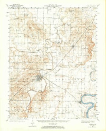
Topographic sheets covering this place
6 surveys from 9 printed sheetsMatched by testing this settlement's coordinate against the published boundary of every sheet in the United States Geological Survey's historical collection. Each opens the scanned sheet at the Survey.
- 1940 USGS Carmi quadrangle1:62500
- 1943 USGS Carmi quadrangle1:62500, 2 printings
- 1958 USGS Belleville quadrangle1:250000, 3 printings
- 1962 USGS Belleville quadrangle1:250000
- 1974 USGS Carmi quadrangle1:24000
- 1982 USGS Mount Vernon quadrangle1:100000


Mines and quarries near this place
2 within 5 milesRegional context, not property-specific evidence. The federal mineral resources record lists 2 workings within 5 miles of Carmi: 2 past producers. None of them still produces. What was taken out: Stone, Crushed/Broken, Clay. Distance is straight-line from the map coordinates, so a quarry counted here may appear on a neighbouring settlement's page as well.
| Where | Site | Commodity | Status | Recorded |
|---|---|---|---|---|
| Big Hill Branch Clay Exposure | Clay | Past Producer | ||
| White County Highway Department | Stone, Crushed/Broken | Past Producer |
Storms near this place
60 of 111 shownRegional context, not property-specific evidence. The National Weather Service names Carmi in 111 storm reports between 1993 and 2023: 42 flood, 32 thunderstorm wind, 18 hail, 8 flash flood. No death or injury is recorded in these reports. Each account below is quoted exactly as the forecast office filed it, from the NOAA Storm Events Database, and each date opens the federal record of that event.
| When | Event | Place named | Harm | What the report says |
|---|---|---|---|---|
| April 2002 | Hail | Carmi | $750,000 | Hundreds of homes and vehicles were damaged by hail across White County. |
| April 2011 | Thunderstorm Wind | Carmi | $500,000 | A swath of damaging straight-line winds around 90 mph extended from Carmi northeast to Crossville. In Carmi and Crossville, there was widespread damage to trees and power lines. Numerous power poles were snapped. Sections of the metal walls of a large warehouse type building in Carmi were peeled back on the south and west sides. A mobile home was knocked off its foundation in Carmi. Much of the city was without power for 36 to 48 hours. Part of the roof was blown off the high school. Uprooted trees fell across homes and vehicles. A carport was blown into trees. In Crossville, numerous trees and limbs were blown down on every street. Some trees landed on houses and vehicles. A mobile home was demolished about a mile east of Crossville. |
| August 2004 | Flash Flood | Carmi | $500,000 | A total of 7.85 inches of rain was measured by the co-operative observer at Carmi during the afternoon, mostly during a three-hour period. Parts of dozens of streets were impassable or inaccessible during and after the storm. The water was slow to recede, and many streets were blocked off, including the two state highways through town. Water up to three feet deep filled many basements and invaded the first floors of some homes. Water was knee-deep in one home, and at least five feet deep in the basement of another home. Water inundated the parking lot of a convenience store, and the occupants of the store were evacuated by a backhoe. Many businesses were closed. Occupants of a mobile home were evacuated, and a basement wall collapsed at a home on Webb Street. Vehicles were swamped, including some cars that stalled while trying to pass through deep water on Main Street. The high water made it difficult or impossible for utility crews and emergency workers to respond to power lines downed by high winds in the storms. |
| August 2004 | Thunderstorm Wind | Carmi | $150,000 | Dozens of trees and hundreds of branches were blown down, including some that fell on homes and power lines. Power was out to virtually the entire city of Carmi at one time or another during or after the storm. Trees blocked traffic on about a dozen streets, and at least one car was damaged by a falling tree. There was a report of a double-wide mobile home being blown off its foundation. The problems of downed electric lines and poles were complicated by extensive flash flooding, which slowed the response of repair crews. A number of live wires landed in floodwaters. Power was restored to most residents of the city within 24 hours. |
| July 2011 | Flash Flood | Carmi | $100,000 | Thunderstorms with torrential rainfall dumped nearly four inches of rain in Carmi. During a 10-minute span, rainfall was 0.73 inches at Carmi. A number of rural roads were washed out. Several hours after the rain ended, one of the washouts caused a major vehicle wreck on County Road 900 north of Norris City. The vehicle was towed from the scene, and a passenger was treated for significant injuries (indirect injury not directly caused by flooding). Portions of roadways were washed out along the Hamilton County line. Entire sections of roadway were washed out, leaving holes more than a foot deep in some places. |
| June 2007 | Thunderstorm Wind | Carmi | $100,000 | Extensive wind damage occurred, primarily on the west side of Carmi. Trees were snapped or uprooted, limbs were broken, and power poles were snapped. Some damage occurred to structures, such as the removal of the roof from a metal building and shifting of a rear garage wall. A travel trailer was rolled. A dumpster was blown onto a roadway. Debris from an equipment business was blown onto the parking lot of a nearby business. Some of the debris landed on vehicles. The damage area was approximately 1 mile by 1.5 miles. Very little or no damage was reported in downtown Carmi or eastern parts of town. |
| April 1996 | Flash Flood | Carmi | $100,000 | no account filed |
| December 2015 | Tornado (EF1) | Carmi | $75,000 | Nearly two dozen large trees were uprooted or snapped. Numerous large limbs were snapped. The tornado began near the intersection of County Roads 1500N and 850E and ended on County Road 1575. One large tree landed on a dog pound. Many of the downed trees were in a campground area on the northwest side of Carmi. A campground bath house was struck by a falling tree. Peak winds were estimated near 105 mph. |
| June 2010 | Thunderstorm Wind | Carmi | $50,000 | In Carmi, three power poles and a light pole were blown down. A few trees and numerous large tree limbs were blown down. There were numerous power outages. South of Epworth, a couple of trees were down. |
| June 2007 | Thunderstorm Wind | Carmi | $50,000 | Numerous trees were blown down from Crossville to Carmi. At Crossville, a home was heavily damaged when a large tree crashed through a kitchen window. Several other property owners in the Crossville area sustained minor wind damage. Trees were reported down over several roadways. A vehicle struck a downed tree in the Phillipstown area. Numerous power outages lingered through the day. Electrical service was restored to all customers within about 12 hours. |
| July 2000 | Thunderstorm Wind | Carmi | $50,000 | Thunderstorms produced strong, damaging winds across parts of White County. Numerous trees and power lines were down in Carmi. One large limb fell on a truck. |
| July 2000 | Flash Flood | Carmi | $50,000 | Water was over several roads in the Carmi area, including U.S. Highway 45. The Wabash Christian Retirement Center was flooded. Water from the outside courtyards ran into the building and through the kitchen, dining room, and lobby. Griffith Lake was overflowing, running across Oak Street and causing problems for vehicles on that road. Several other locations in Carmi were flooded. |
| January 2016 | Flood | Carmi | $30,000 | Major flooding of the Little Wabash River continued into January. At the Carmi river gage, the river crested at 35.74 feet on the 3rd. This flood was similar to the flood of April, 2008, when the river crested at 35.54 feet. Flood stage there is 27 feet. Businesses just downstream of Route 14 and Route 1 in Carmi were flooded. Many county roads were flooded. Extensive flooding of farm fields and woodlands occurred. Since planting season was not underway when flooding began, there was little if any crop damage. |
| March 2008 | Flood | Carmi | $25,000 | Major flooding of the Little Wabash River occurred. At the Carmi gage, the river crested at 35.34 feet on March 25. Flood stage there is 27 feet, and major flooding begins at 35 feet. Businesses just downstream of IL Route 14 and Route 1 in Carmi flooded. Flood waters flowed up McHenry Slough, and areas near Route 1 and 14 in Carmi began to flood. County roads were inundated. Considerable flooding of low-lying fields occurred. |
| November 2005 | Thunderstorm Wind | Carmi | $25,000 | A number of trees and power lines were down in Carmi. One tree fell on a house. In Crossville, a tree fell over a trailer. |
| March 2012 | Thunderstorm Wind | Carmi | $20,000 | Numerous power lines were blown down. |
| August 2010 | Thunderstorm Wind | Carmi | $20,000 | Utility crews repaired power lines damaged by falling tree limbs. Numerous tree limbs were blown down on the northwest side of Carmi. A few miles east of Norris City, three large trees were blown down in a front yard. Two of the trees were pine trees, and the other was a maple. All three trees were over 40 feet tall. A trampoline was blown over across the street. |
| July 1996 | Lightning | Carmi | $20,000 | no account filed |
| May 2016 | Thunderstorm Wind | Carmi | $18,000 | In Carmi, snapped trees and power poles were reported. Winds gusted to near 65 mph at Crossville based on a report from a trained spotter. |
| July 2023 | Thunderstorm Wind | Carmi | $15,000 | Trees and power lines were blown down. Power outages were widespread. |
| August 2020 | Thunderstorm Wind | Carmi | $15,000 | Tree limbs were down in Carmi and across the county. |
| March 2012 | Tornado (EF0) | Carmi | $15,000 | The tornado touchdown was witnessed by the county emergency management director. The intermittent damage path followed County Road 1100 fairly closely. Near the beginning of the track, a body shop was damaged. Some tree and power line damage occurred. A metal carport was blown away. |
| June 2022 | Thunderstorm Wind | Carmi | $10,000 | A few trees were covering roadways in Carmi, as well as numerous branches and debris. A wind gust to 59 mph was measured at the Carmi airport. |
| May 2018 | Thunderstorm Wind | Carmi | $10,000 | Small trees and power lines were down. |
| April 2014 | Flood | Carmi | $10,000 | Moderate flooding occurred along the Little Wabash River. At the Carmi river gage, the river crested at 33.19 feet on the 11th. This crest was about one-half foot above the flood crest in March of 2011. Flood stage is 27 feet, and moderate flooding begins at 32 feet. Some county roads were inundated. Floodwaters backed up McHenry slough. Areas near Routes 1 and 14 in Carmi began to flood. There was considerable flooding of low-lying fields and woodlands near the river. |
| October 2010 | Thunderstorm Wind | Carmi | $10,000 | A few trees and utility poles were down in the city. There were some power outages. |
| June 1999 | Thunderstorm Wind | Carmi | $10,000 | Numerous trees and limbs were down around Carmi. |
| May 1995 | Thunderstorm Wind | Carmi | $10,000 | A few trees and large limbs were blown down in the Carmi area. |
| March 1996 | Thunderstorm Wind | Carmi | $10,000 | no account filed |
| February 2014 | Thunderstorm Wind | Carmi | $9,000 | Numerous tree limbs were blown down. A flag pole was snapped. The peak wind gust was measured at 59 mph at the Carmi airport. |
| July 2022 | Thunderstorm Wind | Carmi | $5,000 | Trees were down in the city of Carmi. |
| April 2018 | Flood | Carmi | $5,000 | Moderate flooding continued on the Little Wabash River from late March. At the Carmi river gage, the river crested at 34.06 feet on April 5. Flood stage is 27 feet. This crest was about a half foot higher than the flood the preceding month, in March. Low-lying areas near Routes 1 and 14 in Carmi began to flood. Numerous county roads were inundated. Considerable flooding of low farmland occurred, delaying the planting season for farmers. Boat traffic was prohibited from the Highway 141 bridge to the confluence with the Wabash River. |
| March 2015 | Flood | Carmi | $5,000 | Moderate flooding occurred on the Little Wabash River. At the Carmi river gage, the river crested at 33.38 feet on the 19th. Flood stage is 27 feet. Low-lying areas near Routes 1 and 14 in Carmi began to flood. Some county roads were inundated. |
| July 2013 | Flood | Carmi | $5,000 | Moderate flooding occurred along the Little Wabash River near Carmi. The crest of 33.62 feet occurred on the afternoon of the 8th. Flood stage there is 27 feet. Low-lying areas near Routes 1 and 14 in Carmi began to flood. Some county roads were inundated. |
| September 2000 | Thunderstorm Wind | Carmi | $5,000 | Trees were down about 5 miles south of Carmi on Route 1, and about 3 miles west of Carmi on Route 14. |
| August 2019 | Thunderstorm Wind | Carmi | $3,000 | Tree limbs were blown down around the county. |
| January 2005 | Thunderstorm Wind | Carmi | $3,000 | Tree limbs and power lines were blown down. |
| September 2000 | Thunderstorm Wind | Carmi | $3,000 | Trees were down on Route 141 west of the Wabash Bridge, blocking westbound traffic. |
| May 1998 | Thunderstorm Wind | Carmi | $3,000 | Small trees were down in Carmi. |
| March 2018 | Flood | Carmi | $2,000 | Moderate flooding continued on the Little Wabash River from late February. At the Carmi river gage, the river crested at 33.45 feet on March 3. Flood stage is 27 feet. This crest was about a foot lower than the flood of June, 2015. Low-lying areas near Routes 1 and 14 in Carmi began to flood. Some county roads were inundated. Considerable flooding of low farmland occurred, but the land was mostly unplanted. Boat traffic was prohibited from the Highway 141 bridge to the confluence with the Wabash River. |
| June 2015 | Flood | Carmi | $2,000 | Moderate flooding occurred along the Little Wabash River. At the Carmi river gage, the river crested at 34.52 feet on the 28th. Flood stage is 27 feet. Areas near Routes 1 and 14 in Carmi flooded. County roads were inundated. The river remained above flood stage into July. |
| July 2015 | Flood | Carmi | $2,000 | Moderate flooding continued along the Little Wabash River from June into mid-July. At the Carmi river gage, the river crested at 34.52 feet in late June. Flood stage is 27 feet. Areas near Routes 1 and 14 in Carmi flooded. County roads were inundated. |
| December 2013 | Flood | Carmi | $2,000 | Minor flooding occurred along the Little Wabash River. Some county roads were inundated. Low-lying fields and woodlands were underwater. |
| July 2021 | Thunderstorm Wind | Carmi | $1,000 | Wires were down. |
| March 2016 | Flood | Carmi | $1,000 | Minor flooding continued from February along the Little Wabash River. Several county roads were inundated. Some low-lying fields were flooded. |
| April 1994 | Thunderstorm Wind | Carmi | $500 | Large trees were blown down in Carmi and the surrounding area. |
| February 2022 | Flood | Carmi | - | Moderate flooding occurred on the Little Wabash River. At the Carmi river gage, the river crested at 32.94 feet on the evening of the 27th. Flood stage is 27 feet. There was considerable flooding of low-lying farmland and fields. Some rural back country roads were under water. The river remained above flood stage into March. |
| July 2022 | Flood | Carmi | - | Several inches of water covered numerous roads within the county, including portions of Highways 1, 14, and 45. |
| April 2021 | Flood | Carmi | - | Minor flooding on the Little Wabash River ended early in the month. Low-lying fields and woodlands in the flood plain were under water. |
| March 2021 | Flood | Carmi | - | Minor flooding occurred on the Little Wabash River. Low-lying fields and woodlands in the flood plain were underwater. |
| August 2019 | Funnel Cloud | Carmi | - | A photo of the funnel cloud was taken by the general public. |
| February 2018 | Flood | Carmi | - | Minor flooding developed along the Little Wabash River. Low-lying agricultural land was flooded. Several county roads were inundated. The river continued rising into March. |
| March 2018 | Flood | Carmi | - | The Little Wabash River rose above flood stage on the 29th and continued rising through the end of the month. The flooding during late March was generally minor. |
| March 2017 | Hail | Carmi | - | Nickel-size hail occurred just outside of town. |
| April 2017 | Flood | Carmi | - | The Little Wabash River rose above flood stage. Through the end of April, the flooding was mostly minor to moderate. However, the river continued rising beyond the end of the month. |
| August 2017 | Hail | Carmi | - | A trained spotter reported quarter-size hail in Carmi, with slightly larger hail just north of the city. |
| August 2017 | Hail | Carmi | - | Dime-size hail covered the ground. |
| February 2016 | Flood | Carmi | - | Minor flooding occurred along the Little Wabash River. Some low-lying fields were flooded. The river continued rising into early March. |
| August 2016 | Flood | Carmi | - | Minor flooding occurred on the Little Wabash River. A few county roads were inundated. Some low-lying fields and woodlands near the river were underwater. |
| April 2015 | Flood | Carmi | - | Minor flooding occurred along the Little Wabash River. Some county roads were inundated, along with low-lying bottomland fields. |
Nearest settlements
The eight closest, with where each one stands in the county. Distances are straight-line, computed from the Geographic Names Information System coordinates.
| Map | Place | Distance | Sheets |
|---|---|---|---|
| Milan | 1.1 miles | 9 | |
| Epworth | 3.1 miles | 11 | |
| Bingman Station | 4.6 miles | 9 | |
| Brownsville | 5.7 miles | 9 | |
| Garnerville | 5.8 miles | 11 | |
| Brownsport (historical) | 6.6 miles | 11 | |
| Elm Grove (historical) | 6.9 miles | 21 | |
| Crossville | 7.0 miles | 9 |
Provenance
This settlement is recorded in the Geographic Names Information System as feature 405613. The sheet list is computed by point-in-boundary test against the United States Geological Survey's historical topographic inventory. Both are works of the United States government and carry no copyright under 17 U.S.C. 105.
Mines and quarries. USGS Mineral Resources Data System (MRDS) https://mrdata.usgs.gov/mrds/ A work of the United States government, no copyright under 17 U.S.C. 105.
Storms. NOAA National Centers for Environmental Information, Storm Events Database https://www.ncei.noaa.gov/stormevents/ A work of the United States government, no copyright under 17 U.S.C. 105. Narratives are quoted verbatim from the National Weather Service report and are not edited or summarised.