 Block
From the record
7 National Register listings published here.
Sources: the county history on the Internet Archive · the National Register database, National Park Service
51 topographic sheets cover 30 settlements here, and 7 properties are on the National Register of Historic Places.
7 National Register listings published here.
Sources: the county history on the Internet Archive · the National Register database, National Park Service
Every property in this county listed on the National Register of Historic Places, with the year it was listed and the federal nomination document.
| Photograph | Property | Type | Listed | Reference |
|---|---|---|---|---|
 | Carmi Chapter House | building | 1980 | 80001416 |
 | William W. Gray House | building | 1992 | 92000049 |
 | L. Haas Store | building | 1994 | 94000026 |
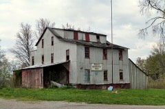 | Old Morrison Mill | building | 1984 | 84001169 |
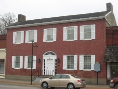 | Ratcliff Inn | building | 1973 | 73000719 |
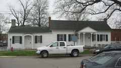 | Robinson-Stewart House | building | 1973 | 73000720 |
 | James Robert Williams House | building | 1987 | 86003716 |
The NOAA Storm Events Database holds 416 reports for this county, causing 2 deaths, 21 injuries and about $15,686,000 in recorded property damage. Each settlement page carries the reports that name it.
| Kind of event | Reports |
|---|---|
| Flood | 164 |
| Thunderstorm Wind | 117 |
| Hail | 64 |
| Tornado | 25 |
| Flash Flood | 25 |
| Heavy Rain | 10 |
| Lightning | 6 |
| Funnel Cloud | 5 |
The most serious of them, by death, then injury, then recorded damage. The accounts are quoted exactly as the forecast office filed them.
| When | Event | Place named | Harm | What the report says |
|---|---|---|---|---|
| February 2017 | Tornado (EF3) | Carmi Muni Arpt | 1 killed, 1 hurt, $2,000,000 | The tornado touched down between Crossville and Carmi, quickly strengthening to EF-3 intensity before crossing Illinois Route 1. The tornado track stayed northeast of Carmi, in relatively sparsely populated farmland. In White County, 35 structures were damaged or destroyed. At least several of those were homes. Just west of Highway 1, several vehicles were rolled over and moved, and a single-wide mobile home was destroyed. Near where the tornado crossed Route 1, an older house was moved three feet off its foundation. The house did not appear to be bolted to the foundation. Most of the second floor was removed. A double-wide mobile home was destroyed in the same area near Route 1. The width of the damage path was about 300 yards along Route 1. Just south of Crossville on County Road 1675E, a vehicle was rolled about 30 yards, and a house was destroyed. Some walls of the house collapsed, and most of the roof came off. Peak winds at this location were estimated near 150 mph. The sole fatality occurred south of Crossville, where an elderly man was caught outdoors when the tornado struck. The man was found in a farm field about 40 yards from his house. His wife was inside in the house, and she received scrapes and bruises. Another EF-3 damage location was east of Crossville, where a vehicle was moved about 30 yards and an old house was partially destroyed. The average path width was about 300 yards in White County. The tornado continued across the Wabash River into Posey County, Indiana. |
| May 1990 | Thunderstorm Wind | not stated | 1 killed | no account filed |
| June 2019 | Flood | Maunie | 10 hurt, $30,000 | no account filed |
| January 1989 | Tornado (F2) | not stated | 6 hurt, $2,500,000 | no account filed |
| October 2001 | Thunderstorm Wind | Centerville | 2 hurt, $200,000 | Damaging straight-line winds raked northern White County, downing trees and power lines, and destroying at least one pole barn. On County Road 800 East, a school bus was stopped when it was caught between fallen trees. A number of semi-tractor trailers and cars were blown off Interstate 64 about 6 miles west of Grayville. The driver of one of the semis was treated at a local hospital for minor injuries. A second person was injured on Interstate 64, but no details were available. South of Burnt Prairie, several hogs were killed when a silo blew over and crashed into a hog barn. Roofs were blown off several buildings at a fertilizer plant near Burnt Prairie. A number of residences around Centerville were damaged, mainly by downed trees and limbs. Trees and limbs were downed in Crossville and Grayville, including one that fell on a home in Crossville. Several power lines were down in Carmi, and at least two poles were broken. |
| April 2011 | Lightning | Crossville | 2 hurt | A man and his son were struck by lightning while hunting. The lightning apparently struck the barrel of a shotgun being carried by the son. Both were hospitalized with minor to moderate injuries. |
| April 2011 | Tornado (EF2) | Concord | $2,000,000 | This tornado several miles southeast of Carmi severely damaged two farms. Over a dozen grain bins were destroyed. One of the grain bins followed a curved path that crossed a fence twice. A seven-ton truck that was parked in a shed was overturned onto its side. An equipment shed was unroofed. Windows were blown out on all sides of a large, multi-story house. The house sustained considerable loss of roofing material and collapse of a non load-bearing wall. Several objects in the house were found across the street, including a mirror and curtains. Power poles were snapped. Irrigation pivots were overturned. The pattern of flattened corn stubble indicated convergent winds in a field. Peak winds were estimated near 130 mph. The average path width was 125 yards. |
| April 1996 | Tornado (F1) | Carmi Muni Arpt | $1,000,000 | no account filed |
| May 2011 | Flood | Maunie | $800,000 | Major flooding continued on the Wabash River from April. At the New Harmony (Indiana) river gage, the river crested at 23.67 feet on May 4. This level was the fourth highest crest on record, exceeding the 2005 flood by about six inches. This was the highest level since 1943. Sandbagging began to prevent Wabash River floodwaters from entering the Grayville water plant. Several homes in Grayville were threatened by rising water, and water entered a number of basements. The approach to the bridge to Maunie was washed out. The 172 residents of Maunie were asked to evacuate, but 42 of them did not. An airboat was brought in by Illinois police to shuttle supplies into the isolated community and evacuate medical patients. The airboats were used to assist residents in the communities of Dogtown and Concord that were isolated by floodwaters. In New Haven, a combination of Little Wabash River floodwater and Wabash River backwater flooded more than a dozen homes. |
| April 2002 | Hail | Carmi | $750,000 | Hundreds of homes and vehicles were damaged by hail across White County. |
| April 2011 | Thunderstorm Wind | Carmi | $500,000 | A swath of damaging straight-line winds around 90 mph extended from Carmi northeast to Crossville. In Carmi and Crossville, there was widespread damage to trees and power lines. Numerous power poles were snapped. Sections of the metal walls of a large warehouse type building in Carmi were peeled back on the south and west sides. A mobile home was knocked off its foundation in Carmi. Much of the city was without power for 36 to 48 hours. Part of the roof was blown off the high school. Uprooted trees fell across homes and vehicles. A carport was blown into trees. In Crossville, numerous trees and limbs were blown down on every street. Some trees landed on houses and vehicles. A mobile home was demolished about a mile east of Crossville. |
| August 2004 | Flash Flood | Carmi | $500,000 | A total of 7.85 inches of rain was measured by the co-operative observer at Carmi during the afternoon, mostly during a three-hour period. Parts of dozens of streets were impassable or inaccessible during and after the storm. The water was slow to recede, and many streets were blocked off, including the two state highways through town. Water up to three feet deep filled many basements and invaded the first floors of some homes. Water was knee-deep in one home, and at least five feet deep in the basement of another home. Water inundated the parking lot of a convenience store, and the occupants of the store were evacuated by a backhoe. Many businesses were closed. Occupants of a mobile home were evacuated, and a basement wall collapsed at a home on Webb Street. Vehicles were swamped, including some cars that stalled while trying to pass through deep water on Main Street. The high water made it difficult or impossible for utility crews and emergency workers to respond to power lines downed by high winds in the storms. |
| May 1996 | Flash Flood | Enfield | $500,000 | no account filed |
| April 2011 | Tornado (EF1) | Epworth | $300,000 | A house lost the entire roof, and most windows were broken. A trailer home was blown a couple of feet off its foundation. Two to three grain bins were blown less than a hundred yards away. Utility poles were snapped. Numerous trees were snapped or uprooted. Peak winds were estimated around 110 mph. The average path width was 100 yards. |
| March 2008 | Flood | Burnt Prairie | $300,000 | Many rural and county roads were flooded. U.S. Highway 45 was closed north of Enfield. A vehicle became stranded in floodwaters west of Grayville. The driver was rescued by emergency personnel. Illinois Route 1 in Crossville was closed for a few hours. In Omaha, a fertilizer and agrichemical warehouse was flooded with four feet of water. |
| January 2012 | Tornado (EF2) | Enfield | $250,000 | The tornado's strength was EF-0 to EF-1 for most of its path, except near the intersection of Route 14 and U.S. Highway 45. Near this intersection just south of Enfield, a 60-by-105 foot storage barn with wooden truss and steel wall construction was destroyed. Debris from the barn was blown up to 400 yards away. Many of the contents of the barn were lost. Two combines were damaged. A nearby car-and-a-half cinder block garage was destroyed, with concrete blocks thrown over 100 yards. One block was hurled through a window of a pickup truck. A dog pen on the north side of the garage was blown away, and two dogs were missing. A 40-foot tower was bent halfway up. A nearby house and barn sustained minimal damage. Several smaller barns were damaged or destroyed along the path. A greenhouse was destroyed near Centerville. Several trees were down and snapped. Two power lines were blown down across Illinois Route 14 just east of Highway 45. Route 14 was closed for about an hour and a half. Many utility poles were snapped off or leaning along both U.S. 45 and Illinois Route 14, as well as a few other locations along the path. This tornado struck some of the same property that the 1925 Tri-State Tornado devastated. Peak winds were estimated near 120 mph. The average path width was about 50 yards. |
| February 1965 | Tornado (F2) | not stated | $250,000 | no account filed |
| March 2022 | Tornado (EF1) | Norris City | $200,000 | This tornado formed in rural farm country several miles southwest of Carmi, then tracked northeast across residential areas in the southeast and east central parts of the city of Carmi. At least a dozen houses received shingle damage, mostly in Carmi. A few large sheds were extensively damaged, one of which was completely destroyed. Some of the debris from a shed was blown into an assisted living center in Carmi. Dozens of trees were uprooted or snapped, some of which blocked roads. One small johnboat was blown into a pond. Power poles and lines were down along the path. Peak winds based on a storm damage survey were estimated near 100 mph. |
| December 2015 | Thunderstorm Wind | Maunie | $150,000 | A National Weather Service damage survey revealed a strong downburst struck the community of Maunie. In Maunie, the cement and brick facade of a building partially collapsed. A tree was uprooted in front of the post office. About a half mile north of Maunie, one large irrigation unit was turned over and bent. Several large trees were uprooted, and large limbs were snapped. On County Road 1225, a machine shed roof was blown off. Peak winds were estimated near 100 mph. |
| May 2011 | Flood | Concord | $150,000 | Major flooding continued on the Little Wabash River from April. At the Carmi river gage, the river crested at 38.34 feet on May 3. This reading was the second highest on record, missing the record level set in 1961 by only about an inch. Due to flooding of the Little Wabash River, the bridge on Route 1 and several low-lying streets in Carmi were closed. At least ten businesses in East Carmi were flooded. The businesses were closed for up to three weeks. Flooding damaged or cut off access to about 20 homes and a church. Backwater from the Little Wabash River caused major flooding on the Skillet Fork River in the Mill Shoals and Springerton areas. Some sandbagging was done in Mill Shoals, and a section of U.S. 45 was closed. County and city schools were closed. |
| April 2011 | Thunderstorm Wind | Emma | $150,000 | About six miles southeast of Carmi at the intersection of County Roads 900N and 1500E, an intense downburst with winds near 120 mph struck. This downburst was a short distance east of the end of an EF-2 tornado track. A large equipment shed was unroofed, and an exterior wall collapsed. Two parked flatbed trailers were overturned. Dozens of trees were uprooted or snapped along a fence row. The damage area was only about one-third of a mile long and 400 yards wide. |
| April 2011 | Thunderstorm Wind | Norris City | $150,000 | The rubber roofing was blown off the high school gym in Norris City. The gym was further damaged by rainwater. Falling trees damaged several homes in the area. A metal carport was flipped over. |
| August 2004 | Thunderstorm Wind | Carmi | $150,000 | Dozens of trees and hundreds of branches were blown down, including some that fell on homes and power lines. Power was out to virtually the entire city of Carmi at one time or another during or after the storm. Trees blocked traffic on about a dozen streets, and at least one car was damaged by a falling tree. There was a report of a double-wide mobile home being blown off its foundation. The problems of downed electric lines and poles were complicated by extensive flash flooding, which slowed the response of repair crews. A number of live wires landed in floodwaters. Power was restored to most residents of the city within 24 hours. |
| May 2022 | Thunderstorm Wind | Crossville | $100,000 | Widespread wind damage occurred in Crossville, including very large tree branches that were snapped. Many trees were blown down or uprooted, along with structural damage to several buildings and houses. Numerous power lines were blown down. |
| May 2017 | Flood | Centerville | $100,000 | Major to historic flooding occurred on the Little Wabash River. At the Carmi river gage, the river crested at 36.01 feet on the 8th. Flood stage is 27 feet. This crest of 36 feet was less than 2.5 feet below the flood crest in the spring of 2011. A few families in the Carmi area were displaced by flooding. Illinois Route 1 in Carmi was closed. Several streets in East Carmi and many rural roads were closed by flooding. Extensive flooding of farmlands and fields occurred. Some oil wells were shut down by flooding. |
| July 2011 | Flash Flood | Carmi | $100,000 | Thunderstorms with torrential rainfall dumped nearly four inches of rain in Carmi. During a 10-minute span, rainfall was 0.73 inches at Carmi. A number of rural roads were washed out. Several hours after the rain ended, one of the washouts caused a major vehicle wreck on County Road 900 north of Norris City. The vehicle was towed from the scene, and a passenger was treated for significant injuries (indirect injury not directly caused by flooding). Portions of roadways were washed out along the Hamilton County line. Entire sections of roadway were washed out, leaving holes more than a foot deep in some places. |
| January 2008 | Thunderstorm Wind | Grayville | $100,000 | A large section of the roof was torn off an elementary school on the west side of Grayville. A nursing home in Grayville sustained some roof damage. A barn west of town was destroyed. Several trees and utility poles were down. South of Carmi, some outbuildings were destroyed near Epworth. Sheet metal was blown into a power substation. In Norris City, the Masonic lodge lost its roof. On Route 1, a motorist drove into a fallen tree across the road. |
| June 2007 | Thunderstorm Wind | Carmi | $100,000 | Extensive wind damage occurred, primarily on the west side of Carmi. Trees were snapped or uprooted, limbs were broken, and power poles were snapped. Some damage occurred to structures, such as the removal of the roof from a metal building and shifting of a rear garage wall. A travel trailer was rolled. A dumpster was blown onto a roadway. Debris from an equipment business was blown onto the parking lot of a nearby business. Some of the debris landed on vehicles. The damage area was approximately 1 mile by 1.5 miles. Very little or no damage was reported in downtown Carmi or eastern parts of town. |
| April 2006 | Thunderstorm Wind | Countywide | $100,000 | Widespread wind damage occurred in White County. Two mobile homes were overturned. One mobile home a few miles northeast of Enfield was destroyed, along with all its contents. A second mobile home was overturned along County Road 1700 a couple miles north of Carmi. Between Carmi and Enfield, a roof was blown off a barn. Numerous trees were down across the northern half of the county, several of which landed on homes. In Enfield, a machine shed was destroyed, a tree fell on a mobile home, and three other trees landed across roads. The village of Enfield was without power when a utility pole snapped. A couple of trees were blown down in Norris City, including one on U.S. Route 45 just south of town. Utility poles were downed south of Crossville, between Enfield and Carmi, just north of Carmi, and just west of Crossville. In the northwest corner of the county, several poles were downed near Mill Shoals along U.S. Highway 45. An empty 2400-bushel grain bin was destroyed north of Carmi. |
| April 1996 | Flash Flood | Carmi | $100,000 | no account filed |
| February 1996 | Lightning | Enfield | $80,000 | no account filed |
| June 2019 | Thunderstorm Wind | Crossville | $75,000 | A tractor-trailer rig was blown over west-southwest of Grayville on Interstate 64. In the same vicinity, a large electric transmission line and double power poles were blown down onto a roadway. Multiple large trees were blown down along Highway 1 between Crossville and Grayville. Numerous power lines were down in and around Crossville. |
| December 2015 | Tornado (EF1) | Carmi | $75,000 | Nearly two dozen large trees were uprooted or snapped. Numerous large limbs were snapped. The tornado began near the intersection of County Roads 1500N and 850E and ended on County Road 1575. One large tree landed on a dog pound. Many of the downed trees were in a campground area on the northwest side of Carmi. A campground bath house was struck by a falling tree. Peak winds were estimated near 105 mph. |
| April 2017 | Thunderstorm Wind | Enfield | $60,000 | A downburst with peak winds estimated near 90 mph tracked through Enfield from southwest to northeast. Dozens of trees and large limbs were blown down, primarily within the city limits. Some minor roof damage occurred at several houses, an apartment building, and a school. A section of the covering of the school roof, approximately 60 to 100 feet in length, was blown off. Power lines were down. A carport was blown away and wrapped around a tree. A large tarp was torn off a very large grain pile. The most intense tree damage was in the city park, where several large hardwood trees up to four feet in diameter were uprooted. The damage path extended from the western city limit to the eastern city limit, a distance of about 1.2 miles. The width of the microburst averaged 600 yards. |
| April 2018 | Tornado (EF1) | New Haven | $50,000 | At a farming business located in very sparsely populated country, considerable damage occurred in a storage yard. Numerous heavy irrigation pipes were moved, and some were bent. Three barns lost metal roofing. A semi tanker trailer was overturned. Debris was thrown 200 to 400 yards. Farming irrigation equipment was damaged and moved. In a small wooded area immediately behind the storage yard, dozens of large trees were snapped or uprooted in a convergent pattern. The path continued intermittently through a wooded area to the flood plain of the Wabash River. Peak winds were estimated near 110 mph. |
| April 2014 | Tornado (EF1) | Trumbull | $50,000 | At a home with an attached garage, the roof was lifted and partially separated from the walls. A large 42-by-66 foot machine shed with an attached lean-to was partially unroofed, and the doors were blown inward. Several small outbuildings were overturned. Approximately a dozen trees, mainly pine trees, were snapped or uprooted. Some debris was blown at least one-half mile away. The most intense damage occurred on County Road 1560N, northwest of Carmi. Peak winds were estimated near 100 mph. |
| April 2011 | Thunderstorm Wind | Carmi Muni Arpt | $50,000 | A cropduster was flipped at the Carmi airport. |
| April 2011 | Lightning | Crossville | $50,000 | Lightning struck a mobile home, starting a fire that destroyed it. |
| June 2010 | Thunderstorm Wind | Carmi | $50,000 | In Carmi, three power poles and a light pole were blown down. A few trees and numerous large tree limbs were blown down. There were numerous power outages. South of Epworth, a couple of trees were down. |
| June 2007 | Thunderstorm Wind | Carmi | $50,000 | Numerous trees were blown down from Crossville to Carmi. At Crossville, a home was heavily damaged when a large tree crashed through a kitchen window. Several other property owners in the Crossville area sustained minor wind damage. Trees were reported down over several roadways. A vehicle struck a downed tree in the Phillipstown area. Numerous power outages lingered through the day. Electrical service was restored to all customers within about 12 hours. |
| October 2001 | Tornado (F0) | Springerton | $50,000 | A weak, short-lived tornado with top winds of 70 to 75 MPH caused extensive damage in Springerton. Numerous trees and power poles were snapped, some landing on homes and businesses. Roofs were blown off several homes, front porches were blown off, and a few machine sheds were blown away. Many headstones in a local cemetery were overturned. |
| July 2000 | Thunderstorm Wind | Carmi | $50,000 | Thunderstorms produced strong, damaging winds across parts of White County. Numerous trees and power lines were down in Carmi. One large limb fell on a truck. |
| July 2000 | Flash Flood | Carmi | $50,000 | Water was over several roads in the Carmi area, including U.S. Highway 45. The Wabash Christian Retirement Center was flooded. Water from the outside courtyards ran into the building and through the kitchen, dining room, and lobby. Griffith Lake was overflowing, running across Oak Street and causing problems for vehicles on that road. Several other locations in Carmi were flooded. |
| July 1994 | Thunderstorm Wind | not stated | $50,000 | A rapidly moving thunderstorm produced widespread damage. Numerous trees were blown down with several reports of power outages. |
| March 2022 | Thunderstorm Wind | Crossville | $40,000 | A few pole barns were damaged or destroyed. |
| April 2011 | Thunderstorm Wind | Grayville | $40,000 | Many trees were toppled. |
| July 2011 | Thunderstorm Wind | Grayville | $40,000 | A large tree fell on a house, causing significant damage. The storm damaged branches and limbs, knocking out power to portions of the city. |
| July 2006 | Thunderstorm Wind | Countywide | $40,000 | Some trees were down around the county. Norris City was especially hard hit, where at least two trees landed on residences. One tree landed on a front porch and vehicle. The other tree fell on a trailer home and broke through the roof. The entire community was without power for several hours. In Carmi, many tree limbs and a few trees were down, causing power outages. A few streets were blocked by downed limbs. |
| May 1999 | Thunderstorm Wind | New Haven | $40,000 | In New Haven, numerous trees and three power lines were down, doing some damage to homes and outbuildings. The roof of a building was peeled off one mile west of New Haven. A tree fell on a vehicle, and a metal outbuilding was blown over. |
| May 2024 | Tornado (EF1) | Grayville | $30,000 | An EF-1 tornado began in far northeastern White County south of Grayville. As it progressed eastward, the tornado damaged numerous trees and produced minor damage to homes in the area. A carport was damaged with damage to vehicles due to debris falling on them. The tornado crossed an offshoot of the Wabash River, reaching the portion of Gibson County, Indiana on Kingdom Island. Peak estimated winds with the White County segment, and the tornado as a whole, were 110 mph. |
| August 2024 | Thunderstorm Wind | Enfield | $30,000 | A surging storm line moved through Enfield causing wind damage. The top of an elevator grain bin was peeled back. A camper awning was damaged. A large tree was blown down onto a house and minor tree damage occurred throughout the town. |
| July 2023 | Thunderstorm Wind | Norris City | $30,000 | Trees and tree limbs were blown down. A gate was damaged. |
| June 2018 | Thunderstorm Wind | Norris City | $30,000 | The damage from this microburst was most focused around and south of Sandy Run Lake. The damage began near the Hamilton-White County line and continued to east of Highway 1, where the damage became more sporadic. Many dozens of trees, some large, were uprooted or broken. Trees were down along Highway 1. At least two homes were damaged due to falling trees. One was a mobile home on Highway 300 North and another on Sandy Run Lake. A brief tornado with identical peak winds of 85 mph occurred on the north edge of the microburst area. |
| June 2018 | Thunderstorm Wind | Enfield | $30,000 | Widespread wind damage occurred in southern and western parts of the county. Multiple trees were blown down. A tree landed on a house in Norris City. |
| January 2016 | Flood | Carmi | $30,000 | Major flooding of the Little Wabash River continued into January. At the Carmi river gage, the river crested at 35.74 feet on the 3rd. This flood was similar to the flood of April, 2008, when the river crested at 35.54 feet. Flood stage there is 27 feet. Businesses just downstream of Route 14 and Route 1 in Carmi were flooded. Many county roads were flooded. Extensive flooding of farm fields and woodlands occurred. Since planting season was not underway when flooding began, there was little if any crop damage. |
| April 2008 | Flood | Carmi Muni Arpt | $30,000 | Major flooding of the Little Wabash River occurred. At the Carmi gage, the April river crest was 35.54 feet on the 4th. Flood stage at Carmi is 27 feet. Businesses just downstream of Route 14 and Route 1 in Carmi were flooded. Many county roads were flooded. Extensive flooding of farm fields and woodlands occurred. Since planting season was not underway when flooding began, there was little if any crop damage. |
| August 2004 | Flash Flood | Countywide | $30,000 | Major flooding of creeks and roads occurred. Numerous roads were under water, and several rural roads were closed. Half of the First Street bridge was washed out in Grayville. Owl Creek in Grayville was way out of its banks, sending a foot of water over a road. The village of Crossville experienced widespread flooding. Several blocks of two streets along Elliott Creek were totally under water. Many Crossville residents were unable to leave their homes due to flooding. Illinois Route 1 was closed at the viaduct in Crossville due to high water. A vehicle stalled out in the water, causing one lane to be closed. |
| July 2004 | Thunderstorm Wind | Grayville | $30,000 | Numerous trees and power lines were blown down across White County, specifically in Carmi and Grayville. At Grayville, a spotter measured a wind gust to 74 MPH (64 knots). Trees were blown down on at least 3 houses in Grayville. Power was out in Grayville for about 12 hours. |
| June 1997 | Thunderstorm Wind | Epworth | $30,000 | A barn was heavily damaged, and two nearby houses sustained some damage. |
| May 2011 | Flood | Phillipstown | $30,000 | no account filed |
The Survey's mineral resources record lists 8 workings inside this county. 3 still produce and 5 are closed or unrecorded. Each settlement page carries the workings within five miles of it.
| Commodity | Workings |
|---|---|
| Sand and Gravel, Construction | 6 |
| Stone, Crushed/Broken | 1 |
| Clay | 1 |
The least common of them first, because a county's hundredth gravel pit says nothing its first ten did not.
| Where | Site | Commodity | Status | Recorded |
|---|---|---|---|---|
| Big Hill Branch Clay Exposure | Clay | Past Producer | ||
| White County Highway Department | Stone, Crushed/Broken | Past Producer | ||
| Aulvin Sand & Gravel | Sand and Gravel, Construction | Producer | ||
| Carmi Dredge and Mill | Sand and Gravel, Construction | Past Producer | ||
| Diamond Dredge and Mill | Sand and Gravel, Construction | Past Producer | ||
| Eastwood Dredge and Mill | Sand and Gravel, Construction | Plant | ||
| Maunie Plant/Dredge & Mill | Sand and Gravel, Construction | Producer | ||
| Mcdonald Sand and Gravel Co. Pit | Sand and Gravel, Construction | Past Producer |
One book written about this county, cut here where the book itself is cut, at its printed chapters: 15 chapters in all. Every chapter is public domain, machine-read from the scan and reproduced complete. A chapter already given under one of the county's towns is not repeated in this list.
| Chapter | Length |
|---|---|
| Chapter 1: Natural History | 9,979 words |
| Chapter 2: Early Settlement | 6,635 words |
| Chapter 3: Pioneer Life | 13,920 words |
| Chapter 4: Reminiscences | 7,640 words |
| Chapter 5: Legal | 12,580 words |
| Chapter 6: Political | 4,986 words |
| Chapter 7: Criminal | 9,618 words |
| Chapter 8: The Great War | 14,100 words |
| Chapter 9: Minor Wars | 3,017 words |
| Chapter 10: Material Progress | 6,594 words |
| Chapter 11: The Press | 6,448 words |
| Chapter 12: Musical and Literary | 2,075 words |
| Chapter 13: Eminent Dead | 4,935 words |
| Chapter with an unread heading (no. 14 of those read) | 16,792 words in 2 parts |
| Biographical sketches | 172,670 words in 11 parts |
Named settlements recorded in the Geographic Names Information System, each with the topographic sheets covering it. Villages, hamlets and abandoned places alike. Each is shown with the nearest named watercourse or landform and the survey quadrangle it falls on.
Hawthorne township · 62821 · On Lower Sandy Slough · Maunie quadrangle
11 sheets, 1940 to 1982
No longer a settlement
Burnt Prairie township · 62821 · Near Boyd Hill · Centerville quadrangle
9 sheets, 1940 to 1982
Phillips township · 62827 · Crossville quadrangle
9 sheets, 1940 to 1982
No longer a settlement
Mill Shoals township · 62862 · Springerton quadrangle
9 sheets, 1941 to 1982
No longer a settlement
Mill Shoals township · 62887 · On Beaver Creek · Springerton quadrangle
9 sheets, 1941 to 1982
The vanished settlements of White County: the places named above that are no longer on the map.