 Block
Champaign, Illinois
24 topographic sheets cover this place, the earliest surveyed in 1906 and the latest in 1998. It stands in Champaign City Township. It lies in ZIP code area 61820. It stands on Boneyard Creek. The Survey maps it on the Urbana quadrangle. 88,302 people lived here at the 2020 count. It stands 738 feet above sea level.
Research this city
On record in Champaign
Buildings and businesses the archive holds for this place. Each opens its own page, with the source record it came from.
On the National Register 12 of 29 shown
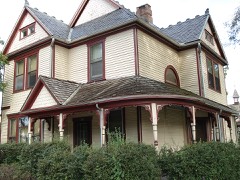 Henry Ahrens Houselisted 2011
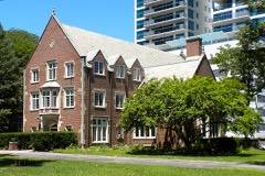 Alpha Delta Phi Fraternity Houselisted 1990
 Alpha Phi Fraternity House-Beta Alpha Chapterlisted 2005
 Alpha Rho Chi Fraternity Houselisted 1997
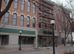 Bailey-Rug Buildinglisted 1997
 Beta Theta Pi Fraternity Houselisted 1989
 Building at 201 North Market Streetlisted 1997
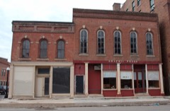 Building at 203-205 North Market Streetlisted 1997
 Burnham Athenaeumlisted 1978
 Cattle Banklisted 1975
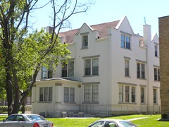 Delta Kappa Epsilon Fraternity Houselisted 1990
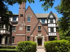 Delta Upsilon Fraternity Houselisted 1990
Population over time
3 figuresChampaign grew from 1,727 to 88,302 between 1860 and 2020. These are the recorded population figures Wikidata holds for this place, reached through the Geographic Names Information System number this page is keyed on rather than by name, so they belong to this place and not to another of the same name. Most are census counts, but not all are: an early figure may be a founding or settlement estimate, and an estimate published within five years of a census is left out. The change column is computed, and is left blank where more than 20 years separate a figure from the one before it, because a gap that long is not a change between two counts.
| Year | People | Change |
|---|---|---|
| 1860 | 1,727 | |
| 2010 | 81,055 | |
| 2020 | 88,302 | +7,247 (+9%) |
Topographic sheets covering this place
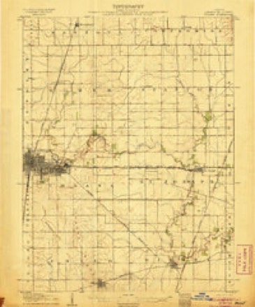
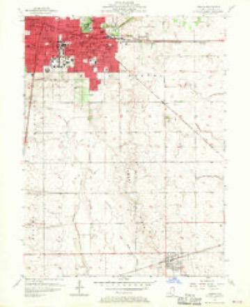
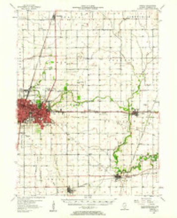
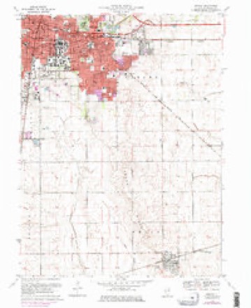
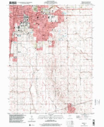
10 surveys from 24 printed sheetsMatched by testing this settlement's coordinate against the published boundary of every sheet in the United States Geological Survey's historical collection. Each opens the scanned sheet at the Survey.
- 1906 USGS Urbana quadrangle1:62500, 7 printings
- 1957 USGS Urbana quadrangle1:24000, 2 printings
- 1957 USGS Urbana quadrangle1:62500, 2 printings
- 1958 USGS Peoria quadrangle1:250000, 4 printings
- 1961 USGS Peoria quadrangle1:250000
- 1963 USGS Peoria quadrangle1:250000
- 1970 USGS Urbana quadrangle1:24000, 3 printings
- 1985 USGS Champaign quadrangle1:100000, 2 printings
- 1990 USGS Peoria quadrangle1:250000
- 1998 USGS Urbana quadrangle1:24000




Fires near this place
13 since 2007Regional context, not property-specific evidence. The federal wildfire occurrence database lists 13 fires within 5 miles of Champaign in 2007, burning about 130 acres in total. 1 started naturally. 2 were recorded as arson. Distance is straight-line from the map coordinates, so a fire counted here may appear on a neighbouring settlement's page as well.
| Reported cause | Fires |
|---|---|
| Missing data/not specified/undetermined | 6 |
| Equipment and vehicle use | 2 |
| Arson/incendiarism | 2 |
| Smoking | 2 |
| Natural | 1 |
The most recent of them, most recent first, with the day each was reported and the service that recorded it.
| Date | Cause | Size | Reported by | Name on the report |
|---|---|---|---|---|
| 6 September 2007 | Missing data/not specified/undetermined | 1.0 acres | Illinois Division of Forestry Resources | not named |
| 22 September 2007 | Missing data/not specified/undetermined | 1.0 acres | Illinois Division of Forestry Resources | not named |
| 2 September 2007 | Smoking | 10 acres | Illinois Division of Forestry Resources | not named |
| 18 September 2007 | Arson/incendiarism | 10 acres | Illinois Division of Forestry Resources | not named |
| 11 August 2007 | Smoking | 1.0 acres | Illinois Division of Forestry Resources | not named |
| 7 June 2007 | Missing data/not specified/undetermined | 6.0 acres | Illinois Division of Forestry Resources | not named |
| 15 June 2007 | Missing data/not specified/undetermined | 1.0 acres | Illinois Division of Forestry Resources | not named |
| 11 June 2007 | Natural | 2.0 acres | Illinois Division of Forestry Resources | not named |
Settlements close enough to share some of these fires:
Mines and quarries near this place
2 within 5 milesRegional context, not property-specific evidence. The federal mineral resources record lists 2 workings within 5 miles of Champaign: 2 past producers. None of them still produces. What was taken out: Stone, Crushed/Broken. Distance is straight-line from the map coordinates, so a quarry counted here may appear on a neighbouring settlement's page as well.
| Where | Site | Commodity | Status | Recorded |
|---|---|---|---|---|
| Champaign City Hwy Dept | Stone, Crushed/Broken | Past Producer | ||
| Urbana City Eng | Stone, Crushed/Broken | Past Producer |
Storms near this place
60 of 109 shownRegional context, not property-specific evidence. The National Weather Service names Champaign in 109 storm reports between 1994 and 2026: 55 thunderstorm wind, 38 hail, 8 flash flood, 6 tornado. The reports record 2 injuries. Each account below is quoted exactly as the forecast office filed it, from the NOAA Storm Events Database, and each date opens the federal record of that event.
| When | Event | Place named | Harm | What the report says |
|---|---|---|---|---|
| October 2001 | Tornado (F1) | Champaign | 2 hurt, $500,000 | The tornado initially touched down just west of the intersection of Interstates 57 and 74. An animal hospital sustained minor damage to some free standing brick walls. Moving east northeast from this location, a semi was blown over on the clover leaf of the Interstate intersection. The driver did not sustain any injuries. To the east of the intersection, a fabrication business was destroyed with the entire building having collapsed and a 30 foot section of the front wall was pushed back towards the rear of the building. Two occupants of the business sustained minor injuries. One sustained a broken hand and numerous cuts and bruises and the other occupant had a minor bump on his head. Another building behind this business sustained major damage. The tornado then crossed a field into a small subdivision. A duplex sustained major damage when the western half of it was destroyed. Further down several homes sustained minor roof damage, with the exception of one home which had part of its roof ripped off. Numerous trees and several power lines were blown down as well. Damage was estimated around $500,000. |
| June 2009 | Thunderstorm Wind | Champaign | $100,000 | Six structures suffered roof damage in Champaign. Multiple trees and power lines were blown down across the city as well. |
| July 2017 | Thunderstorm Wind | Champaign | $90,000 | Numerous trees were snapped or uprooted. |
| June 2019 | Thunderstorm Wind | Champaign | $60,000 | Numerous trees were blown down. |
| August 2012 | Thunderstorm Wind | Champaign | $60,000 | Strong thunderstorm winds produced damage across a 2 square mile area on the west and southwest side of Champaign. Numerous tree branches and power lines were blown down, creating a power outage for several hours. The damage was bounded by Springfield Avenue on the north, Prospect Avenue on the east, Windsor Avenue on the south, and Duncan Road on the west. |
| June 2015 | Thunderstorm Wind | Champaign | $40,000 | Numerous 4 to 6-inch diameter tree branches were blown down across Champaign. |
| October 2010 | Thunderstorm Wind | Champaign | $40,000 | A roof was blown off a house and several power poles were knocked down around the 3200 block of Edward Hoffman Drive. |
| June 2009 | Thunderstorm Wind | Champaign | $40,000 | Numerous trees were blown down on the north side of Champaign. |
| July 2009 | Lightning | Champaign | $40,000 | Lightning struck the roof of a house, causing a fire in the attic. Four people in the house escaped without injury. The fire was contained in the attic and did minor damage to second floor rooms. |
| June 2015 | Thunderstorm Wind | Champaign | $35,000 | Severe wind damage occurred to a building in the 1400 block of North Prospect Avenue in Champaign. |
| May 2013 | Thunderstorm Wind | Champaign | $30,000 | Several tree branches were blown down around Champaign. |
| July 2008 | Thunderstorm Wind | Champaign | $30,000 | Several trees were blown down in the city of Champaign. |
| August 2020 | Thunderstorm Wind | Champaign | $20,000 | A tree was blown onto a house. |
| May 2018 | Thunderstorm Wind | Champaign | $15,000 | Numerous trees were damaged along US-150 near Parkland Community College. |
| August 2009 | Thunderstorm Wind | Champaign | $15,000 | Numerous 3-inch diameter tree limbs were blown down in Champaign. |
| July 2008 | Thunderstorm Wind | Champaign | $15,000 | Power lines were blown down onto IL Route 10 between Bondville and Barker. |
| July 2001 | Thunderstorm Wind | Champaign | $15,000 | Thunderstorm winds blew off part of the roof of a storage building, damaging a car nearby. Also, numerous tree limbs and power lines were blown down. |
| May 2018 | Thunderstorm Wind | Champaign | $10,000 | Several tree branches were blown down across the University of Illinois campus. |
| May 2016 | Thunderstorm Wind | Champaign | $3,000 | Two large trees were blown over in Champaign. |
| June 2016 | Thunderstorm Wind | Champaign | $2,000 | A tree was blown down across the intersection of Mattis and Healey in Champaign. |
| June 2013 | Thunderstorm Wind | Champaign | $2,000 | A large tree was snapped off near Hessel Park in Champaign. |
| October 2007 | Thunderstorm Wind | Champaign | $2,000 | A tree was blown down on Kirby Street.| |
| July 2014 | Thunderstorm Wind | Champaign | $1,500 | A large tree was blown down onto Mattis Avenue just north of Springfield Avenue. |
| June 2014 | Thunderstorm Wind | Champaign | $1,000 | A tree was blown down at the intersection of University and Clark. |
| March 2025 | Thunderstorm Wind | Champaign | - | A tree was blown down near the intersection of Church St. and McKinley Avenue. |
| May 2025 | Thunderstorm Wind | Champaign | - | A tree was blown down near the intersection of West Springfield Avenue and South State Street. |
| July 2025 | Flash Flood | Champaign | - | Cars were driving through bumper-deep water flowing across the road on the north side of Champaign. |
| August 2024 | Flash Flood | Champaign | - | Water was flowing across the road and sidewalk on Columbia Avenue near Neil Street. |
| May 2024 | Flood | Champaign | - | Ponding of water occurred on roads and yards. This report was from mPING. |
| July 2024 | Thunderstorm Wind | Champaign | - | A large tree was blown onto a garage on west Church Street. |
| July 2024 | Thunderstorm Wind | Champaign | - | Large tree limbs were blown down at Hemlock and Crescent drive, as well as on Harrington Drive. Power outages were reported as a result of the damage. |
| July 2024 | Thunderstorm Wind | Champaign | - | Small tree limbs were blown down, report from mPING. |
| April 2024 | Thunderstorm Wind | Champaign | - | A power line was blown down into a tree. |
| August 2024 | Thunderstorm Wind | Champaign | - | A large tree branch was blown down at Clover Lane and Blackthorn Drive. |
| November 2024 | Flash Flood | Champaign | - | A vehicle stalled in high water beneath a viaduct in Champaign. |
| February 2023 | Tornado (EFU) | Champaign | - | A tornado touched down in an open field between I-57 and West Ford Harris Road about 5 miles northwest of Urbana at 8:55 AM CST. It tracked northeastward and crossed I-57 at exit number 240 before quickly dissipating just east of the exit at 8:56 AM CST. No damage was reported. |
| June 2023 | Thunderstorm Wind | Champaign | - | Large trees were blown down in Campustown at the University of Illinois. |
| June 2023 | Thunderstorm Wind | Champaign | - | Several tree branches were blown down, and a light pole was knocked over on West John Street. |
| September 2022 | Flash Flood | Champaign | - | The underpass at Kirby Avenue and Neil Street was flooded. |
| June 2021 | Thunderstorm Wind | Champaign | - | Numerous tree limbs were blown down. |
| August 2021 | Thunderstorm Wind | Champaign | - | Several trees and power lines were blown down. |
| May 2020 | Thunderstorm Wind | Champaign | - | A large tree limb was blown onto a fence. |
| July 2020 | Thunderstorm Wind | Champaign | - | A six-inch diameter tree limb was blown down. |
| July 2020 | Thunderstorm Wind | Champaign | - | A few trees and tree branches were blown down. |
| July 2020 | Thunderstorm Wind | Champaign | - | A large tree limb was blown onto a car. |
| May 2019 | Thunderstorm Wind | Champaign | - | A power pole was snapped at Prospect and Washington. |
| May 2019 | Tornado (EF1) | Champaign | - | A tornado touched down within a line of severe thunderstorms near Mayfair Road and Broadmoor Drive in Champaign at 11:23 PM CDT May 25th. The tornado damaged numerous trees as it moved to the east-southeast parallel to Broadmoor Drive before dissipating near Richards Lane and Park Haven Drive in Champaign at 11:25 PM CDT. |
| June 2019 | Thunderstorm Wind | Champaign | - | A traffic signal was blown down on Prospect Avenue just north of I-74. |
| June 2019 | Thunderstorm Wind | Champaign | - | A tree was blown down on University Avenue, damaging a street light in the process of falling. |
| August 2019 | Thunderstorm Wind | Champaign | - | A large tree was snapped at the base at the intersection of Kirby Avenue and Crescent Drive. |
| August 2018 | Thunderstorm Wind | Champaign | - | A flag pole and several 6-inch diameter tree branches were blown down. |
| June 2017 | Thunderstorm Wind | Champaign | - | A large tree limb was blown down at the intersection of Springfield Avenue and 2nd Street. |
| May 2013 | Thunderstorm Wind | Champaign | - | A large tree branch was blown down onto Springfield Avenue in Champaign. |
| May 2007 | Thunderstorm Wind | Champaign | - | Numerous tree limbs and power lines were blown down. |
| April 2006 | Tornado (F0) | Champaign | - | The tornado briefly touched down. No damage was reported. |
| July 2006 | Flash Flood | Champaign | - | Several roads in town flooded and had to be closed, including Kirby, Neil and Vine streets. |
| July 2005 | Thunderstorm Wind | Champaign | - | Several large trees and power poles blown down. |
| July 2005 | Thunderstorm Wind | Champaign | - | Several large tree limbs blown down. |
| September 2005 | Thunderstorm Wind | Champaign | - | Numerous trees blown down. A semi trailer was blown over on Interstate 57 at mile marker 229 and a vehicle was blown off Interstate 74 at mile marker 195. |
| July 2004 | Flash Flood | Champaign | - | Very heavy rain fell over a short amount of time causing street flooding in Champaign and Urbana. |
Nearest settlements
The eight closest, with where each one stands in the county. Distances are straight-line, computed from the Geographic Names Information System coordinates.
| Map | Place | Distance | Sheets |
|---|---|---|---|
| Wilbur Heights | 1.8 miles | 23 | |
| Urbana | 2.0 miles | 24 | |
| Kenwood | 2.8 miles | 21 | |
| Staley | 3.7 miles | 21 | |
| Augerville | 4.1 miles | 23 | |
| Savoy | 4.3 miles | 21 | |
| Mira | 4.8 miles | 24 | |
| Leverett | 5.3 miles | 23 |
Elsewhere
Matched on this settlement's Geographic Names Information System number rather than its name, so it cannot be a different place of the same name in another state.
| Wikipedia article on Champaign | An encyclopaedic summary. Its text is share-alike, so it is linked here rather than copied. |
| Wikidata item Q577964 | The structured record the population and elevation above come from. Public domain (CC0). |
Provenance
This settlement is recorded in the Geographic Names Information System as feature 405936. The sheet list is computed by point-in-boundary test against the United States Geological Survey's historical topographic inventory. Both are works of the United States government and carry no copyright under 17 U.S.C. 105.
Wildfire. Short, Karen C. 2022. Spatial wildfire occurrence data for the United States, 1992-2020 [FPA_FOD_20221014]. 6th Edition. Fort Collins, CO: Forest Service Research Data Archive. https://doi.org/10.2737/RDS-2013-0009.6 Collected with United States Government funding and usable without additional permissions or fees.
Mines and quarries. USGS Mineral Resources Data System (MRDS) https://mrdata.usgs.gov/mrds/ A work of the United States government, no copyright under 17 U.S.C. 105.
Storms. NOAA National Centers for Environmental Information, Storm Events Database https://www.ncei.noaa.gov/stormevents/ A work of the United States government, no copyright under 17 U.S.C. 105. Narratives are quoted verbatim from the National Weather Service report and are not edited or summarised.