 Block
Chana, Illinois
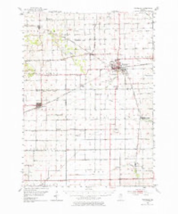
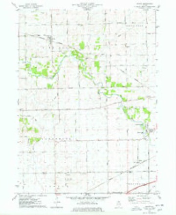
10 topographic sheets cover this place, the earliest surveyed in 1952 and the latest in 1985. It stands in Pine Rock Township. It lies in ZIP code area 61015. The Survey maps it on the Chana quadrangle. It stands 781 feet above sea level.
Topographic sheets covering this place
5 surveys from 10 printed sheetsMatched by testing this settlement's coordinate against the published boundary of every sheet in the United States Geological Survey's historical collection. Each opens the scanned sheet at the Survey.
- 1952 USGS Rochelle quadrangle1:62500, 3 printings
- 1958 USGS Aurora quadrangle1:250000, 3 printings
- 1961 USGS Aurora quadrangle1:250000
- 1975 USGS Chana quadrangle1:24000
- 1985 USGS Dixon quadrangle1:100000, 2 printings



What happened here
An account from the chapter on Pine Rock township. The inset identifies its exact source book and publication year.
Butterfiel,D Aivdbew J.
BUTTERFIELrD ElilHU, Farmer ; Sec. 19; P. O. Honey Greek; born in Troy Tp., Bradford Co., Pa. ; School Director ; came to this Co. in Oct., 1854; married Jane Lewis, who was born in Brooklyn, Susquehanna Co., Pa., Feb. 28, 1821, on May 19, 1839; have had eleven children, three of whom are dead; Mr. Butterfield furnished ihree sons to fight for the Union in the late rebellion; Charles, wounded twice, Louis, and Elihu M., who was a prisoner at Andersonville and Florence, Ala.
In the county-history sources
4,002 words on this townshipThe History of Ogle County, Illinois, Containing a History of the County, Its Cities, Towns, Etc., a Biographical Directory of Its Citizens, War Record of Its Volunteers in the Late Rebellion, General and Local Statistics ... History of the Northwest, History of Illinois ... Etc, published 1878 names this settlement in its chapter on Pine Rock Township. These are the passages that mention it, exactly as the scans read.
DEL.AIR AIKEN, Farmer; Sec. 11; P. O. Chana ; born in Cayuga Co., Province, Ontario, Canada, 1840; Republican; served as a soldier during the Rebellion in Co. M., 8th Regt. I. V. C. ; married Perla Allen Oct. 13, 1876 ; Mrs. Delair, who is a member of the Lutheran Church, was born in Erin Tp., 111., March 15, 1855; has 80 acres.
Passage source: The History of Ogle County, Illinois, Containing a History of the County, Its Cities, Towns, Etc., a Biographical Directory of Its Citizens, War Record of Its Volunteers in the Late Rebellion, General and Local Statistics ... History of the Northwest, History of Illinois ... Etc, published 1878.
TBASK IISAAC, Farmer; Sec. 17; P. O. Chana; Republican; Captain Trask, who was Town Clerk and Supervisor for a number of years, was born in Gloucester, Mass., Sept. 13, 1804; when 13 years old he went to sea as a sailor before the mast; at 21 he was commander of a vessel in the East India trade out of Baltimore, and made several voyages to that and other foreign countries; married Isabel Rutter May 20, 1833 ; Mrs. Trask was born May 20, 1805, in Baltimore ; Captain Trask came to this Co. in 1837, and two years after brought out his wife and family; have had six children: Israel, born in Baltimore Feb. 22, 1834 ; Margaret R, born in Baltimore May 7, 1836 ; Somes, Dorn m Ogle Co., Aug. 26, 1840, died Oct. 12, 1840; Edward Olwyn, born in Ogle Co. April 10, 1841 ; Ann S., born in Ogle Co. May 21, 1844; Sarah Pue, born in Ogle Co. Jan. 12, 1847; owns 309 acres valued at $65 per acre.
Passage source: The History of Ogle County, Illinois, Containing a History of the County, Its Cities, Towns, Etc., a Biographical Directory of Its Citizens, War Record of Its Volunteers in the Late Rebellion, General and Local Statistics ... History of the Northwest, History of Illinois ... Etc, published 1878.
WEI.TY DAVID H. Grain Shipper and Stock Dealer ; Chana ; owns 220 acres farm laod, and the finest residence in Chana ; Republican ; born in Washington Co., Md., Oct. 1, lb21 ; came to this Co. in the Spring of 1844, remaining three years; he moved to Carroll Co., residing there for some time ; returning to this Co., he has lived in Marion and Pine Rock Tps. ; Mr. W. passed six years in California where he was in the quartz business ; married twice ; first wife was Leah Detrich, married Nov. 6, 1845 ; she was born July 17, 1826 ; died Feb. 6, 1861 ; second wife was Ann Adams; married Aug. 21, 1861; she was born Dec. 10, 1842 ; have had five children : Susan E., Martha H., and George L., by his first marriage; Mary E. and Sophia Belle by his second marriage.
Passage source: The History of Ogle County, Illinois, Containing a History of the County, Its Cities, Towns, Etc., a Biographical Directory of Its Citizens, War Record of Its Volunteers in the Late Rebellion, General and Local Statistics ... History of the Northwest, History of Illinois ... Etc, published 1878.
Machine-read from a century-old scan, so expect the errors a machine makes: misspelled names, dropped words, stray characters.
Read the whole chapter on Pine Rock Township - it names this place 5 more 5 times.
Fires near this place
12 since 2007Regional context, not property-specific evidence. The federal wildfire occurrence database lists 12 fires within 5 miles of Chana between 2007 and 2020, burning about 203 acres in total. None started naturally. None was recorded as arson. Distance is straight-line from the map coordinates, so a fire counted here may appear on a neighbouring settlement's page as well.
| Reported cause | Fires |
|---|---|
| Debris and open burning | 7 |
| Missing data/not specified/undetermined | 5 |
The most recent of them, most recent first, with the day each was reported and the service that recorded it.
| Date | Cause | Size | Reported by | Name on the report |
|---|---|---|---|---|
| 6 May 2007 | Missing data/not specified/undetermined | 2.5 acres | Illinois Division of Forestry Resources | not named |
| 9 April 2019 | Missing data/not specified/undetermined | 1.0 acres | Illinois Division of Forestry Resources | 19-0297 |
| 20 April 2019 | Debris and open burning | 1.0 acres | Illinois Division of Forestry Resources | 19-0317 |
| 23 March 2020 | Debris and open burning | 1.0 acres | Illinois Division of Forestry Resources | 20-0210 |
| 23 March 2020 | Debris and open burning | 5.0 acres | Illinois Division of Forestry Resources | 20-0203 |
| 20 March 2007 | Missing data/not specified/undetermined | 10 acres | Illinois Division of Forestry Resources | not named |
| 20 March 2007 | Missing data/not specified/undetermined | 7.0 acres | Illinois Division of Forestry Resources | not named |
| 19 March 2011 | Debris and open burning | under an acre | Illinois Division of Forestry Resources | PERRIVE |
Settlements close enough to share some of these fires:
Mines and quarries near this place
5 within 5 milesRegional context, not property-specific evidence. The federal mineral resources record lists 5 workings within 5 miles of Chana: 4 past producers, 1 plant. 1 still produces. What was taken out: Stone, Crushed/Broken. Distance is straight-line from the map coordinates, so a quarry counted here may appear on a neighbouring settlement's page as well.
| Where | Site | Commodity | Status | Recorded |
|---|---|---|---|---|
| Prindle Pit & Mill | Stone, Crushed/Broken | Plant | ||
| Schoonhoven Quarry | Stone, Crushed/Broken | Past Producer | ||
| Unnamed Limestone Quarry | Stone, Crushed/Broken | Past Producer | ||
| Unnamed Limestone Quarry | Stone, Crushed/Broken | Past Producer | ||
| W. Karper Quarry | Stone, Crushed/Broken | Past Producer |
Storms near this place
6 since 2004Regional context, not property-specific evidence. The National Weather Service names Chana in 6 storm reports between 2004 and 2025: 3 thunderstorm wind, 1 hail, 1 tornado, 1 flash flood. No death or injury is recorded in these reports. Each account below is quoted exactly as the forecast office filed it, from the NOAA Storm Events Database, and each date opens the federal record of that event.
| When | Event | Place named | Harm | What the report says |
|---|---|---|---|---|
| July 2025 | Flash Flood | Chana | $1,000 | Route 64 was flooded in multiple locations between Skare Road and Interstate 39 and ditches along the road were full of water. Video showed a few inches of water on Route 251 near Route 64. Multiple houses and basements were flooded in Hillcrest and on the north side of Rochelle. Fields at Rochelle Township High School were flooded. The Kyte River overflowed its banks. Approximately 35 acres of corn and soybeans were damaged or destroyed by flood waters. A private weather station near Lindenwood measured 3.20 inches of rain between 20:08 CST and 21:08 CST. |
| May 2020 | Tornado (EF1) | Chana | - | A tornado touched down near the intersection of S Rocky Hollow and E Canfield Roads. Peak winds were estimated between 90 mph and 100 mph based on damage to outbuildings and two farmsteads that were significantly damaged. There were also several trees and utility poles blown down. |
| September 2007 | Thunderstorm Wind | Chana | - | A tree was blown down. |
| October 2006 | Thunderstorm Wind | Chana | - | Tree limbs blown down east of Chana. |
| July 2004 | Thunderstorm Wind | Chana | - | Trees knocked down by strong wind gusts. |
| May 2014 | Hail | Chana | - | no account filed |
Nearest settlements
The eight closest, with where each one stands in the county. Distances are straight-line, computed from the Geographic Names Information System coordinates.
| Map | Place | Distance | Sheets |
|---|---|---|---|
| Paynes Point | 3.1 miles | 15 | |
| Honey Creek | 3.3 miles | 12 | |
| Watertown | 4.0 miles | 12 | |
| Skare Estates | 4.4 miles | 10 | |
| Hickory Ridge | 4.5 miles | 10 | |
| Frahms Country Acres | 4.7 miles | 10 | |
| Kyte Side Estates | 4.8 miles | 10 | |
| Crestwood Acres | 5.0 miles | 10 |
Elsewhere
Matched on this settlement's Geographic Names Information System number rather than its name, so it cannot be a different place of the same name in another state.
| Wikipedia article on Chana | An encyclopaedic summary. Its text is share-alike, so it is linked here rather than copied. |
| Wikidata item Q5070400 | The structured record the population and elevation above come from. Public domain (CC0). |
Provenance
This settlement is recorded in the Geographic Names Information System as feature 405944. The sheet list is computed by point-in-boundary test against the United States Geological Survey's historical topographic inventory. Both are works of the United States government and carry no copyright under 17 U.S.C. 105.
Wildfire. Short, Karen C. 2022. Spatial wildfire occurrence data for the United States, 1992-2020 [FPA_FOD_20221014]. 6th Edition. Fort Collins, CO: Forest Service Research Data Archive. https://doi.org/10.2737/RDS-2013-0009.6 Collected with United States Government funding and usable without additional permissions or fees.
Mines and quarries. USGS Mineral Resources Data System (MRDS) https://mrdata.usgs.gov/mrds/ A work of the United States government, no copyright under 17 U.S.C. 105.
Storms. NOAA National Centers for Environmental Information, Storm Events Database https://www.ncei.noaa.gov/stormevents/ A work of the United States government, no copyright under 17 U.S.C. 105. Narratives are quoted verbatim from the National Weather Service report and are not edited or summarised.