 Block
Kings, Illinois
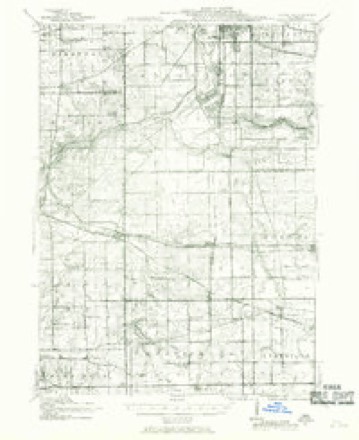
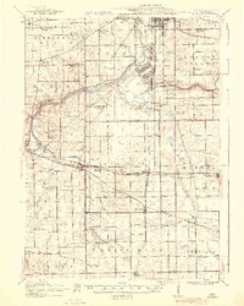
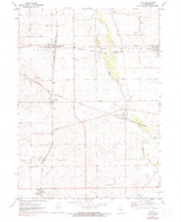
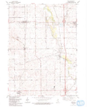
16 topographic sheets cover this place, the earliest surveyed in 1917 and the latest in 1993. It stands in White Rock Township. It lies in ZIP code area 61068. The Survey maps it on the Kings quadrangle.
Topographic sheets covering this place
9 surveys from 16 printed sheetsMatched by testing this settlement's coordinate against the published boundary of every sheet in the United States Geological Survey's historical collection. Each opens the scanned sheet at the Survey.
- 1917 USGS Kings quadrangle1:62500
- 1918 USGS Kings quadrangle1:62500, 3 printings
- 1954 USGS Rockford quadrangle1:250000
- 1955 USGS Rockford quadrangle1:250000
- 1958 USGS Rockford quadrangle1:250000, 4 printings
- 1963 USGS Rockford quadrangle1:250000
- 1971 USGS Kings quadrangle1:24000, 2 printings
- 1981 USGS Rockford quadrangle1:100000, 2 printings
- 1993 USGS Kings quadrangle1:24000





In the county-history sources
6,903 words on this townshipThe History of Ogle County, Illinois, Containing a History of the County, Its Cities, Towns, Etc., a Biographical Directory of Its Citizens, War Record of Its Volunteers in the Late Rebellion, General and Local Statistics ... History of the Northwest, History of Illinois ... Etc, published 1878 names this settlement in its chapter on White Rock Township. These are the passages that mention it, exactly as the scans read.
BAILrBY WILLI AH B. Farmer; Sec. 28; P. O. Kings: born Nov. 20, 1840, in Ottawa, Canada; came to Ogle Co. in 1860, and removed to his present farm in 1875; rents 120 acres; married Rebecca Oakes March 4, 1867; she was born April 2, 1842, and died March 29, 1874; they had four children, three now living : Mattie E., Hiram C. and Geo. O., who was an infant when his mother died, and his father gave him to Wm. H. Dresser, who adopted him; second marriage was to Mrs. Elizabeth
Passage source: The History of Ogle County, Illinois, Containing a History of the County, Its Cities, Towns, Etc., a Biographical Directory of Its Citizens, War Record of Its Volunteers in the Late Rebellion, General and Local Statistics ... History of the Northwest, History of Illinois ... Etc, published 1878.
Farmer; Sec. 28; P. O. Kings; born Feb. 13, 1838, in Warren Co., Pa. ; in 1859 went to Minn, and engaged in hunting and trapping, and on one occasion was lost and remained without food for 72 hours, the thermometer being 40 degrees below zero; came to White Rock in 1860, and worked by the month for two years ; then engaged in trading in lands till 1872, when he settled on his present farm; owns 130 acres, valued at $55 per acre; married Mary A. Mayberry Oct. 8, 1862 ; she was born Oct. 28, 1832, in Warren Co., N. J. ; had six children, five now living: Delmer M., Eva M., Hattie E., Herbert A. and Almedah A.; Nellie E. was born Aug. 11, 1869, and died Jan. 19, 1877 ; Mr. B. is a member of the White Rock Centre Congregational Church ; his wife is a member of the M. E. Church ; he has been Road Commissioner Hud School Director; is independent in politics.
Passage source: The History of Ogle County, Illinois, Containing a History of the County, Its Cities, Towns, Etc., a Biographical Directory of Its Citizens, War Record of Its Volunteers in the Late Rebellion, General and Local Statistics ... History of the Northwest, History of Illinois ... Etc, published 1878.
HAYES HIRAM, Farmer; Sec. 23; P. O. Kings; born July 23, 1822, in Licking Co., Ohio; in 1839, came with his parents to Ogle Co. and settled in Marion, and removed to his present farm in 1856 ; he owns 720 acres, valued at $50 per acre, and 480 acres in Nebraska, valued at $5 per acre; married his first wife, Margaret Campbell, Feb. 7, 1849; she was born Dec. 7, 1832, and died Jan. 13, 1850 ; had one child, Margaret M., now Mrs. Lewis ; Mrs. H. was a daughter of Mr. Campbell, who was shot by the Drlscols; he was Captain of the company which was formed to capture these outlaws, and for this reason they wished to break up the company, by shooting the captain, as in other places they had broken up companies in this way ; Mr. H. was one of the parties who took an active part in the capture and conviction of the Driscols; his second marriage was April 9, 1858, to Elizabeth Brown; she was born Dec. 7, 1837, in Licking Co., Ohio; had eleven children; seven living: Mary E., in Morris Co., N. J. ; came to Licking Co., Ohio, in 1817; went to Mississippi, Louisiana, Arkansas, etc., in 1837, and came to Ogle Co. and settled in his present locality in 1841 ; he owns 300 acres, valued at $70 per acre, and 280 acres in Cass Co., Iowa, valued at $15 per acre; married Abbie Weeks May 4, 1843; she was born Nov. 10, 1824, in Ohio, and died Oct. 29, 1865; had five children by this marriage: Henry M., born Aug. 16, 1844; Harriet E., May 13, 1846; Sarah J., Dec. 30, 1857; Gilbert M., Aug. 12, 1853, and John C. F., June 26, 1856 ; his second marriage was to Maria Caster April 18, 1867 ; she was born in 1834 in Licking Co., Ohio, and died March 8, 1870; had one child by this marriage, Elmer Grant, born May 3, 1869; third marriage to Lovisa Jane Sears March 23, 1871 ; she was born Oct. 12, 1840, in N. Y. ; had two children ; Geo. D., born Feb. 14, 1872, died Sept. 29, 1872; Ira N., born Nov. 2, 1873 ; is an Adventist ; Republican; has been Justice of the Peace, Constable and School Director ; he commenced building his present residence in 1858, and finished it in 1861; it is built of lime and sandstone, and is supposed to be fire proof; it is the only house of the kind in this Tp. ; Daniel Collins, of New York City, was the architect and builder; the stone for the construction of this residence came from Marion, Fox River, Walnut Grove and Paine's Point.
Passage source: The History of Ogle County, Illinois, Containing a History of the County, Its Cities, Towns, Etc., a Biographical Directory of Its Citizens, War Record of Its Volunteers in the Late Rebellion, General and Local Statistics ... History of the Northwest, History of Illinois ... Etc, published 1878.
Machine-read from a century-old scan, so expect the errors a machine makes: misspelled names, dropped words, stray characters.
Read the whole chapter on White Rock Township - it names this place 12 more 12 times.
Fires near this place
5 since 2010Regional context, not property-specific evidence. The federal wildfire occurrence database lists 5 fires within 5 miles of Kings between 2010 and 2020, burning about 174 acres in total. None started naturally. None was recorded as arson. Distance is straight-line from the map coordinates, so a fire counted here may appear on a neighbouring settlement's page as well.
| Reported cause | Fires |
|---|---|
| Debris and open burning | 4 |
| Missing data/not specified/undetermined | 1 |
The most recent of them, most recent first, with the day each was reported and the service that recorded it.
| Date | Cause | Size | Reported by | Name on the report |
|---|---|---|---|---|
| 23 March 2020 | Debris and open burning | 1.0 acres | Illinois Division of Forestry Resources | 20-0210 |
| 19 March 2011 | Debris and open burning | under an acre | Illinois Division of Forestry Resources | PERRIVE |
| 19 March 2010 | Debris and open burning | 3.0 acres | Illinois Division of Forestry Resources | JORDALL |
| 22 October 2010 | Missing data/not specified/undetermined | 70 acres | Illinois Division of Forestry Resources | SWEGER |
| 14 October 2010 | Debris and open burning | 100 acres | Illinois Division of Forestry Resources | SAAM |
Settlements close enough to share some of these fires:
Mines and quarries near this place
8 within 5 milesRegional context, not property-specific evidence. The federal mineral resources record lists 8 workings within 5 miles of Kings: 7 past producers, 1 plant. 1 still produces. What was taken out: Stone, Crushed/Broken. Distance is straight-line from the map coordinates, so a quarry counted here may appear on a neighbouring settlement's page as well.
| Where | Site | Commodity | Status | Recorded |
|---|---|---|---|---|
| Prindle Pit & Mill | Stone, Crushed/Broken | Plant | ||
| Schoonhoven Quarry | Stone, Crushed/Broken | Past Producer | ||
| Unnamed Limestone Quarry | Stone, Crushed/Broken | Past Producer | ||
| Unnamed Limestone Quarry | Stone, Crushed/Broken | Past Producer | ||
| Unnamed Limestone Quarry | Stone, Crushed/Broken | Past Producer | ||
| Unnamed Limestone Quarry | Stone, Crushed/Broken | Past Producer | ||
| Unnamed Limestone Quarry | Stone, Crushed/Broken | Past Producer | ||
| Unnamed Limestone Quarry | Stone, Crushed/Broken | Past Producer |
Storms near this place
6 since 2004Regional context, not property-specific evidence. The National Weather Service names Kings in 6 storm reports between 2004 and 2025: 5 thunderstorm wind, 1 hail. No death or injury is recorded in these reports. Each account below is quoted exactly as the forecast office filed it, from the NOAA Storm Events Database, and each date opens the federal record of that event.
| When | Event | Place named | Harm | What the report says |
|---|---|---|---|---|
| May 2025 | Thunderstorm Wind | Kings | - | A private weather station measured a wind gust to 60 mph. |
| August 2020 | Thunderstorm Wind | Kings | - | A large tree limb was blown down. |
| July 2007 | Thunderstorm Wind | Kings | - | A tree was blown onto Route 64 near Kings. |
| October 2006 | Thunderstorm Wind | Kings | - | Eight tree limb blown down. |
| July 2004 | Thunderstorm Wind | Kings | - | Large limbs torn off of trees. |
| May 2014 | Hail | Kings | - | no account filed |
Nearest settlements
The eight closest, with where each one stands in the county. Distances are straight-line, computed from the Geographic Names Information System coordinates.
| Map | Place | Distance | Sheets |
|---|---|---|---|
| White Rock Center | 1.2 miles | 16 | |
| White Rock | 2.7 miles | 15 | |
| Holcomb | 4.2 miles | 16 | |
| Briarwood | 4.3 miles | 11 | |
| Hillcrest | 4.3 miles | 11 | |
| Flagg Center | 4.5 miles | 11 | |
| Askvig Addition | 4.5 miles | 11 | |
| Highland Estates | 4.5 miles | 11 |
Provenance
This settlement is recorded in the Geographic Names Information System as feature 411506. The sheet list is computed by point-in-boundary test against the United States Geological Survey's historical topographic inventory. Both are works of the United States government and carry no copyright under 17 U.S.C. 105.
Wildfire. Short, Karen C. 2022. Spatial wildfire occurrence data for the United States, 1992-2020 [FPA_FOD_20221014]. 6th Edition. Fort Collins, CO: Forest Service Research Data Archive. https://doi.org/10.2737/RDS-2013-0009.6 Collected with United States Government funding and usable without additional permissions or fees.
Mines and quarries. USGS Mineral Resources Data System (MRDS) https://mrdata.usgs.gov/mrds/ A work of the United States government, no copyright under 17 U.S.C. 105.
Storms. NOAA National Centers for Environmental Information, Storm Events Database https://www.ncei.noaa.gov/stormevents/ A work of the United States government, no copyright under 17 U.S.C. 105. Narratives are quoted verbatim from the National Weather Service report and are not edited or summarised.