 Block
Channahon, Illinois
23 topographic sheets cover this place, the earliest surveyed in 1892 and the latest in 1999. It stands in Channahon Township. It lies in ZIP code area 60410. It stands on DuPage River. The Survey maps it on the Channahon quadrangle. 13,383 people lived here at the 2020 count. It stands 531 feet above sea level.
Population over time
2 figuresChannahon grew from 12,560 to 13,383 between 2010 and 2020. These are the recorded population figures Wikidata holds for this place, reached through the Geographic Names Information System number this page is keyed on rather than by name, so they belong to this place and not to another of the same name. Most are census counts, but not all are: an early figure may be a founding or settlement estimate, and an estimate published within five years of a census is left out. The change column is computed, and is left blank where more than 20 years separate a figure from the one before it, because a gap that long is not a change between two counts.
| Year | People | Change |
|---|---|---|
| 2010 | 12,560 | |
| 2020 | 13,383 | +823 (+7%) |
Topographic sheets covering this place
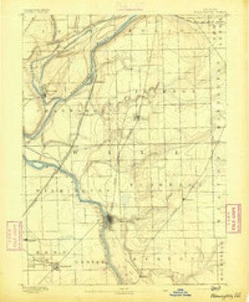
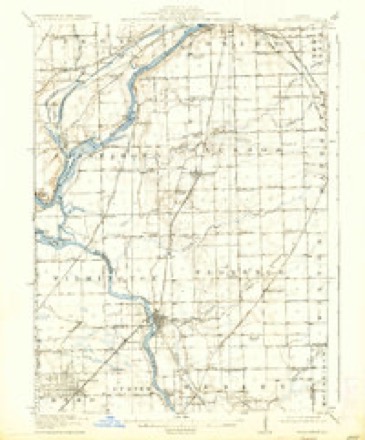
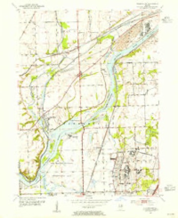
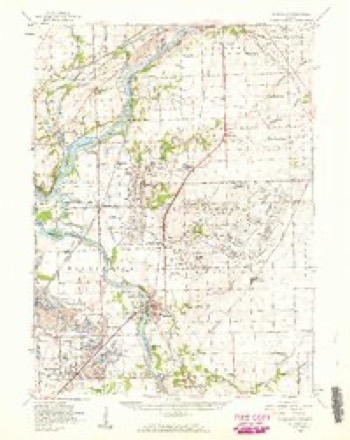
10 surveys from 23 printed sheetsMatched by testing this settlement's coordinate against the published boundary of every sheet in the United States Geological Survey's historical collection. Each opens the scanned sheet at the Survey.
- 1892 USGS Wilmington quadrangle1:62500, 3 printings
- 1918 USGS Wilmington quadrangle1:62500, 5 printings
- 1954 USGS Channahon quadrangle1:24000, 4 printings
- 1954 USGS Wilmington quadrangle1:62500, 3 printings
- 1958 USGS Aurora quadrangle1:250000, 3 printings
- 1961 USGS Aurora quadrangle1:250000
- 1985 USGS Ottawa quadrangle1:100000
- 1991 USGS Ottawa quadrangle1:100000
- 1993 USGS Channahon quadrangle1:24000
- 1999 USGS Channahon quadrangle1:24000


In the county-history sources
759 words on this townshipThe History of Will County, Illinois, Containing a History of the County ... a Directory of Its Real Estate Owners; Portraits of Early Settlers and Prominent Men; General and Local Statistics ... History of Illinois ... History of the Northwest .., published 1878 names this settlement in its chapter on Channahon Township. These are the passages that mention it, exactly as the scans read.
The village of Channahon is situated on the Illinois & Michigan Canal, and on the Du Page River, a little above its junction with the Des Planes, and has the double advantage of a most excellent water-power, and a cheap freight transportation. It was laid out by Myrvin Benjamin, in 1845, and was called Du Page, after the first post office established in the township. During the building of the Canal, it is said that the Canal Trustees had something to do with the village, in some way or other, and called it " Swifton," after one of their number ; but this story is disputed by some of the old citizens of the place, who say that its name still stands upon the records as Du Page, although the name of the present post office is Channahon, and the village is usually called by the same name. The first house erected in the village was put up by Benjamin, about the time of the laying of it out, and was used as a hotel by Mrs. Story. It is now occupied as a residence by David Billsland. Chauncey Stickney opened the first store in the village in 1845, which was the first mercantile venture in the township as well as in the village. After the laying-out of the village, Du Page post office was removed into it and the name changed to Channahon, and at present Charles Fowler is Postmaster. The following is the business summary: Four stores, by C. & C. E. Fowler, J. Lewis, Dr. Joseph Fitch, Timothy Gorman ; one grocery store ; two blacksmith-shops ; one wagon-shop and hardware store. For a small place like Channahon, there is quite an extensive business carried on, and a good trade maintained. They have the advantage of a daily mail, which is brought across the country from Minooka, a point on the Rock Island Railroad. The Channahon Mills were built by Joseph Lewis, and after passing through the hands of several parties, are now owned by a man named Sprague, and at present operated by a Mr. Eversoll. They are frame buildings, containing two runs of buhrs, for flour and feed, and run by the water power of the Canal.
Passage source: The History of Will County, Illinois, Containing a History of the County ... a Directory of Its Real Estate Owners; Portraits of Early Settlers and Prominent Men; General and Local Statistics ... History of Illinois ... History of the Northwest .., published 1878.
The Methodist Episcopal Church, located in the village of Channahon, is the only church edifice in either township or village. It was built in 1852-53, and is a large and handsome frame building. Rev. R. K. Bibbins was the Pastor last year, but the session of Conference just closed sent to the charge Rev. Mr. Gillespie. There is a membership of between eighty and ninety, with a Sunday school equally strong, under the superintendenee of Dr. J. Fitch. Although this is the only church-building in the township, religious services are frequently held in the schoolhouses, as well as Sunday schools. The first schoolhouse built in the village of Channahon was in 1839, before the village was laid out, and is now degraded by being used as a stable ; the next one was "built in 1854, and burned in 1868, when the present handsome edifice was erected and opened in 1869. It is an elegant and substantial two-story frame building, finished ofi' in the most approved modern style. The school is graded, with a high-school department, and is in charge of Prof. Layburn, assisted by Misses Brown and Blount.
Passage source: The History of Will County, Illinois, Containing a History of the County ... a Directory of Its Real Estate Owners; Portraits of Early Settlers and Prominent Men; General and Local Statistics ... History of Illinois ... History of the Northwest .., published 1878.
The Masonic Order is represented by Channahon Lodge, No. 262. It was chartered in 1857, and the present ofiicers are as follows : Albert Randall, Worshipful Master ; Nelson Bedford, Senior Warden ; R. C. Miller, Junior Warden, and C. Fowler, Secretary, with forty-five names on the roll of membership. -
Passage source: The History of Will County, Illinois, Containing a History of the County ... a Directory of Its Real Estate Owners; Portraits of Early Settlers and Prominent Men; General and Local Statistics ... History of Illinois ... History of the Northwest .., published 1878.
Machine-read from a century-old scan, so expect the errors a machine makes: misspelled names, dropped words, stray characters.
Read the whole chapter on Channahon Township - it names this place 1 more 1 time.
Fires near this place
9 since 2005Regional context, not property-specific evidence. The federal wildfire occurrence database lists 9 fires within 5 miles of Channahon between 2005 and 2019, burning about 33 acres in total. None started naturally. None was recorded as arson. Distance is straight-line from the map coordinates, so a fire counted here may appear on a neighbouring settlement's page as well.
| Reported cause | Fires |
|---|---|
| Missing data/not specified/undetermined | 4 |
| Equipment and vehicle use | 2 |
| Railroad operations and maintenance | 2 |
| Smoking | 1 |
The most recent of them, most recent first, with the day each was reported and the service that recorded it.
| Date | Cause | Size | Reported by | Name on the report |
|---|---|---|---|---|
| 25 August 2019 | Missing data/not specified/undetermined | under an acre | Illinois Division of Forestry Resources | 19-1607 |
| 7 June 2019 | Smoking | under an acre | Illinois Division of Forestry Resources | 19-1027 |
| 1 June 2019 | Missing data/not specified/undetermined | 5.0 acres | Illinois Division of Forestry Resources | 19-0976 |
| 8 April 2019 | Missing data/not specified/undetermined | under an acre | Illinois Division of Forestry Resources | 19-0639 |
| 3 April 2019 | Missing data/not specified/undetermined | under an acre | Illinois Division of Forestry Resources | 19-0604 |
| 25 April 2018 | Railroad operations and maintenance | 9.2 acres | Midewin National Tall Grass Prairie | CENTER POINT |
| 1 April 2015 | Railroad operations and maintenance | 1.0 acres | Midewin National Tall Grass Prairie | DRUMMOND |
| 1 April 2006 | Equipment and vehicle use | 15 acres | Midewin National Tall Grass Prairie | BLODGETT ROAD |
Settlements close enough to share some of these fires:
Mines and quarries near this place
9 within 5 milesRegional context, not property-specific evidence. The federal mineral resources record lists 9 workings within 5 miles of Channahon: 4 producers, 3 occurrences, 2 past producers. 4 still produce. What was taken out: Stone, Crushed/Broken, Sand and Gravel, Construction, Clay, Sand and Gravel, Construction, Stone, Crushed/Broken. Distance is straight-line from the map coordinates, so a quarry counted here may appear on a neighbouring settlement's page as well.
| Where | Site | Commodity | Status | Recorded |
|---|---|---|---|---|
| Vicks Quarry | Sand and Gravel, Construction, Stone, Crushed/Broken | Producer | ||
| Brown & Lambrecht Clay Pit | Clay | Past Producer | ||
| Morris Plant & Pit | Clay | Producer | ||
| Limestone Prospect | Stone, Crushed/Broken | Occurrence | ||
| Limestone Prospect | Stone, Crushed/Broken | Occurrence | ||
| Limestone Prospect | Stone, Crushed/Broken | Occurrence | ||
| Pit Number 1 | Sand and Gravel, Construction | Past Producer | ||
| Star Sand & Gravel | Sand and Gravel, Construction | Producer | ||
| Termar Pit No. 2 | Sand and Gravel, Construction | Producer |
Storms near this place
19 since 2000Regional context, not property-specific evidence. The National Weather Service names Channahon in 19 storm reports between 2000 and 2025: 9 thunderstorm wind, 4 hail, 2 flood, 1 flash flood. The reports record 2 injuries. Each account below is quoted exactly as the forecast office filed it, from the NOAA Storm Events Database, and each date opens the federal record of that event.
| When | Event | Place named | Harm | What the report says |
|---|---|---|---|---|
| July 2024 | Tornado (EF2) | Channahon | 2 hurt | A tornado with estimated peak winds of 130 mph which touched down in Grundy County and crossed into Will County between Lauren Drive and Old Kerry Grove Road. The tornado was likely at its maximum path width of 325 yards as it was crossing into Will County. Several trees and utility poles were blown down in this area. Some homes suffered minor roof damage just west of McKinley Woods Road. Peak wind speeds of 90 mph were estimated in this area. The tornado crossed Durkee Road and increased to its peak intensity of 130 mph as it moved across Interstate 55. In this area, two metal trusses collapsed which caused several high tension power lines to fall across Interstate 55. When these high tension lines fell, two semi trucks hit the lines and crashed into each other. Five other vehicles were involved and stuck under and between the high tension lines. Two people were injured and another person had to wait several hours before it was safe to exit their car. Interstate 55 was closed until the morning of July 18th while the high tension lines were repaired and debris was removed. Just west of Interstate 55, several parked semi trucks and trailers were overturned and an office building suffered significant roof damage. A pickup truck was flipped over and a van was blown onto its side. Significant damage to trees, utility poles and power lines also occurred in this area. The tornado continued moving northeast and produced significant tree and utility pole damage along and south of Manhattan Road, just west of Route 53, including damage to mature oak trees and several utility poles snapped along Munch Lane. Several homes in this area suffered roof damage consisting of numerous shingles removed. The tornado moved through the Ranch Oaks subdivision just west of Route 52 and south of Jackson Creek causing widespread tree and power line damage. Some trees fell onto houses, other trees fell onto cars. Significant tree damage continued as the tornado crossed Route 52. At least one house suffered structural damage when a large tree fell on it. Roof damage occurred to several large farm storage buildings as the tornado crossed Baker Road just west of Eastern Avenue. Tree damage continued along the rest of the path of the tornado in Will County with the tornado crossing Route 45 and then several trees were snapped and uprooted near the Prestwick Country Club. The tornado crossed Harlem Avenue and moved into Cook County. |
| June 2015 | Hail | Channahon | $50,000 | Numerous reports of hail came in from Channahon. Nickel size hail was reported as early as 7:22 PM CDT with the first severe report of hail arriving at 7:33 PM CDT. The largest hail stones were up to 1.75 inches. Damage to cars was reported by the emergency manager. |
| July 2006 | Lightning | Channahon | $25,000 | A house fire was started by a lightning strike on Field Drive. |
| March 2025 | Thunderstorm Wind | Channahon | - | Weather station KILMORRI23 recorded a 60 mph gust near Channahon. |
| July 2025 | Thunderstorm Wind | Channahon | - | A photo showed a snapped tree in Channahon. |
| January 2024 | Flood | Channahon | - | Ice jam flooding began during the morning of January 15th along the Kankakee River between Wilmington and the Grundy County line. Minor flooding occurred in low lying areas in Phelan Acres and the Kankakee Cutoff. By afternoon, low lying flooding began in yards along Cottage Road with one structure surrounded by water. Kelly Road and Phillips Road were impassable due to flooding. Minor flooding was reported on Blodgett Road, just east of Kelly Road. A resident was evacuated from an elevated home that became surrounded by water on Muskie Lane. ||On the morning of January 16th, a vehicle became stuck in flood waters along Cottage Road and two occupants needed to be rescued. Blodgett Road became impassable due to flooding and solid ice cover as temperatures remained bitterly cold. During the afternoon, multiple houses were surrounded by water on Readman Lane. River Road became impassable due to flooding north of Interstate 55 and the entrance road to the Kankakee Conservation Area from North River Road became impassable due to flooding. ||On the morning of January 17th, the ice jam reached the Wilmington Dam. Roads in Island Park became impassable due to flooding. Multiple homes remained surrounded by water on Readman Lane. Little change to the flooding occurred for nearly a week as temperatures remained bitterly cold. ||As temperatures began to warm the following week combined with melting snow and heavy rain, the ice began to move and shift, resulting in new flooding. Multiple cars and structures were surrounded by water and ice near Kelly Road and Phillips Road on the morning of January 24th. Eventually the ice jam broke and caused flash flooding late on January 25th into the 26th. The river gauge on the Kankakee River near Wilmington was reading near or above major flood stage until the ice jam broke. |
| September 2021 | Thunderstorm Wind | Channahon | - | Widespread tree damage occurred across much of Channahon. Some trees were uprooted. A dozen or more trees fell onto structures and houses causing roof damage. Siding damage was reported to two houses. The worst damage appeared to be near the DuPage River, southwest of the junior high school. The damage was consistent with wind gusts to around 85 mph. |
| July 2020 | Thunderstorm Wind | Channahon | - | Multiple tree limbs up to 6 inches in diameter were blown down. |
| April 2011 | Hail | Channahon | - | Quarter size hail was reported covering the ground just north of Channahon on Minooka Road. |
| August 2008 | Thunderstorm Wind | Channahon | - | A huge willow tree was completely uprooted, with roots standing 10 to 15 feet into the air. |
| August 2007 | Heavy Rain | Channahon | - | Measured 24 hour rainfall was 5.24 inches. |
| September 2006 | Flood | Channahon | - | Heavy rain caused flooding of several roads and basements across western and central sections of Will County. Interstate 55 was closed near Blodgett Road due to flooding. The Joliet Brandon Road Dam reported 2.26 inches of rain. |
| May 2004 | Flash Flood | Channahon | - | A park was under water. |
| April 2015 | Hail | Channahon | - | no account filed |
| June 2013 | Hail | Channahon | - | no account filed |
| August 2010 | Thunderstorm Wind | Channahon | - | no account filed |
| July 2003 | Thunderstorm Wind | Channahon | - | no account filed |
| August 2003 | Thunderstorm Wind | Channahon | - | no account filed |
| May 2000 | Thunderstorm Wind | Channahon | - | no account filed |
Nearest settlements
The eight closest, with where each one stands in the county. Distances are straight-line, computed from the Geographic Names Information System coordinates.
| Map | Place | Distance | Sheets |
|---|---|---|---|
| Drummond | 3.2 miles | 23 | |
| Millsdale | 3.4 miles | 23 | |
| Birds | 3.6 miles | 23 | |
| Oak Lane | 3.8 miles | 23 | |
| Blodgett | 4.1 miles | 23 | |
| Lake of the Woods | 4.3 miles | 23 | |
| Rock Run Park | 4.4 miles | 23 | |
| River Oaks West | 5.1 miles | 23 |
Elsewhere
Matched on this settlement's Geographic Names Information System number rather than its name, so it cannot be a different place of the same name in another state.
| Wikipedia article on Channahon | An encyclopaedic summary. Its text is share-alike, so it is linked here rather than copied. |
| Wikidata item Q2672298 | The structured record the population and elevation above come from. Public domain (CC0). |
Provenance
This settlement is recorded in the Geographic Names Information System as feature 405955. The sheet list is computed by point-in-boundary test against the United States Geological Survey's historical topographic inventory. Both are works of the United States government and carry no copyright under 17 U.S.C. 105.
Wildfire. Short, Karen C. 2022. Spatial wildfire occurrence data for the United States, 1992-2020 [FPA_FOD_20221014]. 6th Edition. Fort Collins, CO: Forest Service Research Data Archive. https://doi.org/10.2737/RDS-2013-0009.6 Collected with United States Government funding and usable without additional permissions or fees.
Mines and quarries. USGS Mineral Resources Data System (MRDS) https://mrdata.usgs.gov/mrds/ A work of the United States government, no copyright under 17 U.S.C. 105.
Storms. NOAA National Centers for Environmental Information, Storm Events Database https://www.ncei.noaa.gov/stormevents/ A work of the United States government, no copyright under 17 U.S.C. 105. Narratives are quoted verbatim from the National Weather Service report and are not edited or summarised.