Block
From the record
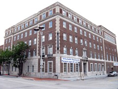
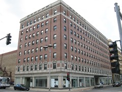
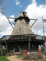
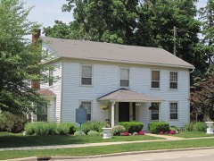
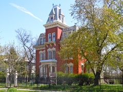
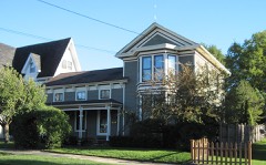
38 National Register listings published here, 1 of them a National Historic Landmark.
Sources: the county history on the Internet Archive · the National Register database, National Park Service
178 topographic sheets cover 336 settlements here, and 38 properties are on the National Register of Historic Places.
38 National Register listings published here, 1 of them a National Historic Landmark.
Sources: the county history on the Internet Archive · the National Register database, National Park Service
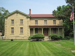
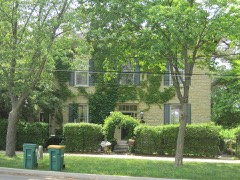
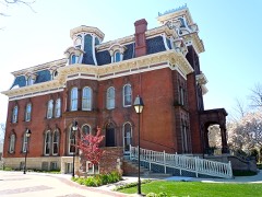
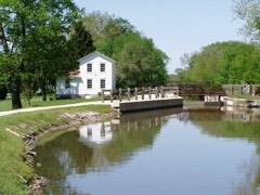
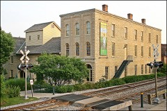
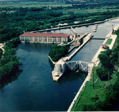
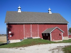
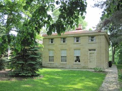
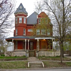
Every property in this county listed on the National Register of Historic Places, with the year it was listed and the federal nomination document.
Every wildfire the federal occurrence database records inside this county: 67 of them, burning about 557 acres. 1 started naturally and 8 were recorded as arson. Each settlement page carries the fires within five miles of it.
| Reported cause | Fires |
|---|---|
| Missing data/not specified/undetermined | 27 |
| Equipment and vehicle use | 12 |
| Arson/incendiarism | 8 |
| Debris and open burning | 7 |
| Railroad operations and maintenance | 5 |
| Smoking | 5 |
| Power generation/transmission/distribution | 2 |
| Natural | 1 |
The five largest, by the area the report gives. None of them was recorded as arson.
| Date | Cause | Size | Reported by | Name on the report |
|---|---|---|---|---|
| 14 April 2003 | Debris and open burning | 232 acres | Midewin National Tall Grass Prairie | GRANT CREEK |
| 27 March 2009 | Missing data/not specified/undetermined | 70 acres | Illinois Division of Forestry Resources | BRACE7 |
| 1 April 2016 | Natural | 67 acres | Midewin National Tall Grass Prairie | CATTAIL |
| 30 March 2005 | Missing data/not specified/undetermined | 50 acres | Midewin National Tall Grass Prairie | LORENZO FIRE |
| 20 March 2018 | Railroad operations and maintenance | 25 acres | Midewin National Tall Grass Prairie | DRUMMOND |
| 10 April 2009 | Missing data/not specified/undetermined | 22 acres | Midewin National Tall Grass Prairie | TRACT 53 |
| 1 April 2006 | Equipment and vehicle use | 15 acres | Midewin National Tall Grass Prairie | BLODGETT ROAD |
| 25 April 2018 | Railroad operations and maintenance | 9.2 acres | Midewin National Tall Grass Prairie | CENTER POINT |
Every settlement page carries the fires within five miles of it - see the settlement index below.
The NOAA Storm Events Database holds 1,251 reports for this county, causing 38 deaths, 499 injuries and about $378,346,560 in recorded property damage. Each settlement page carries the reports that name it.
| Kind of event | Reports |
|---|---|
| Thunderstorm Wind | 564 |
| Hail | 359 |
| Tornado | 98 |
| Flood | 88 |
| Flash Flood | 65 |
| Lightning | 41 |
| Heavy Rain | 22 |
| Funnel Cloud | 13 |
| Wildfire | 1 |
The most serious of them, by death, then injury, then recorded damage. The accounts are quoted exactly as the forecast office filed them.
| When | Event | Place named | Harm | What the report says |
|---|---|---|---|---|
| August 1990 | Tornado (F5) | not stated | 29 killed, 350 hurt, $250,000,000 | no account filed |
| November 1965 | Tornado (F2) | not stated | 2 killed, 90 hurt, $25,000,000 | no account filed |
| July 1996 | Flash Flood | Countywide | 2 killed | no account filed |
| April 1972 | Tornado (F2) | not stated | 1 killed, 22 hurt, $250,000 | no account filed |
| April 1984 | Tornado (F3) | not stated | 1 killed, 5 hurt, $2,500,000 | no account filed |
| July 2016 | Lightning | Bolingbrook | 1 killed, 1 hurt | Woman struck by lightning while walking in the 300 block of Janes Avenue. |
| June 1978 | Tornado (F1) | not stated | 1 killed, $250,000 | no account filed |
| September 2018 | Lightning | Barbers Corners | 1 killed | A man was struck by lightning in Whalon Lake Forest Preserve and died a few days later. |
| June 2008 | Tornado (EF2) | Monee | 6 hurt, $5,500,000 | A tornado developed near Ridgeland Avenue and Dralle Road, where a high tension metal truss tower collapsed and four others were damaged. Power lines blocked Interstate 57. The tornado destroyed a mobile home and outbuildings east of Ridgeland between Dralle and Stuenkel Roads before crossing Interstate 57. The tornado was rated EF2 in this area. Six people were injured in vehicles on Interstate 57. Several cars were damaged and a semi trailer was completely destroyed. East of Interstate 57 at Stuenkel Road, a large warehouse had bay doors blown in, much of the roof collapsed, and the west wall blown in. Utility poles were pushed over along South Central Avenue. |
| April 1961 | Tornado (F3) | not stated | 4 hurt, $2,500,000 | no account filed |
| May 1988 | Tornado (F1) | not stated | 3 hurt, $250,000 | no account filed |
| October 2010 | Tornado (EF2) | Peotone | 2 hurt, $500,000 | A tornado touched down about 4 miles east of Peotone. The tornado produced its most intense damage along South Will Center Road, about halfway between Corning Road and Peotone-Beacher Road, removing a house's roof, collapsing exterior walls on the second floor of the house, and completely destroying a garage and three other outbuildings. Two teenage boys were injured in the house. Four power poles were also downed just northeast of the area along Peotone-Beecher Road. Additional EF1 and EF0 damage was found along a path running southwest toward Kennedy Road. This damage consisted of collapsed outbuildings, snapped cedar trees, and damage to homes. One home on Corning Road was pushed off its foundation and the chimney collapsed. |
| August 1993 | Thunderstorm Wind | Crest Hill Joliet | 2 hurt, $500,000 | A thunderstorm produced widespread downburst wind damage in Crest Hill and Joliet. Measured wind gusts to 82 mph were recorded on the West side of Joliet. A survey of the damage in Crest Hill found a narrow concentrated path through a corn field where the corn was flattened and lying at an angle to the path. This was likely a small tornado or gustnado that touched down briefly. There was also an apartment garage destroyed at this point. South and southeast of this area was widespread damage to trees, fences and homes. There was severe roof damage to a church. A tent collapsed at an outdoor festival injuring two people. |
| July 2024 | Tornado (EF2) | Channahon | 2 hurt | A tornado with estimated peak winds of 130 mph which touched down in Grundy County and crossed into Will County between Lauren Drive and Old Kerry Grove Road. The tornado was likely at its maximum path width of 325 yards as it was crossing into Will County. Several trees and utility poles were blown down in this area. Some homes suffered minor roof damage just west of McKinley Woods Road. Peak wind speeds of 90 mph were estimated in this area. The tornado crossed Durkee Road and increased to its peak intensity of 130 mph as it moved across Interstate 55. In this area, two metal trusses collapsed which caused several high tension power lines to fall across Interstate 55. When these high tension lines fell, two semi trucks hit the lines and crashed into each other. Five other vehicles were involved and stuck under and between the high tension lines. Two people were injured and another person had to wait several hours before it was safe to exit their car. Interstate 55 was closed until the morning of July 18th while the high tension lines were repaired and debris was removed. Just west of Interstate 55, several parked semi trucks and trailers were overturned and an office building suffered significant roof damage. A pickup truck was flipped over and a van was blown onto its side. Significant damage to trees, utility poles and power lines also occurred in this area. The tornado continued moving northeast and produced significant tree and utility pole damage along and south of Manhattan Road, just west of Route 53, including damage to mature oak trees and several utility poles snapped along Munch Lane. Several homes in this area suffered roof damage consisting of numerous shingles removed. The tornado moved through the Ranch Oaks subdivision just west of Route 52 and south of Jackson Creek causing widespread tree and power line damage. Some trees fell onto houses, other trees fell onto cars. Significant tree damage continued as the tornado crossed Route 52. At least one house suffered structural damage when a large tree fell on it. Roof damage occurred to several large farm storage buildings as the tornado crossed Baker Road just west of Eastern Avenue. Tree damage continued along the rest of the path of the tornado in Will County with the tornado crossing Route 45 and then several trees were snapped and uprooted near the Prestwick Country Club. The tornado crossed Harlem Avenue and moved into Cook County. |
| July 2024 | Tornado (EF1) | Minooka | 2 hurt | A tornado with estimated peak winds of 110 mph which touched down in Kendall County crossed into Will County just south of Mound Road. It quickly crossed Mound Road where it produced damage to numerous trees and outbuildings. The tornado continued to produce tree damage in Shorewood, including snapped trees. It crossed the Fox River and caused a partial roof collapse to a home on Canterbury Street. Two people inside the house were injured. The tornado continued moving northeast, crossing Interstate 55 and snapping trees in a forest preserve south of the Joliet Regional Airport. Several trees were uprooted in a subdivision near McDonough Street and Houbolt Road. Damage to corn crops also occurred in this area. The tornado continued moving northeast across the Inwood Golf Course. Over 100 trees were damaged, some snapped, others uprooted. Some of the trees that were damaged were 70 years old. The tornado crossed the intersection of Route 52 and Larkin Avenue. Significant tree damage, power line damage and utility pole damage occurred in this area. Numerous roofs were also damaged including a church on Midland Avenue just north of Route 52. The tornado was likely at peak intensity as it moved through the golf course to areas east of Larkin Avenue. The tornado continued producing tree damage as it moved northeast and crossed the Des Plaines River. After crossing the river, the tornado began to weaken producing sporadic tree damage until it ended near the intersection of Route 6 and Briggs Street. |
| July 1997 | Tornado (F1) | Mokena | 2 hurt | A tornado was observed along a 2-mile path in a northwest to southeast track from about I-80 at 104th Avenue across 191st Street, across Rt 45 into the Arbury Hills Subdivision east of Mokena. The greatest damage occurred on I-80; where a semi was blown off the road and two people were injured in the truck. Just south of I-80, a horse barn was destroyed and another lifted off of the ground. Extensive damage was observed at an RV dealership on 191st street where a 7000 lb. trailer was lifted off of the ground and piled atop two other trailers. Also, along one block of Catalpa Street in the Arbury Hill Subdivision where two houses sustained enough roof damage to be declared unhabitable. There was also extensive tree damage in the subdivision. |
| May 1988 | Tornado (F1) | not stated | 1 hurt, $250,000 | no account filed |
| June 1979 | Tornado | not stated | 1 hurt, $25,000 | no account filed |
| May 2007 | Thunderstorm Wind | Peotone | 1 hurt, $10,000 | A semi truck was blown over on Interstate 57, one mile north of Will-Peotone Road. The driver was taken to a hospital with minor injuries. Trees and tree limbs were blown down in Peotone. |
| July 2016 | Lightning | Bolingbrook | 1 hurt | Woman struck by lightning in the 300 block of Janes Ave. |
| June 2012 | Thunderstorm Wind | Joliet Wilhem Fld Ar | 1 hurt | A man was injured at Route 66 Raceway when an inflated oil can that was used for advertising blew into the man and knocked him into a wall. He suffered a broken leg and shoulder. |
| March 2004 | Lightning | Joliet | 1 hurt | Person struck by lightning at Salma and Lasser Rds |
| June 2002 | Lightning | Joliet | 1 hurt | no account filed |
| April 1988 | Thunderstorm Wind | not stated | 1 hurt | no account filed |
| March 1991 | Tornado (F3) | not stated | $25,000,000 | no account filed |
| March 1991 | Tornado (F3) | not stated | $25,000,000 | no account filed |
| July 2003 | Flash Flood | North Central Portion | $14,000,000 | no account filed |
| April 2004 | Tornado (F1) | Joliet | $5,000,000 | The tornado swept out a path through a mainly residential section on the near west side of Joliet known as the "Cathedral Area". Initial damage was found near the intersection of Jefferson St. (U.S. route 52) and William Street. The damage path then continued northeastward to a point near the intersections of Ruby Street, Bluff Street, and the Des Plaines River. Most of the damage was of F-0 intensity, with extensive tree damage and very minor damage to structures. However there were three pockets of more substantial primary structural damage which consisted mainly of roofs being torn off residences and garages being totally demolished. In all, 10 residences were declared uninhabitable. |
| July 2006 | Flash Flood | Joliet | $3,000,000 | Major flooding affected the city of Joliet during the afternoon and evening hours of July 27th. Torrential Rains fell across parts of the city with 5.50 inches falling in just 90 minutes between 4 pm and 530 pm near Black Road and Infantry Drive. Storm total rainfall of 6.13 inches was reported on the west side of Joliet. Approximately 30 homes and businesses suffered basement flooding. Center Street Ramps to Interstate 80 were closed with four feet of standing water. Cars were stranded in 4 to 5 feet of water under the viaduct on Route 30 east of Briggs Street. Pavement buckled under the force of the flood waters at Western and Cass Avenues. Raynor and Ingallis were closed with 12 to 16 inches of water. The intersection of Larkin and Jefferson closed with 2 to 3 feet of water. Springfield and Glenwood Streets had 10 to 12 inches of water. Numerous other locations reported less significant flooding. |
| November 2013 | Tornado (EF2) | Braidwood | $2,000,000 | This is a continuation of a tornado that began at 12:22 PM CST in Grundy County. The tornado moved into Will County on N Will Road just south of State Route 113. There was considerable damage to businesses on State Route 113 between N Will Road and I-55. An RV dealership had numerous vehicles overturned and damaged. A two story structure lost its roof and had portions of its walls ripped off. A model home was completely removed from its foundation on the north side of State Route 113. A manufactured building had its roof ripped off with all the walls collapsed. Widespread tree damage was observed along the west side of I-55 where the tornado almost tracked parallel to as it weakened. The tornado crossed I-55 near Widows Road where several hardwood trees were uprooted. The tornado tracked into the Midewin Tallgrass Prairie where it damaged several metal structures just west of Route 53. The tornado lifted just east of Route 53. Maximum wind speeds were estimated to be up to 125 mph. |
| August 2025 | Flash Flood | Romeoville | $1,000,000 | Significant flooding was reported around parts of northern Will County, namely in the vicinities of Joliet, Romeoville, and Plainfield. In Joliet, Caton Farm Rd was closed at Joe Adler Dr, and IL Rt. 53 was closed at a viaduct south of Caton Farm Rd due to flooding. A car was reported stranded in floodwater near Center St north of I-80 in Joliet. In Crest Hill, street flooding was reported at IL Rt. 53 and Theodore St. Standing water was reported at IL-126 and County Line Rd in Plainfield. An estimated 250 structures were flooded in this area amounting to around $1 million in flood damages. |
| August 2025 | Flash Flood | Marley | $1,000,000 | Numerous reports of street flooding came out of the east side of Mokena, south of I-80. Near the Hickory Creek train station, at least 6 inches of water were flooding a viaduct. Up to 3 feet of water were reported on a roadway near Hercht Park. A nearby private weather station recorded 3.62 inches of rain from approximately 6 to 9 PM CST. Reports show flooding began in the area following an initial push of heavy rain during the 6PM CST hour, with additional flooding following subsequent storms through the evening. An estimated 200 structures were flooded around the Mokena, Frankfort, and Crete areas totaling around $1 million in flood damages. |
| August 2010 | Flash Flood | Birds | $1,000,000 | Significant and widespread flooding occurred across north central Will County during the morning hours of August 3rd. Numerous roads were flooded and closed. Route 53 at Murphy had 6 to 8 inches of rapidly moving flood water; several cars were stuck in flood waters at Theodore and Larkin, which was impassible; five cars were stalled in flood waters on Route 53 north of Romeo Road; Route 30 was flooded and closed between Cherry Hill and Briggs Street; Interstate 80 was flooded and closed in both directions at Briggs Street and Cherry Hill; Route 53 near Lewis Unversity was flooded and closed; numerous streets in Crest Hill were flooded, including Larkin Avenue, Route 53, Gaylord and Theodore; and the Route 53 Alcan overpass. Flooding was also reported on Hammes, Oneida and Madison Streets near St. Joesph Hospital in Joliet. The Dupage River flooded parts of Caton Farm and Lily Cache Roads. Numerous basements were also flooded. Storm total rainfall amounts included 4.44 inches in Joliet; 3.92 inches near Larkin and Theodore in Joliet; 3.09 inches in Crest Hill; 2.78 inches two miles southeast of New Lenox and 2.78 inches at the National Weather Service office in Romeoville. |
| September 2008 | Flash Flood | Wolfs | $1,000,000 | Flash flooding or significant flooding was reported across most of western Will County, including street closures due to flooding, basement flooding and creek, stream and river flooding. Extensive flooding was reported at Royce Road which was closed just west of Route 53 due to flooding from the East Branch of the Dupage River. Weber Road was closed between Royce Road and Boughton Roads due to extensive flooding from the Dupage River. Many roads were closed due to flooding in the southern part of Naperville. Flooding was reported along the Dupage River in Plainfield. Two vehicles were submerged along Plainfield Naperville Road in Plainfield. |
| June 2013 | Thunderstorm Wind | Crystal Lawns | $800,000 | Hundreds of trees were blown down across Joliet, including some that fell onto structures. Nineteen power lines were blown down. There were 56 road closures across town due to debris. |
| November 2013 | Tornado (EF2) | Wilton | $750,000 | The tornado touched down south of W Bruns Road and east of S Kankakee Street. This tornado quickly intensified to EF-2 damaging five houses along Bruns Road rendering them uninhabitable by removing large sections of the roofs and leading to partial wall collapse. Four high tension power line towers were bent along S Schoolhouse Road. Two houses and a barn were heavily damaged on W Dralle Road where large portions of the roofs were ripped off. Several trees were snapped and uprooted as well. Another farm on S Scheer Road had roof damage consistent to EF-1 intensity. The last sign of damage occurred just south of Steger Road where large branches were blown down. Maximum winds were estimated to around 125 mph. |
| June 2014 | Tornado (EF1) | Walker | $500,000 | A tornado caused damage to trees and residences between Plainfield and Romeoville. Over 50 trees, including many large softwood trees, were uprooted within a concentrated path. A dozen modest to large trees were blown to the northwest against the eastward path of the storm. Numerous roads were blocked due to fallen trees. There was minor damage to numerous residences in the Woodlands of the Reserve and Lakewood Falls subdivisions. This damage was mainly siding and shingles peeled off along with windows blown out. The tornado crossed I-55 near mile marker 261. The tornado was embedded within a larger area of straight line wind damage. Maximum winds were estimated to 95 mph. |
| June 2008 | Tornado (EF2) | Andres | $500,000 | A tornado touched down along Paulding Road just west of Center Road, south of the Green Garden Country Club. A garage was leveled and a house had part of its roof torn off and damage to the second story exterior walls. At the southwest corner of Bruns and 88th Avenue, barns and trees were damaged. The tornado continued along Bruns Road between 80th and 88th Avenues. On the south side of Bruns Road, a barn and an outbuilding were completely destroyed. The house lost a large section of the southeast wall on the second floor. Another house was heavily damaged with siding and a west wall blown off. North of Bruns Road, there was a barn that was practically destroyed with only a partial wall standing. A horse barn was destroyed with the stables intact and horses still standing in them. In the backyard of the next home, there were trees blown down and debris, such as trailers and a small rowboat were blown into the creek immediately north of Bruns Road. A chain link fence was pulled from the ground. Many trees were uprooted and blown over. Power lines were also blown down. The next house had damage to two garages. The doors were blown out of both garages and the roof of one garage was severely damaged. The house had siding and roof shingles blown off. A house at the east end of this section on Bruns Road, closest to 80th Avenue, had siding blown off and chimney damage. The tornado ended southwest of the intersection of Harlem Avenue and Manhattan-Monee Road, where there was minor tree damage. |
| June 2008 | Tornado (EF2) | Godley | $500,000 | A tornado touched down in far northwest Kankakee County then crossed County Line Road into Will County north of Essex. Tree tops were sheared off at Essex and Cooper Roads. A clear path could be seen in the trees at McGuire Road. At Route 113 and Smiley Road near Custer Park, trees were snapped and uprooted. Across the Kankakee River, a two story house had its roof completely removed and there was extensive tree damage. The tornado reached EF2 intensity at this point. The tornado continued across Route 102 near Ritchie where trees were damaged. The tornado crossed old Chicago Road near Kahler Road where power lines were blown down, a shed and barn were damaged and there was minor damage to a house. Another shed was destroyed. The tornado weakened as it moved from Symerton and Kennedy Roads to Warner Bridge and Arsenal Roads. There was no damage except to one tree. There was minor damage to a barn and tree limbs north of Arsenal Road before the tornado dissipated. |
| September 2008 | Flash Flood | Franklin Square | $500,000 | Flash flooding or significant flooding was reported across many parts of eastern and central Will County, including street closures due to flooding, basement flooding and creek, stream and river flooding. North Peotone Road had 8 to 12 inches of water just west of Harlem Avenue. |
| August 2008 | Tornado (EF1) | Plainfield Clow Arpt | $500,000 | A tornado developed about one half mile east of Plainfield Naperville Road and about one block south of Boughton Road. There was a narrow path of more intense damage in a subdivision where several homes had sections of roofing torn off, siding and soffits torn loose, trees snapped and limbs blown down. The most intense damage was on Sparrow Lane, Maroon Bell Lane and Silverado Street. The tornado was rated EF1 at this point. Here one house was likely a total loss due to structural damage to the roof, covered porch, garage and one wall. A garage was destroyed at another home. The tornado weakened to EF0 east of this area from Kings Road to Indian Chase Meadows. There was sporadic damage to trees and limbs and a few homes had damage to shingles, siding and soffits. A small section of roof was removed from a house just east of Indian Chase Meadows. At this point, the tornado appears to have dissipated, but strong straight line winds fanned out. |
| August 1993 | Tornado (F2) | New Lennox | $500,000 | A tornado touched down briefly in a New Lenox subdivision. On house was nearly destroyed. The roof was torn off and there was severe damage to one wall. Another home sustained minor damage and trees were damaged. |
| August 2003 | Flash Flood | North Central Portion | $500,000 | no account filed |
| May 2011 | Lightning | Wolfs | $300,000 | Lightning struck a house on Scottsdale Circle which ignited the second floor roof. The house was deemed uninhabitable. |
| May 2011 | Lightning | Beecher | $300,000 | A house near the intersection of South Ashland Avenue and Peotone-Beecher Road caught on fire after being struck by lightning. The roof and second story were completely destroyed by the fire and the first floor was destroyed by water damage. |
| August 2025 | Flash Flood | New Lenox | $250,000 | Numerous reports of street, yard, and basement flooding came out of the Joliet, Crest Hill, Lockport, and Homer Glen areas. In Homer Glen, a video shared via social media showed 1 to 2 feet of standing water on a residential street southwest of 167th St and Cedar Rd. Around 50 flooded structures were estimated amounting to roughly $250,000 in damages. |
| January 2024 | Flash Flood | Lorenzo | $250,000 | The combination of warming temperatures, melting snow and heavy rain caused an ice jam to break along the Kankakee River between Wilmington and the Grundy County line during the late evening of January 25th resulting in flash flooding along portions of the river through the late evening of January 26th. ||Roads and structures were flooded in Wilmington during the late evening of January 25th and by early morning of the 26th, a hotel and an apartment complex were evcauated. A roadway was damaged in South Island Park. Yards were flooded along Towpath Lane. Route 53 was closed and water reached the bottom of the Route 53 bridge over the Kankakee River. Ice piled up against a guardrail and water reached the shoulder of Widows Road near the water treatment plant. By midday, water was reported on Widows Road and surrounded two homes, one of the homes was flooded with 3 to 4 feet of water. Eventually 3 to 4 feet of water reached the pump house and wells at the water treatment plant. Flooding was reported on Ballou Road from Forked Creek.||Later in the evening of the 26th, River Road south of Interstate 55 was flooded and impassable. Only a few hours later, the water receded and ice and debris removal began on River Road. Flooding continued to recede during the evening of the 26th though ice chunks, some significant in size, littered areas along and near the Kankakee River. |
| June 2015 | Tornado (EF2) | Braidwood | $250,000 | This is a continuation of a tornado that begin in Grundy County. The tornado crossed into Will County near E Reed Road. The tornado crossed part of the property of the Braidwood Nuclear Generating Station producing tree damage. Wooden power poles were broken along Route 53, and again along Zilm Road. A garage was nearly completely destroyed along Ohlhues Road. (Tornado 8b of 10). |
| May 2014 | Thunderstorm Wind | (Jot) Joliet Distric | $250,000 | Severe winds tore off portions of the roof at a Best Budget Inn on West Jefferson Street. |
| June 2014 | Thunderstorm Wind | Romeoville | $250,000 | An NWS Storm Survey confirmed scattered straight-line wind damage across Romeoville consistent with 70 to 90 mph winds. Large tree limbs were blown down and an evergreen tree was snapped at its base along Marquette Drive and Enterprise Drive. A large metal street light was broken at its base and leaning on power lines near Romeo Road and Route 53. Multiple trees were blown down west of Route 53 partially blocking Belmont Drive. Power lines were down at Romeo Road and Macon Avenue. A tree was blown down blocking Homer Avenue. Portions of Route 53 were closed due to power lines down across the road north of Normantown Road. Minor roof damage occurred across the area. |
| October 2006 | Thunderstorm Wind | Crest Hill | $250,000 | Numerous trees and tree limbs were blown down on west side of Crest Hill and the north and northwest side of Joliet. Several garage doors damaged by wind. One garage door blown in causing damage to the structure. A fence was also blown down. |
| May 1988 | Tornado (F1) | not stated | $250,000 | no account filed |
| June 1984 | Tornado (F1) | not stated | $250,000 | no account filed |
| June 1984 | Tornado (F0) | not stated | $250,000 | no account filed |
| April 1982 | Tornado (F0) | not stated | $250,000 | no account filed |
| April 1972 | Tornado (F1) | not stated | $250,000 | no account filed |
| April 1972 | Tornado (F2) | not stated | $250,000 | no account filed |
| June 1969 | Tornado (F1) | not stated | $250,000 | no account filed |
| July 1960 | Tornado (F1) | not stated | $250,000 | no account filed |
| August 2011 | Lightning | New Lenox Howell Arp | $200,000 | A lightning strike destroyed the roof and chimney of a two story home on the 22500 block of Home Court. |
The Survey's mineral resources record lists 58 workings inside this county. 21 still produce and 37 are closed or unrecorded. Each settlement page carries the workings within five miles of it.
| Commodity | Workings |
|---|---|
| Stone, Crushed/Broken | 38 |
| Sand and Gravel, Construction | 12 |
| Sulfur | 3 |
| Phosphorus-Phosphates | 2 |
| Clay | 1 |
| Sand and Gravel, Construction, Stone, Crushed/Broken | 1 |
| Magnesite | 1 |
The least common of them first, because a county's hundredth gravel pit says nothing its first ten did not.
| Where | Site | Commodity | Status | Recorded |
|---|---|---|---|---|
| Brown & Lambrecht Clay Pit | Clay | Past Producer | ||
| U S Refactories Div. Mill | Magnesite | Producer | ||
| Vicks Quarry | Sand and Gravel, Construction, Stone, Crushed/Broken | Producer | ||
| Joliet Phos-Acid Plant | Phosphorus-Phosphates | Plant | ||
| Joliet Phosphoric Acid Plant | Phosphorus-Phosphates | Past Producer | ||
| (Facility) Mobil Oil Joilet Refinery | Sulfur | Plant | ||
| (Facility) Union 76 Chicago Refinery | Sulfur | Plant | ||
| Texaco Lockport Plant | Sulfur | Producer | ||
| Bohac Sand Pit | Sand and Gravel, Construction | Producer | ||
| Charles & Son Sand Pit | Sand and Gravel, Construction | Past Producer | ||
| Fatlan Sand Pit | Sand and Gravel, Construction | Producer | ||
| Lemont Pit | Sand and Gravel, Construction | Past Producer | ||
| Lockport Pit/Yard 15 | Sand and Gravel, Construction | Past Producer | ||
| Patterson Pit | Sand and Gravel, Construction | Past Producer | ||
| Pit Number 1 | Sand and Gravel, Construction | Past Producer | ||
| Plainfield Pit | Sand and Gravel, Construction | Producer | ||
| Plainfield Plant & Mine | Sand and Gravel, Construction | Plant | ||
| Star Sand & Gravel | Sand and Gravel, Construction | Producer | ||
| Termar Pit No. 2 | Sand and Gravel, Construction | Producer | ||
| Yackley Pit | Sand and Gravel, Construction | Past Producer | ||
| Avery No. 2 Pit & Mill | Stone, Crushed/Broken | Plant | ||
| Avery No. 3 Pit & Mill | Stone, Crushed/Broken | Producer | ||
| Barbers Corners Plant | Stone, Crushed/Broken | Plant | ||
| Barbers Corners Quarry & Mill | Stone, Crushed/Broken | Past Producer | ||
| Boughton Quarry & Mill | Stone, Crushed/Broken | Plant | ||
| Dupage River Quarry E.E. Hauling | Stone, Crushed/Broken | Producer | ||
| Gross & Mc Cowan Lumber Co. Quarry | Stone, Crushed/Broken | Past Producer | ||
| Inland Crushed Stone Co Quarry | Stone, Crushed/Broken | Past Producer | ||
| Jackson Township Hwy. Dept. | Stone, Crushed/Broken | Past Producer | ||
| Jackson Township Quarry | Stone, Crushed/Broken | Past Producer | ||
| Joliet Quarry & Mill Yard 340 | Stone, Crushed/Broken | Producer | ||
| Lemont Quarry & Mill Yard 360 | Stone, Crushed/Broken | Producer | ||
| Limestone Prospect | Stone, Crushed/Broken | Occurrence | ||
| Limestone Prospect | Stone, Crushed/Broken | Occurrence | ||
| Limestone Prospect | Stone, Crushed/Broken | Occurrence | ||
| Limestone Prospect | Stone, Crushed/Broken | Occurrence | ||
| Limestone Prospect | Stone, Crushed/Broken | Occurrence | ||
| Limestone Prospect | Stone, Crushed/Broken | Past Producer | ||
| Limestone Prospect | Stone, Crushed/Broken | Occurrence | ||
| Limestone Prospect | Stone, Crushed/Broken | Occurrence | ||
| Limestone Prospect | Stone, Crushed/Broken | Occurrence | ||
| Limestone Prospect | Stone, Crushed/Broken | Occurrence | ||
| Limestone Prospect | Stone, Crushed/Broken | Occurrence | ||
| Lincoln Stone Quarry | Stone, Crushed/Broken | Past Producer | ||
| Markgraf Stone Company Quarry | Stone, Crushed/Broken | Past Producer | ||
| National Stone Co Limestone Quarry | Stone, Crushed/Broken | Past Producer | ||
| Plainfield Quarry | Stone, Crushed/Broken | Past Producer | ||
| Rockdale Quarry | Stone, Crushed/Broken | Producer | ||
| Romeo Quarry & Mill | Stone, Crushed/Broken | Plant | ||
| Swan, Medin & Company Quarry | Stone, Crushed/Broken | Past Producer | ||
| Unnamed Limestone Quarry | Stone, Crushed/Broken | Past Producer | ||
| Unnamed Limestone Quarry | Stone, Crushed/Broken | Past Producer | ||
| Unnamed Limestone Quarry | Stone, Crushed/Broken | Past Producer | ||
| Unnamed Limestone Quarry | Stone, Crushed/Broken | Past Producer | ||
| Wesley Township Quarry | Stone, Crushed/Broken | Past Producer | ||
| Western Stone Company Quarry | Stone, Crushed/Broken | Past Producer | ||
| Will Co. Hwy. Dept. | Stone, Crushed/Broken | Past Producer | ||
| Wilton Township Quarry | Stone, Crushed/Broken | Past Producer |
History of Will County, Illinois devotes a chapter to each township: its boundaries and streams, who settled it and when, the mills, the schools and the churches. All 10 are reproduced here in full. Each row shows the township's own shape and where it lies in the county, drawn from the Census Bureau's boundary. Which settlements belong to which township is computed from that same boundary, not taken from the book.
2 books written about this county, cut here where the book itself is cut, at its printed chapters: 2 chapters in all. Every chapter is public domain, machine-read from the scan and reproduced complete. A chapter already given under one of the county's towns is not repeated in this list.
| Chapter | Length |
|---|---|
| The whole text | 456,399 words in 29 parts |
| Chapter | Length |
|---|---|
| The whole text | 215,094 words in 14 parts |
Named settlements recorded in the Geographic Names Information System, each with the topographic sheets covering it. Villages, hamlets and abandoned places alike. Each is shown with the nearest named watercourse or landform and the survey quadrangle it falls on.
Plainfield township · 60586 · On Mink Creek · Plainfield quadrangle
23 sheets, 1892 to 1998
Plainfield township · 60586 · On Mink Creek · Plainfield quadrangle
23 sheets, 1892 to 1998
Homer township · 60441 · Romeoville quadrangle
24 sheets, 1892 to 1998
Homer township · 60441 · On North Fraction Run · Joliet quadrangle
23 sheets, 1892 to 1998
Lockport township · 60441 · On Fiddyment Creek · Joliet quadrangle
23 sheets, 1892 to 1998
Wheatland township · 60565 · On Spring Brook · Normantown quadrangle
22 sheets, 1892 to 1993
Plainfield township · 60586 · On Lily Cache Creek · Plainfield quadrangle
23 sheets, 1892 to 1998
Homer township · 60441 · On North Fraction Run · Joliet quadrangle
23 sheets, 1892 to 1998
Du Page township · 60440 · On West Branch Du Page River · Romeoville quadrangle
24 sheets, 1892 to 1998
Du Page township · 60440 · On West Branch Du Page River · Romeoville quadrangle
24 sheets, 1892 to 1998
Plainfield township · 60586 · On Lily Cache Creek · Plainfield quadrangle
23 sheets, 1892 to 1998
Channahon township · 60410 · On DuPage River · Channahon quadrangle
23 sheets, 1892 to 1999
Wheatland township · 60490 · On Spring Brook · Normantown quadrangle
22 sheets, 1892 to 1993
Homer township · 60441 · On North Fraction Run · Mokena quadrangle
23 sheets, 1890 to 1998
Troy township · 60431 · On Lily Cache Creek · Plainfield quadrangle
23 sheets, 1892 to 1998
Wheatland township · 60564 · On Spring Brook · Normantown quadrangle
22 sheets, 1892 to 1993
Plainfield township · 60431 · On Mink Creek · Plainfield quadrangle
23 sheets, 1892 to 1998
Homer township · 60491 · On North Fraction Run · Mokena quadrangle
23 sheets, 1890 to 1998
Du Page township · 60565 · On West Branch Du Page River · Normantown quadrangle
22 sheets, 1892 to 1993
Plainfield township · 60544 · On Mink Creek · Plainfield quadrangle
23 sheets, 1892 to 1998
Du Page township · 60490 · On West Branch Du Page River · Normantown quadrangle
22 sheets, 1892 to 1993
Du Page township · 60490 · On West Branch Du Page River · Normantown quadrangle
22 sheets, 1892 to 1993
Du Page township · 60490 · On West Branch Du Page River · Normantown quadrangle
22 sheets, 1892 to 1993
Plainfield township · 60544 · On Mink Creek · Plainfield quadrangle
23 sheets, 1892 to 1998
Wilmington township · 60481 · Near Bardwell Island · Wilmington quadrangle
23 sheets, 1892 to 1999
Plainfield township · 60586 · On Lily Cache Creek · Plainfield quadrangle
23 sheets, 1892 to 1998
Joliet township · 60433 · On Spring Creek · Joliet quadrangle
23 sheets, 1892 to 1998
Channahon township · 60421 · Near Treat Island · Channahon quadrangle
23 sheets, 1892 to 1999
Lockport township · 60446 · On Long Run · Romeoville quadrangle
24 sheets, 1892 to 1998
Plainfield township · 60586 · On Lily Cache Creek · Plainfield quadrangle
23 sheets, 1892 to 1998
Wheatland township · 60565 · On Spring Brook · Normantown quadrangle
22 sheets, 1892 to 1993
Du Page township · 60490 · On West Branch Du Page River · Normantown quadrangle
22 sheets, 1892 to 1993
Troy township · 60586 · On Lily Cache Creek · Plainfield quadrangle
23 sheets, 1892 to 1998
Plainfield township · 60586 · On Lily Cache Creek · Plainfield quadrangle
23 sheets, 1892 to 1998
Wheatland township · 60565 · On Spring Brook · Normantown quadrangle
22 sheets, 1892 to 1993
Plainfield township · 60586 · On Lily Cache Creek · Plainfield quadrangle
23 sheets, 1892 to 1998
Homer township · 60491 · On North Fraction Run · Joliet quadrangle
23 sheets, 1892 to 1998
Troy township · 60431 · On Lily Cache Creek · Plainfield quadrangle
23 sheets, 1892 to 1998
Du Page township · 60565 · On West Branch Du Page River · Normantown quadrangle
22 sheets, 1892 to 1993
Wheatland township · 60490 · On Spring Brook · Normantown quadrangle
22 sheets, 1892 to 1993
Wheatland township · 60565 · On Spring Brook · Normantown quadrangle
22 sheets, 1892 to 1993
Du Page township · 60565 · On West Branch Du Page River · Normantown quadrangle
22 sheets, 1892 to 1993
Plainfield township · 60586 · On Lily Cache Creek · Plainfield quadrangle
23 sheets, 1892 to 1998
Plainfield township · 60586 · On Lily Cache Creek · Plainfield quadrangle
23 sheets, 1892 to 1998
Wilmington township · 60481 · On Forked Creek · Wilmington quadrangle
23 sheets, 1892 to 1999
Wheatland township · 60564 · On Spring Brook · Normantown quadrangle
22 sheets, 1892 to 1993
Lockport township · 60441 · On Fraction Run · Joliet quadrangle
23 sheets, 1892 to 1998
Plainfield township · 60431 · On Lily Cache Creek · Plainfield quadrangle
23 sheets, 1892 to 1998
Plainfield township · 60586 · On Lily Cache Creek · Plainfield quadrangle
23 sheets, 1892 to 1998
Plainfield township · 60586 · On Lily Cache Creek · Plainfield quadrangle
23 sheets, 1892 to 1998
Plainfield township · 60586 · On Lily Cache Creek · Plainfield quadrangle
23 sheets, 1892 to 1998
Plainfield township · 60431 · On Lily Cache Creek · Plainfield quadrangle
23 sheets, 1892 to 1998
Wilmington township · 60481 · On Forked Creek · Wilmington quadrangle
23 sheets, 1892 to 1999
Wilmington township · 60481 · On Jordan Creek · Wilmington quadrangle
23 sheets, 1892 to 1999
Plainfield township · 60586 · On Mink Creek · Plainfield quadrangle
23 sheets, 1892 to 1998
Du Page township · 60565 · On West Branch Du Page River · Normantown quadrangle
22 sheets, 1892 to 1993
The vanished settlements of Will County: the places named above that are no longer on the map.