 Block
Durham, Illinois
15 topographic sheets cover this place, the earliest surveyed in 1932 and the latest in 1990. It stands in Durham Township. It lies in ZIP code area 62330. The Survey maps it on the Burnside quadrangle. It stands 643 feet above sea level.
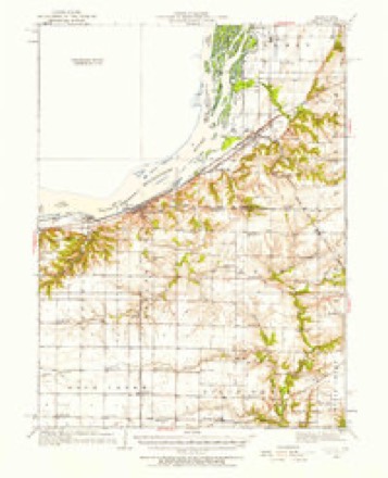
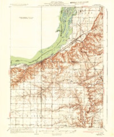
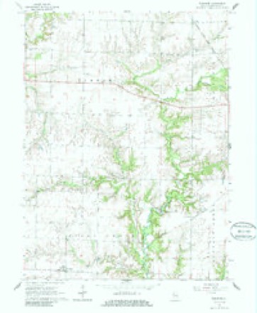
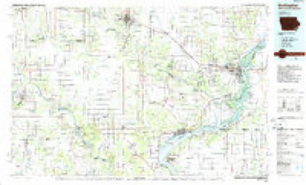
Topographic sheets covering this place
8 surveys from 15 printed sheetsMatched by testing this settlement's coordinate against the published boundary of every sheet in the United States Geological Survey's historical collection. Each opens the scanned sheet at the Survey.
- 1932 USGS Lomax quadrangle1:62500
- 1937 USGS Lomax quadrangle1:62500, 2 printings
- 1958 USGS Burlington quadrangle1:250000, 4 printings
- 1961 USGS Burlington quadrangle1:250000
- 1963 USGS Burlington quadrangle1:250000
- 1964 USGS Burnside quadrangle1:24000, 2 printings
- 1985 USGS Burlington quadrangle1:100000, 2 printings
- 1990 USGS Burlington quadrangle1:250000, 2 printings




In the county-history sources
6,133 words on this townshipHistory of Hancock County, Illinois, Together with an Outline History of the State, and a Digest of State Laws, published 1880 names this settlement in its chapter on Durham Township. These are the passages that mention it, exactly as the scans read.
There is probably no better township of land in the county than that numbered 7-6, and named Durham. It lies on the extreme north line of the count}', and is chiefly prairie, though much of it is rolling and well drained. It has a small branch of Crooked creek on its east side, and a portion of Camp creek in its northwest corner, each of which are skirted by bodies of timber. Ail the railroad it contains is about a mile of the Burlington branch of the Toledo, from Disco across its northeast corner. Its northwest corner lies less than two miles from the river at Dallas City. Durham may be called the western extension of what in the early days was known as " North Prairie," a tract of splendid farming country lying north of La Harpe and extending into Henderson county. Disco, on the east line of the township, must be near the center of it. This town was laid in Feb., 187G, by John Shutwell, and is located on the line of Durham and La Ilarpe townships. It is young and small yet, but seems to be a place of considerable business as a railroad station.
Passage source: History of Hancock County, Illinois, Together with an Outline History of the State, and a Digest of State Laws, published 1880.
Among the early settlers in Durham we have the names of Thomas Dixon, Sr., George Weaver, John Gihnore and brothers, of 1835; and Jacob Mendenhall, "William Logan, Ferdinand Brent and son, James and Wm. Meeker, and Jesse Avise, of 1S36. Among those the dates of whose emigration we are not advised, are the Bovses, Manifolds, Loftons, Harknesses, Wilsons, James Mills, I. Wfmp, Wm. McGuire.
Passage source: History of Hancock County, Illinois, Together with an Outline History of the State, and a Digest of State Laws, published 1880.
Among the first things in Durham township, we may mention: First school-house, of hewed logs, built in 1S37, and called Camp Creek school-house; first school taught by Mary Jane Jacobs, now of Washington Territory. First preaching by Rev. Wm. Johnson, Episcopalian; first Sabbath-school by Wm. McGuire, at same place; first M. E. preacher was Hev. Pool; first P. O. was called Camp Creek, John L. Avise, P. M. Concerning this P. O. it was on sec. 18, west line of the tp. ; when Mr. Avise died it was kept by his widow; and when she married Mr. Lyman Harkness, he was made P. M., - three in one family. It was afterward removed to Durham Corners, and kept by J. Hugh McGuire.
Passage source: History of Hancock County, Illinois, Together with an Outline History of the State, and a Digest of State Laws, published 1880.
Machine-read from a century-old scan, so expect the errors a machine makes: misspelled names, dropped words, stray characters.
Read the whole chapter on Durham Township - it names this place 19 more 19 times.
Mines and quarries near this place
2 within 5 milesRegional context, not property-specific evidence. The federal mineral resources record lists 2 workings within 5 miles of Durham: 2 past producers. None of them still produces. What was taken out: Stone, Crushed/Broken. Distance is straight-line from the map coordinates, so a quarry counted here may appear on a neighbouring settlement's page as well.
| Where | Site | Commodity | Status | Recorded |
|---|---|---|---|---|
| Biggsville Quarry Medusa Agg. | Stone, Crushed/Broken | Past Producer | ||
| Dallas City Quarry Turner Stone | Stone, Crushed/Broken | Past Producer |
Storms near this place
8 since 2002Regional context, not property-specific evidence. The National Weather Service names Durham in 8 storm reports between 2002 and 2023: 3 thunderstorm wind, 2 flood, 2 hail, 1 tornado. No death or injury is recorded in these reports. Each account below is quoted exactly as the forecast office filed it, from the NOAA Storm Events Database, and each date opens the federal record of that event.
| When | Event | Place named | Harm | What the report says |
|---|---|---|---|---|
| May 2009 | Flood | Durham | $250,000 | Heavy rains from May 13th to May 15th resulted in the La Moine River near Colmar going above the moderate flood stage level of 22 feet around 9 pm on May 15 and the major flood stage level of 24 feet around 1:30 am on May 17. It crested around 24.84 feet around 6 pm on May 17. It fell back below the major flood stage level around 10:30 am on May 18 and the moderate flood stage level around 6 am on May 19. |
| May 2009 | Flood | Durham | $100,000 | Heavy rains during the last four days of April resulted in the La Moine River near Colmar going above the moderate flood stage level of 22 feet on May 1 around 9:30 am. It crested around 22.8 feet around 2 am May 2. It fell back below the moderate flood stage level around 1 am May 3. |
| June 2010 | Thunderstorm Wind | Durham | $1,000 | Wind gusts estimated to be 60 mph were observed 3 miles southeast of Dallas City, IL at 601 pm June 21. Some debris was blowing in the wind and rain with possible rotation. |
| August 2023 | Tornado (EFU) | Durham | - | A storm chaser shared a video evidence of multiple brief touch downs of suction vortices. The chaser video shows three distinct tornado locations along this path. No reports of damage have been received. The touch downs were very sporadic along a path of 8 miles. |
| June 2023 | Thunderstorm Wind | Durham | - | Time estimated from radar, storm chaser wind estimate. |
| February 2017 | Hail | Durham | - | A spotter reported pea size hail increasing to the size of quarters during a two minute long hail storm. |
| March 2002 | Thunderstorm Wind | Durham | - | Many tree limbs and several large trees down. |
| July 2021 | Hail | Durham | - | no account filed |
Nearest settlements
The eight closest, with where each one stands in the county. Distances are straight-line, computed from the Geographic Names Information System coordinates.
Elsewhere
Matched on this settlement's Geographic Names Information System number rather than its name, so it cannot be a different place of the same name in another state.
| Wikipedia article on Durham | An encyclopaedic summary. Its text is share-alike, so it is linked here rather than copied. |
| Wikidata item Q5316445 | The structured record the population and elevation above come from. Public domain (CC0). |
Provenance
This settlement is recorded in the Geographic Names Information System as feature 422643. The sheet list is computed by point-in-boundary test against the United States Geological Survey's historical topographic inventory. Both are works of the United States government and carry no copyright under 17 U.S.C. 105.
Mines and quarries. USGS Mineral Resources Data System (MRDS) https://mrdata.usgs.gov/mrds/ A work of the United States government, no copyright under 17 U.S.C. 105.
Storms. NOAA National Centers for Environmental Information, Storm Events Database https://www.ncei.noaa.gov/stormevents/ A work of the United States government, no copyright under 17 U.S.C. 105. Narratives are quoted verbatim from the National Weather Service report and are not edited or summarised.