 Block
Dwight, Illinois
10 topographic sheets cover this place, the earliest surveyed in 1948 and the latest in 1991. It stands in Dwight Township. It lies in ZIP code area 60420. The Survey maps it on the Dwight quadrangle. 4,032 people lived here at the 2020 count. It stands 630 feet above sea level.
On record in Dwight
Buildings and businesses the archive holds for this place. Each opens its own page, with the source record it came from.
On the National Register 4 records
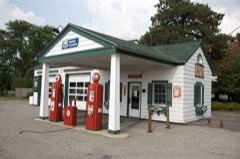 Ambler's Texaco Gas Stationlisted 2001
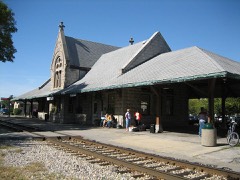 Dwight Chicago and Alton Railroad Depotlisted 1982
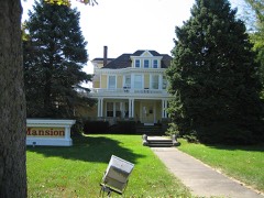 John R. Oughton Houselisted 1980
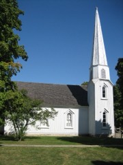 Pioneer Gothic Churchlisted 1983
Population over time
2 figuresDwight fell from 4,260 to 4,032 between 2010 and 2020. These are the recorded population figures Wikidata holds for this place, reached through the Geographic Names Information System number this page is keyed on rather than by name, so they belong to this place and not to another of the same name. Most are census counts, but not all are: an early figure may be a founding or settlement estimate, and an estimate published within five years of a census is left out. The change column is computed, and is left blank where more than 20 years separate a figure from the one before it, because a gap that long is not a change between two counts.
| Year | People | Change |
|---|---|---|
| 2010 | 4,260 | |
| 2020 | 4,032 | -228 (-5%) |
Topographic sheets covering this place
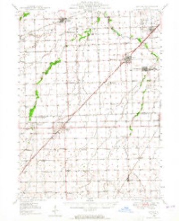
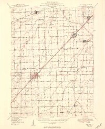
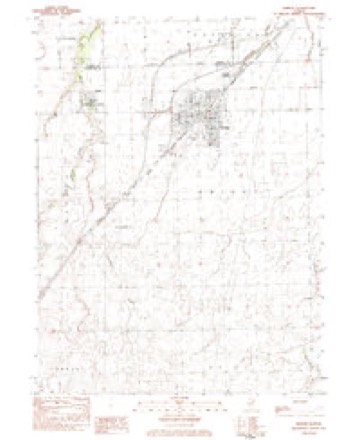
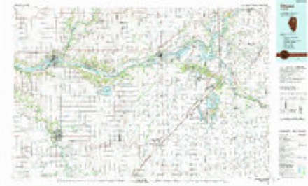
7 surveys from 10 printed sheetsMatched by testing this settlement's coordinate against the published boundary of every sheet in the United States Geological Survey's historical collection. Each opens the scanned sheet at the Survey.
- 1948 USGS Dwight quadrangle1:62500
- 1950 USGS Dwight quadrangle1:62500, 2 printings
- 1958 USGS Aurora quadrangle1:250000, 3 printings
- 1961 USGS Aurora quadrangle1:250000
- 1983 USGS Dwight quadrangle1:24000
- 1985 USGS Ottawa quadrangle1:100000
- 1991 USGS Ottawa quadrangle1:100000


In the county-history sources
8,642 words on this townshipThe History of Livingston County, Illinois : Containing a History of the County, Its Cities, Towns, &c. .., published 1878 names this settlement in its chapter on Dwight Township. These are the passages that mention it, exactly as the scans read.
Dwight is situated on the main line of the Chicago, Alton & St. Louis Railroad, at the junction of its Western Division, and is about seventy miles from Chicago, and twenty miles from Pontiac, the county seat. It is a place of about 2,000 inhabitants, is the third in size, and one of the most important shipping points in the county. The repair shops and the round house of the Western Division of the Chicago, Alton & St. Louis Railroad are located here, as well as the headquarters of the bridge builders of the main line. The tank men were stationed here until recently, when they removed their headquarters to Bloomington. A large number of men employed by the two roads live in the village of D wight, and have all their interests centering here.
Passage source: The History of Livingston County, Illinois : Containing a History of the County, Its Cities, Towns, &c. .., published 1878.
It was surveyed by Nelson Buck, Deputy County Surveyor, for Amos Edwards, the regular Surveyor of the county, in the Fall of 1853, for R. P. Morgan, Jr., Jas. C. Spencer, John Lathrop and J. and K. W. Fell, who owned the land on which it stands. The original town embraced the southwest quarter of the southeast quarter of Section 4 ; also the northwest quarter of the northeast quarter, and the northeast quarter of the northwest (quarter of Section 9, Township 30 north, Range 7 east of the Third Principal Meridian, and on the 30th day of January, 1854, was dedicated by Mr. Morgan, and the plat admitted to record. The following are his dedicator^/ words : " To be known as the town of Dwight, and the streets and alleys described on the town plat are hereby donated to the public." It was named for Henry Dwight, of New York, who was a capitalist, and furnished the money to build the road from Joliet to Bloomington, known now as the Chicago, Alton & St. Louis Railroad. He is said to have lost a fortune in the construction of this road ; and as a compliment to him, and in honor of his noble deeds, his name was given to the new village, which, in spite of efforts to change it, it has ever since borne. A " quill " of the time thus poetized :
Passage source: The History of Livingston County, Illinois : Containing a History of the County, Its Cities, Towns, &c. .., published 1878.
The first house or cabin in the village of Dwight was built by a man fi-om Morris, whose name is now forgotten. It was a frame building, 16x24 feet, one and a half stories high, erected on Lot 8, Block 18, in 1853. and was built originally for a store or a kind of supply depot for the railroad hands, and finally passed into the possession of Dr. Haggerty, whose family still own it.
Passage source: The History of Livingston County, Illinois : Containing a History of the County, Its Cities, Towns, &c. .., published 1878.
Machine-read from a century-old scan, so expect the errors a machine makes: misspelled names, dropped words, stray characters.
Read the whole chapter on Dwight Township - it names this place 25 more 25 times.
Fires near this place
36 since 2003Regional context, not property-specific evidence. The federal wildfire occurrence database lists 36 fires within 5 miles of Dwight between 2003 and 2005, burning about 45 acres in total. None started naturally. 3 were recorded as arson. Distance is straight-line from the map coordinates, so a fire counted here may appear on a neighbouring settlement's page as well.
| Reported cause | Fires |
|---|---|
| Missing data/not specified/undetermined | 28 |
| Arson/incendiarism | 3 |
| Recreation and ceremony | 2 |
| Debris and open burning | 2 |
| Equipment and vehicle use | 1 |
The most recent of them, most recent first, with the day each was reported and the service that recorded it.
| Date | Cause | Size | Reported by | Name on the report |
|---|---|---|---|---|
| 9 September 2005 | Missing data/not specified/undetermined | under an acre | Illinois State Fire Marshal's Office | not named |
| 24 September 2004 | Missing data/not specified/undetermined | under an acre | Illinois State Fire Marshal's Office | not named |
| 17 September 2003 | Recreation and ceremony | 1.0 acres | Illinois State Fire Marshal's Office | not named |
| 11 September 2005 | Missing data/not specified/undetermined | under an acre | Illinois State Fire Marshal's Office | not named |
| 11 September 2005 | Missing data/not specified/undetermined | under an acre | Illinois State Fire Marshal's Office | not named |
| 8 July 2005 | Missing data/not specified/undetermined | under an acre | Illinois State Fire Marshal's Office | not named |
| 8 July 2005 | Missing data/not specified/undetermined | under an acre | Illinois State Fire Marshal's Office | not named |
| 7 July 2004 | Equipment and vehicle use | under an acre | Illinois State Fire Marshal's Office | not named |
Settlements close enough to share some of these fires:
Storms near this place
32 since 1994Regional context, not property-specific evidence. The National Weather Service names Dwight in 32 storm reports between 1994 and 2025: 16 thunderstorm wind, 11 hail, 3 flood, 1 flash flood. No death or injury is recorded in these reports. Each account below is quoted exactly as the forecast office filed it, from the NOAA Storm Events Database, and each date opens the federal record of that event.
| When | Event | Place named | Harm | What the report says |
|---|---|---|---|---|
| June 1998 | Flood | Dwight | $250,000 | Thunderstorms dumped 4 to 6 inches of rain in northeast Livingston County. A cooperative observer at Dwight measured 4.75 inches. Numerous roads, yards and basements were flooded. A car dealership suffered about $250,000 in damages when the parking lot flooded. Gooseberry Creek and Brewster Creek flooded. Illinois Highway 47 was closed. |
| June 2008 | Thunderstorm Wind | Dwight | $10,000 | A large tree was snapped off a few feet above the ground. The tree landed on a house causing damage. |
| August 2008 | Thunderstorm Wind | Dwight | $3,000 | Trees, tree limbs and power lines were blown down between Dwight and Campus. |
| May 2008 | Thunderstorm Wind | Dwight | $500 | Shingles were blown off a house and small tree limbs were blown down. |
| May 2025 | Thunderstorm Wind | Dwight | - | Large tree limbs were snapped off of trees. |
| July 2025 | Thunderstorm Wind | Dwight | - | A photo showed a large tree limb that was snapped. |
| August 2022 | Thunderstorm Wind | Dwight | - | Small tree limbs were blown down. |
| August 2020 | Thunderstorm Wind | Dwight | - | Numerous metal farm buildings were damaged including roofs and metal siding blown off. A large tree was snapped and fell onto a house. |
| June 2020 | Thunderstorm Wind | Dwight | - | At least two semi trucks were blown over just west of Dwight. |
| August 2014 | Flood | Dwight | - | Street flooding up to two feet deep was reported in Dwight. |
| January 2008 | Hail | Dwight | - | Penny size hail was reported at Gardner Road and Route 47. |
| January 2008 | Thunderstorm Wind | Dwight | - | Wind gusts were estimated to 60 mph at Gardner Road and Route 47. |
| May 2006 | Flood | Dwight | - | Six to twelve inches of water over roads. |
| October 2006 | Thunderstorm Wind | Dwight | - | A farm grain wagon was blown over. |
| March 2005 | Hail | Dwight | - | Penny sized hail was reported at the intersection of Rt. 17 and I-55. |
| May 2004 | Hail | Dwight | - | Nickel to golf ball size hail was reported. |
| May 2004 | Flash Flood | Dwight | - | Roads were closed due to flooding. |
| May 2004 | Thunderstorm Wind | Dwight | - | Trees were blown down in the road causing traffic problems. |
| May 2004 | Tornado (F0) | Dwight | - | An experienced storm spotter and chaser reported a tornado 6 miles southwest of Dwight. Trees were damaged in this area. It had a brief narrow path. |
| May 2004 | Thunderstorm Wind | Dwight | - | Trees were blown down on Route 17. |
| April 2023 | Hail | Dwight | - | no account filed |
| June 2015 | Hail | Dwight | - | no account filed |
| April 2014 | Hail | Dwight | - | no account filed |
| May 2012 | Hail | Dwight | - | no account filed |
| May 2006 | Hail | Dwight | - | no account filed |
| September 2005 | Hail | Dwight | - | no account filed |
| April 2003 | Thunderstorm Wind | Dwight | - | no account filed |
| May 2000 | Thunderstorm Wind | Dwight | - | no account filed |
| May 1999 | Thunderstorm Wind | Dwight | - | no account filed |
| May 1998 | Hail | Dwight | - | no account filed |
| January 1996 | Thunderstorm Wind | Dwight | - | no account filed |
| April 1994 | Hail | Dwight | - | no account filed |
Nearest settlements
The eight closest, with where each one stands in the county. Distances are straight-line, computed from the Geographic Names Information System coordinates.
Elsewhere
Matched on this settlement's Geographic Names Information System number rather than its name, so it cannot be a different place of the same name in another state.
| Wikipedia article on Dwight | An encyclopaedic summary. Its text is share-alike, so it is linked here rather than copied. |
| Wikidata item Q2338703 | The structured record the population and elevation above come from. Public domain (CC0). |
Provenance
This settlement is recorded in the Geographic Names Information System as feature 407550. The sheet list is computed by point-in-boundary test against the United States Geological Survey's historical topographic inventory. Both are works of the United States government and carry no copyright under 17 U.S.C. 105.
Wildfire. Short, Karen C. 2022. Spatial wildfire occurrence data for the United States, 1992-2020 [FPA_FOD_20221014]. 6th Edition. Fort Collins, CO: Forest Service Research Data Archive. https://doi.org/10.2737/RDS-2013-0009.6 Collected with United States Government funding and usable without additional permissions or fees.
Storms. NOAA National Centers for Environmental Information, Storm Events Database https://www.ncei.noaa.gov/stormevents/ A work of the United States government, no copyright under 17 U.S.C. 105. Narratives are quoted verbatim from the National Weather Service report and are not edited or summarised.