 Block
From the record
15 National Register listings published here.
Sources: the county history on the Internet Archive · the National Register database, National Park Service
66 topographic sheets cover 56 settlements here, and 15 properties are on the National Register of Historic Places.
15 National Register listings published here.
Sources: the county history on the Internet Archive · the National Register database, National Park Service
Every property in this county listed on the National Register of Historic Places, with the year it was listed and the federal nomination document.
| Photograph | Property | Type | Listed | Reference |
|---|---|---|---|---|
 | Ambler's Texaco Gas Station | site | 2001 | 01001311 |
 | Thomas A. Beach House | building | 1983 | 83000324 |
 | Dwight Chicago and Alton Railroad Depot | building | 1982 | 82000398 |
 | Fairbury City Hall | building | 1996 | 96000090 |
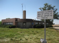 | Illinois State Police Office, Pontiac | building | 2007 | 07000117 |
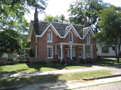 | Jones House | building | 1978 | 78001163 |
 | Livingston County Courthouse | building | 1986 | 86003165 |
| Memorial Bandstand of Long Point | structure | 2023 | 100008844 | |
 | John R. Oughton House | building | 1980 | 80001383 |
 | Pioneer Gothic Church | building | 1983 | 83000325 |
 | Pontiac City Hall and Fire Station | building | 1990 | 90001200 |
| Route 66, Cayuga to Chenoa | structure | 2003 | 99000115 | |
 | Raymond Schultz Round Barn | building | 1982 | 82002582 |
 | Standard Oil Gasoline Station | building | 1997 | 97001338 |
| Strevell House | building | 2023 | 100008845 |
Every wildfire the federal occurrence database records inside this county: 48 of them, burning about 312 acres. 1 started naturally and 3 were recorded as arson. Each settlement page carries the fires within five miles of it.
| Reported cause | Fires |
|---|---|
| Missing data/not specified/undetermined | 37 |
| Equipment and vehicle use | 3 |
| Arson/incendiarism | 3 |
| Debris and open burning | 2 |
| Recreation and ceremony | 2 |
| Natural | 1 |
The five largest, by the area the report gives. None of them was recorded as arson.
| Date | Cause | Size | Reported by | Name on the report |
|---|---|---|---|---|
| 13 April 2010 | Missing data/not specified/undetermined | 75 acres | Illinois Division of Forestry Resources | DAVIS |
| 24 March 2010 | Missing data/not specified/undetermined | 50 acres | Illinois Division of Forestry Resources | ALLAN |
| 11 September 2010 | Missing data/not specified/undetermined | 40 acres | Illinois Division of Forestry Resources | CHENOA |
| 13 September 2010 | Missing data/not specified/undetermined | 35 acres | Illinois Division of Forestry Resources | PONTIAC |
| 3 October 2018 | Debris and open burning | 25 acres | Illinois Division of Forestry Resources | CROSSROAD CRATING |
| 21 September 2010 | Missing data/not specified/undetermined | 25 acres | Illinois Division of Forestry Resources | FAIRBURY2 |
| 20 October 2003 | Missing data/not specified/undetermined | 20 acres | Illinois State Fire Marshal's Office | not named |
| 1 April 2010 | Missing data/not specified/undetermined | 15 acres | Illinois Division of Forestry Resources | GOULD |
Every settlement page carries the fires within five miles of it - see the settlement index below.
The NOAA Storm Events Database holds 418 reports for this county, causing 3 deaths, 18 injuries and about $12,768,750 in recorded property damage. Each settlement page carries the reports that name it.
| Kind of event | Reports |
|---|---|
| Thunderstorm Wind | 199 |
| Hail | 97 |
| Tornado | 55 |
| Flood | 25 |
| Flash Flood | 21 |
| Heavy Rain | 10 |
| Funnel Cloud | 8 |
| Lightning | 3 |
The most serious of them, by death, then injury, then recorded damage. The accounts are quoted exactly as the forecast office filed them.
| When | Event | Place named | Harm | What the report says |
|---|---|---|---|---|
| June 2010 | Tornado (EF2) | Sunbury | 1 killed, 13 hurt, $3,000,000 | The beginning of the Dwight tornado occurred about 6 miles west of Dwight and about a quarter mile south of IL Route 17. On N 2200 E Road, 0.3 miles south of IL Route 17, a farm house sustained damage to windows, siding, and shingles, with many trees uprooted or damaged. Outbuildings were also damaged. The tornado at this point was rated EF1, with a path width of 70 yards. Debris from this farm was spread 200 yards wide across the field at N 2300E Road. ||The tornado proceeded to strike the golf course at N 2400 E Road, where numerous large trees were snapped and uprooted. Golf cart sheds were unroofed or severely damaged. At this point the tornado was rated low end EF2 with a path width of 300 yards. The tornado then moved east across Interstate 55 and moved into Dwight, damaging a lumber yard and other businesses. At Williams Street and old Route 66 a mobile home park was hit. Fourteen people were injured. One person who was seriously injured, later died. At the mobile home park, 35 mobile homes were destroyed. Damage here was rated EF2. Large trees were uprooted and power poles were snapped at the railroad tracks. At a ball field a little farther east, trees and fences were damaged and an announcer's booth was destroyed. Slightly farther east, there was minor damage to a church, but the church's garage was destroyed. There was damage to the high school auditorium roof and facade, and a greenhouse. A storage garage was destroyed at the high school. ||The tornado then continued east into a subdivision between Philmar Street and Prospect Avenue, where many large trees were downed on top of homes. At Sunset Drive and Wilmac Street a garage door and roof were taken off. A roof was taken off a house on Linden Street a half block west of Il Route 47. Three houses were uninhabitable and had to be destroyed. More than 100 homes had some damage. Damage in Dwight was rated high end EF1 to low end EF2. The tornado dissipated in an open field east of Route 47. |
| December 2015 | Flood | Blair | 1 killed | Flooding occurred in rural Dwight. A Bourbonnais, IL man was found dead and Livingston County officers said the vehicle hydroplaned or became submerged in water, and then was overcome by the current. |
| July 2010 | Lightning | Clay | 1 killed | A 57 year old man was riding a bicycle on Road 700 East, about one quarter mile north of Road 3100 North when he was struck by lightning. The man was pronounced dead at the scene a short time later. |
| June 2016 | Tornado (EF2) | Graymont | 4 hurt | The tornado started just under two tenths of a mile north of the intersection of E 2000 N Rd and County Highway 13. As it moved southeast and crossed N 900 E Rd, there were numerous trees snapped and the path width was approximately 250 ft. At a house near E 1900 N Rd, there were other trees snapped. When the tornado crossed E 1800 N Rd, it strengthened to EF-2 and a barn was totally destroyed, and electrical transmission lines were broken. As it moved southeast past the intersection of Rt 116 and Interstate 55, a small retail building had the exterior walls collapsed. At a mobile home park off S. Ladd St, a mobile home was pushed off its foundation and destroyed. Near the intersection of N 1725 E Rd and E 1550 N Rd, the tornado was 1/4 mile in width and there were 3 snapped power poles and a silo in a field. Peak winds were estimated at 125 mph, and max width was 440 yards. (Tornado 13 of 15). |
| May 2006 | Thunderstorm Wind | Pontiac | 1 hurt, $25,000 | A semi tractor trailer was blown over on Interstate 55 near Route 116. The driver needed to be cut out of the truck and was taken to the hospital. |
| September 1986 | Tornado (F2) | not stated | $2,500,000 | no account filed |
| June 1980 | Tornado (F2) | not stated | $2,500,000 | no account filed |
| January 2008 | Flood | Lodemia | $2,000,000 | Heavy rain fell onto saturated and frozen ground across Livingston County on January 8th. The rain quickly ran off into streams and rivers which then overflowed their banks. Widespread and significant flooding occurred in many areas of the county including the city of Pontiac. Much of the city was under water with businesses, schools and homes flooded and damaged. One man died after slipping and falling in his flooded basement and many others had to be rescued after their cars became stranded in flood waters. Numerous roads were flooded and closed across the county. Storm total rainfall amounts included 3.87 inches in Fairbury, 3.40 inches in Pontiac and 2.58 inches in Dwight. |
| June 2010 | Tornado (EF3) | Missal | $750,000 | Very quickly after the tornado that hit Streator lifted, yet another tornado touched down over extreme northern Livingston county approximately one quarter mile south of the county line and about a half mile west of 1100 E Road. Shortly after touching down, this tornado caused severe damage to homes on 1100 E Road and destroyed a barn as well. There were also several large trees downed in this location. As the tornado continued eastward, it completely collapsed a metal truss high tension electrical tower and bent over several other metal truss electrical towers in its path, which is consistent with low end EF3 damage. At this time the tornado was moving through an extremely rural area, however there was also a lone hardwood tree in its path that was debarked, with only large de-leafed branches remaining. ||The tornado continued eastward crossing Illinois Route 170 just south of the LaSalle and Livingston county line where hardwood trees were snapped. Large trees were broken at a farm house and a machine shed and grain bins were destroyed. The tornado then moved eastward for several more miles downing multiple trees and resulting in some minor structural damage between 1700 E Road and 1800 E Road. |
| June 1998 | Flood | Dwight | $250,000 | Thunderstorms dumped 4 to 6 inches of rain in northeast Livingston County. A cooperative observer at Dwight measured 4.75 inches. Numerous roads, yards and basements were flooded. A car dealership suffered about $250,000 in damages when the parking lot flooded. Gooseberry Creek and Brewster Creek flooded. Illinois Highway 47 was closed. |
| April 1982 | Tornado (F0) | not stated | $250,000 | no account filed |
| April 1982 | Tornado (F1) | not stated | $250,000 | no account filed |
| June 1978 | Tornado (F2) | not stated | $250,000 | no account filed |
| April 1954 | Tornado (F3) | not stated | $250,000 | no account filed |
| June 2000 | Thunderstorm Wind | Chatsworth | $150,000 | no account filed |
| June 2010 | Tornado (EF0) | Sunbury | $100,000 | A secondary tornado occurred 3 miles northwest of Dwight in northern Livingston County. The tornado began near the intersection of Rd 3300N and 2300E, where it caused minor damage to a home and surrounding trees. The tornado continued to the southeast where it derailed a train off its tracks near 2400E Road. At this point, the tornado moved east causing minor damage to some area trees before crossing Interstate 55, where it then lifted. The tornado was rated EF0 with winds estimated at around 80 mph and a path width of 20 yards. |
| June 1995 | Tornado (F1) | Blackstone | $85,000 | A small tornado caused $75 thousand in damage to conveyors, roofs, and tanks at one business and caused $8 thousand in damage to a roof of an office building at the Hicksgas plant. A barn and trees were also damaged in the area. Several people witnessed a funnel cloud just before the wind hit. |
| November 2013 | Tornado (EF2) | Long Pt | $75,000 | This is a continuation of a tornado that began in Tazewell County (NWS Central Illinois) and tracked across Woodford County, entering NWS Chicago county warning area in La Salle County, and finally ending in Livingston County. The tornado entered Livingston County about a third of a mile north of E 2400 N Road where power poles were leaning. Several outbuildings were heavily damaged or destroyed on E 2475 N Road. Hardwood trees were snapped on N 200 E Road as well as wooden power poles. A large shed housing a fire engine was completely destroyed with the fire engine rolled onto its side on Long Point Blacktop Road near the intersection of N 400 E Road. On the northeast side of that intersection, a wooded area saw extensive tree damage with numerous trees sheared off about 20 to 30 feet from their bases. The damage path ended about half a mile north of Long Point Blacktop Road between N 450 E Road and Route 23. Maximum wind speeds were estimated to be up to 135 mph. |
| June 2008 | Tornado (EF1) | Nevada | $50,000 | A tornado touched down near 2000E and 2900N. Utility poles were snapped along 2900N. On 2100E north of 3000N, half of the roof of a barn was blown off. At 3100N, a house suffered roof and tree damage. The tornado ended near 2200E, just south of 3200N. |
| June 2008 | Tornado (EF1) | Flanagan | $40,000 | A tornado touched down in Waldo Township, south of 1100 North, between 100 East and 200 East. A house suffered roof damage near this location. A small agriculture building was blown around a larger agricultural machine shed and destroyed. The larger machine shed suffered some roof damage. Trees and a child's play set were also damaged. Tree damage was reported south of 1200 North between 300 East and 400 East. Some small agricultural buildings were destroyed south of 1300 North, just east of 400 East. |
| November 1971 | Tornado (F1) | not stated | $25,000 | no account filed |
| September 1969 | Tornado (F1) | not stated | $25,000 | no account filed |
| April 1965 | Tornado (F1) | not stated | $25,000 | no account filed |
| March 1957 | Tornado (F1) | not stated | $25,000 | no account filed |
| July 1950 | Tornado (F1) | not stated | $25,000 | no account filed |
| June 2010 | Tornado (EF0) | Blair | $20,000 | A tornado formed along the north side of 3100 N Road, between 3100 E Road and 3200 E Road, for one quarter of a mile. The tornado was rated EF0 here. There was additional minor damage to tree limbs and a metal farm outbuilding for about half a mile along the north side of 3100 N Road, between 3400 E Road and 3500 E Road. The tornado here was rated EF0 with a path width of 20 yards. |
| March 2009 | Tornado (EF0) | Rooks Creek | $20,000 | An EF0 tornado touched down on county road 1500N between 1100E and 1200E. A detached garage was destroyed at this location and the debris was deposited in a field to the northeast. A hay barn at this same location suffered little damage although a trailer camper parked inside the barn was pushed through the wooden front door by straight line winds which were funneled through the open back of the barn. |
| August 2016 | Flash Flood | Odell | $10,000 | Some roads with water on them and many yards and houses flooded. Time estimated per radar. |
| June 2010 | Thunderstorm Wind | Pontiac | $10,000 | Wind gusts were estimated as high as 80 mph. Multiple tree limbs and power lines were blown down. One tree limb fell onto a house on Timber Street causing damage to the roof. |
| June 2008 | Thunderstorm Wind | Fairbury | $10,000 | A huge tree fell against a house in Fairbury causing significant damage to the front of the house. |
| June 2008 | Thunderstorm Wind | Dwight | $10,000 | A large tree was snapped off a few feet above the ground. The tree landed on a house causing damage. |
| December 2007 | Thunderstorm Wind | Odell | $10,000 | A roof was blown off a building. |
| July 2001 | Thunderstorm Wind | Countywide | $5,000 | no account filed |
| May 2006 | Thunderstorm Wind | Cornell | $4,000 | Utility poles and power lines were blown down near 2500 North and 1400 East. |
| August 2008 | Thunderstorm Wind | Dwight | $3,000 | Trees, tree limbs and power lines were blown down between Dwight and Campus. |
| August 2008 | Thunderstorm Wind | Pontiac | $3,000 | Several tree limbs and power lines were blown down. |
| September 1961 | Tornado (F0) | not stated | $2,500 | no account filed |
| October 2017 | Thunderstorm Wind | Fairbury | $2,000 | Multiple large tree limbs and power lines were blown down. |
| June 2010 | Tornado (EF0) | Wing | $2,000 | A very brief and weak tornado occurred 6 miles northeast of Fairbury in southern Livingston County. There was damage to a barn and corn crop. Vents on this barn were torn off with the corn crop flattened and twisted throughout the field. The tornado was rated EF0 with winds estimated at around 70 mph. |
| August 2016 | Lightning | Odell | $1,000 | Car struck by lightning on I-55 at mile marker 210. |
| May 2013 | Thunderstorm Wind | Pontiac | $1,000 | Several large trees and power lines were blown down. |
| June 2011 | Thunderstorm Wind | Fairbury | $1,000 | Several tree limbs were knocked onto power lines and some large limbs fell onto the roads blocking traffic. |
| June 2011 | Thunderstorm Wind | Pontiac | $1,000 | Tree limbs and power lines were blown down. |
| March 2006 | Thunderstorm Wind | Graymont | $1,000 | A basement door was blown out and road signs were blown down. |
| May 2006 | Thunderstorm Wind | Pontiac | $1,000 | A building and trees were damaged. |
| August 2014 | Lightning | Pontiac | $500 | Lightning struck a utility pole which caught fire. |
| May 2008 | Thunderstorm Wind | Dwight | $500 | Shingles were blown off a house and small tree limbs were blown down. |
| June 1958 | Tornado (F1) | not stated | $250 | no account filed |
| March 2026 | Tornado (EF0) | (Pnt) Pontiac Municipal Airport | - | Based on video evidence, a brief EF-0 tornado occurred just north of Pontiac. Surveillance video shared by a property owner showed a clear circulation with multiple sub-vortices on a quarry lake just west of 1600 East Road, north of old US-66. The tornado was observed in storm chaser videos crossing old US-66 just south of North Creek. Damage along the path of the tornado included the removal of a roof to a boat house and damage to a dock, garage, and fence. The maximum width of the tornado of 175 yards was estimated from the aforementioned surveillance and storm chaser videos. Peak winds were estimated at 75 mph. |
| March 2026 | Tornado (EFU) | Cayuga | - | A Livingston County deputy reported a brief tornado near 2200 North Road and old US-66 east of the community of Cayuga. The time and location of the report was consistent with rotation indicated by radar. There is no known damage that was caused by the tornado. |
| March 2026 | Hail | Rowe | - | Two separate reports of four inch diameter hail came out of Livingston County near the I-55 corridor near the communities of Rowe and Cayuga. A handful of reports came out of this same area ranging in size from 1 to 4 inches in diameter. |
| March 2026 | Hail | Campus | - | A handful of hail reports were received from east of the town of Campus near the Livingston-Kankakee county line. Sizes mostly ranged between 2 and 4 inches. |
| April 2026 | Flash Flood | Flanagan | - | Multiple county roads were flooded near N 400 E Road south of Flanagan with multiple cars stuck in flood waters. |
| April 2026 | Thunderstorm Wind | Sunbury | - | Several power lines were downed along IL-17 west of I-55 near Dwight. |
| April 2026 | Tornado (EF1) | Fairbury | - | An EF-1 tornado with peak winds around 90 mph dropped in rural northeast McLean County before crossing into Livingston County southwest of Fairbury. In the few minutes the tornado survived in Livingston County, it damaged trees and a machine shed. |
| April 2026 | Thunderstorm Wind | Cornell | - | Three power poles were blown over (not snapped) west of Cornell. |
| March 2025 | Thunderstorm Wind | Ocoya | - | A semitruck overturned on I-55 southbound south of mile marker 191. |
| March 2025 | Thunderstorm Wind | Flanagan | - | An Ambient Weather station recorded a 65 mph gust near Gridley. |
| March 2025 | Thunderstorm Wind | Cullom | - | An Ambient Weather station recorded a 60 mph gust near Cullom. |
| May 2025 | Funnel Cloud | Reading | - | A storm chaser shared a video of a rotating funnel cloud near Reading. It was not conclusive from the video whether the funnel was in contact with the ground and no damage was reported. |
The Survey's mineral resources record lists 15 workings inside this county. 6 still produce and 9 are closed or unrecorded. Each settlement page carries the workings within five miles of it.
| Commodity | Workings |
|---|---|
| Stone, Crushed/Broken | 9 |
| Clay | 3 |
| Sand and Gravel, Construction | 2 |
| Stone | 1 |
| Clay, Stone, Crushed/Broken | 1 |
The least common of them first, because a county's hundredth gravel pit says nothing its first ten did not.
| Where | Site | Commodity | Status | Recorded |
|---|---|---|---|---|
| Livingston Hwy. Pit | Stone | Past Producer | ||
| Valley View Shale Quarry | Clay, Stone, Crushed/Broken, Sand and Gravel, Construction | Producer | ||
| Adams Pit | Sand and Gravel, Construction | Past Producer | ||
| Chatsworth Clay Shale Pit | Clay | Past Producer | ||
| Diller Pit | Clay | Past Producer | ||
| Streator Brick Shale Pit | Clay | Producer | ||
| Fairbury | Stone, Crushed/Broken | Past Producer | ||
| Limestone Prospect | Stone, Crushed/Broken | Occurrence | ||
| Mc Dowell Quarry & Mill | Stone, Crushed/Broken | Plant | ||
| Mcdowell Quarry | Stone, Crushed/Broken | Producer | ||
| Pontiac Portable Plant | Stone, Crushed/Broken | Producer | ||
| Raube Quarry | Stone, Crushed/Broken | Past Producer | ||
| Wagner Quarry | Stone, Crushed/Broken | Past Producer | ||
| Western Stone Div. Plant | Stone, Crushed/Broken | Past Producer | ||
| Weston Quarry | Stone, Crushed/Broken | Producer |
The History of Livingston County, Illinois : Containing a History of the County, Its Cities, Towns, &c. .. devotes a chapter to each township: its boundaries and streams, who settled it and when, the mills, the schools and the churches. All 14 are reproduced here in full. Each row shows the township's own shape and where it lies in the county, drawn from the Census Bureau's boundary. Which settlements belong to which township is computed from that same boundary, not taken from the book.
| Shape and position in the county | Township | Settlements in it | Length | Sections |
|---|---|---|---|---|
| Avoca Township | Avoca, Champlin, Lodemia | 114 words | 0 | |
| Charlotte Township | Charlotte | 53 words | 0 | |
| Chatsworth Township | Cereal, Chatsworth | 3,522 words | 0 | |
| Dwight Township | Dwight | 8,642 words | 2 | |
| Forrest Township | Forrest | 2,198 words | 0 | |
| Long Point Township | Long Point | 557 words | 0 | |
| Nevada Township | Nevada, Sunbury | 1,266 words | 0 | |
| Newtown Township | Manville, Missal, New Michigan, Smithdale | 452 words | 1 | |
| Odell Township | Cayuga, Odell | 7,364 words | 2 | |
| Owego Township | Rugby, Swygert | 463 words | 0 | |
| Pontiac Township | Pontiac, Rooks Creek | 10,896 words | 2 | |
| Reading Township | Ancona, Carriage Lane Estates, Coalville, Munster, Reading, Vermilion City | 1,400 words | 3 | |
| Round Grove Township | Blair, Campus, Cardiff | 5,921 words | 6 | |
| Saunemin Township | Eylar, Saunemin, Scovel | 467 words | 1 |
2 books written about this county, cut here where the book itself is cut, at its printed chapters: 25 chapters in all. Every chapter is public domain, machine-read from the scan and reproduced complete. A chapter already given under one of the county's towns is not repeated in this list.
| Chapter | Length |
|---|---|
| The whole text | 390,193 words in 25 parts |
Named settlements recorded in the Geographic Names Information System, each with the topographic sheets covering it. Villages, hamlets and abandoned places alike. Each is shown with the nearest named watercourse or landform and the survey quadrangle it falls on.
Avoca township · 61739 · On North Fork Vermilion River · Southeast Pontiac quadrangle
15 sheets, 1935 to 2001
No longer a settlement
Reading township · 61364 · On Moon Creek · Streator South quadrangle
11 sheets, 1925 to 1991
Reading township · 61364 · On Moon Creek · Streator South quadrangle
11 sheets, 1925 to 1991
Amity township · 61319 · On Ida Creek · Northwest Pontiac quadrangle
15 sheets, 1935 to 1998
Newtown township · 61319 · Blackstone quadrangle
8 sheets, 1958 to 1991
No longer a settlement
Pontiac township · 61764 · On Turtle Creek · Northwest Pontiac quadrangle
15 sheets, 1935 to 1998
Pontiac township · 61764 · On Pike Creek · Northwest Pontiac quadrangle
15 sheets, 1935 to 1998
Sullivan township · 60929 · Cullom quadrangle
13 sheets, 1947 to 1998
No longer a settlement
Reading township · 61364 · On Moon Creek · Streator South quadrangle
11 sheets, 1925 to 1991
The vanished settlements of Livingston County: the places named above that are no longer on the map.