 Block
Elgin, Illinois
20 topographic sheets cover this place, the earliest surveyed in 1925 and the latest in 1998. It stands in Elgin Township. It lies in ZIP code area 60120. It stands on Tyler Creek. The Survey maps it on the Elgin quadrangle. 114,797 people lived here at the 2020 count. It stands 745 feet above sea level.
Research this city
On record in Elgin
Buildings and businesses the archive holds for this place. Each opens its own page, with the source record it came from.
On the National Register 12 of 14 shown
 Elgin Academylisted 1976
 Elgin Downtown Commercial District (Additional Documentation)listed 2014
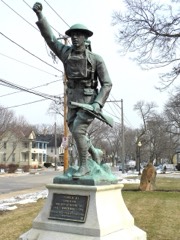 Elgin Historic Districtlisted 1983
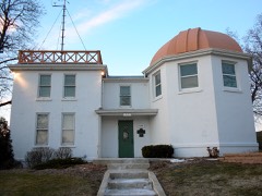 Elgin National Watch Company Observatorylisted 1994
 Elgin Tower Buildinglisted 2002
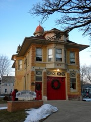 Fire Barn 5listed 1991
 First Universalist Churchlisted 1980
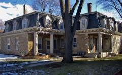 Gifford-Davidson Houselisted 1980
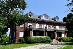 Larkin Home for Childrenlisted 2018
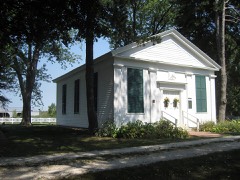 Memorial Washington Reformed Presbyterian Churchlisted 1980
 Ora Pelton Houselisted 1982
 Spring-Douglas Historic Districtlisted 2000
Population over time
2 figuresElgin grew from 108,188 to 114,797 between 2010 and 2020. These are the recorded population figures Wikidata holds for this place, reached through the Geographic Names Information System number this page is keyed on rather than by name, so they belong to this place and not to another of the same name. Most are census counts, but not all are: an early figure may be a founding or settlement estimate, and an estimate published within five years of a census is left out. The change column is computed, and is left blank where more than 20 years separate a figure from the one before it, because a gap that long is not a change between two counts.
| Year | People | Change |
|---|---|---|
| 2010 | 108,188 | |
| 2020 | 114,797 | +6,609 (+6%) |
Topographic sheets covering this place
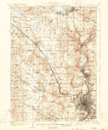
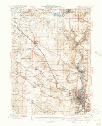
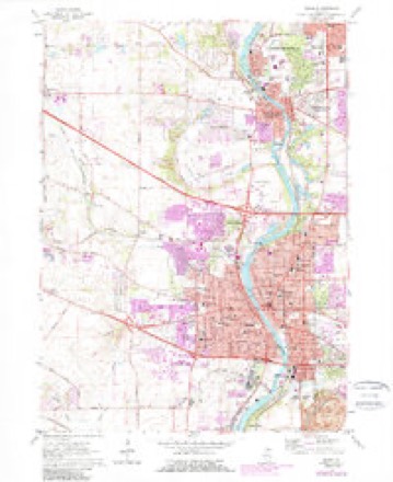
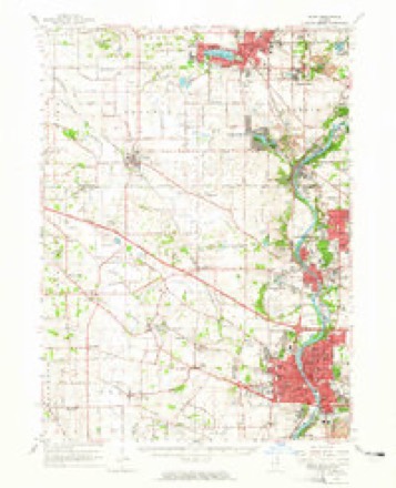
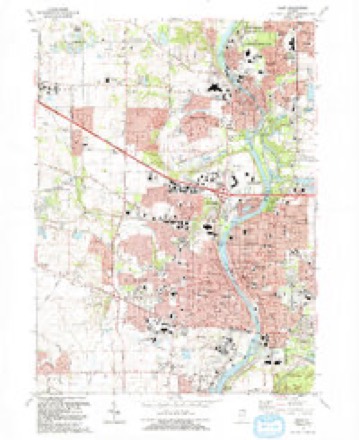
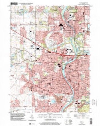
11 surveys from 20 printed sheetsMatched by testing this settlement's coordinate against the published boundary of every sheet in the United States Geological Survey's historical collection. Each opens the scanned sheet at the Survey.
- 1925 USGS Elgin quadrangle1:62500, 4 printings
- 1940 USGS Elgin quadrangle1:62500
- 1954 USGS Rockford quadrangle1:250000
- 1955 USGS Rockford quadrangle1:250000
- 1958 USGS Rockford quadrangle1:250000, 4 printings
- 1962 USGS Elgin quadrangle1:24000, 4 printings
- 1962 USGS Elgin quadrangle1:62500
- 1963 USGS Rockford quadrangle1:250000
- 1981 USGS Elgin quadrangle1:100000
- 1992 USGS Elgin quadrangle1:24000
- 1998 USGS Elgin quadrangle1:24000





Mines and quarries near this place
10 of 16 shownRegional context, not property-specific evidence. The federal mineral resources record lists 16 workings within 5 miles of Elgin: 8 past producers, 6 producers, 2 plants. 8 still produce. What was taken out: Sand and Gravel, Construction, Stone, Crushed/Broken, Stone. Distance is straight-line from the map coordinates, so a quarry counted here may appear on a neighbouring settlement's page as well.
| Where | Site | Commodity | Status | Recorded |
|---|---|---|---|---|
| Elgin City Pit | Stone | Past Producer | ||
| Fox River Quarry | Stone, Crushed/Broken | Producer | ||
| Fox River Quarry | Stone, Crushed/Broken | Past Producer | ||
| Bartlett Pit | Sand and Gravel, Construction | Past Producer | ||
| Bartlett Plant & Pit | Sand and Gravel, Construction | Producer | ||
| Beverly Gravel Pit | Sand and Gravel, Construction | Producer | ||
| Dundee S & G Pit | Sand and Gravel, Construction | Producer | ||
| Elgin Pit | Sand and Gravel, Construction | Past Producer | ||
| Hammond Plant & Pit | Sand and Gravel, Construction | Past Producer | ||
| Hammonds Pit & Mill | Sand and Gravel, Construction | Plant |
Storms near this place
60 of 90 shownRegional context, not property-specific evidence. The National Weather Service names Elgin in 90 storm reports between 1998 and 2026: 51 thunderstorm wind, 20 hail, 6 heavy rain, 4 lightning. The reports record 1 death and 2 injuries. Each account below is quoted exactly as the forecast office filed it, from the NOAA Storm Events Database, and each date opens the federal record of that event.
| When | Event | Place named | Harm | What the report says |
|---|---|---|---|---|
| June 2006 | Lightning | Elgin | 1 killed, 1 hurt | Two men were struck by lightning on a golf course after taking cover under trees. One of the men died from his injuries two days later. |
| July 2003 | Lightning | Elgin | 1 hurt | A 28 year old man was critically injured after being struck by lightning while working on a roof. |
| July 2011 | Lightning | Elgin | $35,000 | A church on Division Street was struck by lightning which broke a hole in the steeple tower. Much of the damage was from heavy rain which entered through the hole. |
| July 2006 | Thunderstorm Wind | Elgin | $30,000 | Trees, tree limbs and power lines were blown down across many areas of Elgin. A tree fell onto a car on West Chicago Street. |
| September 2007 | Thunderstorm Wind | Elgin | $25,000 | Extensive tree damage with some roads closed was reported on the west side of Elgin. One foot diameter tree limbs were blown down. Part of a roof was blown off a business on Fleetwood. |
| July 2017 | Thunderstorm Wind | Elgin | $20,000 | Wind gusts were estimated between 70 mph and 80 mph. Hundreds of trees suffered damaged on the east side of Elgin. Some trees were uprooted with large branches on cars. Several roads were closed due to downed power lines. |
| August 2008 | Lightning | Elgin | $5,000 | A house was struck by lightning on Prairie Street, sparking a fire in the kitchen. Damage was limited to the stove, a wall, cabinet and a window. |
| May 2006 | Thunderstorm Wind | Elgin | $3,000 | Large trees and power lines were blown down. A utility pole was snapped and a fence was also blown down. |
| September 2010 | Thunderstorm Wind | Elgin | $2,000 | Several trees were blown down, some on wires. |
| September 2007 | Thunderstorm Wind | Elgin | $2,000 | A four foot diameter tree was blown down near Worth and Larkin. Power lines were also blown down. |
| April 2026 | Thunderstorm Wind | Elgin | - | A tree was down on Chicago St in Elgin. |
| March 2025 | Thunderstorm Wind | Elgin | - | Large sections of roofing were blown off of the First United Methodist Church in Elgin. |
| March 2025 | Thunderstorm Wind | Elgin | - | A large branch or small tree was down on College St near North St. |
| March 2025 | Thunderstorm Wind | Elgin | - | Extensive tree damage was reported along IL-25 between Summit St and Congdon Ave. |
| March 2025 | Thunderstorm Wind | Elgin | - | Kane County EMA reported a broken tree branch down onto power lines near Fremont St and Hill Ave in Elgin. |
| February 2024 | Hail | South Elgin | - | A photo shared via social media shows one inch hail near Wayne. |
| May 2024 | Thunderstorm Wind | South Elgin | - | A wind gust to 59 mph was measured by a private weather station. Tree limbs were blown down. |
| May 2024 | Thunderstorm Wind | Elgin | - | A tree fell onto a car and damaged the windshield and a utility pole was blown down. |
| June 2024 | Thunderstorm Wind | Elgin | - | A large tree was down across Buckeye St in Elgin blocking the road. |
| January 2023 | Hail | Elgin | - | Photos showed that most hailstones were half an inch in diameter or less, though the largest hailstones were roughly one inch in diameter. |
| April 2023 | Hail | Elgin | - | A photo shared on social media showed quarter size hail near Elgin. |
| August 2022 | Thunderstorm Wind | Elgin | - | Large trees were snapped and large tree limbs were blown down, some onto power lines near National Street and Villa Street. |
| July 2022 | Heavy Rain | Elgin | - | A private weather station measured 3.38 inches of rain in about one hour. |
| July 2022 | Heavy Rain | Elgin | - | A private weather station measured 3.25 inches of rain in about one hour. |
| July 2022 | Thunderstorm Wind | Elgin | - | Several 5 inch diameter tree limbs were blown down. |
| July 2022 | Thunderstorm Wind | South Elgin | - | A large tree was uprooted. |
| July 2022 | Thunderstorm Wind | Elgin | - | Extensive tree damage was reported across the Elgin historic district with trees uprooted and trees that fell onto houses. |
| August 2022 | Thunderstorm Wind | Elgin | - | Multiple small tree limbs were blown down in Elgin. |
| June 2022 | Thunderstorm Wind | Elgin | - | A large tree four to five feet in diameter was snapped and fell onto nearby utility poles between Douglas Avenue and Spring Street. Several other medium to large tree limbs were blown down in the area. |
| July 2021 | Thunderstorm Wind | Elgin | - | A personal weather station measured a gust to 58 mph. |
| July 2021 | Thunderstorm Wind | Elgin | - | A large tree limb was blown down into the road at Liberty Street and Sherman Avenue. |
| July 2021 | Thunderstorm Wind | South Elgin | - | A measured gust to 58 mph was reported. |
| August 2021 | Thunderstorm Wind | Elgin | - | Numerous tree limbs were blown down in Elgin and vicinity. |
| August 2021 | Thunderstorm Wind | South Elgin | - | A large tree limb was blown down. |
| August 2021 | Thunderstorm Wind | Elgin | - | A large tree limb was blown down. |
| June 2020 | Thunderstorm Wind | Elgin | - | Large tree limbs were blown down blocking Hammond Avenue. |
| June 2020 | Flood | Elgin | - | Street flooding was reported at the intersection of Meyer Street and Jane Drive. |
| July 2020 | Thunderstorm Wind | South Elgin | - | Trees were blown down and a steel pier on the Fox River was damaged. |
| July 2020 | Thunderstorm Wind | Elgin | - | A swath of wind damage occurred in Elgin starting north of Route 20 and west of Route 31 and continuing northeast between Route 31 and Dundee Avenue, ending south of Interstate 90. Numerous trees and tree limbs were blown down. Some trees were uprooted. Two tree limbs were blown down onto a car. Utility poles and power lines were also blown down. |
| June 2020 | Thunderstorm Wind | Elgin | - | A one foot diameter tree was blown down onto a house on Oak Street. |
| July 2017 | Flood | Elgin | - | Water was reported on multiple roads in Elgin. Rainfall of 1.33 inches was measured in 25 minutes. |
| April 2016 | Hail | Elgin | - | Quarter size hail was reported near the intersection of Route 20 and McClean Boulevard. |
| July 2016 | Thunderstorm Wind | Elgin | - | Branches down Rt. 25 and Sunset Park Dr. |
| July 2016 | Thunderstorm Wind | Elgin | - | Power lines blown down as well as tree limbs of 4 to 6 inches diameter blown down. Time estimated. |
| September 2015 | Heavy Rain | Elgin | - | CoCoRaHs observer reported 1.01 inches of rain in 20 minutes. Since midnight 1.80 inches of rain had fallen. |
| May 2014 | Flash Flood | Elgin | - | Approximately four to eight inches of flowing water was reported over the intersection of Route 25 and Route 19. |
| November 2013 | Flood | Elgin | - | Several streets in Elgin were flooded with one to two feet of water. A spotter measured 0.95 inches of rain. |
| July 2013 | Thunderstorm Wind | Elgin | - | Winds measured to 60 mph knocked out power near the intersection of Randall Road and Bowes Road. Large tree limbs were blown down in north Elgin. |
| June 2012 | Hail | Elgin | - | Numerous reports of large hail were received from Elgin. Average hail was nickel size with the largest up to ping pong ball size. Hail caused denting in cars and shredded leaves. |
| August 2012 | Thunderstorm Wind | Elgin | - | Wind gusts were estimated to 60 mph. |
| July 2012 | Thunderstorm Wind | Elgin | - | Wind gusts were estimated to 60 mph. Small tree limbs were blown down. |
| June 2011 | Thunderstorm Wind | Elgin | - | Wind gusts were estimated to 60 mph. |
| September 2010 | Thunderstorm Wind | Elgin | - | Wind gusts were estimated to 60 mph. |
| June 2010 | Thunderstorm Wind | Elgin | - | A one foot diameter tree was snapped off 10 feet above the ground. Three houses were damaged by falling limbs in Elgin. |
| June 2009 | Thunderstorm Wind | South Elgin | - | Large tree limbs were blown down. |
| August 2009 | Heavy Rain | Elgin | - | Rainfall of 2.12 inches was reported in the past 24 hours. |
| May 2008 | Hail | South Elgin | - | Penny size hail was reported two miles south of Route 20 on Route 25. |
| May 2008 | Heavy Rain | South Elgin | - | One and one half inches of rain was reported in 15 minutes. |
| August 2008 | Flood | Elgin | - | Street flooding was reported curb to curb at Demmond and Mclean Boulevard. Rainfall of 2.04 inches was also reported. |
| August 2008 | Thunderstorm Wind | South Elgin | - | A large tree was blown down near Crispin Drive and Mclean Boulevard. |
Nearest settlements
The eight closest, with where each one stands in the county. Distances are straight-line, computed from the Geographic Names Information System coordinates.
| Map | Place | Distance | Sheets |
|---|---|---|---|
| Illinois Park | 1.9 miles | 20 | |
| Clintonville | 2.6 miles | 20 | |
| South Elgin | 3.0 miles | 17 | |
| Weldwood Oaks | 3.3 miles | 20 | |
| Almora | 3.3 miles | 20 | |
| Almora Heights | 3.3 miles | 20 | |
| West Highland Acres | 3.6 miles | 20 | |
| Williamsburg Green | 3.8 miles | 20 |
Elsewhere
Matched on this settlement's Geographic Names Information System number rather than its name, so it cannot be a different place of the same name in another state.
| Wikipedia article on Elgin | An encyclopaedic summary. Its text is share-alike, so it is linked here rather than copied. |
| Wikidata item Q499887 | The structured record the population and elevation above come from. Public domain (CC0). |
Provenance
This settlement is recorded in the Geographic Names Information System as feature 407859. The sheet list is computed by point-in-boundary test against the United States Geological Survey's historical topographic inventory. Both are works of the United States government and carry no copyright under 17 U.S.C. 105.
Mines and quarries. USGS Mineral Resources Data System (MRDS) https://mrdata.usgs.gov/mrds/ A work of the United States government, no copyright under 17 U.S.C. 105.
Storms. NOAA National Centers for Environmental Information, Storm Events Database https://www.ncei.noaa.gov/stormevents/ A work of the United States government, no copyright under 17 U.S.C. 105. Narratives are quoted verbatim from the National Weather Service report and are not edited or summarised.