 Block
Fairfield, Illinois
8 topographic sheets cover this place, the earliest surveyed in 1948 and the latest in 1982. It stands in Grover Township. It lies in ZIP code area 62837. The Survey maps it on the Fairfield quadrangle. 4,883 people lived here at the 2020 count. It stands 456 feet above sea level.
Research this city
On record in Fairfield
Buildings and businesses the archive holds for this place. Each opens its own page, with the source record it came from.
On the National Register 2 records
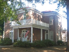 G.J. George Houselisted 2006
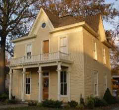 Turney-Hall House (Additional Documentation)listed 2018
Population over time
2 figuresFairfield fell from 5,154 to 4,883 between 2010 and 2020. These are the recorded population figures Wikidata holds for this place, reached through the Geographic Names Information System number this page is keyed on rather than by name, so they belong to this place and not to another of the same name. Most are census counts, but not all are: an early figure may be a founding or settlement estimate, and an estimate published within five years of a census is left out. The change column is computed, and is left blank where more than 20 years separate a figure from the one before it, because a gap that long is not a change between two counts.
| Year | People | Change |
|---|---|---|
| 2010 | 5,154 | |
| 2020 | 4,883 | -271 (-5%) |
Topographic sheets covering this place
5 surveys from 8 printed sheetsMatched by testing this settlement's coordinate against the published boundary of every sheet in the United States Geological Survey's historical collection. Each opens the scanned sheet at the Survey.
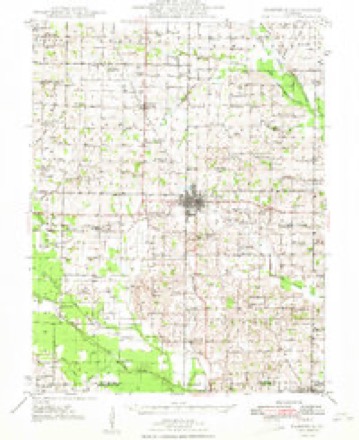
- 1948 USGS Fairfield quadrangle1:62500, 2 printings
- 1958 USGS Belleville quadrangle1:250000, 3 printings
- 1962 USGS Belleville quadrangle1:250000
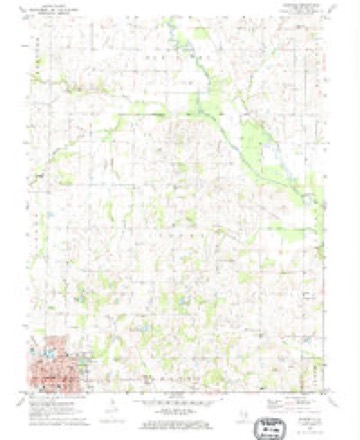
- 1971 USGS Fairfield quadrangle1:24000
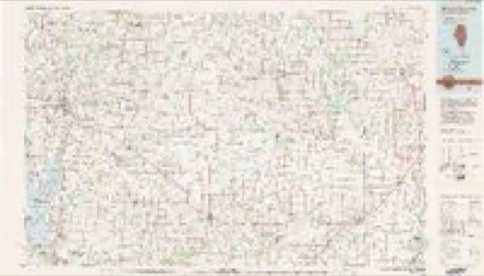
- 1982 USGS Mount Vernon quadrangle1:100000


Fires near this place
1 since 2002Regional context, not property-specific evidence. The federal wildfire occurrence database lists 1 fire within 5 miles of Fairfield in 2002, burning under an acre in total. None started naturally. 1 was recorded as arson. Distance is straight-line from the map coordinates, so a fire counted here may appear on a neighbouring settlement's page as well.
| Reported cause | Fires |
|---|---|
| Arson/incendiarism | 1 |
The most recent of them, most recent first, with the day each was reported and the service that recorded it.
| Date | Cause | Size | Reported by | Name on the report |
|---|---|---|---|---|
| 7 April 2002 | Arson/incendiarism | under an acre | Illinois State Fire Marshal's Office | not named |
Settlements close enough to share some of these fires:
Mines and quarries near this place
1 within 5 milesRegional context, not property-specific evidence. The federal mineral resources record lists 1 working within 5 miles of Fairfield: 1 past producer. None of them still produces. What was taken out: Stone, Crushed/Broken. Distance is straight-line from the map coordinates, so a quarry counted here may appear on a neighbouring settlement's page as well.
| Where | Site | Commodity | Status | Recorded |
|---|---|---|---|---|
| Wayne County Highway Department | Stone, Crushed/Broken | Past Producer |
Storms near this place
60 of 83 shownRegional context, not property-specific evidence. The National Weather Service names Fairfield in 83 storm reports between 1994 and 2025: 31 thunderstorm wind, 18 flash flood, 18 hail, 5 flood. The reports record 3 injuries. Each account below is quoted exactly as the forecast office filed it, from the NOAA Storm Events Database, and each date opens the federal record of that event.
| When | Event | Place named | Harm | What the report says |
|---|---|---|---|---|
| April 2011 | Tornado (EF2) | Fairfield | 2 hurt, $400,000 | One house was destroyed, with part of the roof removed and separation of some walls. A machine shed and several grain bins were destroyed. About a dozen power poles were snapped. Dozens of trees were snapped or uprooted. A tank was blown about 150 yards. An outbuilding was blown across Route 15. The average path width was 100 yards. Peak winds were estimated near 120 mph. |
| April 1994 | Thunderstorm Wind | Fairfield | 1 hurt, $500,000 | Three mobile homes were destroyed in Fairfield injuring one person. Trees and power lines were also blown down in Fairfield. |
| April 2006 | Thunderstorm Wind | Fairfield | $500,000 | Wind damage was widespread in and around Fairfield. The most severe damage was in the Fairfield Municipal Airport area, where a crop-dusting company's hangar collapsed onto three airplanes. Metal from the building blew across a highway and wrapped around a stop sign. A metal storage building across from the hangar was destroyed. Just north of the hangar, the roof was partially peeled off an auto body shop, and a corner of a residential garage was damaged by flying debris. A mobile home was shifted off its foundation about a half mile north of the airport. Metal debris was tangled in power lines near the airport. The roof was peeled off an agribusiness about two to three miles north of Fairfield. The roof of radio station WFIW was partially ripped off. The steeple was blown off a church and through the front of the building while it was in session, but nobody was hurt. Dozens of trees were snapped or uprooted across Fairfield, and several television antennae were snapped. Many of the downed trees were weak or shallow-rooted trees. There was underpinning and shingle damage to other homes in Fairfield. A train ran into downed tree limbs across railroad tracks, causing minor damage to the train and forcing the closure of most railroad crossings in Fairfield for two hours. A National Weather Service damage survey indicated straight-line winds from 70 to 80 MPH were responsible for the damage, which was oriented from southwest to northeast. Relatively light damage occurred in rural areas between Fairfield and the Hamilton County line, where a barn was destroyed and a couple of homes were damaged. A person near the Hamilton County line photographed an apparent "gustnado," and numerous other citizens on the northern edge of Fairfield reported apparent gustnadoes. |
| August 2007 | Thunderstorm Wind | Fairfield | $150,000 | Roofs were damaged, and numerous trees were blown down by very strong thunderstorm winds. The wind damage was primarily from the east side of Fairfield eastward along Route 15. The entire roof was blown off a residence, and another residence was partially unroofed. The unroofed home sustained heavy water damage. Part of the roof of a church was torn off. A few very large pine trees were uprooted. At least a few of the downed trees landed on houses and vehicles. Three small telephone poles were blown down. A cornfield was flattened. |
| January 2008 | Thunderstorm Wind | Fairfield | $120,000 | Roofs were blown off homes and other buildings in and around Fairfield. A roof was blown off of a house along U.S. Highway 45 just south of town. U.S. Highway 45 was closed between Interstate 64 and Fairfield after trees blew across the highway. A 60-foot tall concrete silo was blown over, and several large grain bins were destroyed. Temperatures dropped 26 degrees in less than 30 minutes at the Fairfield airport. |
| June 1999 | Thunderstorm Wind | Fairfield | $100,000 | Over 75 trees were uprooted or destroyed in Fairfield. Several homes and businesses were damaged. Fallen debris caused several complete street blockages. Most of the building damage was due to trees falling on structures. One large house was heavily damaged by a huge walnut tree that was uprooted. The roof was reportedly blown off a dry-cleaning business. |
| April 1996 | Flash Flood | Fairfield | $100,000 | no account filed |
| April 2011 | Thunderstorm Wind | Fairfield | $90,000 | Numerous trees and limbs were blown down. In Fairfield, a large tree landed on a house, and a structure containing three businesses was heavily damaged. In the Barnhill area, a 30-by-40 foot building was destroyed. |
| May 2016 | Hail | Fairfield | $80,000 | A slow-moving severe thunderstorm crossed the city of Fairfield, producing a swath of quarter to golf-ball size hail across the city. |
| April 2024 | Thunderstorm Wind | Fairfield | $50,000 | Thunderstorm winds from a storm line moving eastward caused a large tree to fall onto a trailer home on Le Roy St in Fairfield. |
| March 2006 | Flash Flood | Fairfield | $50,000 | Four roads in Fairfield were flooded. Flood damage to vehicles was reported at a car dealership. |
| March 2024 | Thunderstorm Wind | Fairfield | $30,000 | Widespread tree and powerline damage occurred near Fairfield. |
| March 2022 | Tornado (EF0) | Fairfield | $30,000 | A brief touchdown occurred along Walnut Grove Road. There was a public eyewitness of the tornado. Shingle damage occurred to a few houses. Some larger branches on a few trees were snapped. There was minor damage to a couple of outbuildings. Peak winds were estimated near 75 mph. |
| June 2014 | Thunderstorm Wind | Fairfield | $30,000 | The microburst downed several trees and numerous tree limbs. A small shed was destroyed. Two wooden power poles were broken. The microburst began just west of County Road 600E and continued along and north of County Road 8 for approximately 1.25 miles. The width of the microburst about 750 yards. |
| April 1999 | Lightning | Fairfield | $30,000 | Fire broke out at a Ford car dealership after lightning struck. The metal building was totally involved in flames. |
| June 1997 | Thunderstorm Wind | Fairfield | $25,000 | Lots of trees were down in the southeast part of Fairfield. Two houses sustained major damage when trees fell on them. The damage was to the upper portions of the houses. |
| August 2011 | Thunderstorm Wind | Fairfield | $20,000 | A couple of trees were felled in a cemetery. Tree limbs were knocked down around the city. A tree fell on a power line, knocking out power for several hours in the city. |
| May 2000 | Lightning | Fairfield | $20,000 | Lightning struck the Wal-Mart store near register seven. The lightning bolt came through the tile floor behind the register, making a hole and narrowly missing several people. A couple of shoppers were hit in the legs by pieces of tile blown out by the lightning. One theory is that the lightning travelled underneath the store along a steel beam before rising through the tile. |
| June 1998 | Thunderstorm Wind | Fairfield | $15,000 | Trees were blown down across parts of Wayne County. Some rural residences were damaged, mainly by falling trees, from the Fairfield area to Mount Erie and east. |
| April 1997 | Thunderstorm Wind | Fairfield | $15,000 | no account filed |
| August 2023 | Thunderstorm Wind | Fairfield | $12,000 | Lots of tree limbs were blown down in Fairfield, causing some power outages. A trained spotter estimated a wind gust to 60 mph on the west side of Fairfield. A tree was blown down on County Highway 2 near Mt. Erie. |
| August 2021 | Flash Flood | Fairfield | $10,000 | Flash flooding occurred along U.S. Highway 45. A person was rescued from their vehicle. |
| February 2019 | Flash Flood | Fairfield | $10,000 | Flash flooding of a small creek in Fairfield caused minor flooding of at least three houses. Flooding of a few streets was reported in the city of Fairfield. A few miles east of Fairfield, County Road 925N was flooded and closed. The daily rainfall amount at a mesonet site in Fairfield was 4.28 inches. |
| April 2016 | Thunderstorm Wind | Fairfield | $10,000 | Trees were blown down in Fairfield. Falling trees brought down power lines on U.S. Highway 45 just south of town. |
| August 2008 | Thunderstorm Wind | Fairfield | $10,000 | A large tree fell on a bridge under construction, but the bridge was not damaged. A large tree limb fell on a mobile home, causing minor damage. |
| April 2005 | Thunderstorm Wind | Fairfield | $10,000 | Trees and power lines were blown down. Two trees landed on houses. Roofing was blown off a business. Large tree limbs were blown down, including one that landed on a garage and another on a truck. Some shingles were blown off houses. |
| June 2000 | Flash Flood | Fairfield | $10,000 | Widespread street flooding occurred in Fairfield. Water was reported up to the bottoms of cars, and U.S. Highway 45 had water over it. The sheriff department reported water going into some buildings. Rainfall amounts were measured up to 2.75 inches in less than 3 hours' time. |
| May 1999 | Thunderstorm Wind | Fairfield | $10,000 | Just west of Fairfield, a section of roof was blown off a church. A glass door at the entrance to the Wayne County Courthouse was shattered. |
| July 2009 | Thunderstorm Wind | Fairfield | $8,000 | Several trees were blown down. A few of the trees were uprooted. |
| June 2008 | Thunderstorm Wind | Fairfield | $6,000 | Two trees were down across U.S. Highway 45. |
| July 2025 | Flash Flood | Fairfield | $5,000 | Flash flooding occurred in yards along Johnson Creek in Fairfield, IL. |
| July 2014 | Thunderstorm Wind | Fairfield | $5,000 | Power lines were blown down in the city. |
| April 2012 | Thunderstorm Wind | Fairfield | $5,000 | Tree limbs were blown down and a tree was blown on a garage in Fairfield. |
| June 2011 | Thunderstorm Wind | Fairfield | $4,000 | Tree limbs were down on power lines. |
| July 2021 | Thunderstorm Wind | Fairfield | $3,000 | Telephone lines were down. Weighted tables at a restaurant were blown over. |
| July 1997 | Thunderstorm Wind | Fairfield | $3,000 | Reported by Illinois ESDA. A few trees were down. Food booths at the county fair were toppled. Scraps of metal from livestock barns were blown around the fairgrounds. |
| June 2014 | Tornado (EF0) | Fairfield | $2,000 | This widely photographed and videotaped tornado caused very little damage. Much of its track was over open fields. Where the tornado crossed tree lines, tree limbs were broken. The tornado began southeast of the intersection of Illinois Highway 15 and County Road 10. The tornado travelled east-northeast before curving southeast as it approached the southwest side of Fairfield. Peak winds were estimated near 75 mph. |
| June 2014 | Tornado (EF0) | Fairfield | $2,000 | Near the beginning of the tornado track, just southwest of the intersection of County Road 1650E and County Road 700N, the tornado downed a tree onto a house. There was some structural damage to the house. Otherwise, this videotaped tornado tracked across mostly open fields. There was some disturbance to corn fields as it tracked southeast toward County Road 1800E. Peak winds were estimated near 85 mph. |
| August 2007 | Thunderstorm Wind | Fairfield | $2,000 | Numerous branches from 6 to 8 inches in diameter were blown down at the high school. A couple of trees were blown down across power lines. |
| August 2019 | Thunderstorm Wind | Fairfield | $1,000 | A tree was down on a residential street in the city. |
| August 2025 | Funnel Cloud | Fairfield | - | Video of a funnel cloud extending at least halfway to the surface was shared with the funnel positioned to the NNW of the 900 block of Enterprise Rd north of Fairfield. No damage was reported. |
| July 2024 | Flash Flood | Fairfield | - | Roadway flooding occurred on the north side of Fairfield with 4 inches of water flowing across the road. Radar estimated rainfall totals during the late afternoon to early evening were 1.5-2.5 inches near town and 2.5-3.5 inches west of town. |
| August 2023 | Flash Flood | Fairfield | - | Water was over a portion of U.S. Highway 45 north of Jeffersonville. The road was eventually closed north of Cisne. |
| July 2020 | Flash Flood | Fairfield | - | Numerous roads were flooded in Fairfield. |
| August 2019 | Flash Flood | Fairfield | - | Major routes around Fairfield were closed by flash flooding. Portions of U.S. Highway 45 south of Fairfield and Highway 15 west of Fairfield were impassable due to flooding. |
| August 2019 | Hail | Fairfield | - | The hail was reported near Interstate 64. |
| November 2019 | Flood | Fairfield | - | Two city streets were flooded in Fairfield, and one road was closed east of town. |
| September 2018 | Flash Flood | Fairfield | - | Water was over many roads in the county, including main highways such as Highway 15 and U.S. Highway 45 near Fairfield. Several county roads were flooded. A 48-hour rainfall total of 6.16 inches was reported in Fairfield by a CWOP observer. |
| June 2018 | Flood | Fairfield | - | Widespread flooding was observed along secondary roads between Wayne City and Fairfield. |
| June 2017 | Flood | Fairfield | - | Standing water was reported over portions of U.S. Highway 45 just north of Jeffersonville. |
| May 2012 | Hail | Fairfield | - | Quarter-size hail fell in Fairfield. Hail slightly bigger than quarter size fell on the south side of Fairfield. |
| July 2011 | Flash Flood | Fairfield | - | A radio station in Fairfield measured 1.96 inches in one hour. U.S. Highway 45 was flooded near Geff. Water was over some other roads. Thousands of acres of fertile bottomland were taken out of production. The acreage was mostly planted with corn, along with some soybeans. |
| February 2008 | Funnel Cloud | Fairfield | - | The funnel cloud was observed on Highway 15 just west of Fairfield. |
| August 2007 | Heavy Rain | Fairfield | - | Six inches of water was across Fairfield city roads. |
| June 2006 | Funnel Cloud | Fairfield | - | An off-duty fire/rescue member reported a funnel cloud with rotation. |
| August 2006 | Thunderstorm Wind | Fairfield | - | Trees were blown down. |
| August 2004 | Flash Flood | Fairfield | - | A section of U.S. Highway 45 just south of Fairfield was flooded and causing traffic problems. |
| August 2004 | Flash Flood | Fairfield | - | Several vehicles were stranded in floodwaters on city streets. |
| October 2004 | Heavy Rain | Fairfield | - | Water was reported running across several streets in the city. Ditches were overflowing. |
| April 2002 | Hail | Fairfield | - | Dime to quarter size hail fell in the Fairfield area. |
Nearest settlements
The eight closest, with where each one stands in the county. Distances are straight-line, computed from the Geographic Names Information System coordinates.
| Map | Place | Distance | Sheets |
|---|---|---|---|
| Fairfield Estates | 0.6 miles | 8 | |
| Hubbard | 3.5 miles | 8 | |
| Merriam | 4.5 miles | 8 | |
| Boyleston | 4.6 miles | 8 | |
| Geff | 5.0 miles | 8 | |
| Klines Corner | 5.4 miles | 8 | |
| Campbell | 5.7 miles | 8 | |
| Toms Prairie | 5.7 miles | 8 |
Elsewhere
Matched on this settlement's Geographic Names Information System number rather than its name, so it cannot be a different place of the same name in another state.
| Wikipedia article on Fairfield | An encyclopaedic summary. Its text is share-alike, so it is linked here rather than copied. |
| Wikidata item Q367441 | The structured record the population and elevation above come from. Public domain (CC0). |
Provenance
This settlement is recorded in the Geographic Names Information System as feature 408161. The sheet list is computed by point-in-boundary test against the United States Geological Survey's historical topographic inventory. Both are works of the United States government and carry no copyright under 17 U.S.C. 105.
Wildfire. Short, Karen C. 2022. Spatial wildfire occurrence data for the United States, 1992-2020 [FPA_FOD_20221014]. 6th Edition. Fort Collins, CO: Forest Service Research Data Archive. https://doi.org/10.2737/RDS-2013-0009.6 Collected with United States Government funding and usable without additional permissions or fees.
Mines and quarries. USGS Mineral Resources Data System (MRDS) https://mrdata.usgs.gov/mrds/ A work of the United States government, no copyright under 17 U.S.C. 105.
Storms. NOAA National Centers for Environmental Information, Storm Events Database https://www.ncei.noaa.gov/stormevents/ A work of the United States government, no copyright under 17 U.S.C. 105. Narratives are quoted verbatim from the National Weather Service report and are not edited or summarised.