 Block
Florence, Illinois
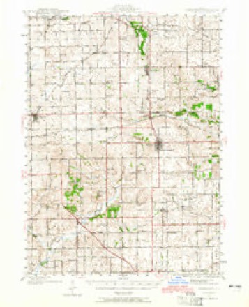
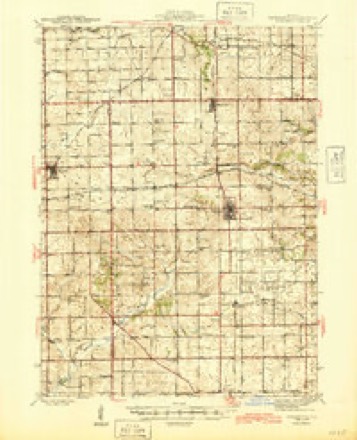
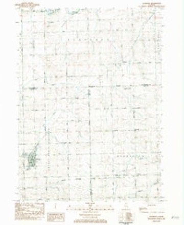
14 topographic sheets cover this place, the earliest surveyed in 1942 and the latest in 1983. It stands in Florence Township. It lies in ZIP code area 61032. The Survey maps it on the Shannon quadrangle.
Topographic sheets covering this place
8 surveys from 14 printed sheetsMatched by testing this settlement's coordinate against the published boundary of every sheet in the United States Geological Survey's historical collection. Each opens the scanned sheet at the Survey.
- 1942 USGS Forreston quadrangle1:62500, 2 printings
- 1945 USGS Forreston quadrangle1:62500, 2 printings
- 1954 USGS Rockford quadrangle1:250000
- 1955 USGS Rockford quadrangle1:250000
- 1958 USGS Rockford quadrangle1:250000, 4 printings
- 1963 USGS Rockford quadrangle1:250000
- 1981 USGS Rockford quadrangle1:100000, 2 printings
- 1983 USGS Shannon quadrangle1:24000





In the county-history sources
5,933 words on this townshipThe History of Stephenson County, Illinois : Containing ... Biographical Sketches ... War Record ... Statistics ... Portraits of Early Settlers ... History of the Northwest, History of Illinois, &c. .., published 1880 names this settlement in its chapter on Florence Township. These are the passages that mention it, exactly as the scans read.
This township is on the south line of the county, being bounded on the north by Harlem, on the east by Silver Creek, on the south by Carroll County, and on the west by Loran Township. Florence contains exactly the surveyor's township of six miles square. In the whole area, there is about 1,000 acres of woodland, the balance being prairie of the finest description. The timber lies principally on the north side of Yellow Creek, and the country there is very productive. The township is thickly settled, and as well supplied with churches and schools as any in the county.
Passage source: The History of Stephenson County, Illinois : Containing ... Biographical Sketches ... War Record ... Statistics ... Portraits of Early Settlers ... History of the Northwest, History of Illinois, &c. .., published 1880.
The first settler to come into Florence was Conrad Van Brocklin, who removed from Western New York in the fall of 1835, and, after taking some time to explore the country, settled with his family on Section 17, in the month of March, 1836. He erected a cabin but a little distance from" the residence he subsequently occupied, and opened a farm. For some months he was without neighbors, other than those residing at Craine's Grove and Freeport, and was obliged to procure his supplies from Galena and elsewhere.
Passage source: The History of Stephenson County, Illinois : Containing ... Biographical Sketches ... War Record ... Statistics ... Portraits of Early Settlers ... History of the Northwest, History of Illinois, &c. .., published 1880.
In August, 1836, Mason Dimmick emigrated into the neighborhood from Ohio, and settled east-northeast of Van Brocklin. That fall, Otis Love and family came in ; the next summer, Lorenzo Lee followed in the wake of Van Brocklin and the rest, and, in 1837, James Hart settled one mile and a half north of Van Brocklin's. These comprise the men who first settled in Florence and began the building-up of that portion of the county.
Passage source: The History of Stephenson County, Illinois : Containing ... Biographical Sketches ... War Record ... Statistics ... Portraits of Early Settlers ... History of the Northwest, History of Illinois, &c. .., published 1880.
Machine-read from a century-old scan, so expect the errors a machine makes: misspelled names, dropped words, stray characters.
Read the whole chapter on Florence Township - it names this place 20 more 20 times.
Fires near this place
9 since 2010Regional context, not property-specific evidence. The federal wildfire occurrence database lists 9 fires within 5 miles of Florence between 2010 and 2020, burning about 3 acres in total. None started naturally. None was recorded as arson. Distance is straight-line from the map coordinates, so a fire counted here may appear on a neighbouring settlement's page as well.
| Reported cause | Fires |
|---|---|
| Debris and open burning | 5 |
| Missing data/not specified/undetermined | 4 |
The most recent of them, most recent first, with the day each was reported and the service that recorded it.
| Date | Cause | Size | Reported by | Name on the report |
|---|---|---|---|---|
| 5 May 2010 | Missing data/not specified/undetermined | 1.0 acres | Illinois Division of Forestry Resources | 1845 |
| 18 May 2014 | Debris and open burning | 1.0 acres | Illinois Division of Forestry Resources | 14-0000049 |
| 11 May 2020 | Debris and open burning | under an acre | Illinois Division of Forestry Resources | 20-0000054 |
| 28 April 2010 | Missing data/not specified/undetermined | under an acre | Illinois Division of Forestry Resources | 1032 |
| 29 March 2010 | Missing data/not specified/undetermined | under an acre | Illinois Division of Forestry Resources | 1023 |
| 17 November 2010 | Missing data/not specified/undetermined | under an acre | Illinois Division of Forestry Resources | 10102 |
| 26 October 2017 | Debris and open burning | under an acre | Illinois Division of Forestry Resources | 17-0000116 |
| 16 October 2010 | Debris and open burning | under an acre | Illinois Division of Forestry Resources | 1094 |
Settlements close enough to share some of these fires:
Mines and quarries near this place
7 within 5 milesRegional context, not property-specific evidence. The federal mineral resources record lists 7 workings within 5 miles of Florence: 6 past producers, 1 producer. 1 still produces. What was taken out: Stone, Crushed/Broken. Distance is straight-line from the map coordinates, so a quarry counted here may appear on a neighbouring settlement's page as well.
| Where | Site | Commodity | Status | Recorded |
|---|---|---|---|---|
| Kutz Quarry | Stone, Crushed/Broken | Producer | ||
| N. Helms Quarry | Stone, Crushed/Broken | Past Producer | ||
| Unnamed Limestone Quarry | Stone, Crushed/Broken | Past Producer | ||
| Unnamed Limestone Quarry | Stone, Crushed/Broken | Past Producer | ||
| Unnamed Limestone Quarry | Stone, Crushed/Broken | Past Producer | ||
| Unnamed Limestone Quarry | Stone, Crushed/Broken | Past Producer | ||
| Unnamed Limestone Quarry | Stone, Crushed/Broken | Past Producer |
Storms near this place
5 since 1999Regional context, not property-specific evidence. The National Weather Service names Florence in 5 storm reports between 1999 and 2023: 4 tornado, 1 hail. No death or injury is recorded in these reports. Each account below is quoted exactly as the forecast office filed it, from the NOAA Storm Events Database, and each date opens the federal record of that event.
| When | Event | Place named | Harm | What the report says |
|---|---|---|---|---|
| March 2023 | Tornado (EFU) | Florence | - | This tornado began southeast of Lanark in Carroll County and tracked to the northeast before moving into Ogle County about a quarter mile north of the intersection of W White Oak Road and N Brookville Road. The tornado path then continued for about 5 miles through Ogle County (see NWS Chicago StormData). The tornado then crossed into Stephenson County, just east of the intersection of N Mt. Vernon Road and Montague Road. This tornado caused extensive damage to several farm buildings and also downed a few trees along its path. The tornado dissipated near the intersection of Florence Road and Illinois Route 26. The tornado was rated EF-1 in Carroll and Ogle Counties. In Stephenson County, there was no observable damage so the rating is |EF-U. |
| August 2020 | Tornado (EF0) | Florence | - | A tornado moved through cropland just south of Freeport. The tornado began just west of Florence, and moved N/NE for about 4.5 miles before dissipating at the southern edge of Freeport. The path was found in high resolution satellite imagery and confirmed by UAS survey. The tornado was on the leading edge of a larger swath of damaging straight line winds. There was no damage directly attributable to the tornado from which an EF-scale rating could be assigned. Thus, the tornado is designated EF-U. |
| March 2011 | Hail | Florence | - | A trained spotter about 2 miles southeast of Florence reported nickel to quarter size hail right on the Stephenson/Ogle county line. |
| June 2003 | Tornado (F0) | Florence | - | Dissipated near IL 26 & Park Rd. |
| June 1999 | Tornado (F0) | Florence | - | Brief tornado touchdown along West Florence Road. No damage was reported. |
Nearest settlements
The eight closest, with where each one stands in the county. Distances are straight-line, computed from the Geographic Names Information System coordinates.
| Map | Place | Distance | Sheets |
|---|---|---|---|
| Bolton | 4.0 miles | 14 | |
| South Freeport | 5.0 miles | 14 | |
| Freeport | 6.0 miles | 15 | |
| West Junction | 6.9 miles | 15 | |
| Valley Creek (historical) | 6.9 miles | 15 | |
| Willow Lake | 8.3 miles | 15 | |
| Browns Mill | 8.7 miles | 15 | |
| Pearl City | 9.5 miles | 14 |
Elsewhere
Matched on this settlement's Geographic Names Information System number rather than its name, so it cannot be a different place of the same name in another state.
| Wikipedia article on Florence | An encyclopaedic summary. Its text is share-alike, so it is linked here rather than copied. |
| Wikidata item Q60756064 | The structured record the population and elevation above come from. Public domain (CC0). |
Provenance
This settlement is recorded in the Geographic Names Information System as feature 408469. The sheet list is computed by point-in-boundary test against the United States Geological Survey's historical topographic inventory. Both are works of the United States government and carry no copyright under 17 U.S.C. 105.
Wildfire. Short, Karen C. 2022. Spatial wildfire occurrence data for the United States, 1992-2020 [FPA_FOD_20221014]. 6th Edition. Fort Collins, CO: Forest Service Research Data Archive. https://doi.org/10.2737/RDS-2013-0009.6 Collected with United States Government funding and usable without additional permissions or fees.
Mines and quarries. USGS Mineral Resources Data System (MRDS) https://mrdata.usgs.gov/mrds/ A work of the United States government, no copyright under 17 U.S.C. 105.
Storms. NOAA National Centers for Environmental Information, Storm Events Database https://www.ncei.noaa.gov/stormevents/ A work of the United States government, no copyright under 17 U.S.C. 105. Narratives are quoted verbatim from the National Weather Service report and are not edited or summarised.