 Block
Freeport, Illinois
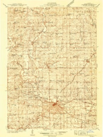
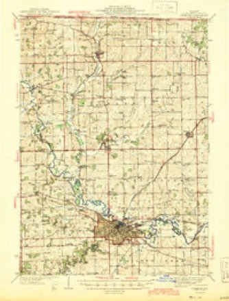
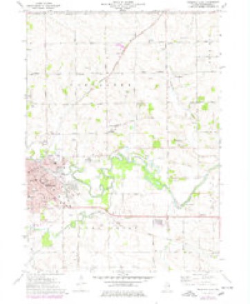
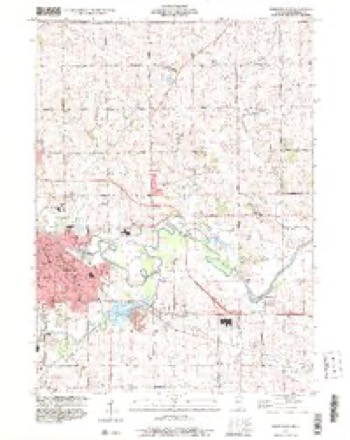
15 topographic sheets cover this place, the earliest surveyed in 1939 and the latest in 1999. It stands in Freeport Township. It lies in ZIP code area 61032. The Survey maps it on the Freeport East quadrangle. 23,973 people lived here at the 2020 count. It stands 778 feet above sea level.
Research this city
On record in Freeport
Buildings and businesses the archive holds for this place. Each opens its own page, with the source record it came from.
On the National Register 4 records
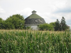 James Bruce Round Barnlisted 1984
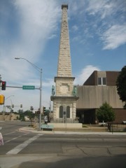 Soldiers' Monumentlisted 1998
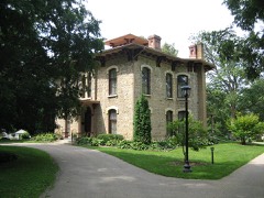 Oscar Taylor Houselisted 1984
- Stephenson County Courthouselisted 1974
Population over time
3 figuresFreeport fell from 26,443 to 23,973 between 2000 and 2020. These are the recorded population figures Wikidata holds for this place, reached through the Geographic Names Information System number this page is keyed on rather than by name, so they belong to this place and not to another of the same name. Most are census counts, but not all are: an early figure may be a founding or settlement estimate, and an estimate published within five years of a census is left out. The change column is computed, and is left blank where more than 20 years separate a figure from the one before it, because a gap that long is not a change between two counts.
| Year | People | Change |
|---|---|---|
| 2000 | 26,443 | |
| 2010 | 25,638 | -805 (-3%) |
| 2020 | 23,973 | -1,665 (-6%) |
Topographic sheets covering this place
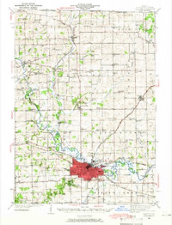
10 surveys from 15 printed sheetsMatched by testing this settlement's coordinate against the published boundary of every sheet in the United States Geological Survey's historical collection. Each opens the scanned sheet at the Survey.
- 1939 USGS Freeport quadrangle1:62500
- 1939 USGS Freeport quadrangle1:48000
- 1944 USGS Freeport quadrangle1:62500
- 1954 USGS Rockford quadrangle1:250000
- 1955 USGS Rockford quadrangle1:250000
- 1958 USGS Rockford quadrangle1:250000, 4 printings
- 1963 USGS Rockford quadrangle1:250000
- 1971 USGS Freeport East quadrangle1:24000, 2 printings
- 1981 USGS Rockford quadrangle1:100000, 2 printings
- 1999 USGS Freeport East quadrangle1:24000





What happened here
An account from the chapter on Freeport township. The inset identifies its exact source book and publication year.
Library Of The
During Father Cavanaugh's pastorate in Freeport there were no railroads. Early in the fifties, the Illinois Central was not completed, and he had to travel almost incessantly with horse and buggy. The cholera made his work yet more laborious, because of the great number of sick people he was called upon to see.
In the county-history sources
153,555 words on this townshipThe History of Stephenson County, Illinois : Containing ... Biographical Sketches ... War Record ... Statistics ... Portraits of Early Settlers ... History of the Northwest, History of Illinois, &c. .., published 1880 names this settlement in its chapter on Freeport Township. These are the passages that mention it, exactly as the scans read.
From 1840 until 1846, indeed up to the building of railroads, the growth of the county, as compared with earlier years, was slow. Other portions of the West were sought by settlers, particularly the lead mines, and received accessions more rapidly. One cause of this was the absence of markets. The population was engaged almost exclusively in agriculture, and after farms were opened there was but a moderate sale of their products for this reason. Settlers have been known to take a load of pork to Mineral Point, where it was disposed of with difficulty at $1.25 per hundred weight, and occasional shipments of grain were made down the Mississippi from Savannah, which practice continued up to the very period, when railroads were operated in the country. These flatboats were laden with produce and floated down the river to New Orleans, unless a market was found en route, and disposed of. The cargo being disposed of, the flat was sold for the lumber it contained, when the merchant who had shipped the venture, together with his supercargo or clerk and laborers, began his wearisome journey homeward. A partial market was found in the lead region, but as productions increased that market became overstocked, and prices decreased so that the transportation of commodities thither could not be made to pay. The same can be said of the Chicago market, though for a difi'erent reason - the distance. Chicago was at that early day beginning to be an important factor in the building up of the West. It was the point at which settlers procured their final outfits, and the market to which farmers transported their grain for sale. The means of conveyance was a lumber wagon drawn by four or five yoke of oxen, the driver pasturing his cattle at night by the wayside, himself camping out and cooking his meals. If he succeeded in progressing over horrible roads, or surviving the crossing of seemingly impassable sloughs and reaching his long journey's end, he was extremely fortunate. Not more so, however, if he was able to find a customer to whom a sale of the grain could be eff"ected at 50 cents per bushel. Whenever he was able to control their patronage, he returned with a load of merchandise for the merchants of Freeport, for which he received a nominal consideration of store goods. Occasionally he found a family of emigrants, who, having reached Chicago by "way of the lake, were waiting for the means of conveyance to continue their trip. In such cases the household goods of this "'lucky find," together with the emigrant and his wife and little ones, were laden on the wagon for the return trip. Such a cargo was a bonanza to the teamster, for passage was invariably cash. With such difficulties to encounter, and the low prices paid for commodities, together with the extravagant charge made for many of the necessaries of life, it is not surprising that wealth was not rapidly amassed. As a compensation for these disadvantages, land was cheap. The broad prairies, which proved to be the finest farming land in the State, were held at a price within reach of the most impecunious. The suggestion is frequently ma^e to some who came at an early day and are yet comparatively the reverse of independent, as to the reason why they failed to invest and wait for a rise ;
Passage source: The History of Stephenson County, Illinois : Containing ... Biographical Sketches ... War Record ... Statistics ... Portraits of Early Settlers ... History of the Northwest, History of Illinois, &c. .., published 1880.
Thus protected, the Mormons began in Illinois a career of missionary work which has attracted thousands to their fold at the sacrifice of every sentiment of self-respect and the regard of all mankind. The emissaries of the sect were distributed throughout Illinois and States contiguous thereto, with results that were made apparent by the annual increase of population in Nauvoo. The proselytes were by no means the ignorant classes represented as the converted of late years, but educated, reasoning men, with their families. The meetings, it is said, held in Stephenson County, were quite respectable, but conversion was accomplished by means entirely dissimilar to those adopted by other denominations. There was little public speaking, the missionaries having recourse te private interviews and personal solicitation to accomplish their miracles. The result of their labors was not, if report in that behalf is predicated upon fact, proportioned to the means used or the diligence and energy exercised. The saint& were thick as lice in Egypt, according to report, but were unable to perform miracles as was Moses, and departed from Stephenson County, wise in their experience, but impoverished as to results. True, there were some who accompanied them, notably Hector C. Haight, of Jefferson Township, and a settler named Shumway, residing in the northern part of the county.
Passage source: The History of Stephenson County, Illinois : Containing ... Biographical Sketches ... War Record ... Statistics ... Portraits of Early Settlers ... History of the Northwest, History of Illinois, &c. .., published 1880.
In this year the town of Oneco, in Oneco Township, was laid out under the direction of John K. Brewster, and Orangeville, within sight of Oneco, was also surveyed about this period by John M. Curtis, though its platting and building up were delayed until 1846, when John Bowers came in and established the place.
Passage source: The History of Stephenson County, Illinois : Containing ... Biographical Sketches ... War Record ... Statistics ... Portraits of Early Settlers ... History of the Northwest, History of Illinois, &c. .., published 1880.
Machine-read from a century-old scan, so expect the errors a machine makes: misspelled names, dropped words, stray characters.
Read the whole chapter on Freeport Township - it names this place 470 more 470 times.
Fires near this place
22 since 2010Regional context, not property-specific evidence. The federal wildfire occurrence database lists 22 fires within 5 miles of Freeport between 2010 and 2017, burning about 20 acres in total. None started naturally. None was recorded as arson. Distance is straight-line from the map coordinates, so a fire counted here may appear on a neighbouring settlement's page as well.
| Reported cause | Fires |
|---|---|
| Missing data/not specified/undetermined | 10 |
| Debris and open burning | 9 |
| Smoking | 2 |
| Power generation/transmission/distribution | 1 |
The most recent of them, most recent first, with the day each was reported and the service that recorded it.
| Date | Cause | Size | Reported by | Name on the report |
|---|---|---|---|---|
| 27 September 2017 | Debris and open burning | under an acre | Illinois Division of Forestry Resources | 17-0000102 |
| 5 May 2010 | Missing data/not specified/undetermined | 1.0 acres | Illinois Division of Forestry Resources | 1845 |
| 29 May 2010 | Missing data/not specified/undetermined | under an acre | Illinois Division of Forestry Resources | 1046 |
| 18 May 2014 | Debris and open burning | 1.0 acres | Illinois Division of Forestry Resources | 14-0000049 |
| 14 May 2013 | Smoking | 1.0 acres | Illinois Division of Forestry Resources | 13-0000039 |
| 14 May 2013 | Debris and open burning | 4.0 acres | Illinois Division of Forestry Resources | 13-0000038 |
| 7 April 2014 | Debris and open burning | 1.0 acres | Illinois Division of Forestry Resources | 14-0000028 |
| 28 April 2010 | Missing data/not specified/undetermined | under an acre | Illinois Division of Forestry Resources | 1032 |
Settlements close enough to share some of these fires:
Mines and quarries near this place
10 of 19 shownRegional context, not property-specific evidence. The federal mineral resources record lists 19 workings within 5 miles of Freeport: 15 past producers, 4 producers. 4 still produce. What was taken out: Stone, Crushed/Broken, Sand and Gravel, Construction. Distance is straight-line from the map coordinates, so a quarry counted here may appear on a neighbouring settlement's page as well.
| Where | Site | Commodity | Status | Recorded |
|---|---|---|---|---|
| Freeport Pit | Sand and Gravel, Construction | Past Producer | ||
| Duth Quarry | Stone, Crushed/Broken | Past Producer | ||
| Dwyer Quarry | Stone, Crushed/Broken | Producer | ||
| Economy Pit | Stone, Crushed/Broken | Producer | ||
| Freeport City Eng. | Stone, Crushed/Broken | Past Producer | ||
| Kutz Quarry | Stone, Crushed/Broken | Producer | ||
| Mills Quarry | Stone, Crushed/Broken | Past Producer | ||
| N. Helms Quarry | Stone, Crushed/Broken | Past Producer | ||
| Nieman Quarry | Stone, Crushed/Broken | Past Producer | ||
| Unnamed Limestone Quarry | Stone, Crushed/Broken | Past Producer |
Storms near this place
60 of 149 shownRegional context, not property-specific evidence. The National Weather Service names Freeport in 149 storm reports between 1995 and 2025: 91 thunderstorm wind, 27 hail, 12 heavy rain, 8 flood. No death or injury is recorded in these reports. Each account below is quoted exactly as the forecast office filed it, from the NOAA Storm Events Database, and each date opens the federal record of that event.
| When | Event | Place named | Harm | What the report says |
|---|---|---|---|---|
| August 2008 | Thunderstorm Wind | Freeport | $250,000 | Wind gusts estimated to be 65 to 75 mph caused widespread tree and structural damage in the vicinity of Freeport, IL between 630 pm and 655 pm August 4. On Rock City Rd, several trees and branches were blown down as well as a metal storage shed. In addition, twenty-five rows of corn on both sides of the road were flattened. Some buildings on the southwest side of town were damaged. On Fairview Rd, a tree was blown over onto a house. On Edwardsville Rd, some large tree limbs were blown down. A power outage was also observed across the county. |
| July 2003 | Thunderstorm Wind | Freeport | $150,000 | Mobile home overturned & limbs down |
| April 2010 | Thunderstorm Wind | Freeport | $100,000 | Wind gusts estimated to be 70 mph snapped some trees and utility poles in half and ripped some siding off of some houses along Pearl City Rd about 0.25 miles west of Highland Community College on the west side of Freeport, IL around 1155 pm April 5. This report was relayed by Stephenson County SKYNET. In addition, a 40 foot tall pine tree on the 1200 block of Lincoln Boulevard fell onto a house. Several Freeport streets were littered with downed trees, especially hard hit were South High Ave, Lemon Ave, Nursery Ave, Bauch Ave, West Pleasant St, and South Highland Ave. The Freeport Journal Standard also contributed to this report. |
| August 2010 | Thunderstorm Wind | Freeport | $50,000 | Wind gusts estimated to be 65 mph blew a limb down in Freeport, IL around 255 pm CDT August 20. The limb, which was 6 to 8 inches in diameter, fell onto some power lines which in turn caused a house fire. This report was relayed by WREX. |
| July 2003 | Thunderstorm Wind | Freeport | $50,000 | 8 inch limbs down |
| June 2009 | Lightning | Freeport | $25,000 | Lightning struck a Church in Freeport, IL around 945 am June 19. |
| June 2008 | Thunderstorm Wind | Freeport | $25,000 | Wind gusts estimated to be 65 mph blew down some 12 inch diameter tree limbs and caused structural damage to some buildings along Highway 20 south of Freeport, IL around 3:10 pm June 12. |
| August 2003 | Hail | Freeport | $25,000 | no account filed |
| September 2005 | Thunderstorm Wind | Freeport | $20,000 | 1 to 3 foot diameter trees were downed during a downburst on the north side of Freeport. One tree fell on a house causing unspecified damage. The Stephenson County Emergency Manager measured 48 knot (55 mph) winds 1 mile south of Freeport. The Freeport Albertus Airport (KFEP) further south of the city measured 46 knot winds during the 1615-1625 CST (2215-2225 UTC) time period. |
| June 2008 | Thunderstorm Wind | Freeport | $15,000 | Winds estimated to be 65 mph blew down several large tree limbs down onto power lines in Freeport, IL at 10:20 am June 8. A power outage resulted affecting a part of Freeport. The tree limbs were over six inches in diameter. |
| June 2008 | Thunderstorm Wind | Freeport | $15,000 | Winds estimated to be 65 mph blew down several trees onto power lines just southwest of Freeport, IL at 10:20 am June 8. A power outage resulted affecting a part of Freeport. |
| May 1999 | Thunderstorm Wind | Freeport | $15,000 | Severe thunderstorm winds downed trees and power lines from Freeport through Cedarville to Rock Grove, including several at the Cedarville Cemetery. Some trees fell onto and blocked Highway 26. At the Dornink Airport in rural Cedarville, 2 hangars were destroyed and a third hangar lost its roof. |
| June 2010 | Thunderstorm Wind | Freeport | $10,000 | Trees and power lines were downed by severe thunderstorm wind. |
| May 1999 | Thunderstorm Wind | Freeport | $8,000 | Severe thunderstorm winds downed 8 trees and a traffic signal. |
| July 2009 | Flash Flood | Freeport | $5,000 | Heavy rains caused some flash flooding of some streets in Freeport, IL during the late evening hours of July 27. Several traffic signals were disabled. |
| August 2008 | Thunderstorm Wind | Freeport | $5,000 | Wind gusts estimated to be 65 mph blew down several trees up to a foot in diameter 1 mile east of Freeport, IL at 630 am August 4. In addition, power lines were knocked down. |
| June 2008 | Thunderstorm Wind | Freeport | $5,000 | Wind gusts estimated to be 70 mph blew down numerous trees and power lines in the vicinity of Freeport, IL around 2:15 pm June 28. |
| July 2006 | Thunderstorm Wind | Freeport | $5,000 | 6 to 8 inch diameter braches down on some roads in the southwest part of the city. Some partially rotted whole trees also down. |
| July 2006 | Thunderstorm Wind | Freeport | $5,000 | Several trees & large limbs down across the city blocking some streets. One tree fell onto a house. |
| June 1999 | Thunderstorm Wind | Freeport | $5,000 | Roof partially torn off an apartment building. |
| October 2004 | Thunderstorm Wind | Freeport | $3,000 | Downburst leveled several trees 2.5 to 3 feet in diameter along with power lines. The trees were solid but had been weakened by severe storms back in August. |
| June 2006 | Thunderstorm Wind | Freeport | $2,000 | trees and power lines down |
| July 2003 | Heavy Rain | Freeport | $2,000 | Street flooding |
| July 2003 | Heavy Rain | Freeport | $2,000 | Small streams & ditches overflowing |
| July 2003 | Heavy Rain | Freeport | $2,000 | Street flooding |
| June 2000 | Thunderstorm Wind | Freeport | $2,000 | no account filed |
| June 1998 | Thunderstorm Wind | Freeport | $1,000 | Several trees were blown down and vents were ripped off a tire store after straight line thunderstorm winds up to 65 mph rushed across the county. |
| July 2017 | Thunderstorm Wind | Freeport | $250 | The local fire department reported a tree branch fell and brought down a power line. |
| August 2025 | Thunderstorm Wind | Freeport | - | A report of several small branches generally between 1 to 2 inches in diameter down in Freeport was received. |
| August 2025 | Thunderstorm Wind | Freeport | - | Several 6 to 7 inch diameter tree limbs were knocked down with some blocking a street in southern Freeport for a time. Time estimated by radar. |
| May 2024 | Thunderstorm Wind | Freeport | - | Trees were blown down in Freeport. Time estimated from radar data. |
| May 2024 | Thunderstorm Wind | Freeport | - | Several large trees blown down, blocking roads. |
| May 2024 | Thunderstorm Wind | Freeport | - | Also reported pea size hail for a minute. |
| May 2024 | Thunderstorm Wind | Freeport | - | Several 4 inch diameter tree branches down. Power lines damaged. Time estimated from radar data. |
| May 2024 | Thunderstorm Wind | Freeport | - | Tree branches down along with an uprooted hardwood tree. The time is based on radar data. |
| July 2024 | Thunderstorm Wind | Freeport | - | A public report of a tree down. Time of the event was estimated using radar. |
| July 2024 | Flash Flood | Freeport | - | A public report of street flooding in Freeport. |
| July 2024 | Thunderstorm Wind | Freeport | - | Law Enforcement reports tree limbs down. |
| June 2023 | Thunderstorm Wind | Freeport | - | An 18 inch diameter tree was blown down at Highland Community College. |
| July 2023 | Thunderstorm Wind | Freeport | - | Several 5 inch or larger tree branches downed by thunderstorm winds. |
| July 2023 | Thunderstorm Wind | Freeport | - | Trained spotter estimated 60 mph wind gusts with the thunderstorm. |
| August 2022 | Flash Flood | Freeport | - | The Emergency Manager reported flooded roadways with water over the tops of fire hydrants on some of the streets on the northwest side of the city. |
| November 2022 | Thunderstorm Wind | Freeport | - | Law Enforcement reported several trees and power lines down in the Freeport Metro area. |
| July 2021 | Thunderstorm Wind | Freeport | - | At least one tree reported down in Freeport. |
| August 2021 | Thunderstorm Wind | Freeport | - | A tree was reported down near the intersection of Illinois 26 and Stephenson Street. |
| December 2021 | Thunderstorm Wind | Freeport | - | A spotter reported a ten inch diameter tree uprooted and blown against a house. |
| July 2020 | Thunderstorm Wind | Freeport | - | A large and healthy limb fell onto two parked cars in Freeport. |
| August 2020 | Hail | Freeport | - | Reported in Freeport from a separate supercell before the derecho straight-line wind damage occurred. |
| March 2019 | Flood | Freeport | - | The Pecatonica River at Freeport rose above major flood stage of 16 feet around 545 PM on March 16th and fell back below major flood stage on March 20th around 9 AM. The river crested at 17.3 feet around midnight on March 19th. Homes along the Pecatonica River in Freeport needed to be evacuated. |
| June 2019 | Thunderstorm Wind | Freeport | - | A public report of a 6 inch tree limb down via Twitter. The time of the event was estimated using radar. |
| May 2019 | Hail | Freeport | - | A morning storm produced heavy rain and pea to penny size hail in Stephenson County. |
| May 2019 | Thunderstorm Wind | Freeport | - | Tree limbs were blown down. |
| July 2018 | Thunderstorm Wind | Freeport | - | The county emergency manager reported numerous trees and power lines were down within town. |
| August 2018 | Thunderstorm Wind | Freeport | - | The Emergency Manager reported isolated trees down. |
| May 2017 | Thunderstorm Wind | Freeport | - | The local law enforcement reported a large tree blown down and was blocking the road on the east side of Freeport. |
| May 2017 | Thunderstorm Wind | Freeport | - | A trained spotter estimated wind gusts of 60 mph. |
| May 2017 | Thunderstorm Wind | Freeport | - | A trained spotter estimated wind gusts up to 60 mph. |
| July 2017 | Thunderstorm Wind | Freeport | - | A trained spotter reported tree limbs down and power was out in the south portion of Freeport. Winds were estimated at 60 mph. |
| July 2017 | Thunderstorm Wind | Freeport | - | Winds were estimated at 60 mph and possibly gusting higher. |
| August 2016 | Thunderstorm Wind | Freeport | - | The Emergency Manager estimated winds of 55 to 60 MPH. |
Nearest settlements
The eight closest, with where each one stands in the county. Distances are straight-line, computed from the Geographic Names Information System coordinates.
| Map | Place | Distance | Sheets |
|---|---|---|---|
| West Junction | 2.4 miles | 15 | |
| Willow Lake | 2.6 miles | 15 | |
| South Freeport | 4.6 miles | 14 | |
| Scioto Mills | 4.8 miles | 15 | |
| Valley Creek (historical) | 4.9 miles | 15 | |
| Browns Mill | 5.4 miles | 15 | |
| Cedarville | 5.5 miles | 13 | |
| Winneshiek | 6.0 miles | 15 |
Elsewhere
Matched on this settlement's Geographic Names Information System number rather than its name, so it cannot be a different place of the same name in another state.
| Wikipedia article on Freeport | An encyclopaedic summary. Its text is share-alike, so it is linked here rather than copied. |
| Wikidata item Q202828 | The structured record the population and elevation above come from. Public domain (CC0). |
Provenance
This settlement is recorded in the Geographic Names Information System as feature 408732. The sheet list is computed by point-in-boundary test against the United States Geological Survey's historical topographic inventory. Both are works of the United States government and carry no copyright under 17 U.S.C. 105.
Wildfire. Short, Karen C. 2022. Spatial wildfire occurrence data for the United States, 1992-2020 [FPA_FOD_20221014]. 6th Edition. Fort Collins, CO: Forest Service Research Data Archive. https://doi.org/10.2737/RDS-2013-0009.6 Collected with United States Government funding and usable without additional permissions or fees.
Mines and quarries. USGS Mineral Resources Data System (MRDS) https://mrdata.usgs.gov/mrds/ A work of the United States government, no copyright under 17 U.S.C. 105.
Storms. NOAA National Centers for Environmental Information, Storm Events Database https://www.ncei.noaa.gov/stormevents/ A work of the United States government, no copyright under 17 U.S.C. 105. Narratives are quoted verbatim from the National Weather Service report and are not edited or summarised.