 Block
Geneva, Illinois
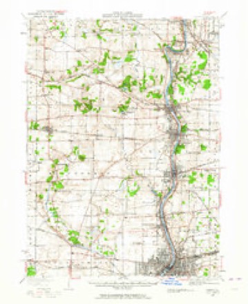
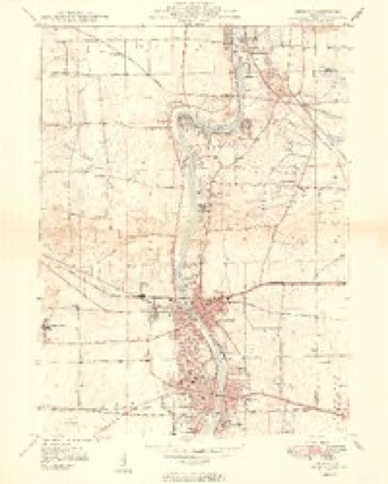
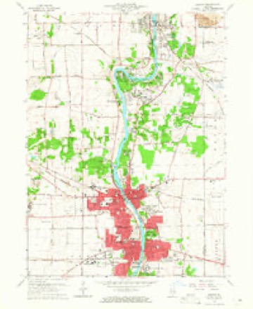
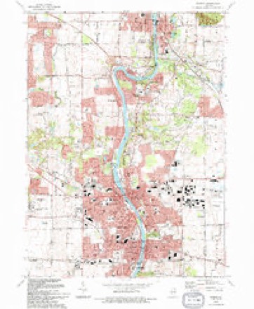
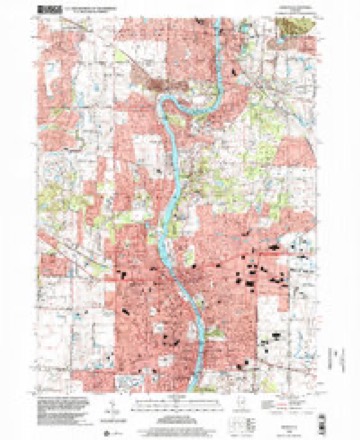
17 topographic sheets cover this place, the earliest surveyed in 1932 and the latest in 1998. It stands in Geneva Township. It lies in ZIP code area 60134. The Survey maps it on the Geneva quadrangle. 21,393 people lived here at the 2020 count. It stands 725 feet above sea level.
On record in Geneva
Buildings and businesses the archive holds for this place. Each opens its own page, with the source record it came from.
On the National Register 9 records
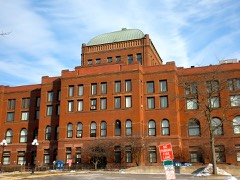 Central Geneva Historic Districtlisted 1979
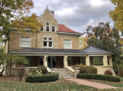 Elizabeth Placelisted 2008
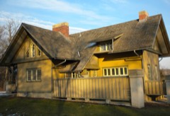 Fabyan Villalisted 1984
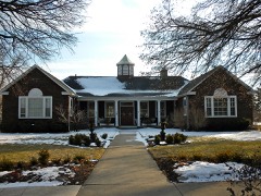 Geneva Country Day Schoollisted 1989
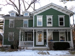 North Geneva Historic Districtlisted 1982
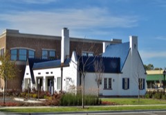 Pure Oil Stationlisted 2013
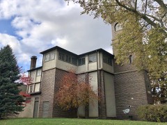 Riverbank Laboratorieslisted 2003
- Central Geneva Historic District (Boundary Increase)listed 2017
- North Geneva Historic District (Boundary Decrease and Additional Documentation)listed 2017
Population over time
3 figuresGeneva grew from 997 to 21,393 between 1860 and 2020. These are the recorded population figures Wikidata holds for this place, reached through the Geographic Names Information System number this page is keyed on rather than by name, so they belong to this place and not to another of the same name. Most are census counts, but not all are: an early figure may be a founding or settlement estimate, and an estimate published within five years of a census is left out. The change column is computed, and is left blank where more than 20 years separate a figure from the one before it, because a gap that long is not a change between two counts.
| Year | People | Change |
|---|---|---|
| 1860 | 997 | |
| 2010 | 21,495 | |
| 2020 | 21,393 | -102 (-0%) |
Topographic sheets covering this place
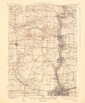
9 surveys from 17 printed sheetsMatched by testing this settlement's coordinate against the published boundary of every sheet in the United States Geological Survey's historical collection. Each opens the scanned sheet at the Survey.
- 1932 USGS Geneva quadrangle1:62500, 3 printings
- 1948 USGS Geneva quadrangle1:62500
- 1949 USGS Geneva quadrangle1:24000, 2 printings
- 1958 USGS Aurora quadrangle1:250000, 3 printings
- 1961 USGS Aurora quadrangle1:250000
- 1964 USGS Geneva quadrangle1:24000, 4 printings
- 1985 USGS Aurora quadrangle1:100000
- 1993 USGS Geneva quadrangle1:24000
- 1998 USGS Geneva quadrangle1:24000



In the county-history sources
2,983 words on this townshipHistory of Kane County, Ill., published 1908 names this settlement in its chapter on Geneva Township. These are the passages that mention it, exactly as the scans read.
At a meeting of the Inhabitants of the Town of Geneva in tlie Count)' of Kane and State of IlHnois at the School House in said Town on the 28th day of January A. D. 1845 '" pursuance of a notice given ten days previous to said Meeting and agreeable to an Act to incorporate the Inhabitants of such Town as may wish to be incorporated and approved Feb. 12th 1831, and on motion Leonard Howard was chosen President and Xelson Warner Clerk, who were duly sworn, when the inhabitants proceeded to vote viva voce and then were their votes in favor of Incorporation and six votes against incorporation.
Passage source: History of Kane County, Ill., published 1908.
The first actual settlement within the corporation of the present town was made in the fall of 1833, by Daniel S. Haight, who built a log cabin near the Geneva Springs, and occupied the same with his family. !Mr. Haight's claim embraced all. or nearly all, of the present site of Geneva, and was sold to James Herrington. December. 1834. It is stated that James Brown made a claim the same time as Mr. Haight, which joined the latter's on the north, and which was purchased by Mr. Frederick Bird in 1834. for $30. In 1834 Mr. Frederick Bird and family located a little north of the present city corporate limits, and James Herrington made purchase of the
Passage source: History of Kane County, Ill., published 1908.
Geneva - There has been some disagreement as to how the name Geneva came to be given the county seat. "Campbell Ford" was urged as a name for the new county seat, in honor of two of the commissioners appointed to make said location, but reliable and authentic information has disclosed the fact that the name of Geneva - after Geneva, New York - was determined upon before the commissioners left Chicago, and the name first suggested by C. B. Dodson, Esquire. The election for the organization of the county was held at Geneva in the log residence of Mr. Herrington in June, 1S36, which was also the date of the location of the county seat and the adoption of its present name.
Passage source: History of Kane County, Ill., published 1908.
Machine-read from a century-old scan, so expect the errors a machine makes: misspelled names, dropped words, stray characters.
Read the whole chapter on Geneva Township - it names this place 8 more 8 times.
Fires near this place
8 since 2013Regional context, not property-specific evidence. The federal wildfire occurrence database lists 8 fires within 5 miles of Geneva between 2013 and 2014, burning about 61 acres in total. None started naturally. 1 was recorded as arson. Distance is straight-line from the map coordinates, so a fire counted here may appear on a neighbouring settlement's page as well.
| Reported cause | Fires |
|---|---|
| Debris and open burning | 3 |
| Missing data/not specified/undetermined | 3 |
| Arson/incendiarism | 1 |
| Equipment and vehicle use | 1 |
The most recent of them, most recent first, with the day each was reported and the service that recorded it.
| Date | Cause | Size | Reported by | Name on the report |
|---|---|---|---|---|
| 5 June 2014 | Missing data/not specified/undetermined | 1.0 acres | Illinois Division of Forestry Resources | 2014-562 |
| 18 June 2014 | Missing data/not specified/undetermined | 1.0 acres | Illinois Division of Forestry Resources | 2014-615 |
| 4 May 2014 | Equipment and vehicle use | 1.0 acres | Illinois Division of Forestry Resources | 2014-445 |
| 7 April 2014 | Missing data/not specified/undetermined | 5.0 acres | Illinois Division of Forestry Resources | 14-177 |
| 7 April 2014 | Arson/incendiarism | 50 acres | Illinois Division of Forestry Resources | 2014-340 |
| 6 April 2014 | Debris and open burning | 2.0 acres | Illinois Division of Forestry Resources | 2013-300 |
| 6 April 2013 | Debris and open burning | under an acre | Illinois Division of Forestry Resources | 2013-294 |
| 5 April 2014 | Debris and open burning | under an acre | Illinois Division of Forestry Resources | 2014-328 |
Settlements close enough to share some of these fires:
Mines and quarries near this place
4 within 5 milesRegional context, not property-specific evidence. The federal mineral resources record lists 4 workings within 5 miles of Geneva: 4 past producers. None of them still produces. What was taken out: Stone, Crushed/Broken, Sand and Gravel, Construction. Distance is straight-line from the map coordinates, so a quarry counted here may appear on a neighbouring settlement's page as well.
| Where | Site | Commodity | Status | Recorded |
|---|---|---|---|---|
| Meyer Pit | Sand and Gravel, Construction | Past Producer | ||
| Hendrickson Quarry | Stone, Crushed/Broken | Past Producer | ||
| Riverbank Stone and Lime Quarry No1 | Stone, Crushed/Broken | Past Producer | ||
| Riverbank Stone and Lime Quarry No2 | Stone, Crushed/Broken | Past Producer |
Storms near this place
37 since 1998Regional context, not property-specific evidence. The National Weather Service names Geneva in 37 storm reports between 1998 and 2024: 22 thunderstorm wind, 10 hail, 2 flood, 2 tornado. The reports record 3 injuries. Each account below is quoted exactly as the forecast office filed it, from the NOAA Storm Events Database, and each date opens the federal record of that event.
| When | Event | Place named | Harm | What the report says |
|---|---|---|---|---|
| August 2012 | Thunderstorm Wind | Geneva | 2 hurt | Two injuries occurred when a wind gust estimated to near 60 mph slammed part of a picnic table into two people. One person was struck in the head and knocked unconscious. Her injuries required a three-hour brain surgery. The other person injured was a minor, and no details were released. |
| June 2008 | Thunderstorm Wind | Geneva | 1 hurt, $20,000 | Several trees and tree limbs were blown down along Chalmers Street. One large tree was completely uprooted. Other tree limbs and power lines were blown down across the east side of Geneva. A van on Nebraska Street lost its back window when hit by a tree limb and a man in his 20s was hit in the head by the tree limb, requiring 20 stitches. |
| July 2023 | Lightning | Geneva | $700,000 | Lightning struck a townhouse in St Charles causing a fire to break out. The fire spread into the next townhouse severely damaging both buildings. Two firefighters were injured while battling the fire. The exact extent of their injuries is unknown, but both of them were released from the hospital within the next day. Damages were estimated at more than $700,000. |
| August 2007 | Thunderstorm Wind | Geneva | $50,000 | Extensive tree and power line damage across Geneva. |
| June 2012 | Thunderstorm Wind | Geneva | $10,000 | Several trees were blown down, including some that fell on top of vehicles and power lines. |
| November 2010 | Thunderstorm Wind | Geneva | $10,000 | A three-sided store directory was blown off its foundation. Awnings were blown off two stores and four panels of a fence were destroyed. |
| June 2008 | Thunderstorm Wind | Geneva | $3,000 | Numerous tree limbs and power lines were blown down. |
| June 2011 | Thunderstorm Wind | Geneva | $2,000 | A tree was blown down on Gray Street. Tree limbs and power lines were also blown down in parts of Geneva. |
| February 2024 | Tornado (EF1) | Geneva | - | This tornado touched down along Keslinger Road west of Randall Road in Geneva. The first instance of damage was noted to a metal garage/storage building, which had portions of roofing and walls damaged or removed and was shifted off its foundation. The structure did not appear to be properly anchored to its foundation. Trees and a traffic light were then damaged as the tornado crossed the intersection, with shingle, soffit, and siding damage noted at a commercial building before the tornado moved into a residential area. A concentrated corridor of damage consistent with EF-1 wind speeds near 95 mph occurred along Cambridge Drive and Essex Court, where damage to several roofs and windows was observed. In addition, nearby trees were significantly damaged with almost all large branches snapped. The tornado weakened and narrowed as it moved east just north of Kaneville Road, with tree damage noted until the tornado dissipated near Kaneville Road and Burgess Road. The tornado was on the ground for fewer than two minutes. |
| June 2024 | Thunderstorm Wind | Geneva | - | Numerous trees and large branches were downed in the Randall Square park area near Fabyan Pkwy. |
| June 2024 | Thunderstorm Wind | Geneva | - | A tree had fallen down onto a house on Maple Ln near Center St in Geneva. |
| July 2024 | Thunderstorm Wind | Geneva | - | Numerous trees and tree limbs were blown down in Geneva, just northeast of Route 38. |
| July 2024 | Tornado (EF0) | Geneva | - | A brief tornado with estimated peak winds of 80 mph touched down just northwest of Route 38, about halfway between Peck Road and Randall Road. The tornado moved southeast causing roof damage to a self storage building, damaging a greenhouse and tossing shopping cart corrals around at a grocery store. A light pole was knocked over and several trees were snapped and uprooted. The tornado ended just northeast of the intersection of Randall Road and Bricher Road. |
| July 2024 | Thunderstorm Wind | Geneva | - | Wind gusts were estimated to 60 mph at Route 38 and Peck Road. |
| April 2023 | Hail | Geneva | - | Quarter size hail was reported at the Kane County Government Building. |
| September 2022 | Hail | Geneva | - | Multiple reports of hail ranging from 1 inch to 1.50 inches in diameter were received from Geneva. |
| September 2022 | Hail | Geneva | - | Hail as large as 1.25 inches in diameter was reported on the west side of Geneva which knocked down twigs and leaves. |
| September 2022 | Thunderstorm Wind | Geneva | - | Trees were blown down near Peck Road. |
| September 2022 | Thunderstorm Wind | Geneva | - | Photos shared on social media showed several trees snapped along Route 38. |
| August 2021 | Thunderstorm Wind | Geneva | - | A fence was blown down. |
| August 2020 | Thunderstorm Wind | Geneva | - | An Oak tree was blown down blocking Fulton Street. |
| July 2016 | Flood | Geneva | - | Street flooding at Kirk Rd and Wilson. Water up to the tops of tires on turning lanes. |
| July 2012 | Thunderstorm Wind | Geneva | - | Large tree limbs were blown down throughout Geneva. |
| July 2012 | Thunderstorm Wind | Geneva | - | A four foot diameter tree was blown down. |
| June 2010 | Thunderstorm Wind | Geneva | - | A large tree, 18 to 24 inches in diameter, was blown down in a parking lot at the Kane County Emergency Management Office. |
| August 2007 | Flood | Geneva | - | Some street and yard flooding with 0.78 inches of rain in 40 minutes. |
| August 2007 | Thunderstorm Wind | Geneva | - | Measured gust to 58 mph. |
| August 2007 | Hail | Geneva | - | Quarter size hail reported at Main and Randall Roads. |
| March 2005 | Hail | Geneva | - | Nickel sized hail reported at the intersection of Fabian and Kirk Rds. |
| May 2004 | Thunderstorm Wind | Geneva | - | Large tree limbs were down. |
| May 2004 | Thunderstorm Wind | Geneva | - | Large tree limbs were down. |
| July 2019 | Hail | Geneva | - | no account filed |
| April 2010 | Hail | Geneva | - | no account filed |
| September 2009 | Hail | Geneva | - | no account filed |
| July 2003 | Hail | Geneva | - | no account filed |
| July 2003 | Hail | Geneva | - | no account filed |
| November 1998 | Thunderstorm Wind | Geneva | - | no account filed |
Nearest settlements
The eight closest, with where each one stands in the county. Distances are straight-line, computed from the Geographic Names Information System coordinates.
| Map | Place | Distance | Sheets |
|---|---|---|---|
| Saint Charles | 1.8 miles | 17 | |
| Surrey Woods | 2.5 miles | 17 | |
| Batavia | 2.6 miles | 15 | |
| Woodland Hills | 2.9 miles | 15 | |
| Wildrose | 3.1 miles | 17 | |
| Wildrose Valley | 3.2 miles | 17 | |
| Spring Green | 3.5 miles | 15 | |
| Thornley | 3.6 miles | 17 |
Elsewhere
Matched on this settlement's Geographic Names Information System number rather than its name, so it cannot be a different place of the same name in another state.
| Wikipedia article on Geneva | An encyclopaedic summary. Its text is share-alike, so it is linked here rather than copied. |
| Wikidata item Q576152 | The structured record the population and elevation above come from. Public domain (CC0). |
Provenance
This settlement is recorded in the Geographic Names Information System as feature 408942. The sheet list is computed by point-in-boundary test against the United States Geological Survey's historical topographic inventory. Both are works of the United States government and carry no copyright under 17 U.S.C. 105.
Wildfire. Short, Karen C. 2022. Spatial wildfire occurrence data for the United States, 1992-2020 [FPA_FOD_20221014]. 6th Edition. Fort Collins, CO: Forest Service Research Data Archive. https://doi.org/10.2737/RDS-2013-0009.6 Collected with United States Government funding and usable without additional permissions or fees.
Mines and quarries. USGS Mineral Resources Data System (MRDS) https://mrdata.usgs.gov/mrds/ A work of the United States government, no copyright under 17 U.S.C. 105.
Storms. NOAA National Centers for Environmental Information, Storm Events Database https://www.ncei.noaa.gov/stormevents/ A work of the United States government, no copyright under 17 U.S.C. 105. Narratives are quoted verbatim from the National Weather Service report and are not edited or summarised.