 Block
Glen Ellyn, Illinois
19 topographic sheets cover this place, the earliest surveyed in 1908 and the latest in 1998. It stands in Milton Township. It lies in ZIP code area 60137. The Survey maps it on the Lombard quadrangle. 28,846 people lived here at the 2020 count. It stands 741 feet above sea level.
On record in Glen Ellyn
Buildings and businesses the archive holds for this place. Each opens its own page, with the source record it came from.
On the National Register 7 records
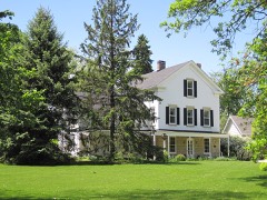 George Baker Houselisted 2010
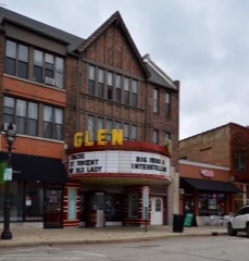 Glen Ellyn Downtown North Historic Districtlisted 2013
 Glen Ellyn Downtown South Historic Districtlisted 2013
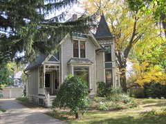 Glen Ellyn Main Street Historic Districtlisted 1984
 Lake Ellyn Parklisted 2017
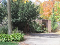 Alfred A. Schiller Houselisted 2008
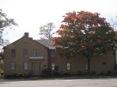 Stacy's Tavernlisted 1974
Population over time
2 figuresGlen Ellyn grew from 27,450 to 28,846 between 2010 and 2020. These are the recorded population figures Wikidata holds for this place, reached through the Geographic Names Information System number this page is keyed on rather than by name, so they belong to this place and not to another of the same name. Most are census counts, but not all are: an early figure may be a founding or settlement estimate, and an estimate published within five years of a census is left out. The change column is computed, and is left blank where more than 20 years separate a figure from the one before it, because a gap that long is not a change between two counts.
| Year | People | Change |
|---|---|---|
| 2010 | 27,450 | |
| 2020 | 28,846 | +1,396 (+5%) |
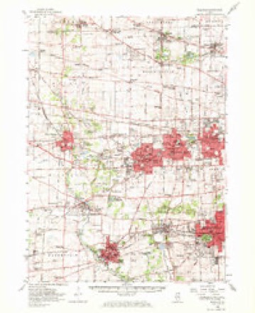
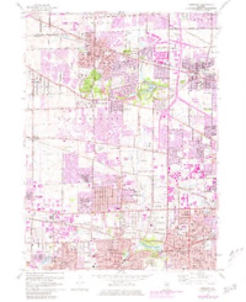
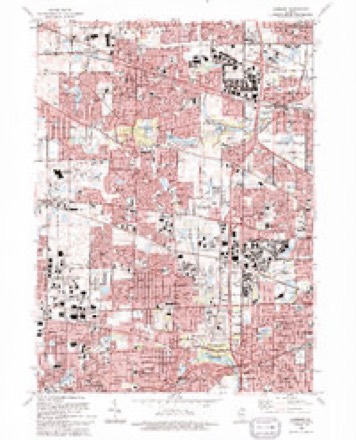
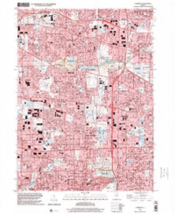
Topographic sheets covering this place
10 surveys from 19 printed sheetsMatched by testing this settlement's coordinate against the published boundary of every sheet in the United States Geological Survey's historical collection. Each opens the scanned sheet at the Survey.
- 1908 USGS Wheaton quadrangle1:62500, 5 printings
- 1948 USGS Wheaton quadrangle1:62500
- 1953 USGS Lombard quadrangle1:24000
- 1954 USGS Wheaton quadrangle1:62500, 2 printings
- 1958 USGS Aurora quadrangle1:250000, 3 printings
- 1961 USGS Aurora quadrangle1:250000
- 1962 USGS Lombard quadrangle1:24000, 3 printings
- 1985 USGS Aurora quadrangle1:100000
- 1993 USGS Lombard quadrangle1:24000
- 1998 USGS Lombard quadrangle1:24000



Mines and quarries near this place
4 within 5 milesRegional context, not property-specific evidence. The federal mineral resources record lists 4 workings within 5 miles of Glen Ellyn: 4 past producers. None of them still produces. What was taken out: Stone. Distance is straight-line from the map coordinates, so a quarry counted here may appear on a neighbouring settlement's page as well.
| Where | Site | Commodity | Status | Recorded |
|---|---|---|---|---|
| Dupage City Hwy. Dept. Pit | Stone | Past Producer | ||
| Glen Ellyn City Pit | Stone | Past Producer | ||
| Village of Lombard Pit | Stone | Past Producer | ||
| Wheaton City Pit | Stone | Past Producer |
Storms near this place
28 since 2000Regional context, not property-specific evidence. The National Weather Service names Glen Ellyn in 28 storm reports between 2000 and 2025: 16 thunderstorm wind, 10 hail, 1 flash flood, 1 funnel cloud. No death or injury is recorded in these reports. Each account below is quoted exactly as the forecast office filed it, from the NOAA Storm Events Database, and each date opens the federal record of that event.
| When | Event | Place named | Harm | What the report says |
|---|---|---|---|---|
| October 2006 | Flash Flood | Glen Ellyn | $300,000 | Widespread flooing across all of Dupage County. Underpasses were flooded and buildings took on water at many locations. Water one foot deep was reported on Army Trail Road in Addison. Water one foot deep was reported at York and Diversy Roads in Elmhurst. Knee deep water was reported at Fairview and Victor in Downers Grove. Water as high as bumpers was reported at Park Street and 53rd in Westmont. Nine inches of standing water at Benton and Charles in Naperville. Midwest Road in Oak Brook was closed with bumper high water. In Glen Ellyn, three cars were stalled in high water on Lambert Road, 5.00 inches of rain was measured one quarter mile east of the College of Dupage. In Woodridge, 3.95 inches of rain was measured. Four miles south of Glen Ellyn, 3.69 inches of rain was measured. Two miles west of Oak Brook, 3.38 inches of rain was measured and 3.31 inches of rain was measured in Darien. |
| July 2012 | Thunderstorm Wind | Glen Ellyn | $10,000 | Extensive tree damage resulted in damage to houses in the 500 block of Forest Avenue. |
| August 2008 | Thunderstorm Wind | Glen Ellyn | $3,000 | Numerous trees, tree limbs and power lines were blown down. |
| May 2015 | Thunderstorm Wind | Glen Ellyn | $1,000 | Six to eight inch diameter tree limbs were blown down and shingles were torn off of a roof. |
| May 2025 | Hail | Glen Ellyn | - | A photo shared on social media showed quarter size hail next to a ruler. |
| July 2025 | Thunderstorm Wind | Glen Ellyn | - | Tree limbs up to 6 inches in diameter were blown down. |
| August 2025 | Thunderstorm Wind | Glen Ellyn | - | A large tree at least one foot in diameter was uprooted and blocking a road in Glen Ellyn. |
| July 2024 | Thunderstorm Wind | Glen Ellyn | - | A 10 inch diameter tree limb was blown down. |
| July 2023 | Hail | Glen Ellyn | - | One inch hail was reported southwest of Glen Ellyn via mPING. |
| May 2022 | Funnel Cloud | Glen Ellyn | - | A rotating wall cloud with a brief funnel cloud was observed from east Wheaton. |
| August 2020 | Thunderstorm Wind | Glen Ellyn | - | A corridor of enhanced straight line winds developed near President Street in northeast Wheaton and continued across northern Glenn Ellyn, ending northeast of Lake Ellyn. Trees and utility poles were damaged along this corridor with the peak of the damage occurring east of Main Street and towards Lake Ellyn Park. Damage was consistent with wind speeds up to 90 mph. |
| August 2015 | Thunderstorm Wind | Glen Ellyn | - | A tree was blown down on Western Avenue and limbs were blown down on Fairview Avenue. |
| July 2012 | Thunderstorm Wind | Glen Ellyn | - | Six to ten inch diameter tree limbs were blown down. |
| July 2011 | Thunderstorm Wind | Glen Ellyn | - | Many trees were blown down in Glen Ellyn including a tree that damaged a house and resulted in the closure of Park Boulevard. Numerous large tree limbs and at least one uprooted tree were reported in a narrow swath of damage south of the railroad tracks and north of Roosevelt Road. |
| June 2008 | Thunderstorm Wind | Glen Ellyn | - | Several tree limbs 3 to 4 inches in diameter were blown down. |
| June 2007 | Thunderstorm Wind | Glen Ellyn | - | A tree was blown down. |
| August 2007 | Thunderstorm Wind | Glen Ellyn | - | A large tree was blown down near Shorewood subdivision. |
| May 2006 | Hail | Glen Ellyn | - | Nickel size hail was reported at Butterfield and Finley. |
| April 2023 | Hail | Glen Ellyn | - | no account filed |
| May 2019 | Hail | Glen Ellyn | - | no account filed |
| August 2018 | Hail | Glen Ellyn | - | no account filed |
| July 2012 | Hail | Glen Ellyn | - | no account filed |
| March 2010 | Hail | Glen Ellyn | - | no account filed |
| July 2009 | Hail | Glen Ellyn | - | no account filed |
| June 2007 | Thunderstorm Wind | Glen Ellyn | - | no account filed |
| October 2005 | Hail | Glen Ellyn | - | no account filed |
| August 2003 | Thunderstorm Wind | Glen Ellyn | - | no account filed |
| August 2000 | Thunderstorm Wind | Glen Ellyn | - | no account filed |
Nearest settlements
The eight closest, with where each one stands in the county. Distances are straight-line, computed from the Geographic Names Information System coordinates.
| Map | Place | Distance | Sheets |
|---|---|---|---|
| North Glen Ellyn | 1.0 miles | 19 | |
| Saddlewood | 1.1 miles | 19 | |
| Glen Oak | 1.5 miles | 19 | |
| Shorewood | 1.6 miles | 19 | |
| Flowerfield | 1.9 miles | 21 | |
| Wheaton | 2.3 miles | 21 | |
| Glendale Heights | 2.3 miles | 19 | |
| Gretna | 2.3 miles | 19 |
Elsewhere
Matched on this settlement's Geographic Names Information System number rather than its name, so it cannot be a different place of the same name in another state.
| Wikipedia article on Glen Ellyn | An encyclopaedic summary. Its text is share-alike, so it is linked here rather than copied. |
| Wikidata item Q1530761 | The structured record the population and elevation above come from. Public domain (CC0). |
Provenance
This settlement is recorded in the Geographic Names Information System as feature 421819. The sheet list is computed by point-in-boundary test against the United States Geological Survey's historical topographic inventory. Both are works of the United States government and carry no copyright under 17 U.S.C. 105.
Mines and quarries. USGS Mineral Resources Data System (MRDS) https://mrdata.usgs.gov/mrds/ A work of the United States government, no copyright under 17 U.S.C. 105.
Storms. NOAA National Centers for Environmental Information, Storm Events Database https://www.ncei.noaa.gov/stormevents/ A work of the United States government, no copyright under 17 U.S.C. 105. Narratives are quoted verbatim from the National Weather Service report and are not edited or summarised.