 Block
Golconda, Illinois
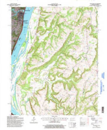
23 topographic sheets cover this place, the earliest surveyed in 1916 and the latest in 1996. It stands in Golconda No. 3 precinct. It lies in ZIP code area 62938. It stands on Lusk Creek. The Survey maps it on the Golconda quadrangle. 630 people lived here at the 2020 count. It stands 427 feet above sea level.
Research this city
On record in Golconda
Buildings and businesses the archive holds for this place. Each opens its own page, with the source record it came from.
On the National Register 1 record
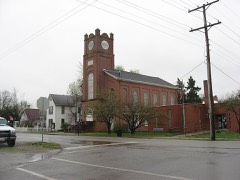 Golconda Historic Districtlisted 1976
Population over time
3 figuresGolconda grew from 404 to 630 between 1860 and 2020. These are the recorded population figures Wikidata holds for this place, reached through the Geographic Names Information System number this page is keyed on rather than by name, so they belong to this place and not to another of the same name. Most are census counts, but not all are: an early figure may be a founding or settlement estimate, and an estimate published within five years of a census is left out. The change column is computed, and is left blank where more than 20 years separate a figure from the one before it, because a gap that long is not a change between two counts.
| Year | People | Change |
|---|---|---|
| 1860 | 404 | |
| 2010 | 668 | |
| 2020 | 630 | -38 (-6%) |
Topographic sheets covering this place
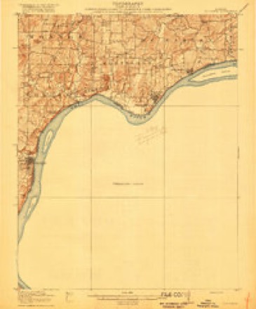
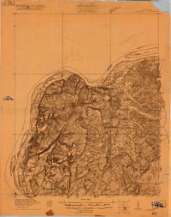
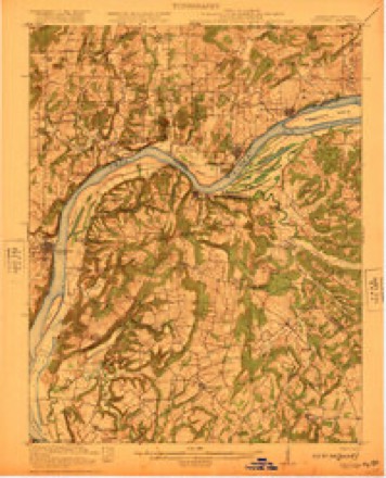
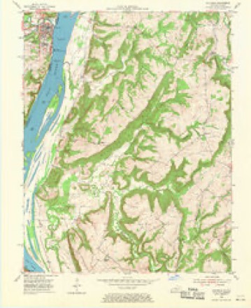
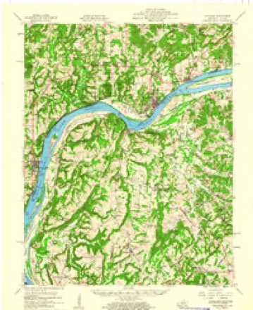
14 surveys from 23 printed sheetsMatched by testing this settlement's coordinate against the published boundary of every sheet in the United States Geological Survey's historical collection. Each opens the scanned sheet at the Survey.
- 1916 USGS Golconda quadrangle1:62500
- 1920 USGS Goloonda quadrangle1:48000
- 1921 USGS Golconda quadrangle1:62500, 3 printings
- 1949 USGS Paducah quadrangle1:250000, 2 printings
- 1950 USGS Paducah quadrangle1:250000
- 1954 USGS Golconda quadrangle1:24000, 3 printings
- 1954 USGS Paducah quadrangle1:250000, 2 printings
- 1959 USGS Golconda quadrangle1:62500, 2 printings
- 1961 USGS Paducah quadrangle1:250000, 2 printings
- 1964 USGS Paducah quadrangle1:250000, 2 printings
- 1984 USGS Paducah quadrangle1:100000
- 1986 USGS Paducah quadrangle1:100000
- 1987 USGS Paducah quadrangle1:250000
- 1996 USGS Golconda quadrangle1:24000






Fires near this place
20 since 2004Regional context, not property-specific evidence. The federal wildfire occurrence database lists 20 fires within 5 miles of Golconda between 2004 and 2020, burning about 185 acres in total. 1 started naturally. 1 was recorded as arson. Distance is straight-line from the map coordinates, so a fire counted here may appear on a neighbouring settlement's page as well.
| Reported cause | Fires |
|---|---|
| Missing data/not specified/undetermined | 8 |
| Equipment and vehicle use | 4 |
| Debris and open burning | 4 |
| Smoking | 2 |
| Arson/incendiarism | 1 |
| Natural | 1 |
The most recent of them, most recent first, with the day each was reported and the service that recorded it.
| Date | Cause | Size | Reported by | Name on the report |
|---|---|---|---|---|
| 6 September 2010 | Equipment and vehicle use | 20 acres | Shawnee National Forest | WALTERSBURG |
| 4 September 2010 | Debris and open burning | 10 acres | Kentucky Division of Forestry | CAVE SPRINGS RD. |
| 3 August 2009 | Debris and open burning | 5.0 acres | Illinois Division of Forestry Resources | 290 |
| 23 August 2018 | Equipment and vehicle use | under an acre | Illinois Division of Forestry Resources | 2535 |
| 19 August 2010 | Missing data/not specified/undetermined | 1.0 acres | Illinois Division of Forestry Resources | 1729 |
| 10 April 2010 | Missing data/not specified/undetermined | 2.0 acres | Illinois Division of Forestry Resources | 1719 |
| 9 March 2018 | Smoking | under an acre | Illinois Division of Forestry Resources | 2512 |
| 8 March 2009 | Natural | under an acre | Illinois Division of Forestry Resources | 1620 |
Settlements close enough to share some of these fires:
Mines and quarries near this place
4 within 5 milesRegional context, not property-specific evidence. The federal mineral resources record lists 4 workings within 5 miles of Golconda: 2 occurrences, 2 prospects. None of them still produces. What was taken out: Stone, Crushed/Broken, Barium-Barite, Fluorine-Fluorite. Distance is straight-line from the map coordinates, so a quarry counted here may appear on a neighbouring settlement's page as well.
| Where | Site | Commodity | Status | Recorded |
|---|---|---|---|---|
| Golconda Sandstone Exposure | Stone, Crushed/Broken | Prospect | ||
| Limestone Prospect | Stone, Crushed/Broken | Occurrence | ||
| Little Jean Mine | Barium-Barite, Fluorine-Fluorite | Occurrence | 1918, 1922 | |
| Little Jean Mine | Barium-Barite, Fluorine-Fluorite | Prospect |
Storms near this place
56 since 1995Regional context, not property-specific evidence. The National Weather Service names Golconda in 56 storm reports between 1995 and 2025: 31 flood, 16 thunderstorm wind, 5 hail, 2 tornado. No death or injury is recorded in these reports. Each account below is quoted exactly as the forecast office filed it, from the NOAA Storm Events Database, and each date opens the federal record of that event.
| When | Event | Place named | Harm | What the report says |
|---|---|---|---|---|
| January 1999 | Tornado (F2) | Golconda | $800,000 | A tornado with top winds estimated near 125 MPH struck a development of cabins and small summer homes in the Shawnee National Forest, at a place called Ropers Landing. The tornado damaged or destroyed about 30 of these structures and caused extensive tree damage. About six cabins were completely demolished. The homes were unhabited in the middle of winter. Ropers Landing is located at the base of a bluff along the Ohio River. The tornado lifted as it crossed the Ohio River. |
| May 2011 | Flood | Golconda | $250,000 | Major flooding continued on the Ohio River from April. At the Golconda river gage, the flood crest of 56.89 feet on the afternoon of May 6 was about 3 feet higher than the 1997 flood. This was still almost six feet lower than the record crest set in 1937. The activation of the New Madrid Floodway by the U.S. Army Corps of Engineers spared Pope County from an even higher crest that would have inundated even larger areas of the county. With the detonation of the Mississippi River levee at Birds Point, Missouri, the Ohio River stopped rising or rose much more slowly at the Golconda gage. Due to Ohio River flooding, the floodgates were installed at Golconda. This required that all access roads into and out of Golconda be closed, since those roads pass through the floodwall openings. Schools and government offices were closed due to the effective shutdown of Golconda, the largest town in the county. The town of Golconda was under a voluntary evacuation request. The Golconda post office was moved to a temporary location outside of town. Residents of the tiny community of Hamletsburg were evacuated. All the residents of Hall Town, which is an unprotected area outside the levee protection system, were evacuated as floodwaters engulfed the community. Lusk Creek backed up into Golconda, flooding a street. Residents of the community of Bay City boated to Golconda for emergency supplies. Floodwaters inundated much of the community of New Liberty. Bay Creek Camp was flooded. Backwater flooded rural gravel roads in the Brownfield area. |
| March 2018 | Flood | Golconda | $100,000 | Moderate flooding continued on the Ohio River from late February. At the Golconda river gage, the river crested at 52.66 feet on March 3. Flood stage is 40 feet. This crest was about one foot lower than the flood of March, 1997. Isolated evacuations of some lowland residents were conducted. In Pope County, a home on Lusk Creek near Golconda was standing in water. Rural Pope County roads were flooded around Brownfield and Hamletsburg. |
| May 1999 | Thunderstorm Wind | Golconda | $50,000 | Two south-facing windows were blown out of the courthouse in Golconda, and a 30 by 40 foot section of its roof was blown off. Numerous trees and power lines were down in Golconda. The upstairs part of the building sustained water damage. |
| March 2011 | Flood | Golconda | $50,000 | no account filed |
| April 2011 | Heavy Rain | Golconda | $40,000 | A secondary road was washed out at the site of a large culvert. |
| February 2019 | Flood | Golconda | $30,000 | Moderate flooding of the Ohio River occurred. At the Golconda gage, the river crested at 51.51 feet on February 25. Flood stage there is 40 feet, and moderate flooding begins at 49 feet. There was considerable flooding of low-lying woods and fields. A few residences in the lowest areas near the river were impacted. Rural Pope County roads were flooded around Brownfield and Hamletsburg. |
| June 2005 | Thunderstorm Wind | Golconda | $25,000 | Two thunderstorm microbursts occurred along Route 146. Both damage areas were about one-half mile in length. The northern microburst, which was less than 200 yards wide, blew down numerous large limbs and uprooted at least one large tree. Between two and three miles south of there, another larger and stronger microburst damaged several structures. The damage area, which was about one-third of a mile wide, was at the intersection of Eddyville Road and Route 146. A porch roof was blown over a house, causing damage to the house's roof. Another house was partially unroofed, and a third house received minor damage. Most of the roof of a large metal workshed/storage building was torn off. Minor damage occurred to a smaller shed. Eight trees were blown down. |
| March 2022 | Thunderstorm Wind | Golconda | $17,000 | A weather service storm survey found scattered thunderstorm wind damage in an area three to five miles north of Golconda along Highway 146. A manufactured home had most of its roofing material removed. A small portion of roofing was blown off a metal barn. A few small tree limbs were down. Peak winds were estimated between 70 and 75 mph. |
| January 2016 | Flood | Golconda | $15,000 | Minor flooding occurred along the Ohio River. Low-lying woods and fields were flooded, as well as some county roads. About 10,000 sandbags were delivered to Golconda to support the placement of flood gates. |
| May 2007 | Thunderstorm Wind | Golconda | $15,000 | Numerous trees were blown down. Siding was off a home. |
| September 2000 | Thunderstorm Wind | Golconda | $15,000 | Large trees were blown down in Golconda, and shingles were blown off roofs. At a marina on the Ohio River, a metal roof over a walkway was blown off, and slips were displaced. |
| April 1999 | Thunderstorm Wind | Golconda | $8,000 | A large tree was uprooted and blown onto a house. |
| July 2023 | Thunderstorm Wind | Golconda | $5,000 | A large tree was down on a house. |
| June 2010 | Thunderstorm Wind | Golconda | $5,000 | A five-foot diameter tree was blown over. Other large tree limbs were blown down, some on power lines. |
| June 1995 | Thunderstorm Wind | Golconda | $5,000 | Trees and power lines were blown down. A tree landed on a car in Golconda, destroying it. |
| April 2018 | Flood | Golconda | $5,000 | no account filed |
| July 2014 | Thunderstorm Wind | Golconda | $4,000 | A few trees were down in Golconda, as well as northeast of town. |
| July 1997 | Thunderstorm Wind | Golconda | $4,000 | Power lines were down. |
| March 2006 | Thunderstorm Wind | Golconda | $3,000 | Power lines were down a few miles west of Golconda. Trees were down in Hamletsburg. |
| January 2000 | Thunderstorm Wind | Golconda | $3,000 | Tree limbs were blown down. |
| April 1995 | Hail | Golconda | $3,000 | no account filed |
| November 1996 | Flash Flood | Golconda | $2,000 | no account filed |
| December 2011 | Flood | Golconda | $1,000 | Minor flooding occurred on the Ohio River. Bottomland fields and some riverside parks were inundated. A few county roads along the river were affected. River recreation facilities such as boat ramps were affected. |
| February 2025 | Flood | Golconda | - | Minor flooding of low-lying areas and a few river access roads occurred near Golconda. |
| February 2022 | Flood | Golconda | - | The Ohio River rose above flood stage late in the month and remained there into March. The crest occurred in March. |
| March 2021 | Flood | Golconda | - | Minor flooding occurred on the Ohio River. Low-lying fields and woodlands in the flood plain were underwater. A few rural county roads were affected. |
| March 2020 | Flood | Golconda | - | Minor flooding occurred on the Ohio River, affecting bottomland woods and fields. The flooding continued into April. |
| March 2019 | Flood | Golconda | - | Moderate flooding of the Ohio River continued from February into March. At the Golconda gage, the river crested at 51.51 feet on February 25. More details on the flood crest and the property damage estimate can be found in the February report. There was considerable flooding of low-lying woods and fields. A few residences in the lowest areas near the river were impacted. Rural Pope County roads were flooded around Brownfield and Hamletsburg. |
| February 2018 | Flood | Golconda | - | The Ohio River rose above flood stage around the 20th and continued rising through the end of the month. Low-lying county roads were flooded and closed. |
| April 2015 | Flood | Golconda | - | Minor flooding occurred along the Ohio River. Low-lying areas near the river were under water, primarily woods and fields. A few county roads and river access points were inundated. |
| December 2015 | Flood | Golconda | - | The Ohio River began its rise above flood stage late in the month. The river did not crest until January. The primary impact of the flooding was in low-lying fields and woodlands, as well as bottomland roads. |
| April 2014 | Flood | Golconda | - | Minor flooding occurred along the Ohio River. Low-lying fields and a few county roads were inundated. Riverside access roads were underwater. |
| February 2012 | Flood | Golconda | - | Minor flooding of low-lying woods and fields occurred along the Ohio River. |
| May 2010 | Flood | Golconda | - | Minor flooding of the Ohio River occurred in the Golconda area. Bottomland fields and woodlands near the river were inundated. |
| May 2009 | Flood | Golconda | - | Minor flooding of the Ohio River occurred. At the Golconda gage, where flood stage is 40 feet, the river crested at 42.07 feet on the 15th. Agricultural bottomland and low-lying areas were flooded. |
| March 2008 | Flood | Golconda | - | Minor flooding of the Ohio River occurred. At the Golconda gage, the river crested at 48.62 feet on March 27. Flood stage there is 40 feet, and moderate flooding begins at 50 feet. Several families were evacuated in Hall Town. Large areas of agricultural land were flooded. Crop losses were negligible since planting was not yet underway. |
| April 2008 | Flood | Golconda | - | Minor flooding of the Ohio River occurred at Golconda. The river remained above flood stage from mid March through mid April. The crest in April was 46.82 feet on the 11th. Flood stage at Golconda is 40 feet. Many low-lying areas were flooded, primarily farm fields and woodlands. |
| February 2008 | Flood | Golconda | - | The Ohio River crested at 42.12 feet at Golconda on the 17th. Flood stage is 40 feet. Minor flooding of low-lying bottomlands and fields occurred. |
| May 2003 | Tornado (F1) | Golconda | - | The tornado began one to two miles south of the "Ropers Landing" community on the Ohio River, then crossed the river into Kentucky. Extensive tree damage was observed along a bluff on the river. The damage path extended to the river bank. |
| May 2003 | Thunderstorm Wind | Golconda | - | Roof damage occurred and numerous trees were blown down at the community of Ropers Landing, which is on the Ohio River. |
| April 1999 | Thunderstorm Wind | Golconda | - | Large tree branches were blown down. |
| January 2022 | Flood | Golconda | - | no account filed |
| March 2022 | Flood | Golconda | - | no account filed |
| April 2020 | Flood | Golconda | - | no account filed |
| February 2020 | Flood | Golconda | - | no account filed |
| January 2019 | Flood | Golconda | - | no account filed |
| January 2019 | Flood | Golconda | - | no account filed |
| February 2019 | Flood | Golconda | - | no account filed |
| June 2019 | Flood | Golconda | - | no account filed |
| April 2015 | Hail | Golconda | - | no account filed |
| December 2011 | Flood | Golconda | - | no account filed |
| June 2005 | Hail | Golconda | - | no account filed |
| July 2004 | Hail | Golconda | - | no account filed |
| June 1998 | Hail | Golconda | - | no account filed |
| April 1997 | Thunderstorm Wind | Golconda | - | no account filed |
Nearest settlements
The eight closest, with where each one stands in the county. Distances are straight-line, computed from the Geographic Names Information System coordinates.
| Map | Place | Distance | Sheets |
|---|---|---|---|
| Hodgeville | 4.2 miles | 21 | |
| Waltersburg | 4.2 miles | 21 | |
| Homberg | 4.5 miles | 21 | |
| Tansill | 5.0 miles | 21 | |
| Gowansville (historical) | 5.2 miles | 24 | |
| Gowins | 5.4 miles | 24 | |
| Rising Sun | 5.6 miles | 21 | |
| Old Brownfield | 5.9 miles | 21 |
Elsewhere
Matched on this settlement's Geographic Names Information System number rather than its name, so it cannot be a different place of the same name in another state.
| Wikipedia article on Golconda | An encyclopaedic summary. Its text is share-alike, so it is linked here rather than copied. |
| Wikidata item Q575641 | The structured record the population and elevation above come from. Public domain (CC0). |
Provenance
This settlement is recorded in the Geographic Names Information System as feature 424929. The sheet list is computed by point-in-boundary test against the United States Geological Survey's historical topographic inventory. Both are works of the United States government and carry no copyright under 17 U.S.C. 105.
Wildfire. Short, Karen C. 2022. Spatial wildfire occurrence data for the United States, 1992-2020 [FPA_FOD_20221014]. 6th Edition. Fort Collins, CO: Forest Service Research Data Archive. https://doi.org/10.2737/RDS-2013-0009.6 Collected with United States Government funding and usable without additional permissions or fees.
Mines and quarries. USGS Mineral Resources Data System (MRDS) https://mrdata.usgs.gov/mrds/ A work of the United States government, no copyright under 17 U.S.C. 105.
Storms. NOAA National Centers for Environmental Information, Storm Events Database https://www.ncei.noaa.gov/stormevents/ A work of the United States government, no copyright under 17 U.S.C. 105. Narratives are quoted verbatim from the National Weather Service report and are not edited or summarised.