 Block
Goreville, Illinois
20 topographic sheets cover this place, the earliest surveyed in 1925 and the latest in 1996. It stands in Goreville No. 1 precinct. It lies in ZIP code area 62939. The Survey maps it on the Goreville quadrangle. 1,068 people lived here at the 2020 count. It stands 735 feet above sea level.
Population over time
2 figuresGoreville grew from 1,049 to 1,068 between 2010 and 2020. These are the recorded population figures Wikidata holds for this place, reached through the Geographic Names Information System number this page is keyed on rather than by name, so they belong to this place and not to another of the same name. Most are census counts, but not all are: an early figure may be a founding or settlement estimate, and an estimate published within five years of a census is left out. The change column is computed, and is left blank where more than 20 years separate a figure from the one before it, because a gap that long is not a change between two counts.
| Year | People | Change |
|---|---|---|
| 2010 | 1,049 | |
| 2020 | 1,068 | +19 (+2%) |
Topographic sheets covering this place
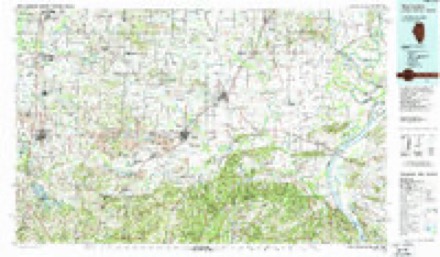
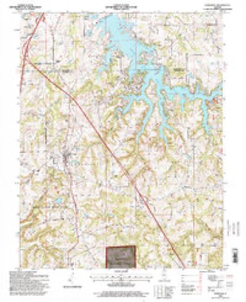
12 surveys from 20 printed sheetsMatched by testing this settlement's coordinate against the published boundary of every sheet in the United States Geological Survey's historical collection. Each opens the scanned sheet at the Survey.
- 1925 USGS Marion quadrangle1:62500, 3 printings
- 1940 USGS Marion quadrangle1:62500
- 1949 USGS Paducah quadrangle1:250000, 2 printings
- 1950 USGS Paducah quadrangle1:250000
- 1954 USGS Paducah quadrangle1:250000, 2 printings
- 1961 USGS Paducah quadrangle1:250000, 2 printings
- 1964 USGS Paducah quadrangle1:250000, 2 printings
- 1966 USGS Goreville quadrangle1:24000, 3 printings
- 1984 USGS West Frankfort quadrangle1:100000
- 1987 USGS Paducah quadrangle1:250000
- 1987 USGS West Frankfort quadrangle1:100000
- 1996 USGS Goreville quadrangle1:24000






Fires near this place
7 since 2011Regional context, not property-specific evidence. The federal wildfire occurrence database lists 7 fires within 5 miles of Goreville between 2011 and 2019, burning about 19 acres in total. None started naturally. 1 was recorded as arson. Distance is straight-line from the map coordinates, so a fire counted here may appear on a neighbouring settlement's page as well.
| Reported cause | Fires |
|---|---|
| Debris and open burning | 4 |
| Arson/incendiarism | 1 |
| Recreation and ceremony | 1 |
| Missing data/not specified/undetermined | 1 |
The most recent of them, most recent first, with the day each was reported and the service that recorded it.
| Date | Cause | Size | Reported by | Name on the report |
|---|---|---|---|---|
| 3 September 2017 | Arson/incendiarism | 2.6 acres | Shawnee National Forest | CEDAR BLUFF |
| 2 September 2017 | Recreation and ceremony | under an acre | Shawnee National Forest | REGENT |
| 22 March 2019 | Debris and open burning | 12 acres | Shawnee National Forest | VAIL DRIVE |
| 21 March 2015 | Debris and open burning | 2.0 acres | Illinois Division of Forestry Resources | BUN01 |
| 18 February 2011 | Debris and open burning | under an acre | Illinois Division of Forestry Resources | MIGHELL |
| 23 October 2019 | Missing data/not specified/undetermined | under an acre | Shawnee National Forest | I-24 FIRE |
| 16 October 2014 | Debris and open burning | 1.5 acres | Illinois Division of Forestry Resources | 16-10-14 |
Settlements close enough to share some of these fires:
Mines and quarries near this place
5 within 5 milesRegional context, not property-specific evidence. The federal mineral resources record lists 5 workings within 5 miles of Goreville: 3 occurrences, 1 producer, 1 prospect. 1 still produces. What was taken out: Stone, Crushed/Broken, Fluorine-Fluorite, Fire Clay (Refractory). Distance is straight-line from the map coordinates, so a quarry counted here may appear on a neighbouring settlement's page as well.
| Where | Site | Commodity | Status | Recorded |
|---|---|---|---|---|
| Shawnee Low Interest Refractory Clay Deposit | Fire Clay (Refractory) | Occurrence | Sedimentary | |
| Fluorine Occurrence | Fluorine-Fluorite | Occurrence | ||
| Fluorine Occurrence | Fluorine-Fluorite | Occurrence | ||
| Lick Creek Sandstone Exposure | Stone, Crushed/Broken | Prospect | ||
| Southern Illinois Stone Quarry | Stone, Crushed/Broken | Producer |
Storms near this place
29 since 1996Regional context, not property-specific evidence. The National Weather Service names Goreville in 29 storm reports between 1996 and 2024: 13 hail, 11 thunderstorm wind, 4 tornado, 1 flood. The reports record 8 injuries. Each account below is quoted exactly as the forecast office filed it, from the NOAA Storm Events Database, and each date opens the federal record of that event.
| When | Event | Place named | Harm | What the report says |
|---|---|---|---|---|
| July 2012 | Thunderstorm Wind | Goreville | 4 hurt, $10,000 | A tree fell on a deck, injuring four people. The house was in a subdivision near Lake of Egypt. |
| October 2004 | Tornado (F2) | Goreville | 2 hurt, $500,000 | The tornado turned east-southeast from Williamson County back into Johnson County. The bulk of the damage and injuries occurred in a neighborhood on the southern half of the Lake of Egypt. The two injured persons were mobile home residents whose homes were demolished. One of the mobile homes was swept clean off its foundation. The demolished home was deposited 50 to 100 yards away. The 32-year-old male occupant of the mobile home, who was ejected from the home, received numerous bruises and cuts. A female resident of another mobile home was injured. In total, three mobile homes were destroyed, and dozens of mobile homes, barns, and sheds were damaged. Rescue efforts were hampered by a large amount of tree debris on roads. Peak winds in the Lake of Egypt neighborhood were estimated near 120 MPH. The tornado lifted as it reached the southeast side of the Lake of Egypt. The parent thunderstorm produced another tornado in northern Johnson County only a few miles beyond where this tornado lifted. |
| May 2024 | Tornado (EF3) | Goreville | 1 hurt, $750,000 | An EF-3 tornado began north of Goreville, IL, where a security camera at a house on Newton Lane captured the tornado's formation. Crossing I-57, the tornado snapped large tree limbs and damaged an outbuilding on Pulley's Mill Ln. The tornado was again filmed crossing I-24 northeast of Goreville. Along IL-37, the tornado did roof damage to two homes and snapped a few wooden power poles. Nearby trees suffered extreme damage, with debarking noted on a few trees near the intersection of IL-37 and Orchared Ln, along with numerous large trees snapped. To the east on Orchard Ln, a home suffered a direct hit by the tornado, with the roof being removed and most of the exterior walls collapsed. A nearby outbuilding was also destroyed, along with several large snapped trees. As the tornado approached the Eagle Point Bay subdivision on Lake of Egypt, it snapped several large trees and wooden electrical poles on Deaton Rd and Greentree Dr. Two manufactured homes were severely damaged or destroyed. One resident here suffered broken bone injuries. Another house had its roof uplifted slightly and was slightly moved off its foundation. Continuing east-southeast into the Eagle Point Bay subdivision, the tornado weakened then dissipated, doing mainly tree damage and minor roof damage to homes along and near John Able Dr and Thunderhead Dr. Peak winds with this tornado were estimated at 150 mph. |
| October 2004 | Tornado (F1) | Goreville | 1 hurt, $10,000 | From Union County, the tornado crossed into extreme northwest Johnson County, only about a half mile south of the Williamson County line. The tornado then moved northeast into Williamson County where Interstate 57 crosses the county line. A semi was overturned on Interstate 57 less than a mile south of the Interstate 24 interchange. The driver was injured. Peak winds along this portion of the tornado path were around 75 MPH. |
| May 2000 | Hail | Goreville | $7,000,000 | A supercell thunderstorm produced baseball size hail from northwest to southeast across parts of Johnson County. The total damage costs for dented cars, smashed windows, and damaged roofs in Vienna was estimated near 7 million dollars. The city's two car dealers sustained about 800,000 dollars damage to a total of 280 cars. At the Johnson County courthouse, the hail broke about 20 windows on the north side of the building and extensively damaged the roof. A funeral home reported hail wrecked the garage, siding, and windows of the funeral home, along with three personal vehicles, for a total damage estimate of 50,000 dollars. Fellowship Baptist Church sustained 15,000 dollars damage. One building contractor estimated 90 percent of all the houses in Vienna needed a new roof. The hail was reported as only dime size in Goreville, but increased to baseball size in Vienna. |
| March 2008 | Flood | Goreville | $1,600,000 | Major flooding occurred in Vienna, where numerous businesses were flooded. A car dealership and another business had 2 to 3 feet of water inside. Local residents reported that flooding in Vienna was the worst since 1973. A number of residences around the county were flooded. Route 37 south of West Vienna was impassable, with water up to the headlights of vehicles. Flooding of the Cache River closed a large section of Illinois Route 37 for days. Railroad tracks were washed out near Belknap. Due to damaged tracks, a train derailed north of Vienna. The engineer and conductor were injured when two locomotives tipped on their side. Sections of U.S. Highway 45 and Route 37 were damaged by floodwater rushing across them. Most of the damage was erosion of shoulders. Farmers lost some animals and equipment to the flooding. Water rose over bridges, and at least three vehicles were carried away by floodwaters. Numerous roads were closed, including the most vital routes: U.S. Highway 45, Route 146, and Route 37. Interstate 24 remained open. Cypress was inaccessible due to road flooding. |
| January 2008 | Thunderstorm Wind | Goreville | $150,000 | An old house was blown completely off its foundation and destroyed. A boat, camper, and large pole barn were destroyed. Roofs were damaged nearby, and trees were blown down in the area. |
| June 2018 | Thunderstorm Wind | Goreville | $50,000 | Widespread wind damage occurred around the county. Numerous trees and power lines were down, causing power outages. A tree landed on a home near Buncombe. Sheriff officials requested residents to stay off the roads due to the amount of tree damage. |
| May 2011 | Thunderstorm Wind | Goreville | $40,000 | Multiple trees were blown down. Some homes received minor damage. |
| April 2024 | Thunderstorm Wind | Goreville | $25,000 | Downburst winds downed a newly constructed pole barn that was still unfinished outside Goreville. |
| June 2015 | Tornado (EF1) | Goreville | $5,000 | Several trees and limbs were blown down, including at least one tree that was uprooted. This brief tornado touched down just west of the Goreville exit off Interstate 24, then tracked almost due north across the interstate. Peak winds were estimated near 90 mph. |
| February 2001 | Thunderstorm Wind | Goreville | $5,000 | A transformer was damaged by wind on the north edge of Goreville, causing a power outage. At the Lake of Egypt Recreation Area, a tree was blown across the road. |
| May 2009 | Thunderstorm Wind | Goreville | $2,000 | Scattered tree limbs and a few trees were blown down on the northern edge of the county. The vast majority of the damage associated with the comma head of a bow echo passed north of the county. |
| April 2014 | Thunderstorm Wind | Goreville | - | A trained spotter estimated winds gusted up to 60 mph. |
| June 2004 | Hail | Goreville | - | A thunderstorm intensified to severe levels over northern Johnson County, producing hail up to quarter size over northeast parts of the county. |
| November 2002 | Thunderstorm Wind | Goreville | - | Several trees were blown down near Lake of Egypt and Goreville. |
| February 1999 | Hail | Goreville | - | Hail up to three-quarters of an inch in diameter occurred in the Vienna and Goreville areas. |
| May 1999 | Hail | Goreville | - | The storm intensified rapidly into a supercell as it moved northward through northern Johnson County. Although only one-inch hail was reported at Goreville, hail up to baseball size fell just over the Williamson County line near Lake of Egypt. |
| May 1998 | Thunderstorm Wind | Goreville | - | A few trees were down in northwest Johnson County. |
| March 2012 | Hail | Goreville | - | no account filed |
| June 2011 | Hail | Goreville | - | no account filed |
| October 2004 | Hail | Goreville | - | no account filed |
| November 2002 | Hail | Goreville | - | no account filed |
| May 2002 | Hail | Goreville | - | no account filed |
| May 2001 | Hail | Goreville | - | no account filed |
| August 2001 | Hail | Goreville | - | no account filed |
| October 2001 | Hail | Goreville | - | no account filed |
| June 1998 | Hail | Goreville | - | no account filed |
| April 1996 | Thunderstorm Wind | Goreville | - | no account filed |
Nearest settlements
The eight closest, with where each one stands in the county. Distances are straight-line, computed from the Geographic Names Information System coordinates.
| Map | Place | Distance | Sheets |
|---|---|---|---|
| Deer Ridge | 2.3 miles | 20 | |
| Sugar Creek Ranch | 2.7 miles | 20 | |
| Eagle Point Bay | 3.3 miles | 20 | |
| Omar | 3.6 miles | 20 | |
| Robinwood | 3.7 miles | 20 | |
| Pharoahs Gardens | 4.3 miles | 20 | |
| Wagon Creek Heaven | 4.4 miles | 20 | |
| Egyptian Hills | 5.1 miles | 20 |
Elsewhere
Matched on this settlement's Geographic Names Information System number rather than its name, so it cannot be a different place of the same name in another state.
| Wikipedia article on Goreville | An encyclopaedic summary. Its text is share-alike, so it is linked here rather than copied. |
| Wikidata item Q2516894 | The structured record the population and elevation above come from. Public domain (CC0). |
Provenance
This settlement is recorded in the Geographic Names Information System as feature 409199. The sheet list is computed by point-in-boundary test against the United States Geological Survey's historical topographic inventory. Both are works of the United States government and carry no copyright under 17 U.S.C. 105.
Wildfire. Short, Karen C. 2022. Spatial wildfire occurrence data for the United States, 1992-2020 [FPA_FOD_20221014]. 6th Edition. Fort Collins, CO: Forest Service Research Data Archive. https://doi.org/10.2737/RDS-2013-0009.6 Collected with United States Government funding and usable without additional permissions or fees.
Mines and quarries. USGS Mineral Resources Data System (MRDS) https://mrdata.usgs.gov/mrds/ A work of the United States government, no copyright under 17 U.S.C. 105.
Storms. NOAA National Centers for Environmental Information, Storm Events Database https://www.ncei.noaa.gov/stormevents/ A work of the United States government, no copyright under 17 U.S.C. 105. Narratives are quoted verbatim from the National Weather Service report and are not edited or summarised.