 Block
Hampshire, Illinois
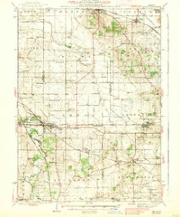
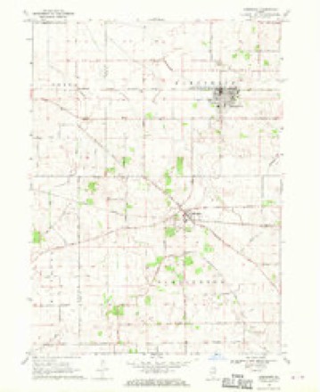
13 topographic sheets cover this place, the earliest surveyed in 1938 and the latest in 1981. It stands in Hampshire Township. It lies in ZIP code area 60140. The Survey maps it on the Hampshire quadrangle. 7,667 people lived here at the 2020 count. It stands 899 feet above sea level.
Population over time
2 figuresHampshire grew from 5,563 to 7,667 between 2010 and 2020. These are the recorded population figures Wikidata holds for this place, reached through the Geographic Names Information System number this page is keyed on rather than by name, so they belong to this place and not to another of the same name. Most are census counts, but not all are: an early figure may be a founding or settlement estimate, and an estimate published within five years of a census is left out. The change column is computed, and is left blank where more than 20 years separate a figure from the one before it, because a gap that long is not a change between two counts.
| Year | People | Change |
|---|---|---|
| 2010 | 5,563 | |
| 2020 | 7,667 | +2,104 (+38%) |
Topographic sheets covering this place
7 surveys from 13 printed sheetsMatched by testing this settlement's coordinate against the published boundary of every sheet in the United States Geological Survey's historical collection. Each opens the scanned sheet at the Survey.
- 1938 USGS Genoa quadrangle1:62500, 3 printings
- 1954 USGS Rockford quadrangle1:250000
- 1955 USGS Rockford quadrangle1:250000
- 1958 USGS Rockford quadrangle1:250000, 4 printings
- 1963 USGS Rockford quadrangle1:250000
- 1968 USGS Hampshire quadrangle1:24000, 2 printings
- 1981 USGS Elgin quadrangle1:100000





In the county-history sources
1,484 words on this townshipHistory of Kane County, Ill., published 1908 names this settlement in its chapter on Hampshire Township. These are the passages that mention it, exactly as the scans read.
Hampshire, located off the line of early travel, was late in being settled, although had adventurous pioneers seen its broad fertile acres it would not have long remained unclaimed, as it did not after Lenas Allen in 1836 came from Vermont and found a land ready for the plow, in striking contrast to the rocky hills he had left. He built a cabin in a few weeks of the trees growing abundantly, the first in the township. It stood half a century and disappeared as late as the '80s. He died on his farm February 5, 1848.
Passage source: History of Kane County, Ill., published 1908.
Following Allen came Thos. E. Whittemore, of New Hampshire, and Samuel Hawley, of Connecticut, in 1836. In 1838 S. A. McAlpes, Daniel Hall and W. H. Seymour, all of New York state, arrived. Stephen Haviland came about the same time. In 1838 came also Rev. Robert Williams and E. O. Garland, from New Hampshire; Joseph Dalby, direct from England; Isaac Paddock and William Trumbull, from New York; also Hilda Coon and John Aurand. Lucien Baldwin arrived from Bennington, Vermont, in 1842. Samuel C. Rowell, father of Fremont Rowell, still leading citizen and merchant of Hampshire, arrived in 1843. He was then eighteen years of age and rode on horseback from Kentucky, where he lived three years. He followed trails and wagon tracks, swam rivers, passed herds of deer and packs of wolves, depending upon settlers' cabins for shelter and food. Owing to his long hair and Southern pioneer dress he was frequently turned away by the settlers, who were suspicious of horse thieves. One such a night he spent in a raging storm, from which he was saved by getting to the cabin of a Vermonter, who had been his neighbor in the East. On her advice he cut his hair and had no further trouble. He returned to Kentucky and was married there, bringing his new wife with him on his settlement here. He opened a store at Old Hampshire in 1850 and removed to New Hampshire in 1874. Fremont Rowell still conducts the business.
Passage source: History of Kane County, Ill., published 1908.
The old state road to Galena passed through the township and for years was the only highway east and west. The next road was opened from St. Charles to Marengo, running through Hampshire township. During the excitement and rush for the newly discovered lead deposits near Galena, the Galena road was much traveled. An old settler has stated that he had seen as many as two hundred teams pass his place in a day. That would mean a dozen everj' hour. In those days "Hen Peck" was one of the important centers of the county. Its location made it an excellent camping place and often as many as fifty men would be in camp at one time.
Passage source: History of Kane County, Ill., published 1908.
Machine-read from a century-old scan, so expect the errors a machine makes: misspelled names, dropped words, stray characters.
Read the whole chapter on Hampshire Township - it names this place 7 more 7 times.
Fires near this place
5 since 2003Regional context, not property-specific evidence. The federal wildfire occurrence database lists 5 fires within 5 miles of Hampshire in 2003, burning about 30 acres in total. None started naturally. None was recorded as arson. Distance is straight-line from the map coordinates, so a fire counted here may appear on a neighbouring settlement's page as well.
| Reported cause | Fires |
|---|---|
| Missing data/not specified/undetermined | 4 |
| Recreation and ceremony | 1 |
The most recent of them, most recent first, with the day each was reported and the service that recorded it.
| Date | Cause | Size | Reported by | Name on the report |
|---|---|---|---|---|
| 28 April 2003 | Recreation and ceremony | under an acre | Illinois State Fire Marshal's Office | not named |
| 2 April 2003 | Missing data/not specified/undetermined | under an acre | Illinois State Fire Marshal's Office | not named |
| 15 April 2003 | Missing data/not specified/undetermined | under an acre | Illinois State Fire Marshal's Office | not named |
| 14 April 2003 | Missing data/not specified/undetermined | 30 acres | Illinois State Fire Marshal's Office | not named |
| 11 April 2003 | Missing data/not specified/undetermined | under an acre | Illinois State Fire Marshal's Office | not named |
Settlements close enough to share some of these fires:
Storms near this place
27 since 1994Regional context, not property-specific evidence. The National Weather Service names Hampshire in 27 storm reports between 1994 and 2026: 18 thunderstorm wind, 4 flood, 2 flash flood, 2 hail. No death or injury is recorded in these reports. Each account below is quoted exactly as the forecast office filed it, from the NOAA Storm Events Database, and each date opens the federal record of that event.
| When | Event | Place named | Harm | What the report says |
|---|---|---|---|---|
| September 2008 | Flash Flood | Hampshire | $3,000,000 | Flash flooding began during the predawn hours and continued into the early afternoon hours across many locations in Kane County. In Geneva, basement flooding was reported in the Emergency Operations Center, and the intersection of Route 25 and Fabyan Parkway was closed. Near Elburn, Empire Road was flooded east of Hampton Road, the intersection of Route 64 and Route 47 was flooded under the train tracks. Residential flooding was reported in Lily Lake. In Elgin, numerous roads and intersections were closed including, Randall and Big Timber Roads, Canyon and Valley Creek, Mark and Mildred Roads, and Jewett and Orange Streets. Flooding was also reported along Beckman Trail, the 300 block of Wilcox, the 400 block of Commonwealth and the 100 block of Brookside. Between Elburn and Maple Park, Keslinger and Schneider Roads were flooded. In Blackberry township, Main and Bunker Streets were flooded. Blackberry Creek overflowed its banks in Aurora. Storm total rainfall from early morning through early afternoon included 7.90 inches 7 miles northwest of St. Charles, 6.33 inches in St. Charles and 4.87 inches in Batavia. |
| July 2006 | Thunderstorm Wind | Hampshire | $2,000 | Numerous trees and power lines blown down. |
| August 2006 | Thunderstorm Wind | Hampshire | $2,000 | Trees and power lines were blown down. |
| April 2026 | Thunderstorm Wind | Hampshire | - | Power lines were downed on the north side of Hampshire. |
| June 2025 | Thunderstorm Wind | Hampshire | - | Trees were blown down at Rt 72 and Romke Rd on the east side of Hampshire. |
| March 2025 | Thunderstorm Wind | Hampshire | - | The southeast portion of the roof of a barn collapsed along IL-72 on the south side of Hampshire. Tree damage was also noted in the vicinity. |
| July 2025 | Thunderstorm Wind | Hampshire | - | Power lines were blown down resulting in power outages in the 100 block of Terwilliger Street. |
| July 2022 | Thunderstorm Wind | Hampshire | - | A small tree was snapped at its base, blocking Melms Road, northwest of Hampshire. |
| July 2022 | Thunderstorm Wind | Hampshire | - | A photo shared on social media showed a large tree that was blown down onto a fence. |
| July 2022 | Flood | Hampshire | - | Multiple reports of street flooding were received in and near Hampshire. |
| July 2022 | Flood | Hampshire | - | One to two feet of standing water was reported in low-lying areas north of Hampshire. The water was still rising during the afternoon of July 6th. A nearby personal weather station measured a two day rain total of 6.50 inches. |
| May 2020 | Tornado (EF0) | Hampshire | - | A tornado touched down in De Kalb County and moved across fields in Kane County and dissipated before reaching Interstate 90. |
| September 2018 | Thunderstorm Wind | Hampshire | - | Multiple trees, tree limbs and power lines were damaged in the Burlington and Hampshire areas. |
| June 2018 | Flash Flood | Hampshire | - | The intersection of Route 72 and State Street was flooded with 12 to 15 inches of water. |
| June 2018 | Flood | Hampshire | - | Roads were flooded due to farm field runoff. |
| August 2010 | Flood | Hampshire | - | Standing water and full ditches were reported along Route 72, west of Hampshire. |
| June 2008 | Thunderstorm Wind | Hampshire | - | A tree was blown down blocking a road. |
| July 2007 | Thunderstorm Wind | Hampshire | - | Six to Eight inch diameter tree limbs blown down at Warner and Jefferson Roads. |
| May 2004 | Thunderstorm Wind | Hampshire | - | Small trees were down. |
| May 2004 | Thunderstorm Wind | Hampshire | - | Trees and power lines were down. Two semi tractor-trailers were blown off the road in northern Kane County. |
| April 1999 | Thunderstorm Wind | Hampshire | - | Thunderstorm winds damaged farms off Plank Road east of Rte 47. Ten utuility poles were bent over. Four large trees were uprooted and others damaged. One barn was leveled, another was partially collapsed, and the roof was taken off another. A light pole was snapped off at the base. The siding was torn off a house. A church had damage to a chimney and steeple. Two homes in Briar Hill had chimney and roof damage. |
| June 1994 | Thunderstorm Wind | Hampshire | - | Trees and power lines were blown down. |
| April 2023 | Hail | Hampshire | - | no account filed |
| June 2009 | Hail | Hampshire | - | no account filed |
| June 2002 | Thunderstorm Wind | Hampshire | - | no account filed |
| August 2001 | Thunderstorm Wind | Hampshire | - | no account filed |
| May 2000 | Thunderstorm Wind | Hampshire | - | no account filed |
Nearest settlements
The eight closest, with where each one stands in the county. Distances are straight-line, computed from the Geographic Names Information System coordinates.
| Map | Place | Distance | Sheets |
|---|---|---|---|
| Allens Corners | 2.6 miles | 17 | |
| Henpeck | 3.1 miles | 17 | |
| Burlington | 3.2 miles | 13 | |
| Starks | 4.0 miles | 17 | |
| Salina | 4.0 miles | 17 | |
| North Plato | 4.6 miles | 17 | |
| Pingree Grove | 6.5 miles | 17 | |
| Plato Center | 7.2 miles | 17 |
Elsewhere
Matched on this settlement's Geographic Names Information System number rather than its name, so it cannot be a different place of the same name in another state.
| Wikipedia article on Hampshire | An encyclopaedic summary. Its text is share-alike, so it is linked here rather than copied. |
| Wikidata item Q2463662 | The structured record the population and elevation above come from. Public domain (CC0). |
Provenance
This settlement is recorded in the Geographic Names Information System as feature 409720. The sheet list is computed by point-in-boundary test against the United States Geological Survey's historical topographic inventory. Both are works of the United States government and carry no copyright under 17 U.S.C. 105.
Wildfire. Short, Karen C. 2022. Spatial wildfire occurrence data for the United States, 1992-2020 [FPA_FOD_20221014]. 6th Edition. Fort Collins, CO: Forest Service Research Data Archive. https://doi.org/10.2737/RDS-2013-0009.6 Collected with United States Government funding and usable without additional permissions or fees.
Storms. NOAA National Centers for Environmental Information, Storm Events Database https://www.ncei.noaa.gov/stormevents/ A work of the United States government, no copyright under 17 U.S.C. 105. Narratives are quoted verbatim from the National Weather Service report and are not edited or summarised.