 Block
Harrisburg, Illinois
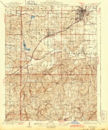
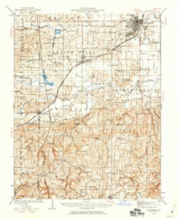
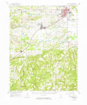
20 topographic sheets cover this place, the earliest surveyed in 1925 and the latest in 1996. It stands in Harrisburg Township. It lies in ZIP code area 62946. The Survey maps it on the Harrisburg quadrangle. 8,219 people lived here at the 2020 count. It stands 397 feet above sea level.
Research this city
On record in Harrisburg
Buildings and businesses the archive holds for this place. Each opens its own page, with the source record it came from.
On the National Register 2 records
 Harrisburg City Halllisted 1998
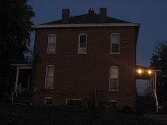 Saline County Poor Farmlisted 2001
Population over time
2 figuresHarrisburg fell from 9,017 to 8,219 between 2010 and 2020. These are the recorded population figures Wikidata holds for this place, reached through the Geographic Names Information System number this page is keyed on rather than by name, so they belong to this place and not to another of the same name. Most are census counts, but not all are: an early figure may be a founding or settlement estimate, and an estimate published within five years of a census is left out. The change column is computed, and is left blank where more than 20 years separate a figure from the one before it, because a gap that long is not a change between two counts.
| Year | People | Change |
|---|---|---|
| 2010 | 9,017 | |
| 2020 | 8,219 | -798 (-9%) |
Topographic sheets covering this place
13 surveys from 20 printed sheetsMatched by testing this settlement's coordinate against the published boundary of every sheet in the United States Geological Survey's historical collection. Each opens the scanned sheet at the Survey.
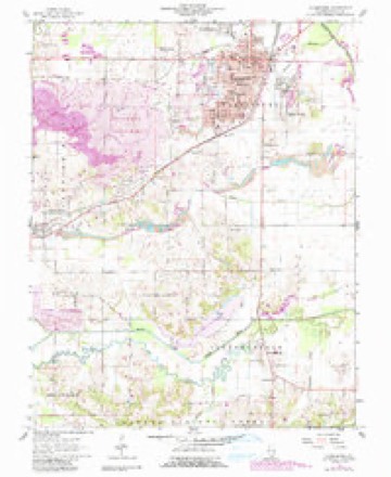
- 1925 USGS Harrisburg quadrangle1:62500, 3 printings
- 1939 USGS Harrisburg quadrangle1:62500
- 1949 USGS Paducah quadrangle1:250000, 2 printings
- 1950 USGS Paducah quadrangle1:250000
- 1954 USGS Paducah quadrangle1:250000, 2 printings
- 1961 USGS Harrisburg quadrangle1:62500
- 1961 USGS Harrisburg quadrangle1:24000, 2 printings
- 1961 USGS Paducah quadrangle1:250000, 2 printings
- 1964 USGS Paducah quadrangle1:250000, 2 printings
- 1984 USGS West Frankfort quadrangle1:100000
- 1987 USGS Paducah quadrangle1:250000
- 1987 USGS West Frankfort quadrangle1:100000
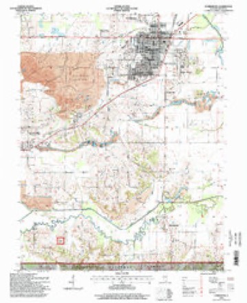
- 1996 USGS Harrisburg quadrangle1:24000






Fires near this place
2 since 2009Regional context, not property-specific evidence. The federal wildfire occurrence database lists 2 fires within 5 miles of Harrisburg in 2009, burning about 40 acres in total. None started naturally. None was recorded as arson. Distance is straight-line from the map coordinates, so a fire counted here may appear on a neighbouring settlement's page as well.
| Reported cause | Fires |
|---|---|
| Missing data/not specified/undetermined | 1 |
| Debris and open burning | 1 |
The most recent of them, most recent first, with the day each was reported and the service that recorded it.
| Date | Cause | Size | Reported by | Name on the report |
|---|---|---|---|---|
| 5 March 2009 | Missing data/not specified/undetermined | 5.0 acres | Illinois Division of Forestry Resources | 1614 |
| 5 March 2009 | Debris and open burning | 35 acres | Shawnee National Forest | RICE RD, |
Settlements close enough to share some of these fires:
Mines and quarries near this place
4 within 5 milesRegional context, not property-specific evidence. The federal mineral resources record lists 4 workings within 5 miles of Harrisburg: 3 past producers, 1 producer. 1 still produces. What was taken out: Stone, Crushed/Broken, Stone. Distance is straight-line from the map coordinates, so a quarry counted here may appear on a neighbouring settlement's page as well.
| Where | Site | Commodity | Status | Recorded |
|---|---|---|---|---|
| Cave In Rock Quarry | Stone | Past Producer | ||
| Downstate No. 1 | Stone, Crushed/Broken | Producer | ||
| Harrisburg City Eng. | Stone, Crushed/Broken | Past Producer | ||
| Saline Highway Department | Stone, Crushed/Broken | Past Producer |
Storms near this place
60 of 118 shownRegional context, not property-specific evidence. The National Weather Service names Harrisburg in 118 storm reports between 1995 and 2025: 58 thunderstorm wind, 29 hail, 17 flash flood, 9 heavy rain. No death or injury is recorded in these reports. Each account below is quoted exactly as the forecast office filed it, from the NOAA Storm Events Database, and each date opens the federal record of that event.
| When | Event | Place named | Harm | What the report says |
|---|---|---|---|---|
| May 1996 | Flash Flood | Harrisburg | $1,500,000 | no account filed |
| April 1996 | Flash Flood | Harrisburg | $1,500,000 | no account filed |
| May 2009 | Thunderstorm Wind | Harrisburg | $400,000 | This microburst struck a 10-block long area in the city of Harrisburg, from the southwest edge of town to the southeast side. The damage ended after striking the commercial strip on U.S. Highway 45. The damage swath was about one-half mile wide. Porches were blown off a couple of housees. Trees up to two feet in diameter fell on houses. Some power lines were down. The wind caused some direct minor structural damage to houses. The press box at a football field was blown out of the stands. A construction trailer was blown on its side. Storage sheds and outbuildings were blown over, including one shed that struck and damaged a few vehicles. A gas station canopy was heavily damaged. |
| April 2014 | Flash Flood | Harrisburg | $200,000 | Widespread flash flooding occurred in the cities of Harrisburg and Eldorado. Multiple streets were under water and residences were flooded in Harrisburg. Most of the flooding occurred on the southeast side of town. In Eldorado, vehicles were stranded and several homes were evacuated. Vehicle rescues were performed along U.S. Highway 45. Sections of Route 45 were under one to two feet of water. Several businesses received water damage. |
| November 2005 | Thunderstorm Wind | Harrisburg | $200,000 | On Old Route 13 just east of Harco Road, several power poles were snapped. Near the airport just west of Raleigh, a barn and outbuilding were damaged, and a greenhouse was destroyed. An auger was tipped over and destroyed, and a tractor and combine were damaged by flying debris. In Raleigh, a portion of a church's roof was peeled off, and a few outbuildings were destroyed. |
| August 2007 | Thunderstorm Wind | Harrisburg | $150,000 | Numerous trees were blown down from Harrisburg south to the county line. At the county fairgrounds in Harrisburg, the grandstands were heavily damaged, fencing was damaged, and utility poles were down. Trees landed on a cattle barn and concession stand. Elsewhere around the city, doors and windows of four businesses were blown out. A garage partially collapsed. Portions of the roof were lifted off an auto body shop and a utility service building. Large trees were uprooted and power lines were down in Harrisburg. |
| April 2011 | Thunderstorm Wind | Harrisburg | $100,000 | Buildings in the downtown area suffered minor damage, such as pieces of roofing blown off. Two windows of a downtown storefront were broken. Scaffolding around a downtown commercial building was blown down. A carport blew into a power line. A chimney was blown down. An antenna tower used for fire department radio communications was blown over. Many trees were blown down, including a few on power lines. |
| February 1999 | Thunderstorm Wind | Harrisburg | $100,000 | A severe thunderstorm struck parts of Harrisburg with winds estimated near 80 MPH. A roof was blown off a house, and windows were blown out of a business. Signs were blown down or damaged, and a car was blown off the road. In downtown Harrisburg along Route 13, three businesses sustained major roof damage. An auto parts store lost a quarter of its roof, which damaged about a quarter of its inventory. |
| June 1998 | Thunderstorm Wind | Harrisburg | $100,000 | A thunderstorm produced wind gusts estimated near 100 MPH in Harrisburg. Hundreds of trees were uprooted or snapped. Some of the trees were up to 5 feet in diameter. Several utility poles were blown over or snapped. A few storage barns and garages were blown off their foundations. Weak structures such as small sheds were completely destroyed. Numerous power lines were down, knocking out power to an estimated 35,000 people. The damage path ranged from 3/4 to 1 mile wide, and between 4 and 5 miles long. |
| May 2011 | Thunderstorm Wind | Harrisburg | $80,000 | In Harrisburg, numerous trees were blown down, and signs were blown over. Several roofs were damaged. Siding was ripped off a building. The area of greatest damage was in a neighborhood on the southeast side of Harrisburg, where a microburst about one mile long and one-third mile wide downed hundreds of trees and limbs. A garage was flattened by an uprooted tree. Winds in the microburst were estimated near 75 mph. A trained spotter seven miles west of Harrisburg estimated winds gusted to 60 mph. |
| May 2024 | Flash Flood | Harrisburg | $75,000 | Training thunderstorms produced significant street flooding in Harrisburg. Floodwaters were estimated at 6 to 12 inches deeper than usual for floodprone streets. Water crossed U.S. 45 south of Harrisburg. The fire department was dispatched to a car floating in a Walmart parking lot. Roughly 2-3 inches of rain (radar estimates were 3-4 inches but hail contamination is likely) fell within 2 hours between 1800-2000CST. |
| May 2024 | Flash Flood | Harrisburg | $50,000 | Significant flash flooding occurred in Harrisburg. Several roads flooded with cars stuck in water. Most of the softball field flooded. Torrential rainfall rates produced radar estimated 1.5-2 inches of rain in Harrisburg, with most of the rain occurring between 1515-1615CST. Flash flooding transitioned to a flood event through the evening. |
| December 2008 | Thunderstorm Wind | Harrisburg | $50,000 | One building in Harrisburg lost its roof. A business in Raleigh lost one fourth of its roof. Large trees were down, blocking Highway 34. |
| August 2005 | Thunderstorm Wind | Harrisburg | $40,000 | Wind gusts estimated from 55 to 60 MPH downed trees and power lines. At least a half dozen trees were knocked down in Eldorado. Several of the trees fell across houses and garages. One tree fell on a swimming pool. Numerous tree limbs and small trees fell across Harrisburg streets. |
| May 2000 | Thunderstorm Wind | Harrisburg | $40,000 | A thunderstorm microburst produced strong damaging winds, estimated between 75 and 80 MPH. Several mobile homes in a rural area just south of Route 13 near the Gallatin County line were affected by the microburst, which was about 1/4 mile wide and 1/2 to 3/4 mile long. One mobile home was destroyed when a tree about 2.5 feet in diameter fell on it. On another mobile home, about 3/4 of a 60-foot attached screened-in porch was torn off. A third mobile home used for storage was moved a few feet off of its foundation. A nearby house lost some shingles and gutters. Several hundred trees in the area were blown down. |
| April 2017 | Flash Flood | Harrisburg | $30,000 | Widespread flash flooding of streets occurred throughout the Harrisburg area, including about 10 square blocks that were impassable in the city. A trained spotter in Eldorado measured 5.25 inches in the overnight storms. |
| July 2023 | Thunderstorm Wind | Harrisburg | $25,000 | Numerous trees were blown down in the county. There were eleven different calls for trees and power lines down in Harrisburg alone. |
| May 2012 | Thunderstorm Wind | Harrisburg | $20,000 | Trees and power lines were blown down. |
| July 2012 | Thunderstorm Wind | Harrisburg | $20,000 | Downed trees and power lines were reported in the city. |
| April 2023 | Thunderstorm Wind | Harrisburg | $15,000 | Five or six large pine trees were topped in Harrisburg. In Eldorado, trees were damaged, and a carport was blown over. |
| April 2016 | Thunderstorm Wind | Harrisburg | $15,000 | A large tree fell on power lines on the south side of town, bringing down a couple of power poles. |
| March 2006 | Flash Flood | Harrisburg | $15,000 | A man and his 10-year-old son were rescued from flooded Brier Creek after their SUV became stranded while trying to cross the creek. The swift-moving water was up to the doors of the vehicle. The road was completely washed out, and warning signs had been posted on both sides of the creek. A boat from the county emergency services agency removed the two trapped occupants of the vehicle. |
| February 2014 | Thunderstorm Wind | Harrisburg | $10,000 | A power pole was blown down. |
| June 2008 | Thunderstorm Wind | Harrisburg | $10,000 | A few trees and power lines were down. |
| September 2012 | Thunderstorm Wind | Harrisburg | $8,000 | Several trees and power lines were blown down. Wind gusts were estimated near 65 mph. |
| July 2023 | Thunderstorm Wind | Harrisburg | $6,000 | Large branches were blown down. A wooden fence was blown over. A tree was down on a house. Peak winds were estimated near 65 mph. |
| June 1999 | Thunderstorm Wind | Harrisburg | $6,000 | Numerous trees and power lines were down. |
| February 2023 | Thunderstorm Wind | Harrisburg | $5,000 | Trees were blown down near Harrisburg. Power outages were reported. Roughly 1778 customers were still without power at daybreak. At Eldorado, a flagpole was bent over and broken as the line of showers moved through. |
| June 2022 | Thunderstorm Wind | Harrisburg | $5,000 | Five trees were blown down. |
| June 2018 | Thunderstorm Wind | Harrisburg | $5,000 | Trees were down in different areas of the community. |
| December 2015 | Thunderstorm Wind | Harrisburg | $5,000 | Large tree branches were blown down. Tree debris was on some roadways. |
| June 2007 | Thunderstorm Wind | Harrisburg | $5,000 | Trees were blown down. |
| June 2007 | Thunderstorm Wind | Harrisburg | $5,000 | Wind snapped about 20 trees along Old Route 13 and Illinois Route 13. Two of the trees briefly covered Old Illinois Route 13. |
| May 1998 | Thunderstorm Wind | Harrisburg | $5,000 | Large tree limbs were down in Harrisburg. Trees were down near Eldorado. |
| July 1997 | Thunderstorm Wind | Harrisburg | $5,000 | Power lines were down. |
| June 2019 | Thunderstorm Wind | Harrisburg | $4,000 | There was a report from law enforcement of multiple trees down in Harrisburg. |
| June 2015 | Thunderstorm Wind | Harrisburg | $4,000 | A couple of trees were down in town, along with snapped power lines. |
| November 2013 | Thunderstorm Wind | Harrisburg | $4,000 | Downed tree limbs were reported. |
| October 2010 | Thunderstorm Wind | Harrisburg | $4,000 | Downed trees blocked Highway 13 on the west side of town. |
| March 2007 | Thunderstorm Wind | Harrisburg | $4,000 | Two power poles were down across U.S. Highway 45. A carport was blown over. At a park on the east side of Harrisburg, the roof was blown off a baseball shelter. |
| April 2006 | Thunderstorm Wind | Harrisburg | $4,000 | A spotter measured wind gusts to 65 MPH in Harrisburg. Trees and power lines were down on the southwest side of town on Blue Hole Road. |
| June 2007 | Thunderstorm Wind | Harrisburg | $3,000 | A few power lines were blown down. |
| March 2022 | Thunderstorm Wind | Harrisburg | $2,000 | A tree and power lines were down on a house. |
| July 2024 | Thunderstorm Wind | Harrisburg | $1,000 | The wind gust was measured as a thunderstorm line moved northeastward through Harrisburg. A tree was blown down onto IL-34 between Harrisburg and Raleigh. |
| March 2006 | Thunderstorm Wind | Harrisburg | $1,000 | Aluminum siding was blown off a building. |
| August 2006 | Thunderstorm Wind | Harrisburg | $1,000 | A trained spotter estimated winds gusted to 60 MPH in Harrisburg. An awning was blown off a restaurant in Harrisburg. |
| May 2018 | Thunderstorm Wind | Harrisburg | $500 | A large tree limb was blown down. |
| March 2025 | Hail | Harrisburg | - | Half dollar to golfball size hail occurred in Harrisburg. |
| April 2024 | Hail | Harrisburg | - | A thunderstorm produced hail measured to penny size, with winds gusting to 55 mph. |
| May 2024 | Hail | Harrisburg | - | Multiple hail reports were made from Harrisburg. A trained spotter reported half dollar size hail towards the southern side of Harrisburg. A public report was made for one inch hail on the northeast side of Harrisburg. Emergency management reported pea to quarter size hail in the city. |
| May 2024 | Hail | Harrisburg | - | As a thunderstorm progressed eastward through the city, a public report of 1 inch hail was made in Harrisburg. A trained spotter reported golf ball size hail further south in Harrisburg. |
| May 2024 | Flood | Harrisburg | - | The afternoon flash flood event in Harrisburg transitioned to an extended period of flooding impacts as remaining standing water was slow to recede, bolstered by off and on evening rainfall. |
| May 2024 | Hail | Harrisburg | - | Ping pong ball size hail was reported in Harrisburg from a supercell storm. |
| February 2019 | Flood | Harrisburg | - | Water was across low-lying rural roads west of Carrier Mills and north and west of Harrisburg. |
| June 2019 | Flash Flood | Harrisburg | - | Numerous city roads in Harrisburg were flooded, and several were closed. |
| April 2016 | Hail | Harrisburg | - | Hail slightly larger than baseball size was reported just south of Harrisburg in the Pankeyville community. The hailstones were reported to be three inches in diameter, or about the size of a tea cup. |
| April 2015 | Heavy Rain | Harrisburg | - | Water was over Illinois Route 145 in a couple of places southwest of Harrisburg. Water was also over Illinois Route 34 at Raleigh. |
| December 2015 | Heavy Rain | Harrisburg | - | A few county roads were closed that routinely become covered with water in heavy rain events. |
| September 2014 | Thunderstorm Wind | Harrisburg | - | A wind gust was estimated near 60 mph by law enforcement personnel. Small hail also occurred. |
| October 2013 | Thunderstorm Wind | Harrisburg | - | A wind gust to 62 mph was measured. |
Nearest settlements
The eight closest, with where each one stands in the county. Distances are straight-line, computed from the Geographic Names Information System coordinates.
| Map | Place | Distance | Sheets |
|---|---|---|---|
| Gaskins City | 0.9 miles | 20 | |
| Dorris Heights | 1.0 miles | 20 | |
| Dorrisville | 1.4 miles | 20 | |
| Garden Heights | 1.4 miles | 20 | |
| Buena Vista | 1.9 miles | 20 | |
| Liberty | 2.1 miles | 20 | |
| Pankeyville | 2.1 miles | 20 | |
| Muddy | 2.2 miles | 19 |
Elsewhere
Matched on this settlement's Geographic Names Information System number rather than its name, so it cannot be a different place of the same name in another state.
| Wikipedia article on Harrisburg | An encyclopaedic summary. Its text is share-alike, so it is linked here rather than copied. |
| Wikidata item Q576252 | The structured record the population and elevation above come from. Public domain (CC0). |
Provenance
This settlement is recorded in the Geographic Names Information System as feature 409850. The sheet list is computed by point-in-boundary test against the United States Geological Survey's historical topographic inventory. Both are works of the United States government and carry no copyright under 17 U.S.C. 105.
Wildfire. Short, Karen C. 2022. Spatial wildfire occurrence data for the United States, 1992-2020 [FPA_FOD_20221014]. 6th Edition. Fort Collins, CO: Forest Service Research Data Archive. https://doi.org/10.2737/RDS-2013-0009.6 Collected with United States Government funding and usable without additional permissions or fees.
Mines and quarries. USGS Mineral Resources Data System (MRDS) https://mrdata.usgs.gov/mrds/ A work of the United States government, no copyright under 17 U.S.C. 105.
Storms. NOAA National Centers for Environmental Information, Storm Events Database https://www.ncei.noaa.gov/stormevents/ A work of the United States government, no copyright under 17 U.S.C. 105. Narratives are quoted verbatim from the National Weather Service report and are not edited or summarised.