 Block
Kaneville, Illinois
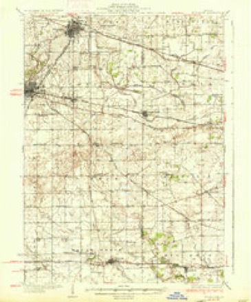
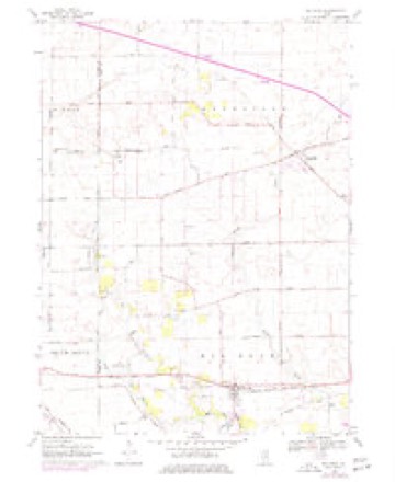
9 topographic sheets cover this place, the earliest surveyed in 1937 and the latest in 1985. It stands in Kaneville Township. It lies in ZIP code area 60119. The Survey maps it on the Big Rock quadrangle. 452 people lived here at the 2020 count. It stands 791 feet above sea level.
Population over time
2 figuresKaneville fell from 484 to 452 between 2010 and 2020. These are the recorded population figures Wikidata holds for this place, reached through the Geographic Names Information System number this page is keyed on rather than by name, so they belong to this place and not to another of the same name. Most are census counts, but not all are: an early figure may be a founding or settlement estimate, and an estimate published within five years of a census is left out. The change column is computed, and is left blank where more than 20 years separate a figure from the one before it, because a gap that long is not a change between two counts.
| Year | People | Change |
|---|---|---|
| 2010 | 484 | |
| 2020 | 452 | -32 (-7%) |
Topographic sheets covering this place
5 surveys from 9 printed sheetsMatched by testing this settlement's coordinate against the published boundary of every sheet in the United States Geological Survey's historical collection. Each opens the scanned sheet at the Survey.
- 1937 USGS Sycamore quadrangle1:62500, 2 printings
- 1958 USGS Aurora quadrangle1:250000, 3 printings
- 1961 USGS Aurora quadrangle1:250000
- 1968 USGS Big Rock quadrangle1:24000, 2 printings
- 1985 USGS Aurora quadrangle1:100000



In the county-history sources
921 words on this townshipHistory of Kane County, Ill., published 1908 names this settlement in its chapter on Kaneville Township. These are the passages that mention it, exactly as the scans read.
The land in Kaneville being nearly all prairie land was the last taken up by settlers, who, being accustomed to the forest land of the East, did not know and for many years did not discover the value of prairie land. They would take up wood land, and after making a clearing would plow in among the stumps sufficiently to cover up the seed that they scattered over the ground. It was many years before they realized the value of the prairie soil and began its regular cultivation.
Passage source: History of Kane County, Ill., published 1908.
The village of Kaneville was laid out and platted by Thaddeus Hoyt in 1861. As early as 1852 William Hall built a house and opened it as a hotel. This was the only public house until 1869, when B. and A. Cary built a hotel. In 1855 the Baptists built a church, and the Methodist Episcopal Church organization moved from Blackberry to Kaneville and built a church, which was replaced in 1875 '\v the present building. In 1857 the old school house was torn down and a new building erected. The first principal of the new school was N. F. Nichols, afterward a lawyer in Aurora. The first store building was erected in 1852 by Mr. Goodwin, who sold out to Hathorn. In 1874 Frank Sperry started in business. In 1888 the township contained eight school houses, all frame buildings ; the most expensive one being in district No. 8, which was erected in 1872 at a cost of $1,000.
Passage source: History of Kane County, Ill., published 1908.
Machine-read from a century-old scan, so expect the errors a machine makes: misspelled names, dropped words, stray characters.
Read the whole chapter on Kaneville Township - it names this place 4 more 4 times.
Mines and quarries near this place
10 of 11 shownRegional context, not property-specific evidence. The federal mineral resources record lists 11 workings within 5 miles of Kaneville: 7 past producers, 2 producers, 2 plants. 4 still produce. What was taken out: Sand and Gravel, Construction. Distance is straight-line from the map coordinates, so a quarry counted here may appear on a neighbouring settlement's page as well.
| Where | Site | Commodity | Status | Recorded |
|---|---|---|---|---|
| Elburn Pit & Mill | Sand and Gravel, Construction | Plant | ||
| Elburn Plant | Sand and Gravel, Construction | Producer | ||
| Feltes Plant No. 7 & Pit | Sand and Gravel, Construction | Past Producer | ||
| Harker Pit | Sand and Gravel, Construction | Past Producer | ||
| Kane County Hwy. Dept. Pit | Sand and Gravel, Construction | Past Producer | ||
| Kane Sand & Gravel | Sand and Gravel, Construction | Producer | ||
| Kaneville Plant & Pit | Sand and Gravel, Construction | Plant | ||
| Kuglee Pit | Sand and Gravel, Construction | Past Producer | ||
| Long Pit | Sand and Gravel, Construction | Past Producer | ||
| Nichols Pit | Sand and Gravel, Construction | Past Producer |
Storms near this place
19 since 2008Regional context, not property-specific evidence. The National Weather Service names Kaneville in 19 storm reports between 2008 and 2026: 11 thunderstorm wind, 8 hail. No death or injury is recorded in these reports. Each account below is quoted exactly as the forecast office filed it, from the NOAA Storm Events Database, and each date opens the federal record of that event.
| When | Event | Place named | Harm | What the report says |
|---|---|---|---|---|
| May 2014 | Hail | Kaneville | $50,000 | Hail 1.50 inches to 2.00 inches was reported across portions of Sugar Grove. There were reports of broken house windows. |
| April 2026 | Thunderstorm Wind | Kaneville | - | A semitruck was overturned on I-88 westbound near Dauberman Rd causing westbound lanes to be shut down. |
| April 2026 | Thunderstorm Wind | Kaneville | - | Power lines and possibly some power poles were downed along Dauberman Rd south of Kaneville. |
| June 2025 | Thunderstorm Wind | Kaneville | - | Two large tree limbs snapped off of a tree in Kaneville near Lovell St. |
| March 2025 | Thunderstorm Wind | Kaneville | - | A tree roughly 3 to 4 ft in diameter and 20 to 30 ft long was downed across the road near Willow Creek. |
| August 2025 | Thunderstorm Wind | Kaneville | - | Trees and power lines were reported down along IL-47 between US-88 and Main St. |
| June 2024 | Thunderstorm Wind | Kaneville | - | Power lines were reported down near 498 Lasher Rd. |
| April 2023 | Hail | Kaneville | - | Golf ball size hail was reported near Main Street and Harter Road. |
| June 2023 | Thunderstorm Wind | Kaneville | - | A photo shared on social media showed a large tree limb that was blown down onto the hood of a car which caused damage near Route 47 and Green Road. |
| June 2021 | Thunderstorm Wind | Kaneville | - | Several trees were blown down between Kaneville and North Aurora. |
| August 2020 | Thunderstorm Wind | Kaneville | - | An 8 inch diameter tree was snapped near Route 47 and Nottingham Drive. |
| November 2020 | Thunderstorm Wind | Kaneville | - | Multiple utility poles were blown down, along with power lines blown down. Small tree limbs were broken. |
| May 2019 | Hail | Kaneville | - | A train spotter measured hail 2.25 inches in diameter with a lot of golf ball size hail. |
| May 2012 | Hail | Kaneville | - | Penny size hail fell near Harter Road and Lasher Road. |
| April 2010 | Hail | Kaneville | - | Golf ball size hail was reported near Interstate 88 and Route 47. |
| June 2008 | Thunderstorm Wind | Kaneville | - | A tree was blown down near Seavey and Lorang Roads. |
| May 2019 | Hail | Kaneville | - | no account filed |
| September 2019 | Hail | Kaneville | - | no account filed |
| April 2017 | Hail | Kaneville | - | no account filed |
Nearest settlements
The eight closest, with where each one stands in the county. Distances are straight-line, computed from the Geographic Names Information System coordinates.
| Map | Place | Distance | Sheets |
|---|---|---|---|
| Blackberry Acres | 2.0 miles | 13 | |
| Willow Creek | 2.9 miles | 13 | |
| Nottingham Woods | 3.0 miles | 13 | |
| Kaneland Estates | 3.4 miles | 9 | |
| Timbercrest | 3.5 miles | 13 | |
| Pine View | 3.6 miles | 9 | |
| Windenoak | 3.6 miles | 13 | |
| Blackberry Woods | 3.6 miles | 13 |
Elsewhere
Matched on this settlement's Geographic Names Information System number rather than its name, so it cannot be a different place of the same name in another state.
| Wikipedia article on Kaneville | An encyclopaedic summary. Its text is share-alike, so it is linked here rather than copied. |
| Wikidata item Q6362086 | The structured record the population and elevation above come from. Public domain (CC0). |
Provenance
This settlement is recorded in the Geographic Names Information System as feature 411298. The sheet list is computed by point-in-boundary test against the United States Geological Survey's historical topographic inventory. Both are works of the United States government and carry no copyright under 17 U.S.C. 105.
Mines and quarries. USGS Mineral Resources Data System (MRDS) https://mrdata.usgs.gov/mrds/ A work of the United States government, no copyright under 17 U.S.C. 105.
Storms. NOAA National Centers for Environmental Information, Storm Events Database https://www.ncei.noaa.gov/stormevents/ A work of the United States government, no copyright under 17 U.S.C. 105. Narratives are quoted verbatim from the National Weather Service report and are not edited or summarised.