 Block
Loami, Illinois
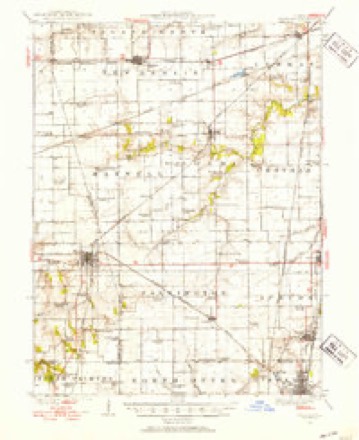
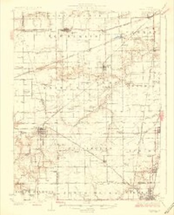
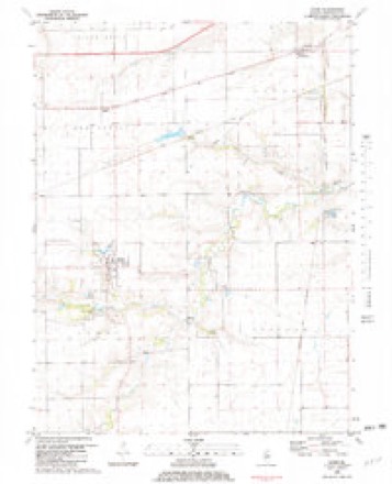
12 topographic sheets cover this place, the earliest surveyed in 1924 and the latest in 1985. It stands in Loami Township. It lies in ZIP code area 62661. The Survey maps it on the Loami quadrangle. 812 people lived here at the 2020 count. It stands 630 feet above sea level.
Population over time
2 figuresLoami grew from 745 to 812 between 2010 and 2020. These are the recorded population figures Wikidata holds for this place, reached through the Geographic Names Information System number this page is keyed on rather than by name, so they belong to this place and not to another of the same name. Most are census counts, but not all are: an early figure may be a founding or settlement estimate, and an estimate published within five years of a census is left out. The change column is computed, and is left blank where more than 20 years separate a figure from the one before it, because a gap that long is not a change between two counts.
| Year | People | Change |
|---|---|---|
| 2010 | 745 | |
| 2020 | 812 | +67 (+9%) |
Topographic sheets covering this place
6 surveys from 12 printed sheetsMatched by testing this settlement's coordinate against the published boundary of every sheet in the United States Geological Survey's historical collection. Each opens the scanned sheet at the Survey.
- 1924 USGS Waverly quadrangle1:62500, 2 printings
- 1926 USGS Waverly quadrangle1:62500, 2 printings
- 1958 USGS Decatur quadrangle1:250000, 3 printings
- 1961 USGS Decatur quadrangle1:250000, 2 printings
- 1981 USGS Loami quadrangle1:24000
- 1985 USGS Springfield quadrangle1:100000, 2 printings



What happened here
An account from the chapter on Loami township. The inset identifies its exact source book and publication year.
Village Of Loami
William and Ebenezer Colburn built a small horse mill upon their place shortly after their arrival, and for some years ground the grain of the neighboring farmers by that slow process; subsequently they built a water-mill, having an over-shot wheel, which proved a failure. They then erected a steam saw and grist-mill, in 1836.
In the county-history sources
9,955 words on this townshipHistory of Sangamon County, Illinois; Together with Sketches of Its Cities, Villages and Townships ... Portraits of Prominent Persons, and Biographies of Representative Citizens. History of Illinois, published 1881 names this settlement in its chapter on Loami Township. These are the passages that mention it, exactly as the scans read.
The township of Loami is located in the first tier of townships on the west, and the second tier from the southern boundary. The general surface of the country is level, and it is watered by Lick creek and its branches.
Passage source: History of Sangamon County, Illinois; Together with Sketches of Its Cities, Villages and Townships ... Portraits of Prominent Persons, and Biographies of Representative Citizens. History of Illinois, published 1881.
The first settler of Loami township was Henry Brown and family, including William Huft'- master and his sister Lucinda, step-children of Mr. Brown. They arrived in March, 1819, and settled on the north side of Lick creek. While Mr, Brown went back after another load of goods, Huifmaster cut logs, built a cabin, and had it ready for the family when Mr. Brown returned. He had also made a trough, placed it in the cabin, cut down bee trees, and filled the trough with honey. When John Campbell came and settled on the south side of Lick creek, in what is now Chatham township, he thought he was the first settler; but hearing the sound of an axe, he went over and found Hufi^master had been there before him. HufPmaster's power of endurance was remarkable. He has been known to have split seven hundred rails in one day. His courage was undisputable, also. On one occasion he was in the woods with Samuel Harbour, when they discovered a panther up a tree. While Harbour went for a gun the panther came down. Huffmaster urged on the dogs that were with him, and securing a large club, went to their assistance. When Harbour returned, much to his surprise he found the panther stretched out dead, and Huffmaster and the dogs standing around it. Mr. Huffmaster died October 19, 1861.
Passage source: History of Sangamon County, Illinois; Together with Sketches of Its Cities, Villages and Townships ... Portraits of Prominent Persons, and Biographies of Representative Citizens. History of Illinois, published 1881.
Paul Colburn, one of the first permanent settlers of Loami, was born about 1761, in Hillsboro county, New Hampshire. He subsequently moved to Massachusetts, where he was united in marriage with Mehitable Ball. In 1809, the family moved to Grafton county, New Hampshire, where they remained until September, 1815; went from there to Ohio.
Passage source: History of Sangamon County, Illinois; Together with Sketches of Its Cities, Villages and Townships ... Portraits of Prominent Persons, and Biographies of Representative Citizens. History of Illinois, published 1881.
Machine-read from a century-old scan, so expect the errors a machine makes: misspelled names, dropped words, stray characters.
Read the whole chapter on Loami Township - it names this place 38 more 38 times.
Fires near this place
1 since 2012Regional context, not property-specific evidence. The federal wildfire occurrence database lists 1 fire within 5 miles of Loami in 2012, burning about 1 acre in total. None started naturally. None was recorded as arson. Distance is straight-line from the map coordinates, so a fire counted here may appear on a neighbouring settlement's page as well.
| Reported cause | Fires |
|---|---|
| Equipment and vehicle use | 1 |
The most recent of them, most recent first, with the day each was reported and the service that recorded it.
| Date | Cause | Size | Reported by | Name on the report |
|---|---|---|---|---|
| 8 July 2012 | Equipment and vehicle use | 1.0 acres | Illinois Division of Forestry Resources | 12-066 |
Settlements close enough to share some of these fires:
Storms near this place
19 since 1996Regional context, not property-specific evidence. The National Weather Service names Loami in 19 storm reports between 1996 and 2023: 11 hail, 4 thunderstorm wind, 3 tornado, 1 flash flood. No death or injury is recorded in these reports. Each account below is quoted exactly as the forecast office filed it, from the NOAA Storm Events Database, and each date opens the federal record of that event.
| When | Event | Place named | Harm | What the report says |
|---|---|---|---|---|
| April 2011 | Thunderstorm Wind | Loami | $250,000 | Several outbuildings, garages, and grain bins were damaged along Johns Creek Road. |
| May 2013 | Thunderstorm Wind | Loami | $40,000 | Several power poles were snapped near Loami. |
| May 2023 | Flash Flood | Loami | $2,000 | Water was flowing across East Loami Road. |
| June 2022 | Thunderstorm Wind | Loami | - | Corn crops were flattened due to strong winds. |
| March 2006 | Tornado (F1) | Loami | - | Continuation of tornado from Morgan county. The total tornado path length was 12.0 miles. Damage with this tornado consisted of snapped power poles, as well as damage to farm buildings and trees. No injuries or fatalities were reported. |
| March 2006 | Thunderstorm Wind | Loami | - | House damaged. |
| April 2006 | Tornado (F1) | Loami | - | Tornado briefly touched down and knocked down 12 power poles and several large trees. |
| May 2023 | Hail | Loami | - | no account filed |
| April 2020 | Hail | Loami | - | no account filed |
| January 2012 | Hail | Loami | - | no account filed |
| March 2012 | Hail | Loami | - | no account filed |
| March 2012 | Hail | Loami | - | no account filed |
| August 2011 | Hail | Loami | - | no account filed |
| June 2011 | Hail | Loami | - | no account filed |
| May 2004 | Hail | Loami | - | no account filed |
| April 2003 | Hail | Loami | - | no account filed |
| April 2003 | Hail | Loami | - | no account filed |
| May 2003 | Hail | Loami | - | no account filed |
| May 1996 | Tornado (F0) | Loami | - | no account filed |
Nearest settlements
The eight closest, with where each one stands in the county. Distances are straight-line, computed from the Geographic Names Information System coordinates.
| Map | Place | Distance | Sheets |
|---|---|---|---|
| Sudduth (historical) | 2.6 miles | 12 | |
| Knapp | 3.1 miles | 12 | |
| Bates | 3.4 miles | 12 | |
| Maxwell (historical) | 4.0 miles | 12 | |
| Prouty | 4.4 miles | 12 | |
| New Berlin | 4.8 miles | 12 | |
| Huffaker | 5.8 miles | 12 | |
| Curran | 6.1 miles | 12 |
Elsewhere
Matched on this settlement's Geographic Names Information System number rather than its name, so it cannot be a different place of the same name in another state.
| Wikipedia article on Loami | An encyclopaedic summary. Its text is share-alike, so it is linked here rather than copied. |
| Wikidata item Q2672091 | The structured record the population and elevation above come from. Public domain (CC0). |
Provenance
This settlement is recorded in the Geographic Names Information System as feature 412461. The sheet list is computed by point-in-boundary test against the United States Geological Survey's historical topographic inventory. Both are works of the United States government and carry no copyright under 17 U.S.C. 105.
Wildfire. Short, Karen C. 2022. Spatial wildfire occurrence data for the United States, 1992-2020 [FPA_FOD_20221014]. 6th Edition. Fort Collins, CO: Forest Service Research Data Archive. https://doi.org/10.2737/RDS-2013-0009.6 Collected with United States Government funding and usable without additional permissions or fees.
Storms. NOAA National Centers for Environmental Information, Storm Events Database https://www.ncei.noaa.gov/stormevents/ A work of the United States government, no copyright under 17 U.S.C. 105. Narratives are quoted verbatim from the National Weather Service report and are not edited or summarised.