 Block
Macomb, Illinois
20 topographic sheets cover this place, the earliest surveyed in 1912 and the latest in 1997. It stands in Macomb City Township. It lies in ZIP code area 61455. The Survey maps it on the Macomb quadrangle. 15,051 people lived here at the 2020 count. It stands 633 feet above sea level.
Research this city
On record in Macomb
Buildings and businesses the archive holds for this place. Each opens its own page, with the source record it came from.
On the National Register 5 records
 William S. Bailey Houselisted 2012
 Lamoine Hotellisted 2010
 Macomb Courthouse Square historic Districtlisted 2013
 McDonough County Courthouselisted 1972
- Western Illinois State Normal School Buildinglisted 1998
Population over time
2 figuresMacomb fell from 19,288 to 15,051 between 2010 and 2020. These are the recorded population figures Wikidata holds for this place, reached through the Geographic Names Information System number this page is keyed on rather than by name, so they belong to this place and not to another of the same name. Most are census counts, but not all are: an early figure may be a founding or settlement estimate, and an estimate published within five years of a census is left out. The change column is computed, and is left blank where more than 20 years separate a figure from the one before it, because a gap that long is not a change between two counts.
| Year | People | Change |
|---|---|---|
| 2010 | 19,288 | |
| 2020 | 15,051 | -4,237 (-22%) |
Topographic sheets covering this place
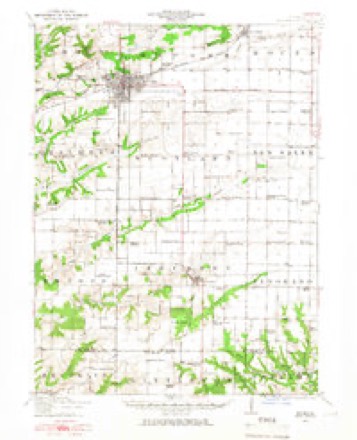
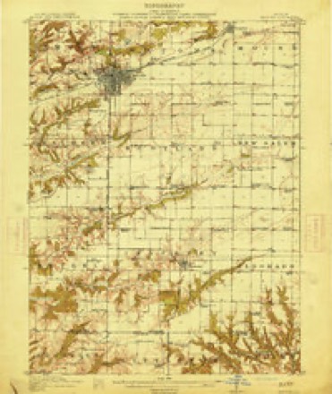
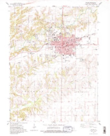
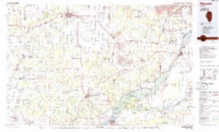
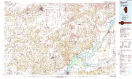
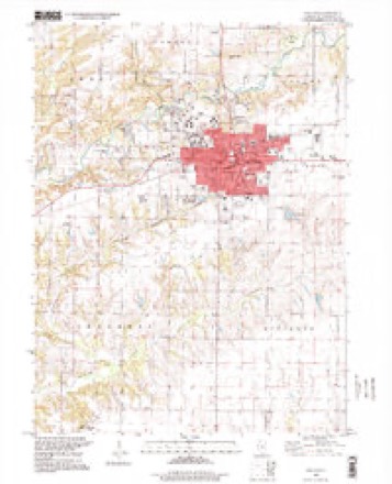
10 surveys from 20 printed sheetsMatched by testing this settlement's coordinate against the published boundary of every sheet in the United States Geological Survey's historical collection. Each opens the scanned sheet at the Survey.
- 1912 USGS Macomb quadrangle1:62500
- 1914 USGS Macomb quadrangle1:62500, 4 printings
- 1958 USGS Burlington quadrangle1:250000, 4 printings
- 1961 USGS Burlington quadrangle1:250000
- 1963 USGS Burlington quadrangle1:250000
- 1974 USGS Macomb quadrangle1:24000, 3 printings
- 1985 USGS Macomb quadrangle1:100000
- 1989 USGS Macomb quadrangle1:100000
- 1990 USGS Burlington quadrangle1:250000, 2 printings
- 1997 USGS Macomb quadrangle1:24000, 2 printings




Fires near this place
5 since 2008Regional context, not property-specific evidence. The federal wildfire occurrence database lists 5 fires within 5 miles of Macomb in 2008, burning about 44 acres in total. 1 started naturally. None was recorded as arson. Distance is straight-line from the map coordinates, so a fire counted here may appear on a neighbouring settlement's page as well.
| Reported cause | Fires |
|---|---|
| Debris and open burning | 4 |
| Natural | 1 |
The most recent of them, most recent first, with the day each was reported and the service that recorded it.
| Date | Cause | Size | Reported by | Name on the report |
|---|---|---|---|---|
| 26 August 2008 | Debris and open burning | under an acre | Illinois Division of Forestry Resources | 45 |
| 30 May 2008 | Natural | under an acre | Illinois Division of Forestry Resources | 27 |
| 5 April 2008 | Debris and open burning | 25 acres | Illinois Division of Forestry Resources | SILBERER |
| 14 March 2008 | Debris and open burning | 15 acres | Illinois Division of Forestry Resources | BROWN |
| 14 March 2008 | Debris and open burning | 4.0 acres | Illinois Division of Forestry Resources | 11 |
Settlements close enough to share some of these fires:
Mines and quarries near this place
1 within 5 milesRegional context, not property-specific evidence. The federal mineral resources record lists 1 working within 5 miles of Macomb: 1 past producer. None of them still produces. What was taken out: Stone. Distance is straight-line from the map coordinates, so a quarry counted here may appear on a neighbouring settlement's page as well.
| Where | Site | Commodity | Status | Recorded |
|---|---|---|---|---|
| Mcdonough Hwy Pit | Stone | Past Producer |
Storms near this place
60 of 149 shownRegional context, not property-specific evidence. The National Weather Service names Macomb in 149 storm reports between 1993 and 2026: 66 thunderstorm wind, 51 hail, 14 flash flood, 12 heavy rain. The reports record 1 injury. Each account below is quoted exactly as the forecast office filed it, from the NOAA Storm Events Database, and each date opens the federal record of that event.
| When | Event | Place named | Harm | What the report says |
|---|---|---|---|---|
| August 1999 | Thunderstorm Wind | Macomb | 1 hurt | 5 year old boy sustained injuries when he was shocked by downed power lines. |
| July 2003 | Thunderstorm Wind | Macomb | $100,000 | Trees & wires down |
| July 2003 | Thunderstorm Wind | Macomb | $30,000 | Power lines down 1000 North Rd |
| June 2008 | Thunderstorm Wind | Macomb | $25,000 | Winds estimated to be 70 mph blew down several trees and power poles in Macomb, IL. |
| June 2003 | Thunderstorm Wind | Macomb | $20,000 | Trees down |
| June 2003 | Flash Flood | Macomb | $20,000 | no account filed |
| July 2003 | Hail | Macomb | $20,000 | no account filed |
| July 2003 | Hail | Macomb | $15,000 | no account filed |
| April 2025 | Thunderstorm Wind | Macomb | $10,000 | The Emergency Manager reported that apartment roof was heavily damaged with the middle section of the roof removed on both sides. In coordination with Emergency Management and reviewing photos of the damage and areas around it, this was determined to be from straight line winds with a speed of 80 mph. the time of the event was estimated using radar. |
| June 2006 | Hail | Macomb | $8,000 | dime to quarter size hail covering the ground. |
| September 2005 | Thunderstorm Wind | Macomb | $7,000 | measured gust |
| September 2005 | Thunderstorm Wind | Macomb | $6,000 | Branches down on Western Illinois University campus and in other parts of the city. There was a report of a measured 57 knot (65 mph) wind gust with the storms. |
| June 2008 | Thunderstorm Wind | Macomb | $5,000 | Winds estimated to be 70 mph blew down several large trees up to two feet in diameter on the west side of Macomb, IL. Time estimated. |
| June 2008 | Thunderstorm Wind | Macomb | $5,000 | Wind gusts estimated to be 60 mph blew down some trees and power lines in Macomb, IL at 2:20 pm June 15. |
| May 2006 | Thunderstorm Wind | Macomb | $5,000 | numerous reports of trees down on the east side of Macomb from law enforcement. |
| May 2006 | Flash Flood | Macomb | $5,000 | Major flooding of several streets with water depths ranging from 6 inches to near 2 feet. Water up to the doors of some businesses. |
| August 2005 | Thunderstorm Wind | Macomb | $5,000 | Trees and power lines down in the city. An unsubstantiated wind gust of 58 knots (67 mph) was reported in Macomb. |
| July 2003 | Heavy Rain | Macomb | $5,000 | Second storm with more street flooding |
| August 1993 | Thunderstorm Wind | Macomb | $5,000 | Several trees were blown down. |
| March 2006 | Hail | Macomb | $3,000 | Dime to quarter sized hail covering the ground. |
| August 2003 | Thunderstorm Wind | Macomb | $3,000 | Huge maple tree down |
| May 2006 | Hail | Macomb | $2,000 | penny to nickel size hail |
| July 2003 | Heavy Rain | Macomb | $2,000 | Street flooding |
| May 2017 | Thunderstorm Wind | Macomb | $1,000 | A trained spotter reported a tree down on a power pole on Maple Avenue near the high school. |
| August 2006 | Lightning | Macomb | $1,000 | A power line was down due to possible lightning strike. |
| March 1998 | Thunderstorm Wind | Macomb | $1,000 | Car dealership sign was blown down. |
| March 2020 | Lightning | Macomb | $500 | The Emergency Manager reported that a tree was damaged by lightning. |
| April 2006 | Hail | Macomb | $500 | On WIU campus. |
| June 2009 | Thunderstorm Wind | Macomb | $100 | Wind gusts estimated to be 70 mph broke the Macomb, IL welcome sign on the east side of town around 800 pm June 27. |
| April 2026 | Thunderstorm Wind | Macomb | - | Several tree branches reported broken off in the city of Macomb. |
| March 2025 | Thunderstorm Wind | Macomb | - | The sheriff department reported multiple power lines down throughout the county. The time was estimated from radar data. |
| April 2025 | Thunderstorm Wind | Macomb | - | A trained spotter reported a large tree was blown down over the roof of a house with some siding damaged. |
| April 2025 | Thunderstorm Wind | Macomb | - | A trained spotter reported that several shingles were lost from the roof of the house. The time of the event was estimated using radar. |
| July 2025 | Flash Flood | Macomb | - | Broadcast Media reported flooded streets with 4 to 6 inches of water. |
| July 2025 | Flash Flood | Macomb | - | Law Enforcement reported that water was over several roads in Macomb including Jackson St and Ward St, and on West Washington St from Johnson on westward. |
| March 2024 | Hail | Macomb | - | Mostly dime to penny sized, with some quarters mixed in. |
| June 2023 | Thunderstorm Wind | Macomb | - | Estimated 80 plus mph winds, with a mature evergreen snapped off at base. |
| June 2023 | Thunderstorm Wind | Macomb | - | Tree blown onto a house. Power lines down. |
| June 2023 | Thunderstorm Wind | Macomb | - | Railroad gate snapped off by strong winds. |
| June 2023 | Thunderstorm Wind | Macomb | - | Reports substantial tree damage around Western Illinois Campus in Macomb. Some powerlines blown down. |
| May 2023 | Thunderstorm Wind | Macomb | - | Several large tree limbs down, with a shed thrown about 30 feet. This was due to winds with the gust front. Time estimated by radar. |
| May 2023 | Thunderstorm Wind | Macomb | - | Two large tree branches downed by the winds. Time was estimated by radar. |
| May 2023 | Thunderstorm Wind | Macomb | - | Roof damage to a warehouse on University Drive and Bower Road. Delayed report and time was estimated from radar. |
| May 2023 | Hail | Macomb | - | Report from Mping. |
| July 2022 | Thunderstorm Wind | Macomb | - | A member of the public reported a 4 inch tree branch down. Time of the event estimated using radar. |
| October 2021 | Hail | Macomb | - | A trained spotter reported a lot of nickel size hail mixed with pea sized hail and heavy rain. |
| June 2021 | Thunderstorm Wind | Macomb | - | A large tree was blown down onto Highway 136, blocking the westbound lanes. |
| April 2020 | Hail | Macomb | - | Received through social media. |
| April 2020 | Hail | Macomb | - | Nickel hail covered the ground. |
| June 2020 | Flash Flood | Macomb | - | Law Enforcement reported that several streets in Macomb were flooded with a few cars stalled. |
| July 2019 | Thunderstorm Wind | Macomb | - | The public reported that corn was flattened in a field. The time of the event was estimated using radar. |
| July 2019 | Thunderstorm Wind | Macomb | - | A trained spotter estimated a thunderstorm wind gust of 60 MPH. |
| May 2019 | Flash Flood | Macomb | - | Highway 136 near Macomb closed with over 2 feet of water over the road. |
| May 2019 | Flash Flood | Macomb | - | Broadcast media showed a video of widespread flash flooding over roads in Macomb. |
| June 2018 | Flash Flood | Macomb | - | Urban flooding of streets was reported by spotters. |
| June 2018 | Thunderstorm Wind | Macomb | - | Numerous tree limbs were blown down on the north side of Macomb. |
| September 2016 | Thunderstorm Wind | Macomb | - | Local law enforcement reported downed tree limbs, also a few limbs on some power lines in Macomb and Sciota. The time of the event was estimated by radar. |
| September 2016 | Thunderstorm Wind | Macomb | - | A trained spotter reported two post signs were snapped of at their bases. Also a large tree limb 10 inches in diameter was down. |
| July 2016 | Thunderstorm Wind | Macomb | - | A trained spotter reported several tree branches were down with diameters up to 5 inches. |
| May 2015 | Flash Flood | Macomb | - | Trained spotters reported severe street flooding in Macomb with several roads closed. Media reports and videos showed water over 1 foot deep spanning several blocks and US Highway 136 was consequently closed.||At Western Illinois University, the intersection of Western Ave. and Adams St. adjacent to Corbin Hall and Olson Hall was closed due to flooding.| |The Macomb Police Department posted on Twitter at 6:29 p.m., saying water was pouring over the roadway in the 900 block of S. Ward St. |
Nearest settlements
The eight closest, with where each one stands in the county. Distances are straight-line, computed from the Geographic Names Information System coordinates.
| Map | Place | Distance | Sheets |
|---|---|---|---|
| East Village | 0.5 miles | 20 | |
| University Village | 0.6 miles | 20 | |
| Lamone Village | 1.6 miles | 20 | |
| Georgetown | 2.5 miles | 20 | |
| Little Ireland (historical) | 3.6 miles | 20 | |
| Bardolph | 6.2 miles | 16 | |
| Colchester | 6.8 miles | 14 | |
| Good Hope | 6.8 miles | 17 |
Elsewhere
Matched on this settlement's Geographic Names Information System number rather than its name, so it cannot be a different place of the same name in another state.
| Wikipedia article on Macomb | An encyclopaedic summary. Its text is share-alike, so it is linked here rather than copied. |
| Wikidata item Q575389 | The structured record the population and elevation above come from. Public domain (CC0). |
Provenance
This settlement is recorded in the Geographic Names Information System as feature 412809. The sheet list is computed by point-in-boundary test against the United States Geological Survey's historical topographic inventory. Both are works of the United States government and carry no copyright under 17 U.S.C. 105.
Wildfire. Short, Karen C. 2022. Spatial wildfire occurrence data for the United States, 1992-2020 [FPA_FOD_20221014]. 6th Edition. Fort Collins, CO: Forest Service Research Data Archive. https://doi.org/10.2737/RDS-2013-0009.6 Collected with United States Government funding and usable without additional permissions or fees.
Mines and quarries. USGS Mineral Resources Data System (MRDS) https://mrdata.usgs.gov/mrds/ A work of the United States government, no copyright under 17 U.S.C. 105.
Storms. NOAA National Centers for Environmental Information, Storm Events Database https://www.ncei.noaa.gov/stormevents/ A work of the United States government, no copyright under 17 U.S.C. 105. Narratives are quoted verbatim from the National Weather Service report and are not edited or summarised.