 Block
Onarga, Illinois
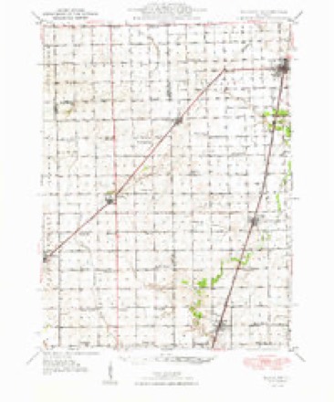
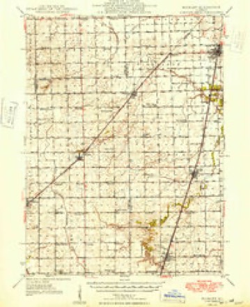
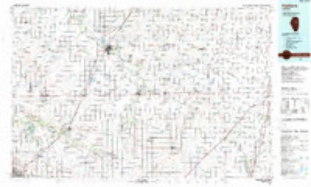
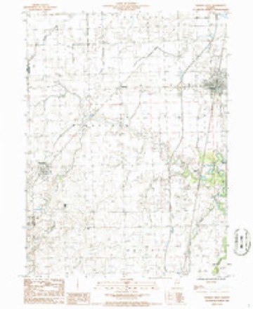
13 topographic sheets cover this place, the earliest surveyed in 1948 and the latest in 1990. It stands in Onarga Township. It lies in ZIP code area 60955. The Survey maps it on the Onarga West quadrangle. 1,333 people lived here at the 2020 count. It stands 669 feet above sea level.
Population over time
2 figuresOnarga fell from 1,368 to 1,333 between 2010 and 2020. These are the recorded population figures Wikidata holds for this place, reached through the Geographic Names Information System number this page is keyed on rather than by name, so they belong to this place and not to another of the same name. Most are census counts, but not all are: an early figure may be a founding or settlement estimate, and an estimate published within five years of a census is left out. The change column is computed, and is left blank where more than 20 years separate a figure from the one before it, because a gap that long is not a change between two counts.
| Year | People | Change |
|---|---|---|
| 2010 | 1,368 | |
| 2020 | 1,333 | -35 (-3%) |
Topographic sheets covering this place
8 surveys from 13 printed sheetsMatched by testing this settlement's coordinate against the published boundary of every sheet in the United States Geological Survey's historical collection. Each opens the scanned sheet at the Survey.
- 1948 USGS Buckley quadrangle1:62500
- 1949 USGS Buckley quadrangle1:62500, 2 printings
- 1958 USGS Peoria quadrangle1:250000, 4 printings
- 1961 USGS Peoria quadrangle1:250000
- 1963 USGS Peoria quadrangle1:250000
- 1985 USGS Fairbury quadrangle1:100000, 2 printings
- 1986 USGS Onarga West quadrangle1:24000
- 1990 USGS Peoria quadrangle1:250000




In the county-history sources
24,565 words on this townshipHistory of Iroquois County, Together with Historic Notes on the Northwest, Gleaned from Early Authors, Old Maps and Manuscripts, Private and Official Correspondence, and Other Authentic, Though, for the Most Part, Out-of-the-way Sources, published 1880 names this settlement in its chapter on Onarga Township. These are the passages that mention it, exactly as the scans read.
Onarga was laid out in the fall of 1854, by David A. Keal, vicepresident of the Illinois Central Railroad Company. He was a resident of Salem, Massachusetts. Since then there have been ten additions laid out, and the plat on Sec. 19, T. 26, R. 11 E., and the east part of Sec. 24, T. 26, R. 10 E., comprises about 300 acres. The village is on a comparatively high ridge, nearly one hundred feet above the lake at Chicago, twenty-three feet above Gilman, three and a half miles north, and over forty feet above the creek bed the same distance south.
Passage source: History of Iroquois County, Together with Historic Notes on the Northwest, Gleaned from Early Authors, Old Maps and Manuscripts, Private and Official Correspondence, and Other Authentic, Though, for the Most Part, Out-of-the-way Sources, published 1880.
Early in the spring of 1854 W. P. Pierson commenced the first business in the place. His stock was less than a car-load of lumber. He and his wife boarded at Judge Pangborn's, over a mile from the depot, till they moved into Lockwood's cabin. The next spring he had completed his dwelling, office and business house combined, a structure 12x16 feet. Right here and in this room was commenced one of the early institutions of the town. Mrs. Mary Pierson commenced a Sabbath-school, with four or five scholars, as soon as they moved into their home. As families were constantly moving in, this school increased rapidly in numbers and efficiency until, in the period of about two years, it numbered some eighty scholars. It overflowed from the residence of Mr. Pierson to his warerooms, and from thence to the new school-house on the hill. All this time it was eminently a union school, and embraced all the children of the village. As the different churches were organized from time to time each drew from this school its scholars, until it was superseded by the different denominational Sabbath-schools of the place. It continued in its original form some six years, and in its day did a good work in forming a nucleus of good influences among the children. It is common to hear persons who are now men and women refer to this school with a smile of pleasure on their faces. They are proud to say, "I was one of Mrs. Pierson's Sabbath-school scholars." Early in the same spring that Pierson commenced business William C. Moore and James Miles erected the very first business house in the place, a structure 18 X 28 feet, now standing opposite the hotel. They opened a general line of goods, and did a good business. Miles sold to Dr. A. N. Crawford early in 1856. In 185T Crawford sold to Moore, and started a drug store. Moore continued the business for some years at the old stand, when it finally fell into the hands of Richard A. Hungerford. Onarga never had a more precise, accurate and thorough business man than William C. Moore. A little while after Moore & Miles built their store D. B. Peck built the second store building, a few rods farther south and nearly opposite the depot. His small stock of goods was brought from Del Rey, and business began in a small shanty before his store was completed, and before Moore & Miles opened out. On July 4 of the same year Oliver L. Clark plastered his house, built where A. K. Doe lives. Soon after this James D. Kelly built a house near the residence of Mrs. C. Venmens, and sold it to T. A. JSTorvell, and built a second on the northwest corner of the seminary lot, and sold that in the early part of 1855 to Townsend B. Gardner. Norvell kept a hotel in 1855. About the time D. B. Peck opened his store, Henry Peck opened a saloon just south of it. Dr. A. N". Crawford settled here in 1854, boarded at Judge Pangborn's, and in 1855 built an office where Durham's bank now is. This office of the doctor is the east room of Isaac Amermaii's residence. Crawford was a well read man, and one of the best physicians ever in the county. He sold out to Dr. John L. Parmalee, who came from Ohio with his family in January, 1856. The same month John C. Culver built his dwelling and moved here from Del Rey. The fall before, he, in partnership with Dr. Lemuel Boyd, opened a lumber yard. In about a year Boyd sold his interest to William H. Skeels. M. H. Messer opened a surveyor's office and general land agency in their lumber office. In October, 1855, John W., James and Abram Owen came from Jacksonville, this state, and while building the house now occupied by J. "W. Owen lived in a cabin of Joshua Evans', over a mile from town. A blacksmith shop was opened, and the next year David Weaver, who for them, and afterward for himself, carried on the business several years, was employed. He built the house where Winslow Woods resides. At this time whisky was sold in at least two places. March, 1856, Culver erected the building now his residence, and Chancellor L. Richardson and Isaac McCourtie opened a dry-goods store below, and the three secret societies had the upper room for their hall. In about a year McCourtie sold his interest to Richardson and soon built a warehouse, and in 1859 Lewis Russ was his partner in the grain, lumber and agricultural implement business, and finally they opened a hardware and furniture store, which they prosecuted to a success, both parties making a fortune. Russ bought McCourtie out, January, 1872, took his son, Lewis D. Russ, as a partner, built the north warehouse the same year, and held the grain business till January 1, 1880, when B. H. Durham bought them out. Russ & Son sold their hardware and furniture store to Elkanah Doolittle in 1875, who ran the business about two years, when it fell into the hands of his son, Milton Doolittle.
Passage source: History of Iroquois County, Together with Historic Notes on the Northwest, Gleaned from Early Authors, Old Maps and Manuscripts, Private and Official Correspondence, and Other Authentic, Though, for the Most Part, Out-of-the-way Sources, published 1880.
Warren H. Doolittle, who sold out to Benjaman H. Durham, April, 1871, and who still continues thejbusiness. Thomas Ward came in 1857, and worked at tailoring for Knight & Thomas. He soon commenced business for himself, and his success has grown into a large dry-goods and grocery trade, employing three clerks. Eliphalet R. Knight and Joseph Thomas rented the store built by D. B. Peck, in 1856, and opened the largest and best stock of goods in the county at that time. Their trade was very large, and extended into every kind of merchandise the new settlers called for. Thomas died March 24, 1858. This event threw the whole responsibility on Knight, who made a strong effort to carry the business alone. In settling the estate of Mr. Thomas his capital was withdrawn, greatly crippling the business. For relief a partner was found in Seely Hetfield, a man of energy and considerable means. For a time the business was prosperous, and a large room was rented of W. P. Pierson. The excessive hard times immediately following, with a large amount of outstanding debts, and bills becoming due, determined Hetfield to withdraw, leaving Knight in possession of the business. In a short time the firm took the form of Knight & Rice, and finally closed up in about 1860 or 1861, with Rice as receiver. Knight raised a company and entered the army, and at the close of the war remained in the south, till his death in 1879. He was a man of untiring energy, extravagant in his habit and plans, rich to-day and poor to-morrow, but never giving up. For a short time after the war he was a member of the educational board of the state of Arkansas. Joseph Thomas, his first partner in business in Onarga, had lived in the county for many years. He was a member of the legislature in 1854. He was a part owner of tlie town of Gilman, and had much influence in procuring individual contribution for the east and west railroad through the county. His energy made him a desirable partner for Mr. Knight ; had he lived, misfortune would not have come to the business he had helped to organize so soon.
Passage source: History of Iroquois County, Together with Historic Notes on the Northwest, Gleaned from Early Authors, Old Maps and Manuscripts, Private and Official Correspondence, and Other Authentic, Though, for the Most Part, Out-of-the-way Sources, published 1880.
Machine-read from a century-old scan, so expect the errors a machine makes: misspelled names, dropped words, stray characters.
Read the whole chapter on Onarga Township - it names this place 81 more 81 times.
Storms near this place
14 since 2000Regional context, not property-specific evidence. The National Weather Service names Onarga in 14 storm reports between 2000 and 2020: 8 thunderstorm wind, 4 hail, 1 flood, 1 flash flood. No death or injury is recorded in these reports. Each account below is quoted exactly as the forecast office filed it, from the NOAA Storm Events Database, and each date opens the federal record of that event.
| When | Event | Place named | Harm | What the report says |
|---|---|---|---|---|
| June 2010 | Thunderstorm Wind | Onarga | $20,000 | Trees and limbs were blown down. The roof of an outbuilding blew onto a camper. |
| December 2008 | Thunderstorm Wind | Onarga | $3,000 | Two utility poles and several power lines were blown down on North Pine Street. |
| May 2020 | Flash Flood | Onarga | - | Route 45 was closed between Onarga and Paxton due to flooding. |
| July 2020 | Thunderstorm Wind | Onarga | - | Power lines were blown down in east Onarga. |
| May 2019 | Thunderstorm Wind | Onarga | - | Trees, tree limbs and power lines were blown down. |
| May 2008 | Thunderstorm Wind | Onarga | - | A wind gust to 60 mph was measured on Interstate 57 about 5 miles southwest of Gilman. |
| March 2007 | Flood | Onarga | - | Route 45 between Onarga and Buckley closed due to high water. |
| May 2006 | Hail | Onarga | - | Quarter size hail was reported between Onarga and Gilman on Interstate 57, near mile marker 282. |
| July 2005 | Thunderstorm Wind | Onarga | - | A gust to 60 mph was reported in Onarga and Crescent City. |
| June 2011 | Thunderstorm Wind | Onarga | - | no account filed |
| June 2010 | Hail | Onarga | - | no account filed |
| April 2006 | Hail | Onarga | - | no account filed |
| May 2003 | Thunderstorm Wind | Onarga | - | no account filed |
| April 2000 | Hail | Onarga | - | no account filed |
Nearest settlements
The eight closest, with where each one stands in the county. Distances are straight-line, computed from the Geographic Names Information System coordinates.
Elsewhere
Matched on this settlement's Geographic Names Information System number rather than its name, so it cannot be a different place of the same name in another state.
| Wikipedia article on Onarga | An encyclopaedic summary. Its text is share-alike, so it is linked here rather than copied. |
| Wikidata item Q2224984 | The structured record the population and elevation above come from. Public domain (CC0). |
Provenance
This settlement is recorded in the Geographic Names Information System as feature 415120. The sheet list is computed by point-in-boundary test against the United States Geological Survey's historical topographic inventory. Both are works of the United States government and carry no copyright under 17 U.S.C. 105.
Storms. NOAA National Centers for Environmental Information, Storm Events Database https://www.ncei.noaa.gov/stormevents/ A work of the United States government, no copyright under 17 U.S.C. 105. Narratives are quoted verbatim from the National Weather Service report and are not edited or summarised.