 Block
Plumfield, Illinois
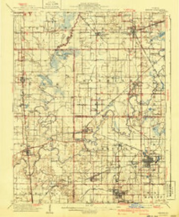
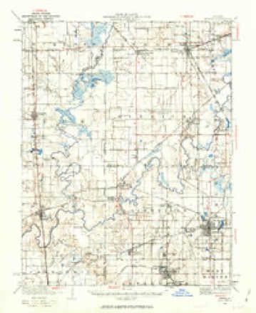
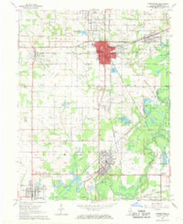
18 topographic sheets cover this place, the earliest surveyed in 1910 and the latest in 1987. It stands in Denning Township. It lies in ZIP code area 62896. The Survey maps it on the Christopher quadrangle. It stands 400 feet above sea level.
Topographic sheets covering this place
11 surveys from 18 printed sheetsMatched by testing this settlement's coordinate against the published boundary of every sheet in the United States Geological Survey's historical collection. Each opens the scanned sheet at the Survey.
- 1910 USGS Herrin quadrangle1:62500, 2 printings
- 1936 USGS Herrin quadrangle1:62500, 2 printings
- 1949 USGS Paducah quadrangle1:250000, 2 printings
- 1950 USGS Paducah quadrangle1:250000
- 1954 USGS Paducah quadrangle1:250000, 2 printings
- 1961 USGS Paducah quadrangle1:250000, 2 printings
- 1964 USGS Paducah quadrangle1:250000, 2 printings
- 1968 USGS Christopher quadrangle1:24000, 2 printings
- 1984 USGS Carbondale quadrangle1:100000
- 1986 USGS Carbondale quadrangle1:100000
- 1987 USGS Paducah quadrangle1:250000






Fires near this place
6 since 2010Regional context, not property-specific evidence. The federal wildfire occurrence database lists 6 fires within 5 miles of Plumfield between 2010 and 2011, burning about 20 acres in total. None started naturally. None was recorded as arson. Distance is straight-line from the map coordinates, so a fire counted here may appear on a neighbouring settlement's page as well.
| Reported cause | Fires |
|---|---|
| Missing data/not specified/undetermined | 5 |
| Debris and open burning | 1 |
The most recent of them, most recent first, with the day each was reported and the service that recorded it.
| Date | Cause | Size | Reported by | Name on the report |
|---|---|---|---|---|
| 25 September 2010 | Missing data/not specified/undetermined | under an acre | Illinois Division of Forestry Resources | 10211 |
| 12 April 2010 | Missing data/not specified/undetermined | under an acre | Illinois Division of Forestry Resources | 10088 |
| 3 March 2011 | Debris and open burning | 12 acres | Illinois Division of Forestry Resources | MILLS |
| 7 November 2010 | Missing data/not specified/undetermined | 5.0 acres | Illinois Division of Forestry Resources | 10301 |
| 12 November 2010 | Missing data/not specified/undetermined | 2.0 acres | Illinois Division of Forestry Resources | 10325 |
| 21 October 2010 | Missing data/not specified/undetermined | under an acre | Illinois Division of Forestry Resources | 10263 |
Settlements close enough to share some of these fires:
Storms near this place
29 since 2006Regional context, not property-specific evidence. The National Weather Service names Plumfield in 29 storm reports between 2006 and 2023: 28 flood, 1 thunderstorm wind. The reports record 1 injury. Each account below is quoted exactly as the forecast office filed it, from the NOAA Storm Events Database, and each date opens the federal record of that event.
| When | Event | Place named | Harm | What the report says |
|---|---|---|---|---|
| May 2011 | Flood | Plumfield | 1 hurt, $500,000 | Record flooding occurred on the Big Muddy River. At the Plumfield river gage, the river crested at 34.68 feet on the evening of May 3. This exceeded the old record set in 1961 by less than an inch. Illinois Route 148 was closed south of Zeigler, as was County Highway 11. A section of Illinois Route 149 was closed, along with Illinois Route 37 north of West Frankfort. About two dozen homes were flooded, mostly in the Mitchell Lake area of Denning Township. Between five and six feet of water entered some homes. A 62-year-old man was found clinging to a tree after ignoring barricades and driving into swift water on the morning of May 3. The man was treated for hypothermia at a local hospital. His vehicle was washed off the roadway into deep water. |
| June 2013 | Thunderstorm Wind | Plumfield | $20,000 | Thunderstorm winds tore the soffit off a garage and threw big waste cans about one-quarter mile. Several trees were snapped, a stop sign was damaged, and large branches were downed. A tree fell on a garage. The damage path was approximately 1 1/2 miles to 2 miles long. The damage occurred about one-half mile north of the Williamson County line and two miles west of Interstate 57. |
| December 2011 | Flood | Plumfield | $1,000 | Minor flooding of bottomland fields occurred along the Big Muddy River. |
| March 2023 | Flood | Plumfield | - | Minor flooding occurred on the Big Muddy River, causing inundation of low-lying fields and woodlands near the river. |
| March 2020 | Flood | Plumfield | - | Minor flooding occurred on the Big Muddy River. Low-lying woods and fields near the river were inundated. |
| January 2020 | Flood | Plumfield | - | Minor flooding occurred on the Big Muddy River. Low-lying woods and fields near the river were inundated. |
| February 2019 | Flood | Plumfield | - | Minor flooding occurred on the Big Muddy River. Low-lying fields and woodlands near the river were inundated. |
| April 2019 | Flood | Plumfield | - | Minor flooding began on the upper portions of the Big Muddy River. Low-lying woods and fields were inundated, along with a few rural county roads. The flooding persisted into May. |
| May 2019 | Flood | Plumfield | - | After rising above flood stage in late April, minor flooding ended on upper portions of the Big Muddy River by mid May. Low-lying woods and fields were inundated, along with a few rural county roads. |
| February 2018 | Flood | Plumfield | - | Minor flooding occurred along the Big Muddy River. Low-lying bottomland woods and fields were inundated. The river remained above flood stage into March. |
| March 2018 | Flood | Plumfield | - | The Big Muddy River rose above flood stage on the 29th and continued rising through the end of the month. The flooding during late March was generally minor. |
| March 2018 | Flood | Plumfield | - | Minor flooding continued on the Big Muddy River from late February. Low-lying bottomland woods and fields were inundated. |
| April 2018 | Flood | Plumfield | - | Minor flooding continued on the Big Muddy River from late March. Low-lying woods and fields near the river were inundated. Some rural secondary roads were underwater. |
| April 2017 | Flood | Plumfield | - | The Big Muddy River rose above flood stage. Through the end of April, the flooding was mostly minor. The river continued rising beyond the end of the month. |
| January 2016 | Flood | Plumfield | - | Minor flooding occurred along the Big Muddy River. Low-lying woods and fields were flooded, as well as some county roads. |
| June 2015 | Flood | Plumfield | - | Minor flooding occurred along the Big Muddy River. Low-lying fields and woodlands near the river were inundated. |
| March 2015 | Flood | Plumfield | - | Minor flooding occurred on the Big Muddy River. At the Plumfield river gage, the river crested at 22.76 feet on the 16th. Flood stage is 20 feet. Low-lying woods and fields near the river were inundated. |
| April 2011 | Flood | Plumfield | - | Due to flooding of the Big Muddy River, Illinois Route 148 was closed south of Zeigler, as was County Highway 11. |
| January 2010 | Flood | Plumfield | - | Minor flooding of the Big Muddy River occurred. At the Plumfield gage, the river crested at 23.34 feet on the 27th of December. Flood stage there is 20 feet. Minor flooding of low-lying fields and pastureland occurred. The river fell back below flood stage on the 2nd of January. |
| May 2009 | Flood | Plumfield | - | Minor flooding of the Big Muddy River occurred. At the Plumfield gage, where flood stage is 20 feet, the river crested at 23.30 feet on the 11th. Low-lying and bottomland areas were flooded. |
| February 2008 | Flood | Plumfield | - | Minor flooding of the Big Muddy River occurred. At Plumfield, the river crested at 20.19 feet on the 9th. Flood stage there is 20 feet. Low-lying fields and woodlands were flooded. |
| May 2008 | Flood | Plumfield | - | Minor flooding of the Big Muddy River occurred. At the Plumfield gage, the river crested at 21.0 feet on the 19th. Flood stage there is 20 feet. Minor flooding of low-lying fields and woodlands occurred. |
| March 2008 | Flood | Plumfield | - | Moderate flooding of the Big Muddy River occurred. At the Plumfield gage, the river crested at 29.86 feet on March 21. Flood stage there is 20 feet, and moderate flooding begins at 25 feet. Yellow Banks Road was closed at the bridge over the Big Muddy River. While floodwaters approached some homes or made access difficult to homes, no homes were known to have been flooded by the river. Considerable flooding of low-lying fields occurred. |
| April 2008 | Flood | Plumfield | - | Moderate flooding of the Big Muddy River occurred. At the Plumfield gage, the April river crest was 27.69 feet on the 6th. Flood stage at Plumfield is 20 feet. Farm fields and woodlands were flooded. Since planting season was not underway when flooding began, there was little if any crop damage. |
| January 2007 | Flood | Plumfield | - | At Plumfield, where flood stage is 20 feet, the Big Muddy River crested at 23.0 feet on the 18th. This resulted in minor flooding of lowland fields and woods. |
| February 2007 | Flood | Plumfield | - | Minor flooding of the Big Muddy River occurred. At Plumfield, where flood stage is 20 feet, the river crested at 21.02 feet on the evening of the 27th. Minor flooding of low-lying fields and woods occurred. |
| March 2011 | Flood | Plumfield | - | no account filed |
| March 2007 | Flood | Plumfield | - | no account filed |
| March 2006 | Flood | Plumfield | - | no account filed |
Nearest settlements
The eight closest, with where each one stands in the county. Distances are straight-line, computed from the Geographic Names Information System coordinates.
| Map | Place | Distance | Sheets |
|---|---|---|---|
| Cambon | 0.7 miles | 18 | |
| Lake Creek | 1.5 miles | 18 | |
| Pershing | 2.3 miles | 18 | |
| Orient | 2.4 miles | 18 | |
| Zeigler | 2.5 miles | 18 | |
| Mitchell | 2.8 miles | 18 | |
| Cleburne | 3.9 miles | 18 | |
| West Frankfort | 4.0 miles | 18 |
Elsewhere
Matched on this settlement's Geographic Names Information System number rather than its name, so it cannot be a different place of the same name in another state.
| Wikipedia article on Plumfield | An encyclopaedic summary. Its text is share-alike, so it is linked here rather than copied. |
| Wikidata item Q54888491 | The structured record the population and elevation above come from. Public domain (CC0). |
Provenance
This settlement is recorded in the Geographic Names Information System as feature 423073. The sheet list is computed by point-in-boundary test against the United States Geological Survey's historical topographic inventory. Both are works of the United States government and carry no copyright under 17 U.S.C. 105.
Wildfire. Short, Karen C. 2022. Spatial wildfire occurrence data for the United States, 1992-2020 [FPA_FOD_20221014]. 6th Edition. Fort Collins, CO: Forest Service Research Data Archive. https://doi.org/10.2737/RDS-2013-0009.6 Collected with United States Government funding and usable without additional permissions or fees.
Storms. NOAA National Centers for Environmental Information, Storm Events Database https://www.ncei.noaa.gov/stormevents/ A work of the United States government, no copyright under 17 U.S.C. 105. Narratives are quoted verbatim from the National Weather Service report and are not edited or summarised.